

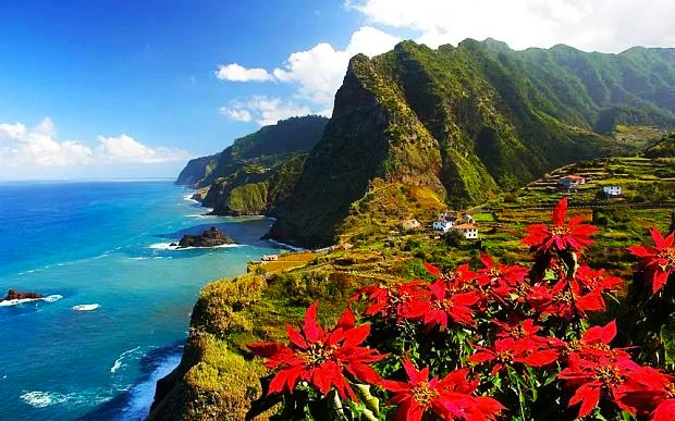
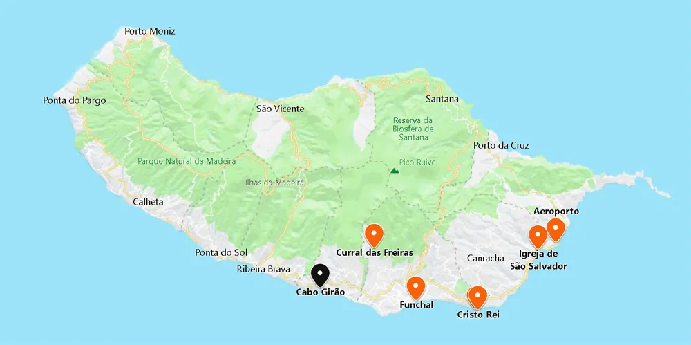
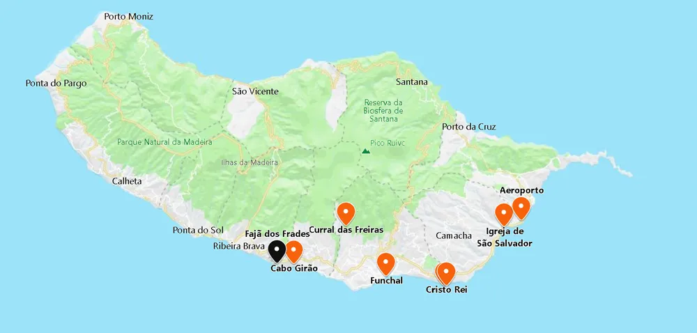
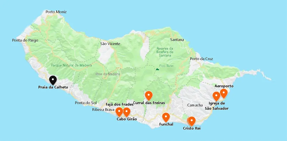
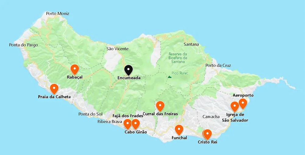
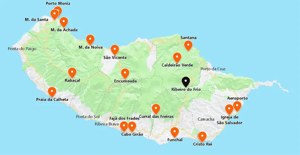
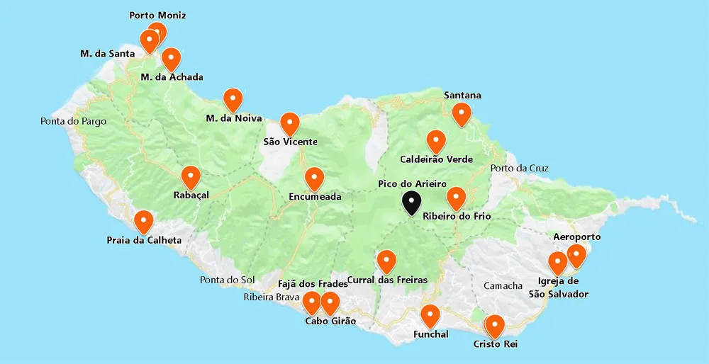
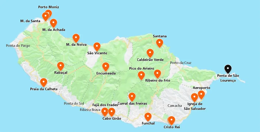
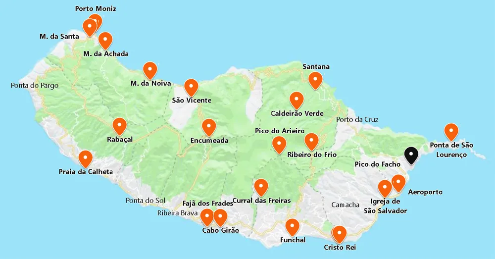
At 600 km off the coast of Morocco, Madeira is a region of mountains surrounded by warm waters, from which rises one of the largest promontories in the world (Cabo Girão Skywalk).
A common tourist activity on Madeira Island is to go to Funchal, the island’s capital, renowned for its old churches and exciting nightlife. A boat journey to observe the island’s cliffs and caverns, hiking along the Levada paths, scuba diving-
Funchal is the modern capital of the archipelago, from where you will discover three fantastic gardens: 2 reached by the charming cable car that takes us to Monte. In the Northeast, you find Santana, its triangular houses and the dramatic Pico Arieiro (Ariero Peak) and Pico Ruivo (Ruivo Peak).
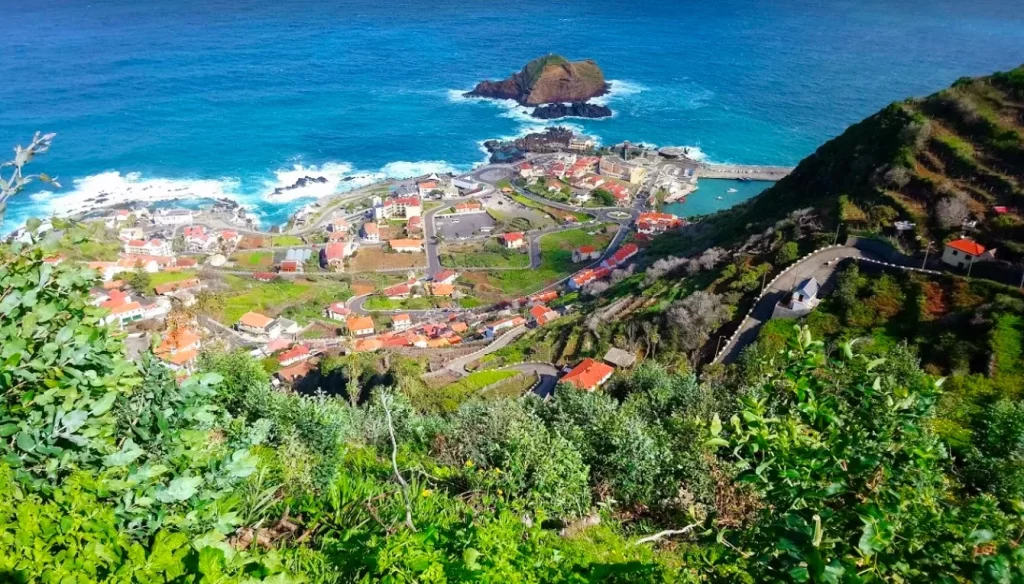
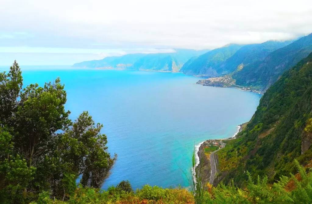
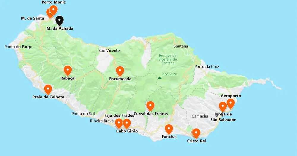
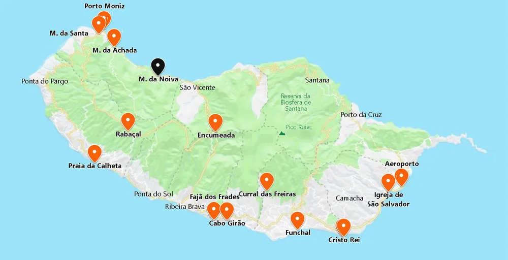
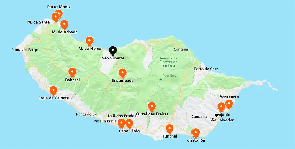
The northwest is untamed – steep slopes cut by waterfalls that flow into the Atlantic; home to refreshing natural pools (Porto Moniz) and magnificent volcanic caves (São Vicente).
Quick Summary – Madeira Island
Location and geography of the island and the archipelago
Roughly 620 miles southwest of Portugal in the Atlantic Ocean lies the Portuguese island of Madeira and its archipelago, including Porto Santo and Desertas.
Popular tourist activities
Tourists flock to Madeira Island to explore Funchal, the capital. Famous for its old churches and lively nightlife, it‘s a must-see. Boats take visitors around the island cliffs and caverns, and the Levada paths offer great hiking. Scuba diving is also an option.
Weather and the best time to visit the island.
Madeira has mild winters and hot summers. The best time for a visit is April to October.
The best time to visit Madeira Island is from April to October. The weather is warm and comfortable during these months.
Depending on your interests, you may need to spend more or less time on Madeira Island. Most visitors stay for 5 to 7 days.
Food on the island
Fresh fish, espetada (meat on skewers), and bolo do caco (a flatbread) are beloved. The island is also full of fantastic Portuguese restaurants.
Popular Beaches
Praia Formosa, Calheta, and Ponta de Sol are a few of the well-known beaches on the island of Madeira.
Lodging options
There are so many top-notch lodging options, namely Belmond Reid’s Palace and Porto Mare.
Historical landmarks on the island
The Cathedral of Funchal and the Quinta das Cruzes Museum are a few of the historical landmarks on Madeira Island.
Outdoor activities
The natural beauty of Madeira Island is unparalleled. Cliffs, caverns, parks, and overlooks offer stunning vistas of the majestic landscape. A sight to behold!
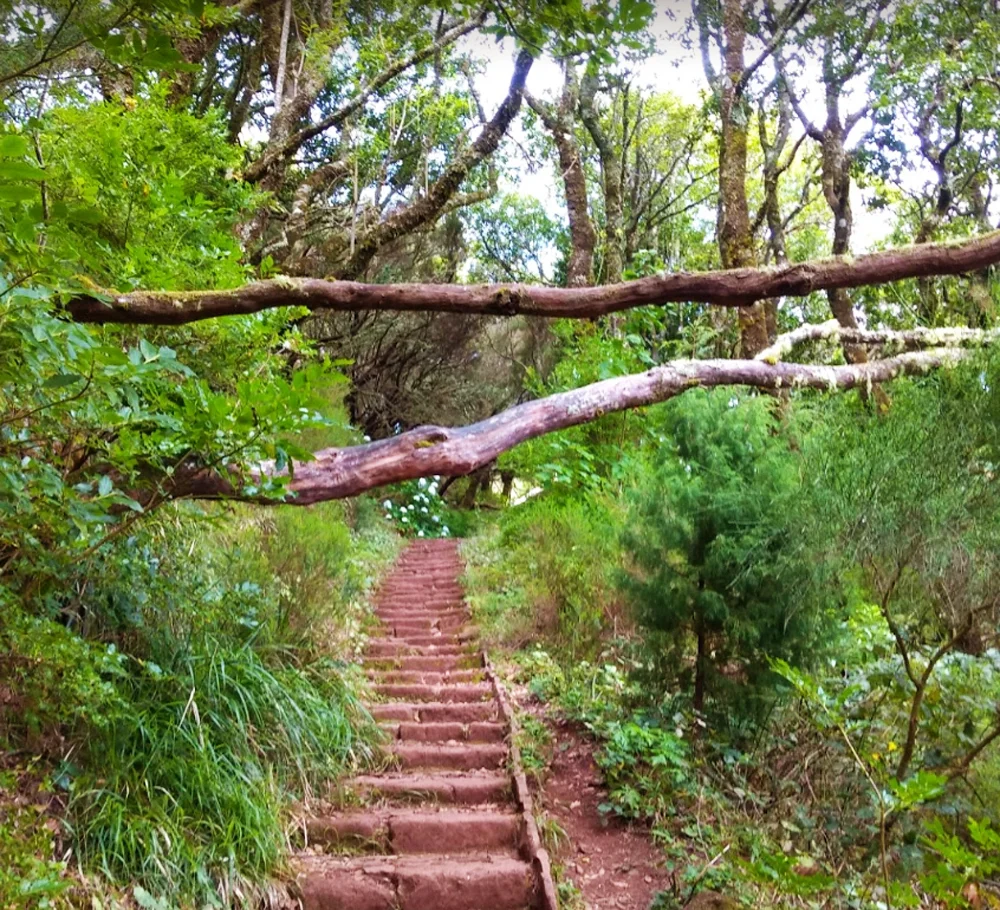
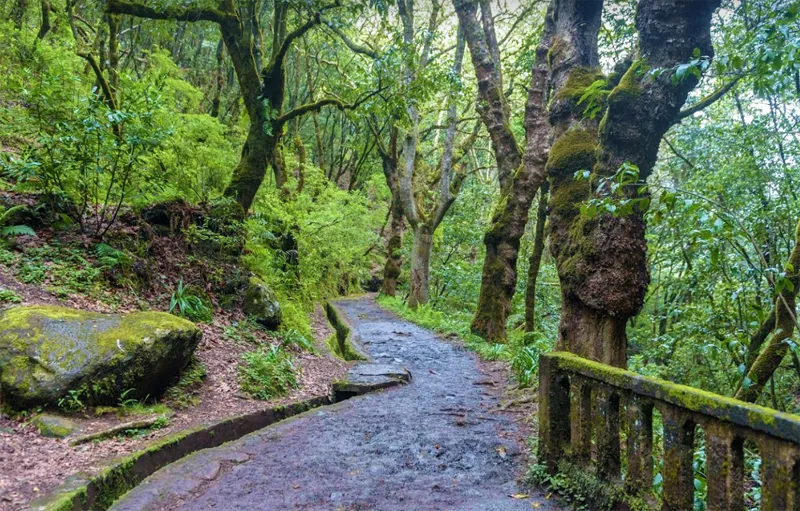
There are many hiking and outdoor activities to explore the natural parks and stroll along the levada trails.
Tour Guides
Many tour operators and guides are popular on Madeira Island. Two of the most popular are Madeira Island Tours and Madeira Wind Birds.
What Things to do to in Funchal?
There are many things to do in Funchal. You can visit the city’s museums and art galleries. You can also ride up Monte in a cable car.
Kid-friendly attractions on Madeira Island?
The Madeira Aquarium, the Madeira Theme Park, and the Madeira Cable Car are just a few kid-friendly attractions on Madeira Island.
Shopping options on the island?
The Funchal Market and the Madeira Shopping Center are excellent places to shop on Madeira Island.
Annual celebrations and events that take place on the island
The Atlantic Festival, the Madeira Wine Festival, and the New Year’s Eve fireworks are popular celebrations on Madeira Island.
Best ways to discover Madeira Island
A car rental, or bus tour, is some of the best ways to discover Madeira Island.
Airport
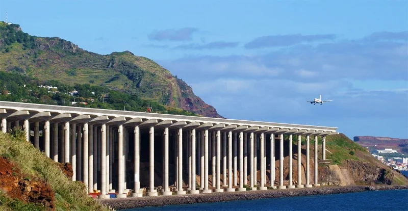
- Coordinates: 32.693956, -16.774952
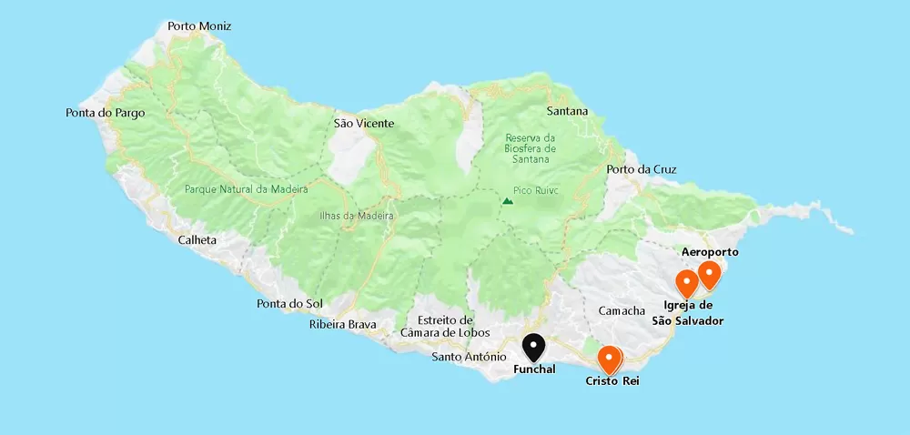
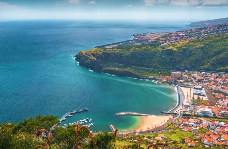
The busy International Airport (Funchal Airport, Officially named Cristiano Ronaldo International Airport) is 20 minutes from Funchal, just outside the town of Santa Cruz. A taxi is the fastest way to Funchal (it costs about 35 euros).
Flying from the Portuguese capital, Lisbon, takes an hour and forty-five minutes – from Porto, a couple of hours. It is a 20-minute flight from the Funchal Airport to get to Porto Santo Island. Ferry options are also available, which take about 2hrs 15 mins.
Things to to Do – Madeira Island:
Christ the King Viewpoint
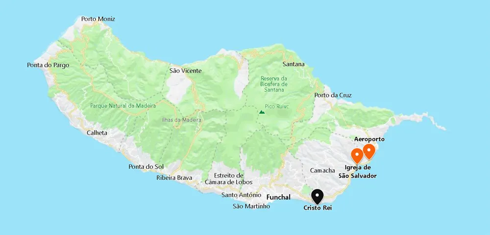
- Coordinates: 32.638286, -16.850722
10 km from Santa Cruz, you can see the miniature replica of the statue that stands in Rio de Janeiro. It was built in the early 20th century on a slope with magnificent sea views. Along the promenade, you discover snack tables accompanied by bushes.
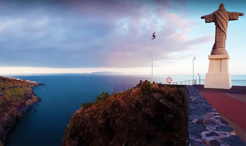
Garajau Beach
- Coordinates: 32.638372, -16.852088
Very close to Cristo Rei, in Ponta do Garajau, the coast ends in the lovely Garajau beach. It is reached by car or cable car (costs about 3 euros). The small beach is watched over by lifeguards in the summer and has a bar.
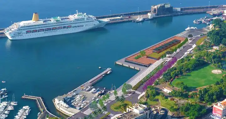
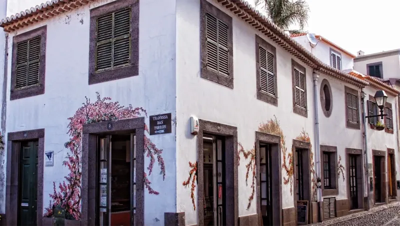
Funchal
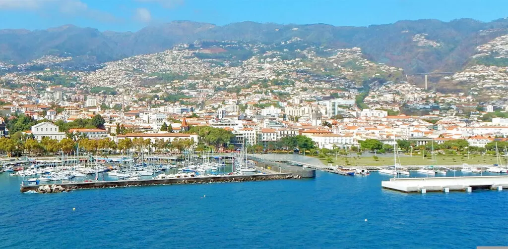
- Coordinates: 32.646357, -16.911522
Funchal began to be populated around six hundred years ago when it was part of the lands of the Order of Christ (in Portugal, it was this Order that succeeded the Templars) and of its governor – Prince Henry the Navigator.
In the 16th century, the aristocracy of Funchal made an unexpected fortune from refining sugar. Later in the 17th century, wine attracted merchants from England.
Funchal Cathedral
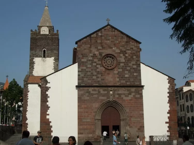
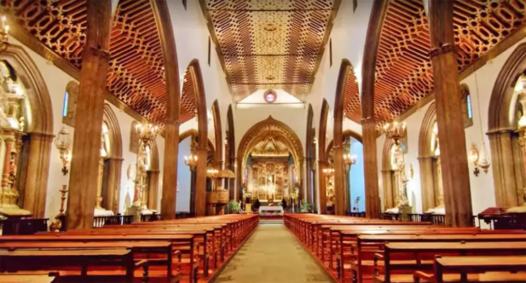
- Coordinates: 32.64819, -16.908251
Funchal’s exquisite cathedral was built between the 15th and 16th centuries on the orders of Dom Manuel I. At the back, it has the spiral tower, witnesses of the golden age of the Portuguese empire.
In the middle of the 16th century, for two decades, it was the largest diocese in the world: Goa (India), São Tomé e Príncipe (Africa), São Salvador (Brazil), Angra do Heroísmo (Azores) – all answered to the archdiocese of Funchal.
Blandy’s Wine Lodge
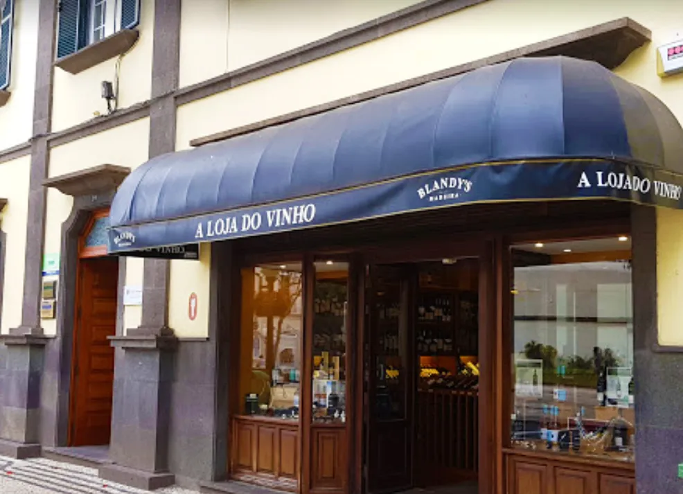
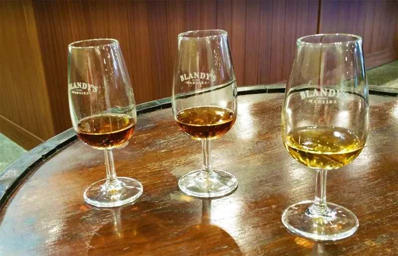
- Coordinates: 32.647802, -16.910596
Close by is the oldest winery in town, Blandy’s Wine Lodge, which sits on a historic island street through which barrels have rolled down to the harbour.
In the museum, you will see a letter from Sir Winston Churchill, a great fan of this fortified wine (16 to 22% alcohol).
Pico Fortress
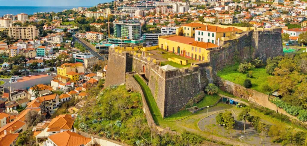
- Coordinates: 32.651363; -16.91644
It is worth climbing the hill towards the Pico Fortress, built in 1611 when Portugal was temporarily under Spanish rule. Take the opportunity to walk along the ramparts and enjoy the beautiful views over the bay of Funchal.
In the bay, the busiest area is the port: ferries leave for the island of Porto Santo, a two-hour trip (costs around €60 – return).
Cristiano Ronaldo Museum
Next to the port, you can see the Cristiano Ronaldo Museum and the respective statue of the athlete.
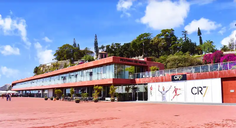
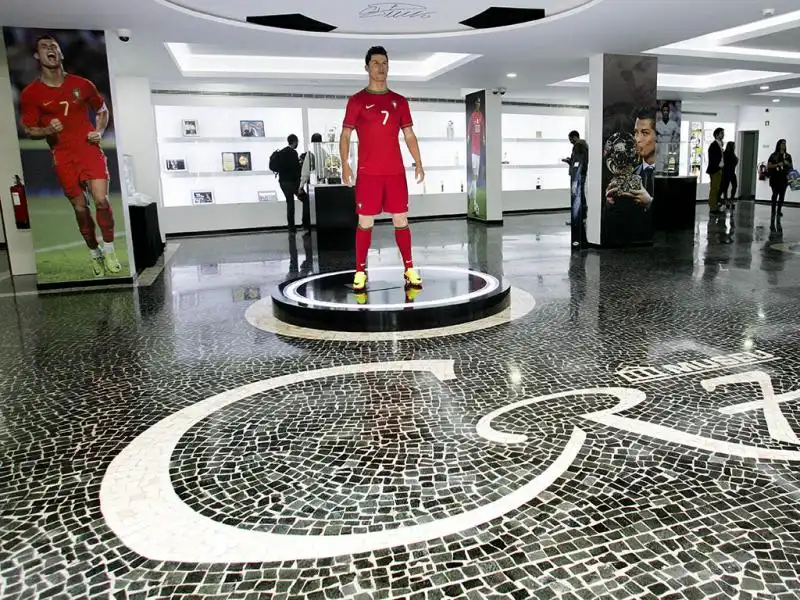
- Coordinates: 32.643922,-16.913804
The space displays some trophies, including a European Champions League Cup and various personal possessions.
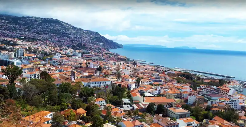
Pico dos Barcelos Viewpoint
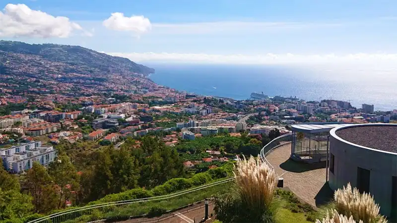
- Coordinates: 32.658727, -16.939599
4 km north of the complex, you reach the beautiful viewpoint of Funchal bay: the Miradouro do Pico dos Barcelos. Nearby, you have free parking, a restaurant, and a children’s playground.
Santa Maria Street
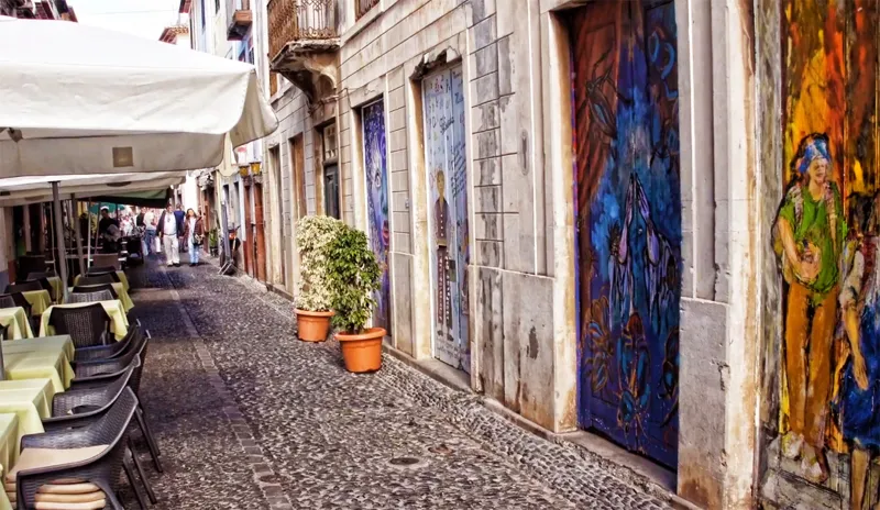
- Coordinates: 32.648077, -16.904110
Travelling to the city’s east side, near the Lavradores Market, unveils the old part of Funchal, sprinkled with atmospheric streets, such as Rua Santa Maria, adorned with urban art on the doors of various bars, galleries and restaurants.
Continuing along Santa Maria street, you pass Largo do Corpo Santo, with Mimosa trees in bloom – some houses here date back to the 15th century (only the commoners lived here).
In the square, you will see the small Chapel of the Corpo Santo, one of the oldest (16th century), dedicated to Saint Peter, The Patron Saint of Fishermen.
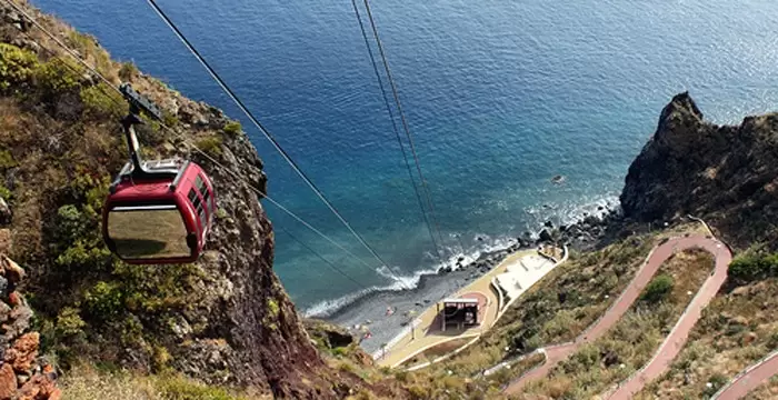
Funchal Cable Car
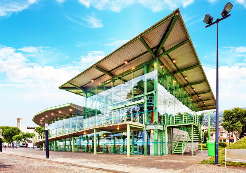
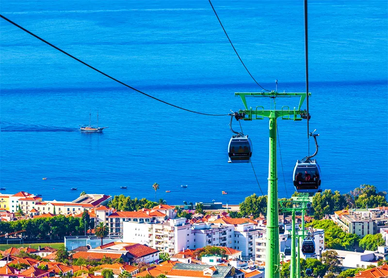
- Coordinates: 32.647073, -16.902250
It is one of the most exciting trips by cable car, where your destination is the small hill with beautiful views of the bay of Funchal and access to two spectacular gardens.
Access to the Funchal Cable Car is half a kilometre from Rua de Santa Maria, near Forte de São Tiago – it costs around 15 euros (round trip). The trip ends near the Church of Nossa Senhora do Monte (19th century), erected on the site of one of the first chapels in the archipelago.
Botanical Garden
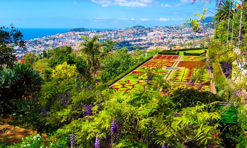
- Coordinates
Near the church, there is the splendid Botanical Garden and unforgettable views. It is home to 2000 plant species from all over the world – although most are indigenous to the Azores, Cape Verde and the Canaries (Macaronesia).
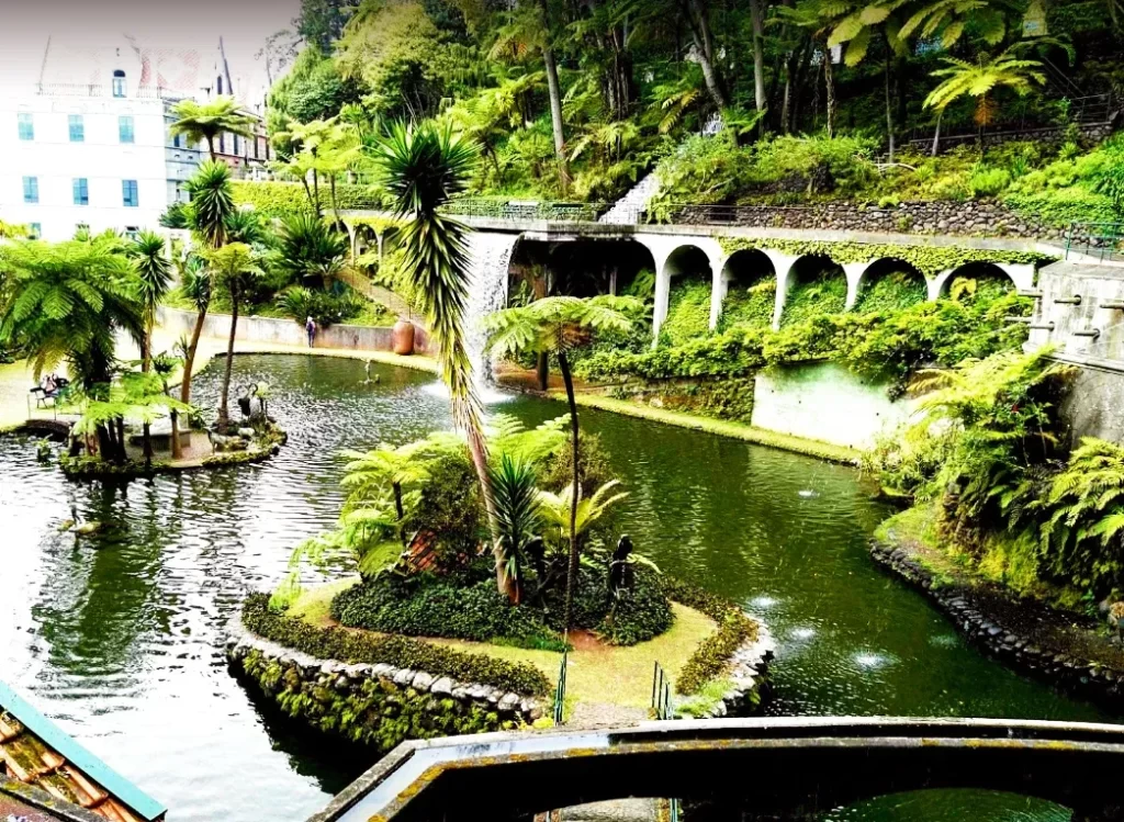
Monte Palace Tropical Garden
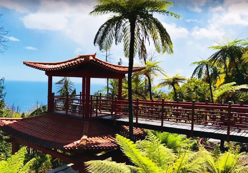
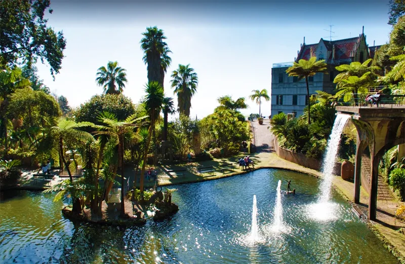
- Coordinates: 32.674259, -16.901575
The other magnificent garden is 500 meters from the Church of Our Lady of Monte. The Monte Palace Tropical Garden, formerly the estate of consul Charles Murray (18th century), is now owned by the Berardo Foundation.
Take note of the magnificent tile panels from the 15th century to the present day. The garden museum (Monte Palace Madeira Museum) dedicates two floors to a sculpture collection of over 1000 works, with several African pieces.
Carreiros do Monte
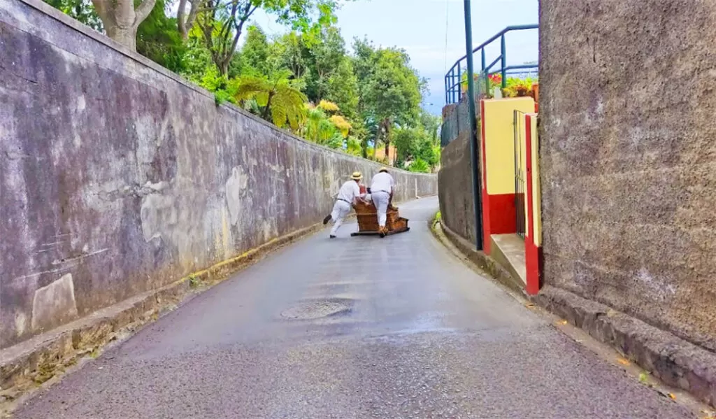
- Coordinates: 32.675367, -16.902711
Next to the church, it is impossible not to notice the traditional transport, dating back to the 19th century, to reach the centre of Funchal – it is one of the island’s main attractions.
Two concentrated Carreiros do Monte, dressed in white and wearing straw hats, guide the tourists in a basket carriage. It’s a 10-minute ride, costing €30 (for three people), reaching speeds of close to forty kilometres – they slow down, if necessary, using their boots.
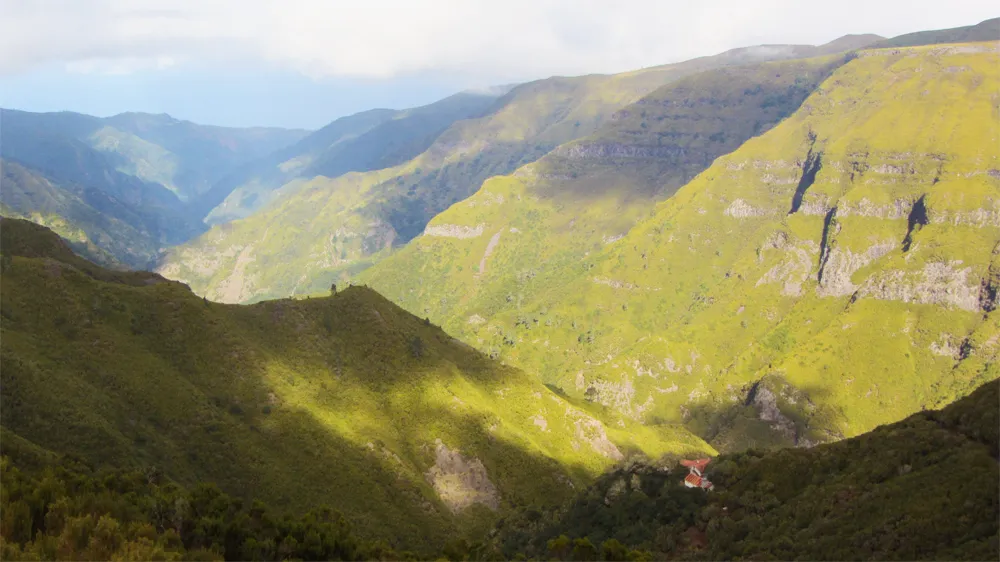
Curral das Freiras Viewpoint
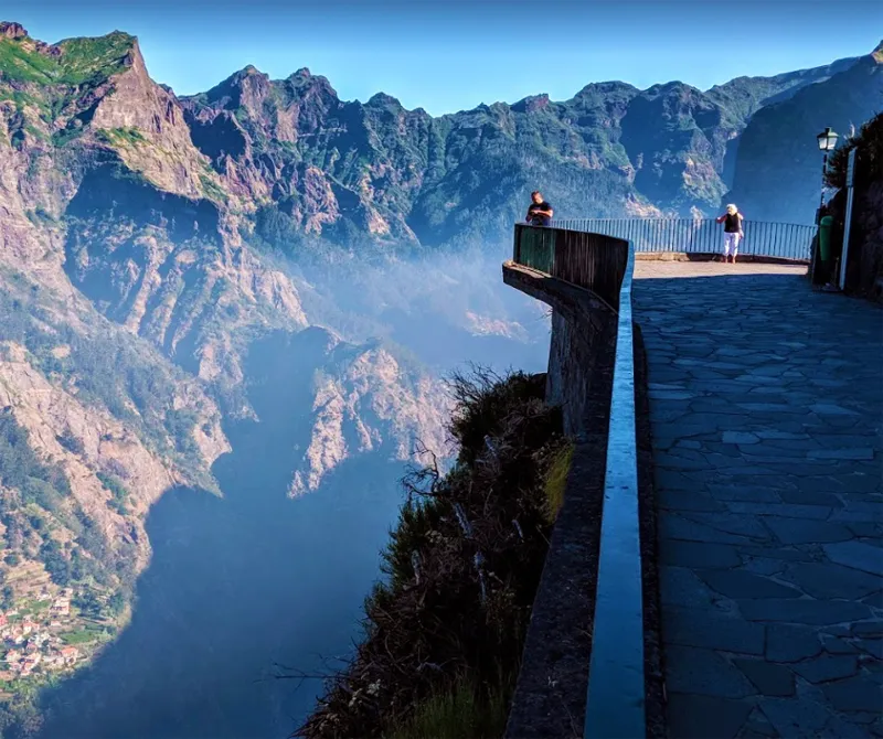
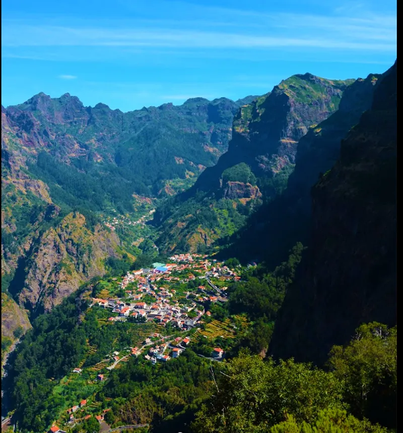
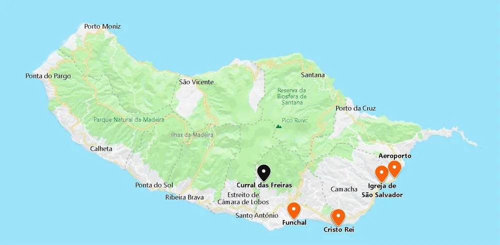
- Coordinates: 32.689223,-16.952053
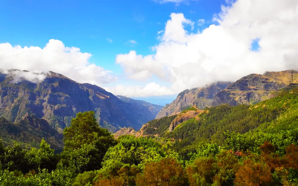
Twenty-five minutes north along the old road, it rewards you with the magnificent Curral das Freiras Viewpoint – a great panorama of Nun’s Valley surrounded by majestic peaks.
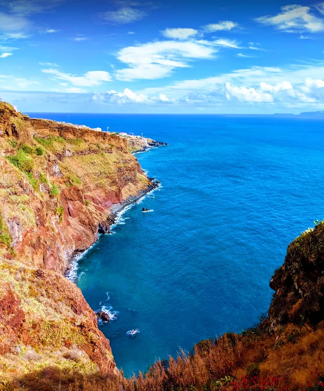
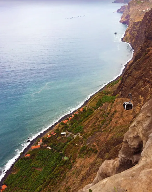
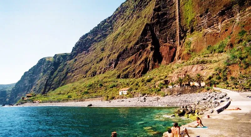
Cape Girão Viewpoint
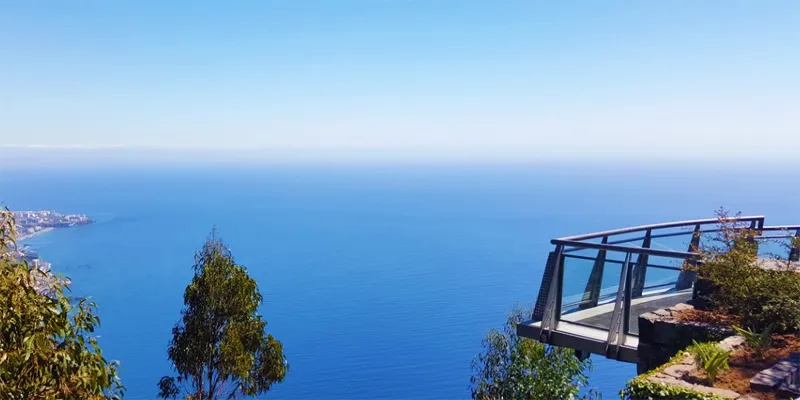
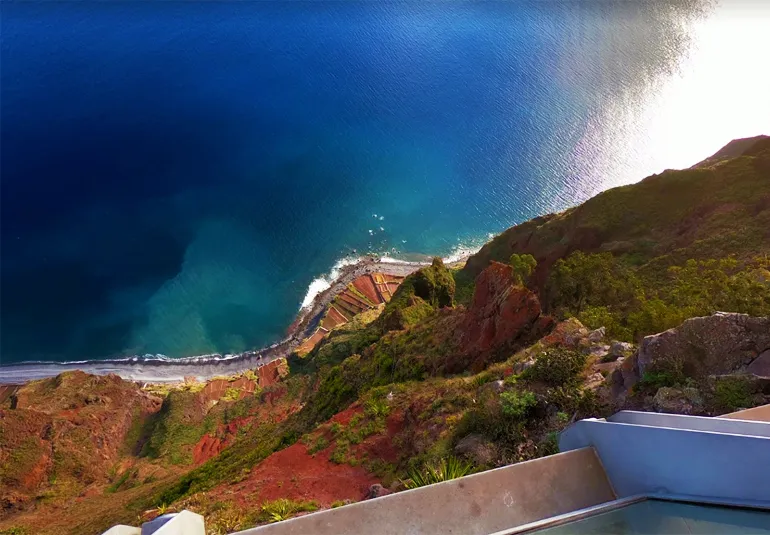
- Coordinates: 32.656657, -17.004561
To the west, we pass through magnificent scenery: namely Girão Cape, 590 meters high. Zarco, credited as one of the discoverers of the Archipelago ended his 1st investigation of the island here, and then returned to his home in Câmara de Lobos (near Funchal).
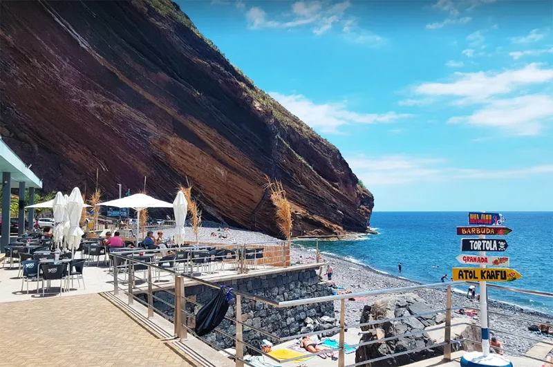
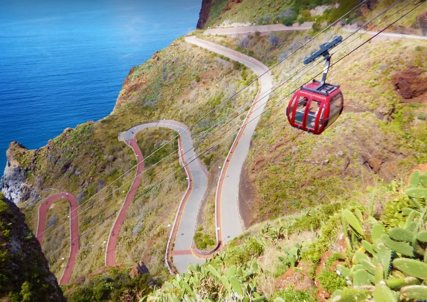
Fajã dos Padres
- Coordinates: 32.655091, -17.023051
Continuing westwards for more than 10 minutes, you will discover Fajã dos Padres, which you reach by cable car. It was part of the land of Zarco’s heirs, later of the Jesuits.
Calheta Beach
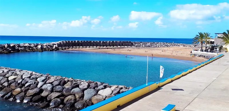
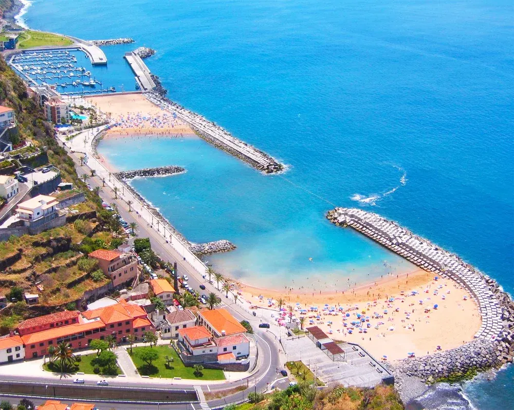
- Coordinates: 32.720364, -17.178526
Calheta is a charming urban center located in a valley that ends at a sleepy beach. A promenade connects the old part with the new one blossoming around the Marina.
The beach is artificial: the sand was brought from Morocco and Figueira da Foz. Don’t forget the sun cream!
In the Recreational Harbour, you can book tours to go whale and dolphin watching. Spectacular!
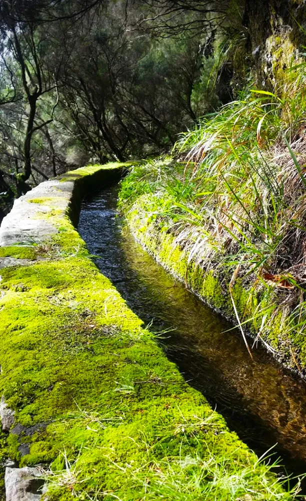
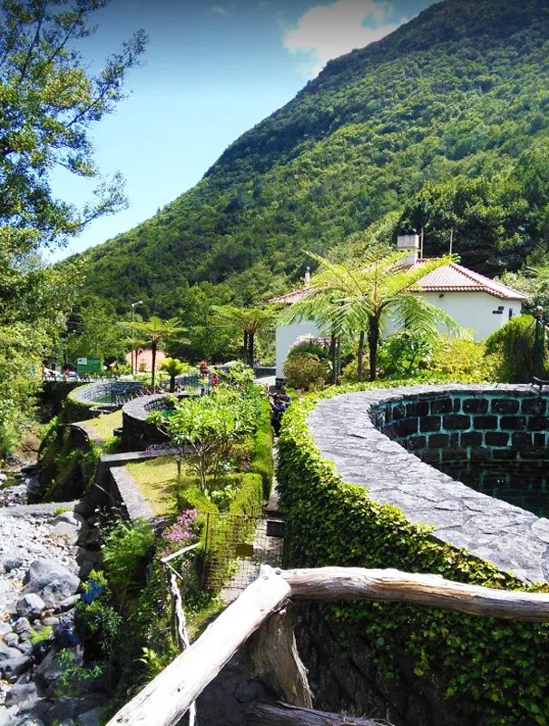
Rabaçal (Levada do Risco and Levada 25 Fontes)
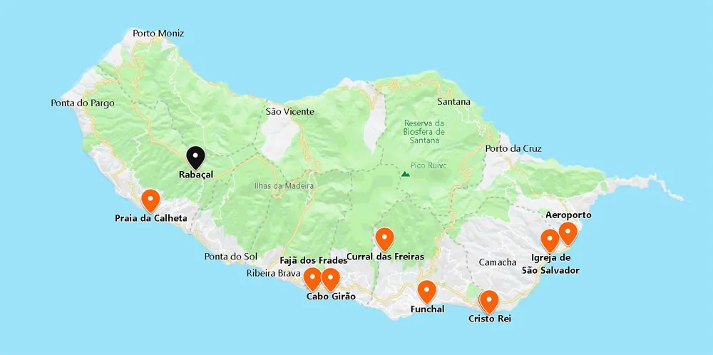
- Coordinates: 32.755567, -17.134695
Rabaçal (20 minutes from Calheta) is a charming valley with splendid trails in communion with the island’s native species. Here you discover two popular Levadas.
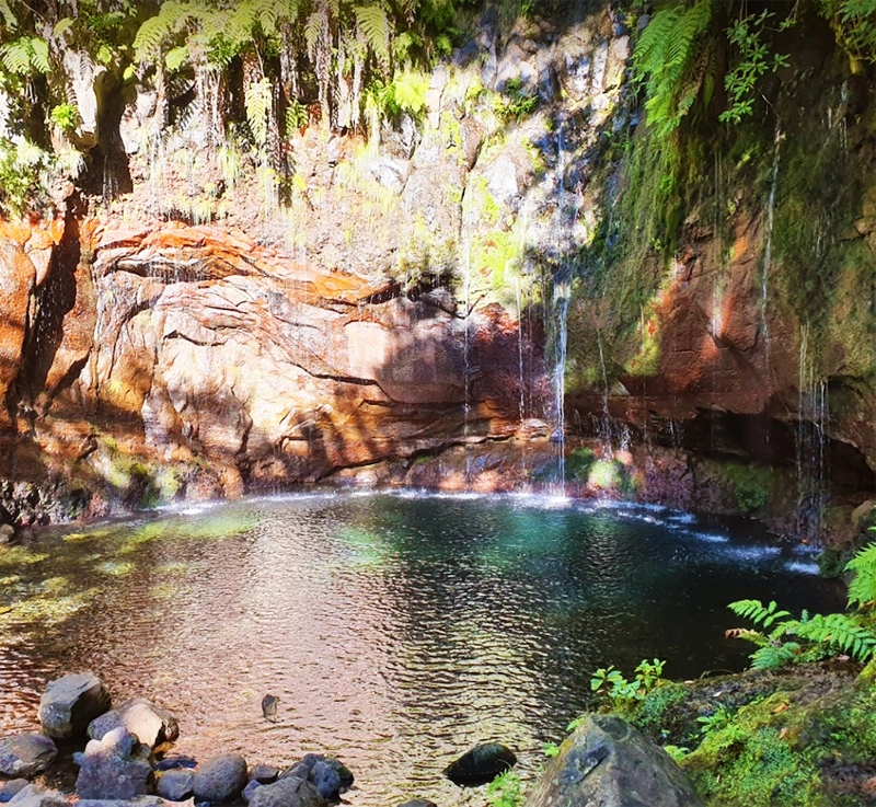
If you explore the Levada das 25 Fontes, you will descend to a waterfall whose water comes from several springs. At Levada do Risco you go up (close to 1000 m) while the birds grace you with their presence.
Access to these Levadas is at the foot of the regional road, ER110, from where it descends to the Rabaçal shelter.
The Levadas fed the mills to grind the wheat. With the introduction of sugar cane, they gained particular importance, as it was very profitable but demanding in water.
As you travel along these arteries, it is hard not to be surprised by the heroic effort that went into making them.
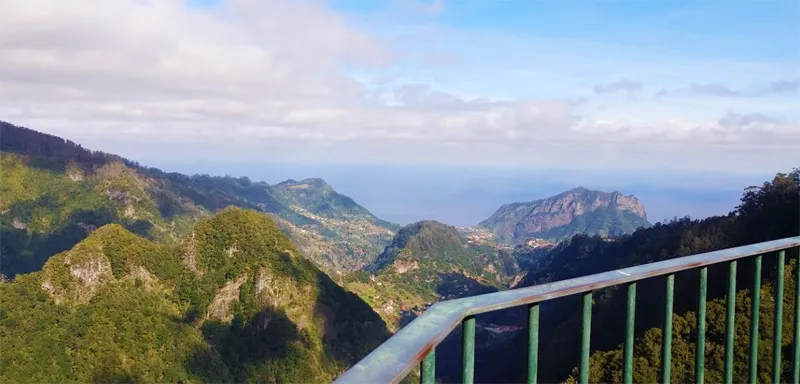
Encumeada Viewpoint
- Coordinates: 32.754347, -17.019512
At the junction of EN204 and 104, at the top of the parish of Serra de Água, at an altitude of 1000 meters, you will discover the Encumeada Viewpoint.
You are rewarded with the magnificent landscape of the mountains, the deep valleys of São Vicente, Ribeira Brava, and the omnipresent ocean on the horizon.
Santa Belvedere
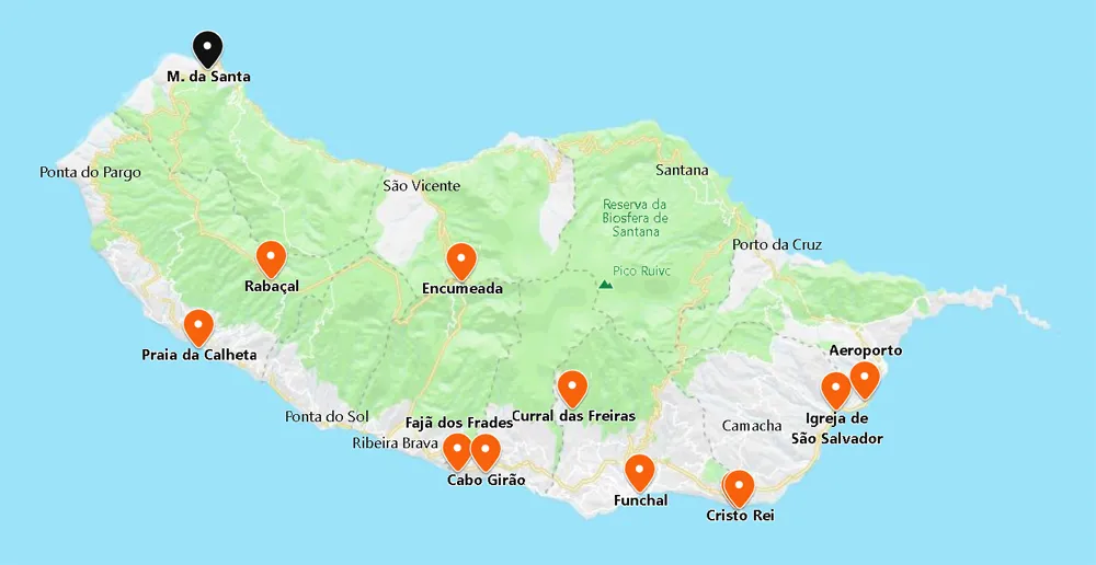
- Coordinates: 32.862503, -17.173286
From Funchal, it is 50 minutes, winding its way northwest to Porto Moniz: a lively municipality with two sets of natural pools.
Along the ER101 road, you will have stunning views of the coastline and along the way, discover the beautiful scenery of Santa Belvedere.
Porto Moniz Natural Swimming Pools
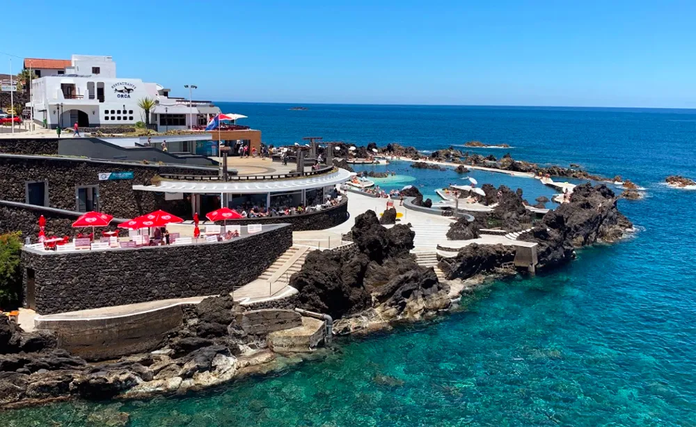
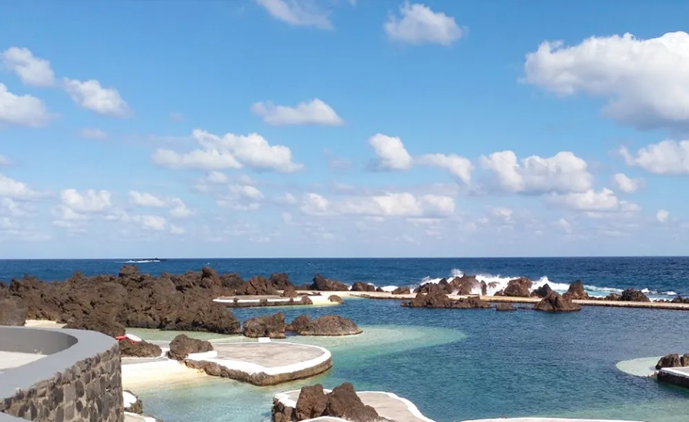
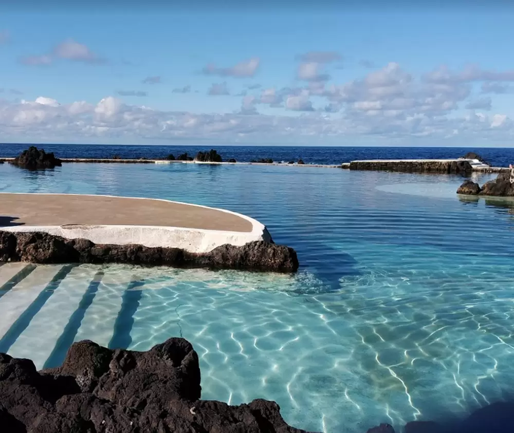
- Coordinates: 32.868036, -17.166351
On the coast, below the Cachalote Restaurant, is Porto Moniz’s first set of natural swimming pools, deliciously hot in summer. To the west, the long seafront promenade concentrates colourful cafés and kiosks, from where the 2nd set of natural swimming pools emerges.
They are pleasant spaces that provide refreshing baths among the volcanic rocks.
Eira da Achada Viewpoint
- Coordinates: 32.848272, -17.152965
Continuing along the regional road 09, you will come across the Eira da Achada Viewpoint, with a vast panorama of the island’s northern coast. Continuing eastwards, you will pass through Seixal, very close to the municipality of São Vicente.
Bride’s Veil Viewpoint
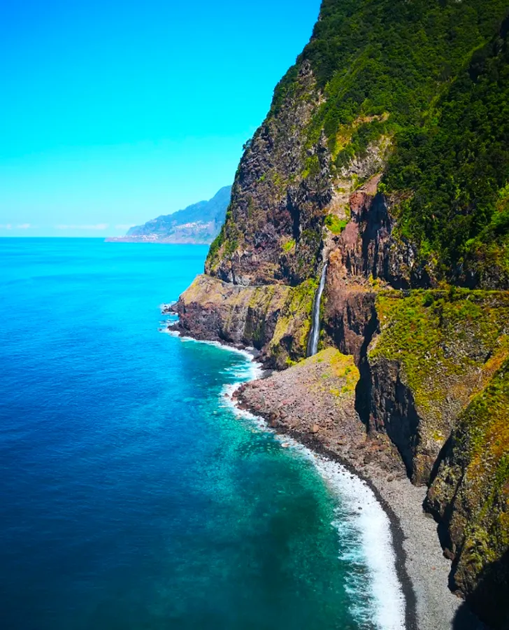
- Coordinates: 32.816141, -17.095325
From Seixal, it is a 5-minute drive to the Véu da Noiva, which offers the sight of a waterfall that leaps from the hillside to join the immense Atlantic Ocean.
São Vicente Caves
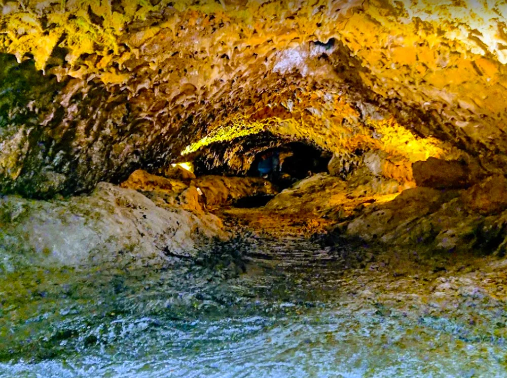
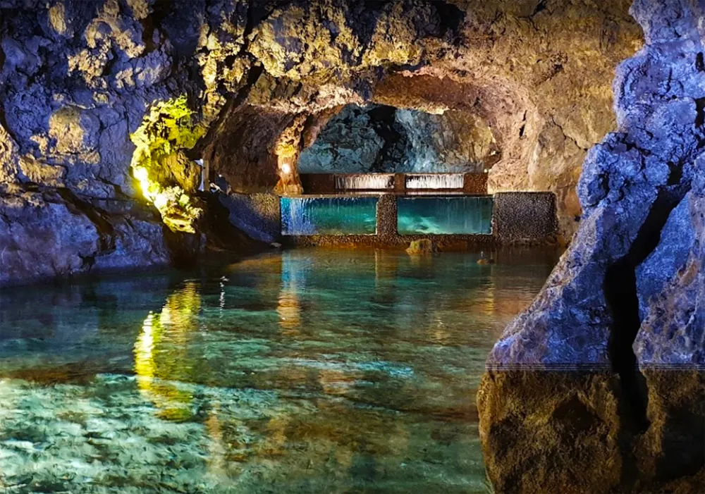
- Coordinates: 32.797572, -17.042076
We venture northwest and discover São Vicente. At the heart of the municipality stands the Parish Church for São Vicente (18th century) in baroque style.
One kilometre south is the entrance to the magnificent São Vicente Caves, discovered by locals in the late 19th century. The underground caves, formed 900 thousand years ago, were then explored by the English naturalist James Yate Johnson.
Santana
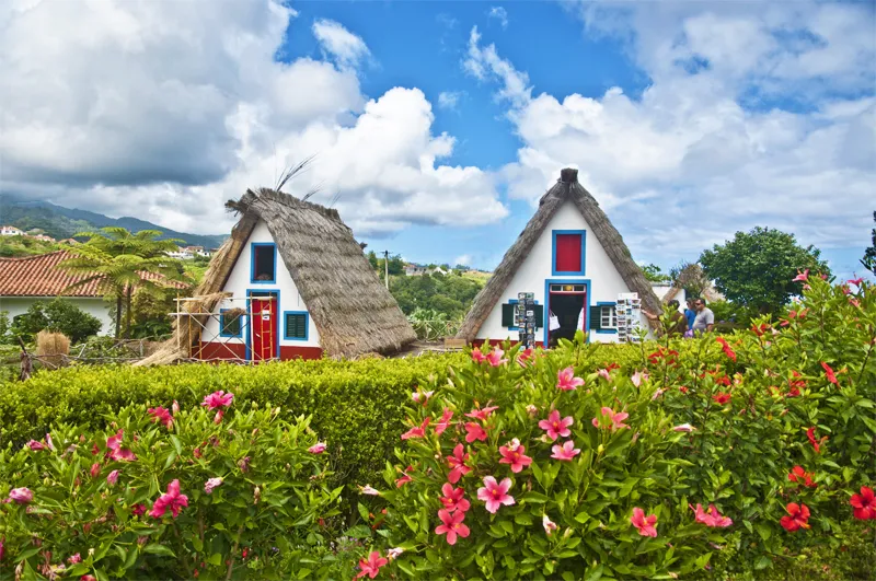
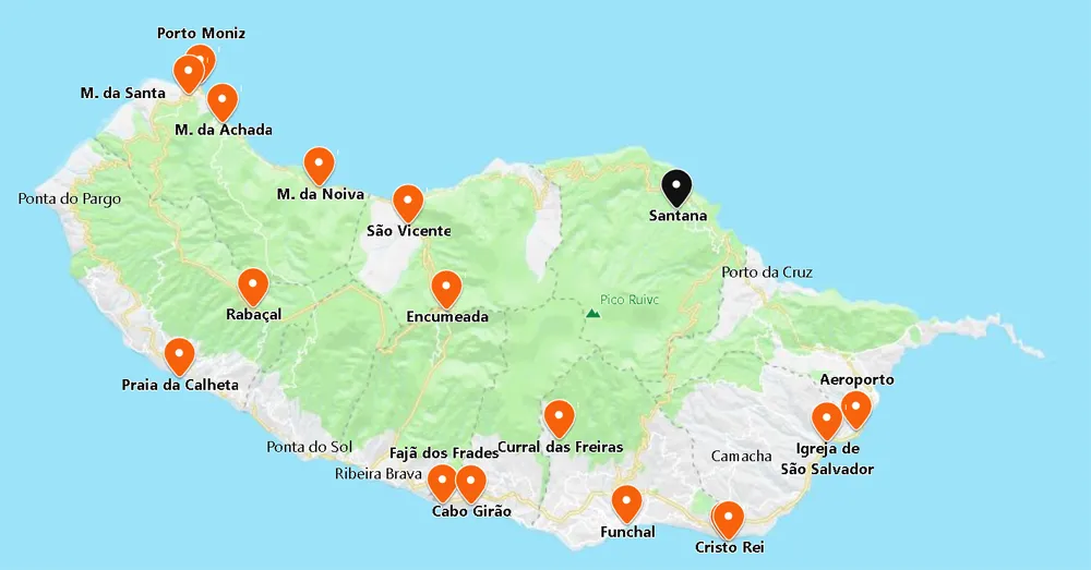
- Coordinates: 32.805233, -16.881841
One hour from São Vicente is Santana and the traditional triangular houses. In the centre, you will discover a well-kept square and a beautiful 17th-century church with a gilded carved altar.
Less than a kilometre away, discover the Madeira Theme Park, 7 hectares of green spaces and pavilions depicting the old daily life of Madeirans. Inside you’ll see a lake, a children’s playground, café, but what captivates us are the handicrafts.
Caldeirão Verde Levada
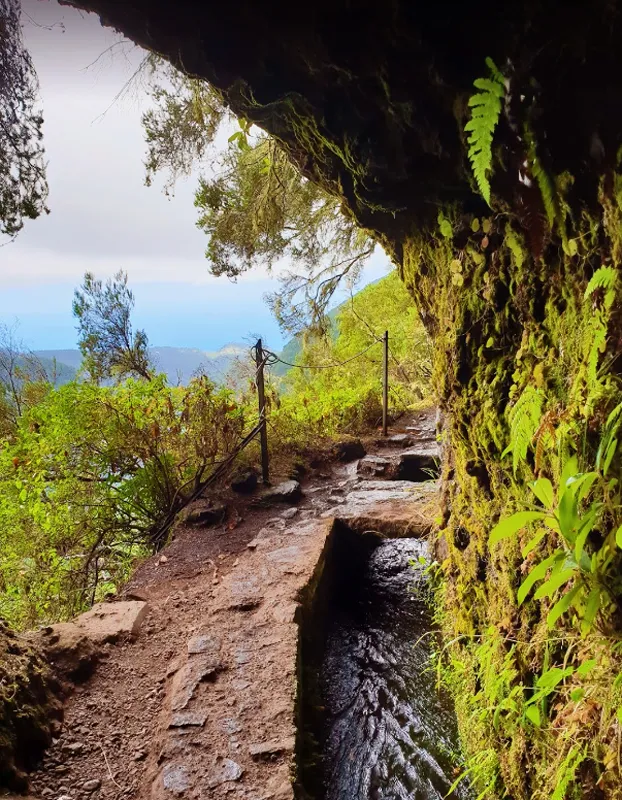
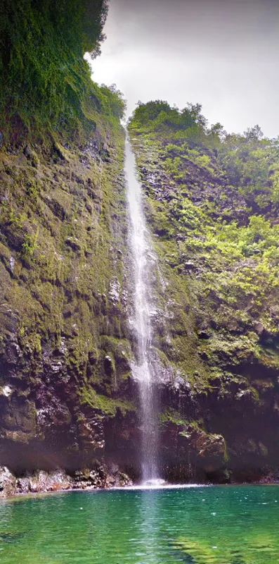
- Coordinates: 32.783606, -16.906026
In the interior of Santana, you’ll find the precious Parque das Queimadas (partly with vegetation typical of the Laurissilva forest – a World Heritage Site concentrated mainly in the north of the island, where it rains the most).
The Queimadas Shelter marks the beginning of the Levada do Caldeirão Verde course – 13 km (round trip – takes five and a half hours) culminating in a charming natural amphitheatre which gives the Levada its name – Caldeirão Verde.
Ribeiro Frio Forest Park
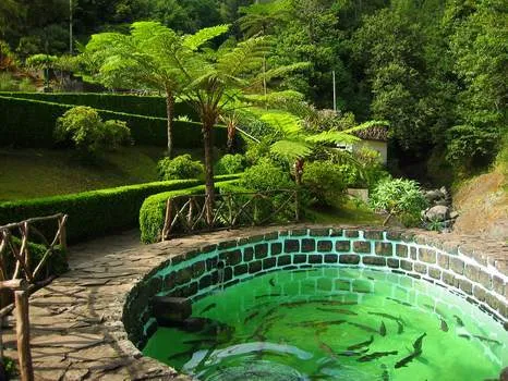
- Coordinates: 32.738963, -16.887248
You reach the beautiful valley of Ribeiro Frio in the middle of the island. Here, we celebrate the sun with great joy, but the sun’s shyness does not weaken the flora. On the contrary: Hydrangeas and Orchids enliven the spaces around the trout farm.
Here you have access to great walks, namely the famous Vereda dos Balcões (1 km, which you complete in an hour and a half). It culminates at the Balcões Belvedere, with a cinematographic panorama of the islands´ peaks.
Pico do Arieiro
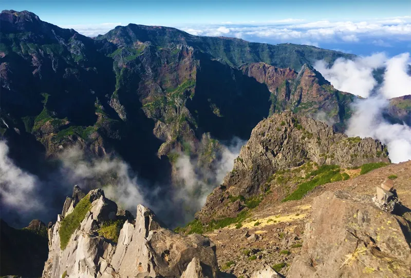
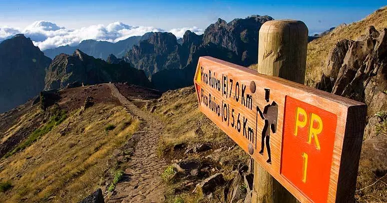
- Coordinates: 32.735648, -16.928603
In the northern interior, 10 km from Ribeiro Frio, is the magnificent view from the Pico do Arieiro Viewpoint – on a clear day, you can see the north and south coast.
Next to the viewpoint begins a popular route on the island: PR1 Vereda do Arieiro, which joins Pico do Arieiro to Pico Ruivo – the two highest peaks on the island.
The total distance is 7 km, but you can only walk up to the Miradouro do Ninho da Manta (1 hour round trip).
Ponta de São Lourenço
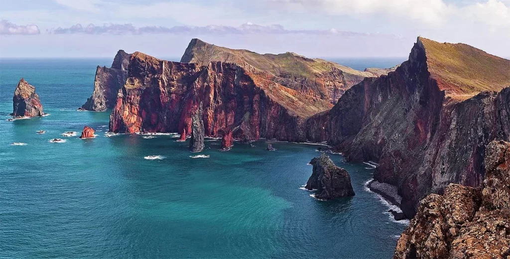
- Coordinates: 32.749259, -16.706715
Exploring the island’s northeast coast, you will discover the Ponta do Rosto Viewpoint, with its unique, wilder and more arid environment.
The trail to the tip of the small peninsula starts near the car park and to complete it takes 3 hours (round trip). At some point on your route, you will have two options: on the 1st, you move down to the quiet pebble beach.
If you choose to go left, you walk to the Casa do Sardinha, a reception centre where you will regain strength. From here, it is 30 minutes to the tip of the peninsula (Ponta do Furado) with an enchanting panorama of the coast and the Atlantic surrounding the islets (Farol and Cevada) on the horizon.
Pico do Facho Viewpoint
- Coordinates: 32.723919, -16.758541
The Machico Strait is 15 km from Ponta de São Lourenço, and the first Portuguese landed in its bay.
On the east side, discover the Pico do Facho lookout point – a 320-metre peak once the ideal place to warn of intruders on the coast. In the past, there was a bonfire during the Feast of the Blessed Sacrament.
Lord of Miracles Chapel
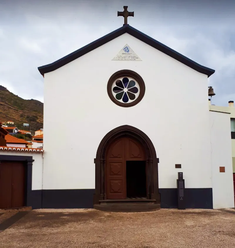
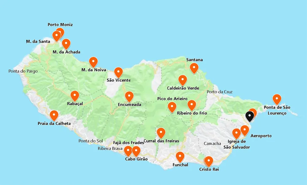
- Coordinates: 32.719100, -16.764172
In the centre of Machico is the Capela do Senhor dos Milagres, where the 1st Mass on the island was celebrated.
Explore the charming cafés along the coast. When the tide is low, you will be rewarded with Banda Além Beach, next to the Recreational Harbour.