

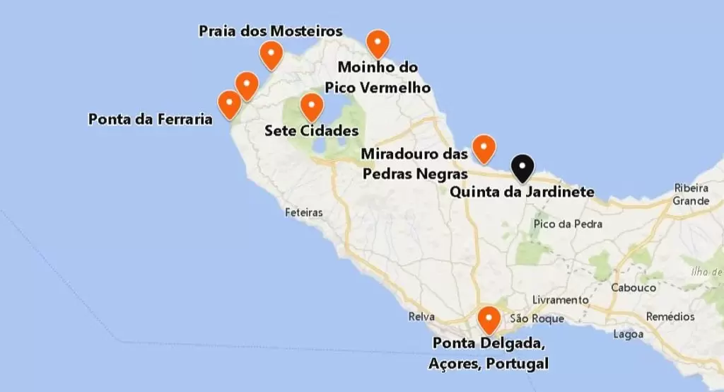
On the Way to Sete Cidades
If you’re visiting the region outside the summer, installing the SPOTAZORES app (IOS, ANDROID) is best. You’ll have access to real-time webcams and can plan your stay on São Miguel Island, avoiding the foggiest times.
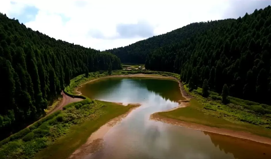
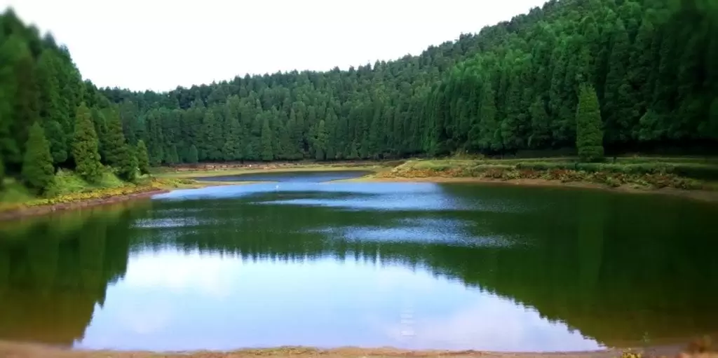
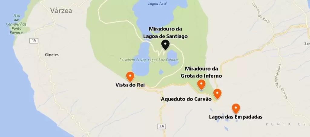
Lagoa das Empadadas

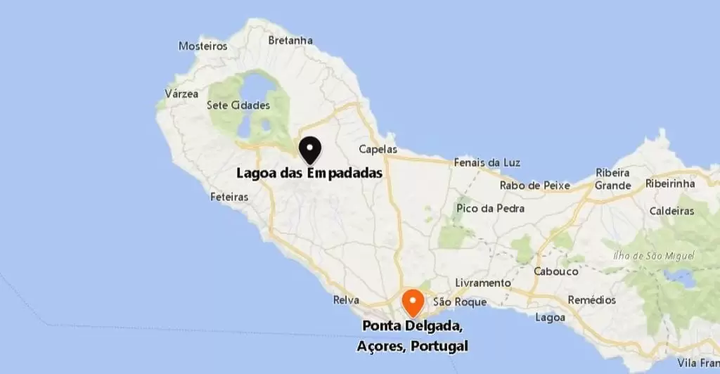
Access to the lagoon – Coordinates: 37.8267043,-25.7426403
From Ponta Delgada, it is 20 minutes along the beautiful regional road northeast to the access to Lagoa das Empadadas. This short climb culminates on a dusty dirt road to the lagoon surrounded by cryptomeria trees.
The periphery of the Lagoa, divided by two water tables, is fully accessible by car. In the past, it supplied the fountains of Ponta Delgada through an aqueduct – today, it is an idyllic place to test your photographic skills.
Carvão Aqueduct
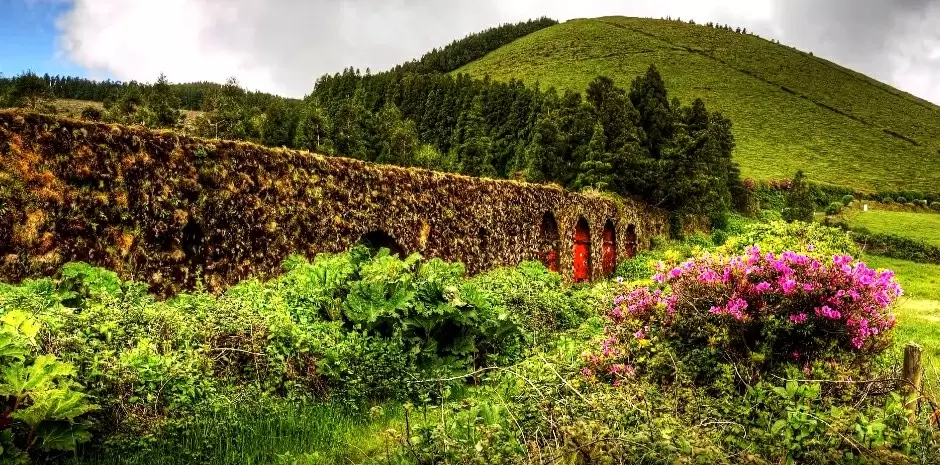
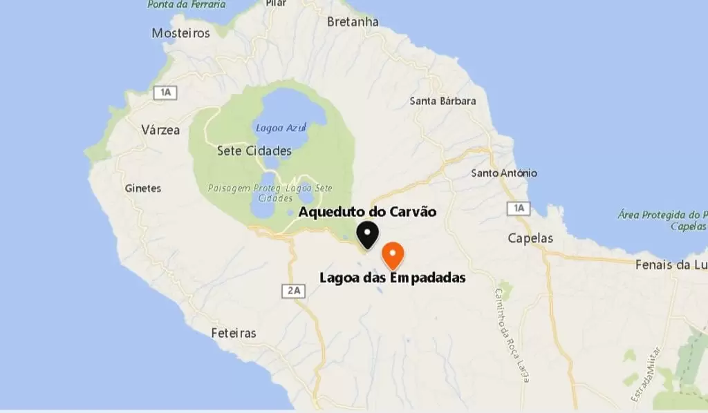
- Coordinates: 37.832502,-25.751831
On the way, you can see the Carvão Aqueduct already in complete symbiosis with nature, giving it a special aura. The 1st aqueduct on the island (16th century) was made of wood, built by the order of Dom Manuel. It was replaced by basalt rock aqueducts in the 18th century.
Grota do Inferno Belvedere

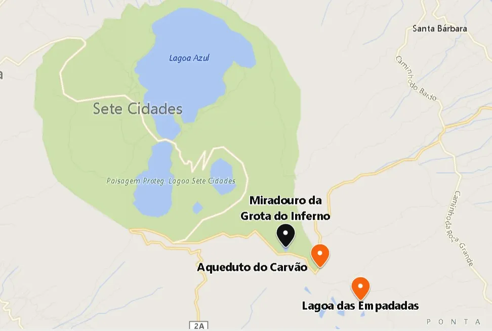
- Coordenadas: 37.836155,-25.75963
Coming from Ponta Delgada to Sete Cidades, you will notice the signposts signing this on your right – past the beautiful old stone aqueduct.
To access the fabulous Grota do Inferno Viewpoint, known as the Miradouro da Boca do Inferno viewpoint, enter the Mata do Canário Gate (open on weekdays until 3pm) – you can drive or walk to the staircase that guides you to the viewpoint.
If you have good weather, you can see the 4 lakes (Lagoa do Santiago, Sete Cidades, Canário and Lagoa Rasa).
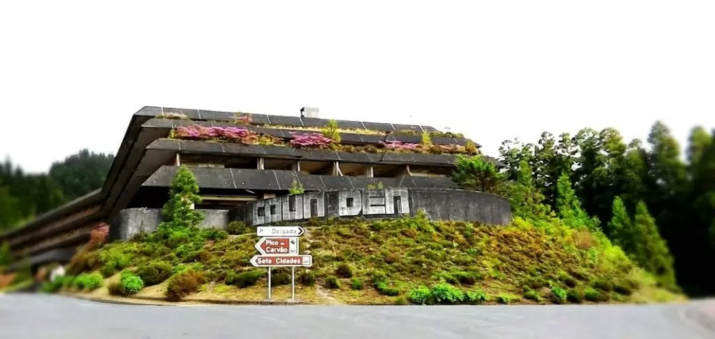
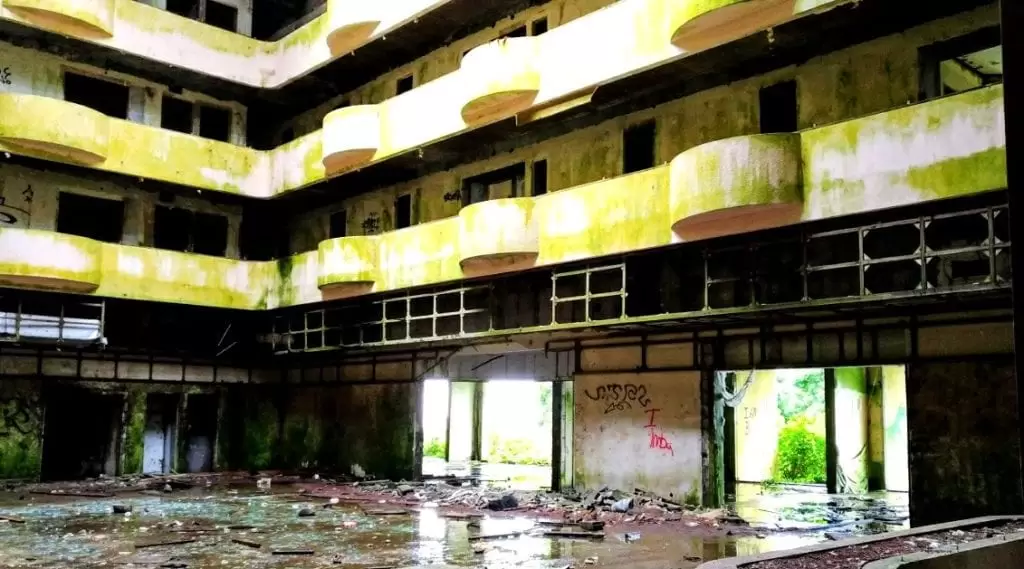
Vista do Rei Viewpoint
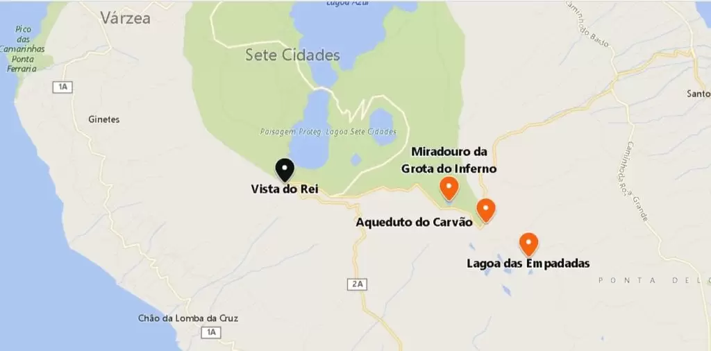
- Coordinates: 37.839217, -25.794818
A 10-minute drive from Lagoa do Canário, along the EN9-1A, you reach the wonderful Miradouro Vista do Rei Viewpoint, where King Dom Carlos (1901) was – with parking space and toilets.
The caldera of the seven cities is undoubtedly one of the most prodigious sights. No image can do it justice, and you’ll have to go in person. In front of you stands what remains of the Monte Palace, once a five-star hotel that closed in 1990. It is a peculiar presence next to nature’s best – and this contrast does not go unnoticed.
Santiago Lake Viewpoint
Continuing along the EN9-1A, it’s not long before you spot the Lagoa de Santiago viewpoint, surrounded by vegetation – it’s no end of greenery and tranquillity. You can easily find a trail if you want to go down to the lake.
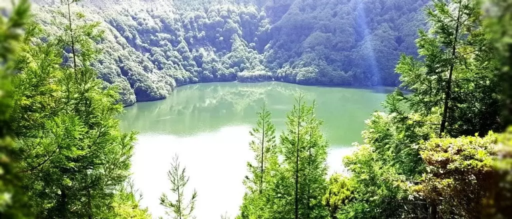
- Coordinates: 37.851659, -25.777391
Just before reaching the Sete Cidades Lake, you see, on the right side, the Parque de Merendas da Volta do Salto, a pleasant picnic area with parking.
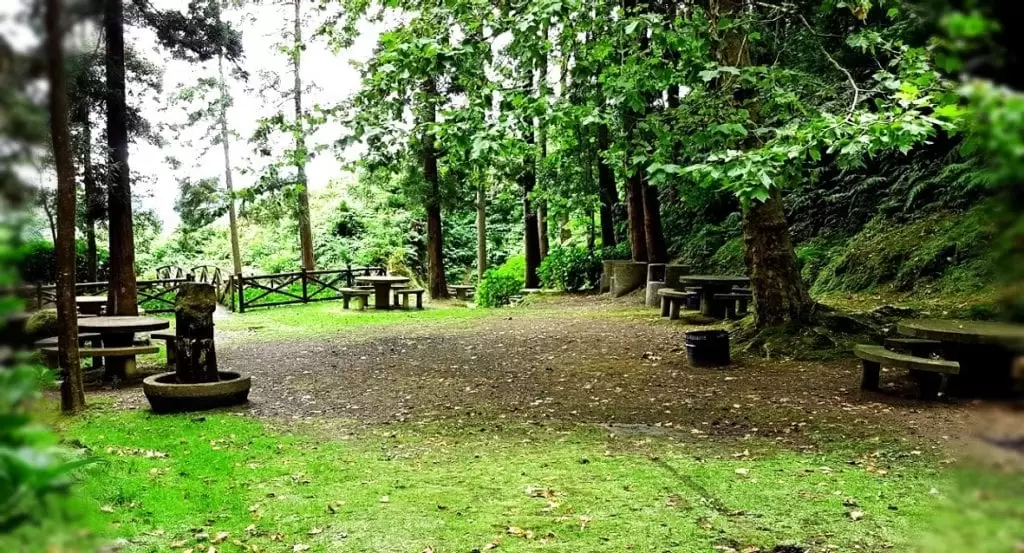

- Coordenadas: 37.8512088,-25.7825491
The road winds downwards through hydrangeas and dense vegetation until it inevitably reaches the Lagoa.
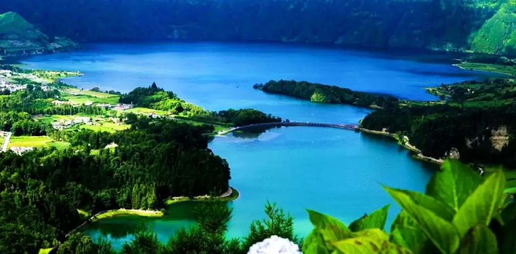
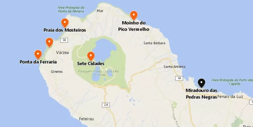
Sete Cidades
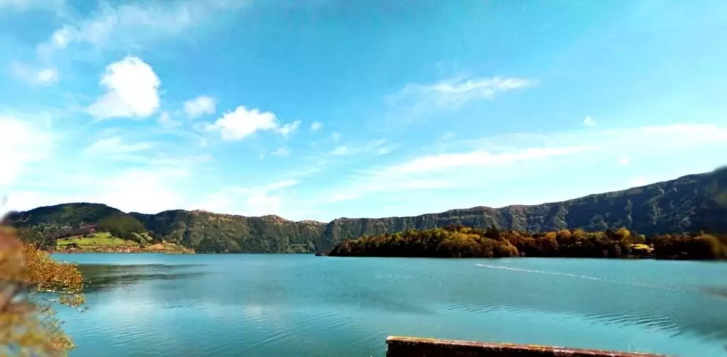
- Coordenadas: 37.859269,-25.795126
The toponymy of Sete Cidades Lake is based on the legendary island in the Atlantic that was a lost Christian kingdom. A legend of the parish tells us a romantic story from another time: in the realm of Seven Cities, there was a king who had a beautiful daughter. She was roaming the fields and one day met a shepherd.
Timidly they spoke. As time went by, romance blossomed. Unfortunately, the king was furious. He wanted his daughter to marry a prince and forbade her to see the shepherd. They could meet one last time.
At the final farewell, they both cried, and as time passed, two lakes were formed, one blue from the princess’s eyes and one green from the shepherd’s eyes – the tears remain united.
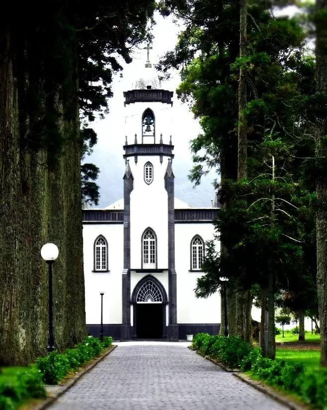
In the parish of Sete Cidades, you can rent canoes next to the lake. There is a beautiful garden, cafés, and restaurants. Right at the beginning of the settlement stands the beautiful neo-Gothic style church (19th century) – São Nicolau Church.
- Coordinates: 37.862723,-25.798102
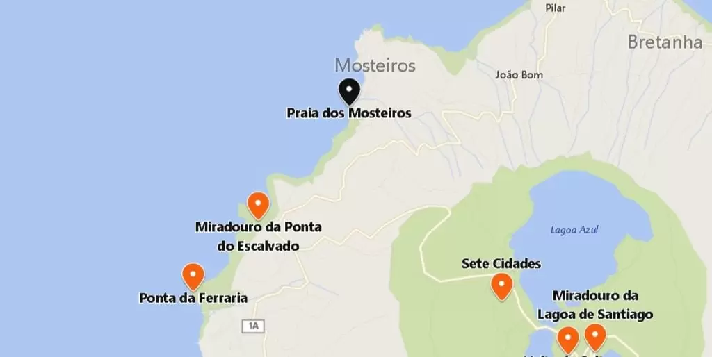
Along the Coast to Capelas
Ponta do Escalvado viewpoint
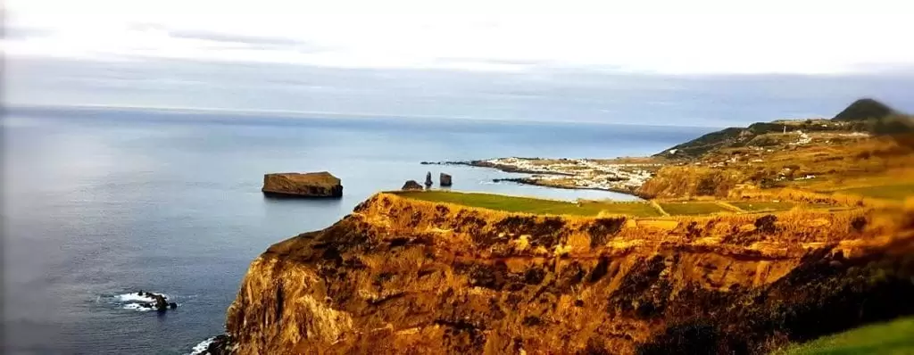
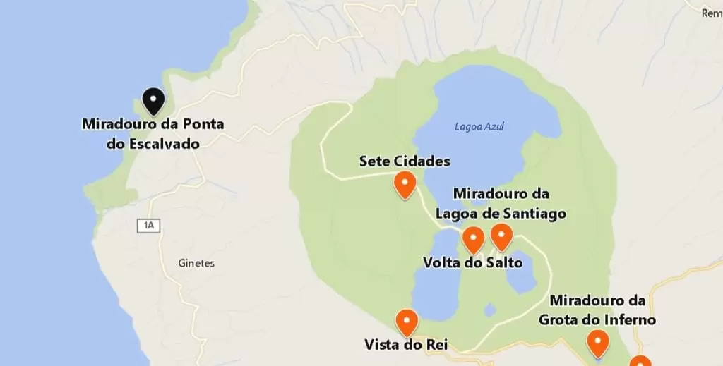
- Coordinates: 37.871308, -25.841343
Leaving Sete Cidades, it’s 6 km to the west coast of São Miguel until you find the Ponta do Escalvado Viewpoint, an excellent place to experience the sunset under the vastness of the sea.
On the right-hand side are views of the village of Mosteiros and its islet. The coastline is beautiful, and lovely stretches of road crowned with blue hydrangeas around it.
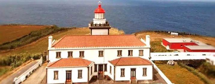
Ponta da Ferraria
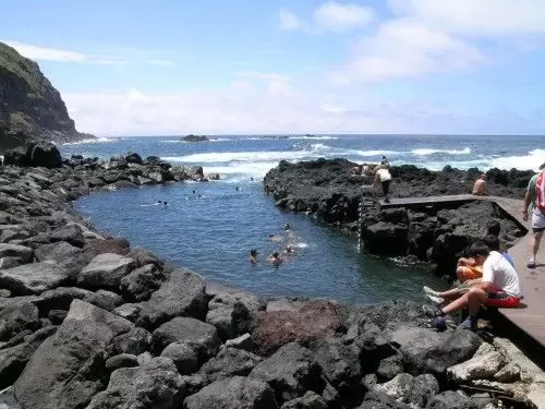
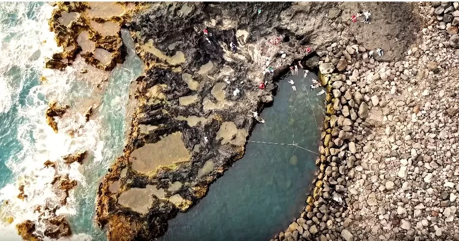
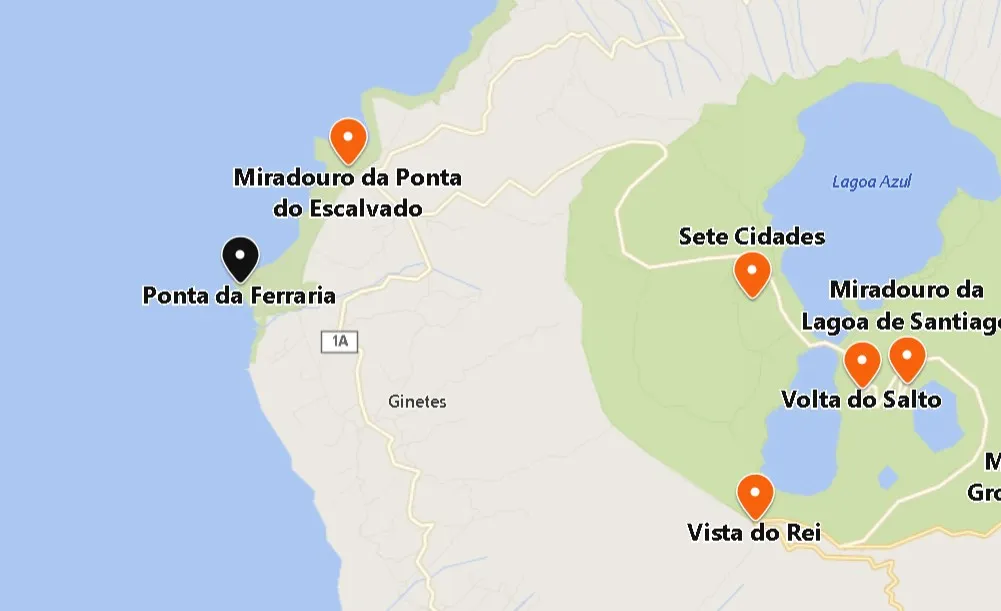
- Coordenadas: 37.860646,-25.853752
3 km from the viewpoint, discover Ponta da Ferraria. A natural pool of hot thermal waters is on the rocky parts by the sea. Don’t forget your sunscreen.
The therapeutic quality of the hot waters makes Ferraria such a special place. The locals even say that those who bathe here are 10 years younger. Well, perhaps in spirit…
- Coordinates: 37.853532, -25.850002
As you walk around the pools, 2 km, the Ferraria Lighthouse (1901) stands under the serene ocean. One of the most beautiful in the Azores, it was once powered by oil.
Mosteiros Beach
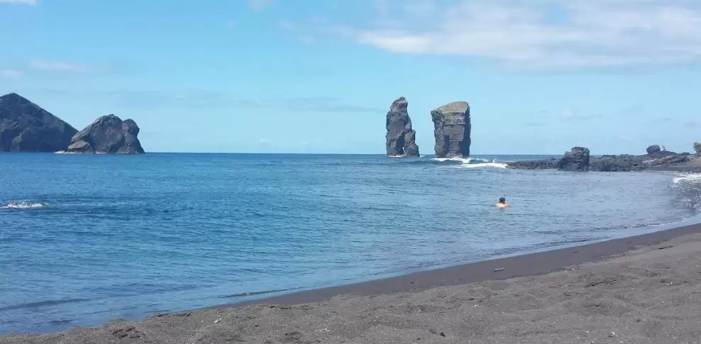
- Coordinates: 37.888385, -25.824080
Sometimes the volcanic lava threw, into the sea, pieces of its own and created here a landscape structure of volcanic fajãs of incredible beauty and fertility.
Continue north, 15 minutes along the EN1-1A, and you will reach Mosteiros Beach, a long sandy beach with typical black sand. Beautiful rocks from volcanic activity rise in the middle of the ocean.

- Coordinates: 37.891181, -25.820147
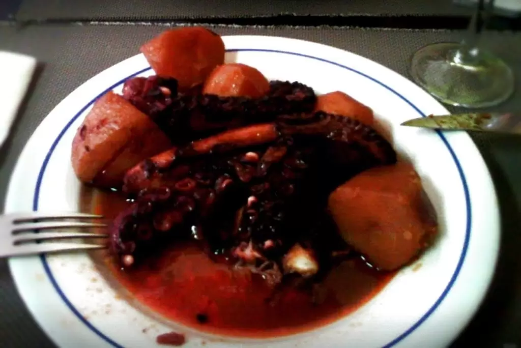
And after a refreshing swim nothing better than a good meal. One of the most typical dishes on the island is the grilled octopus “à Moda de São Miguel“. Try it at the small tavern, O Américo (Rua das Pensões 11).
Moinho do Pico Vermelho
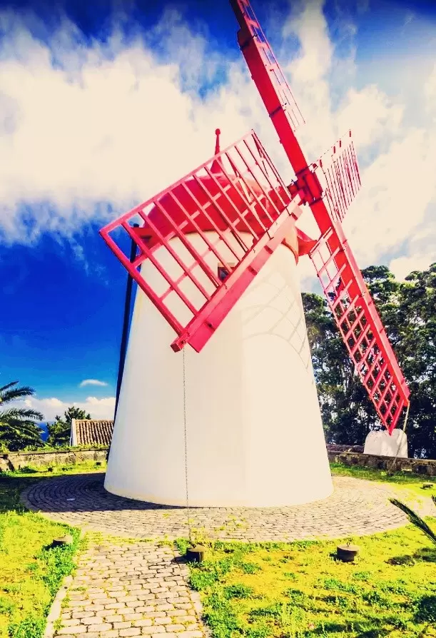
- Coordinates: 37.894800, -25.747723
Moinho do Pico Vermelho is 20 minutes from Mosteiros, east of the EN1-1A – a beautiful Dutch-style mill about 200 years old.
Pedras Negras Viewpoint
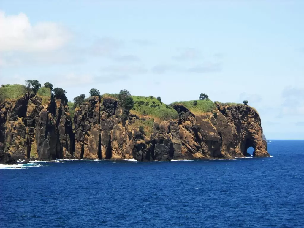
- Coordinates: 37.835658, -25.672490
As you pass the settlement of Capelas, you will see the Pedras Negras viewpoint, from where you can see the unusual rock formation popularised as the Elephant trunk.
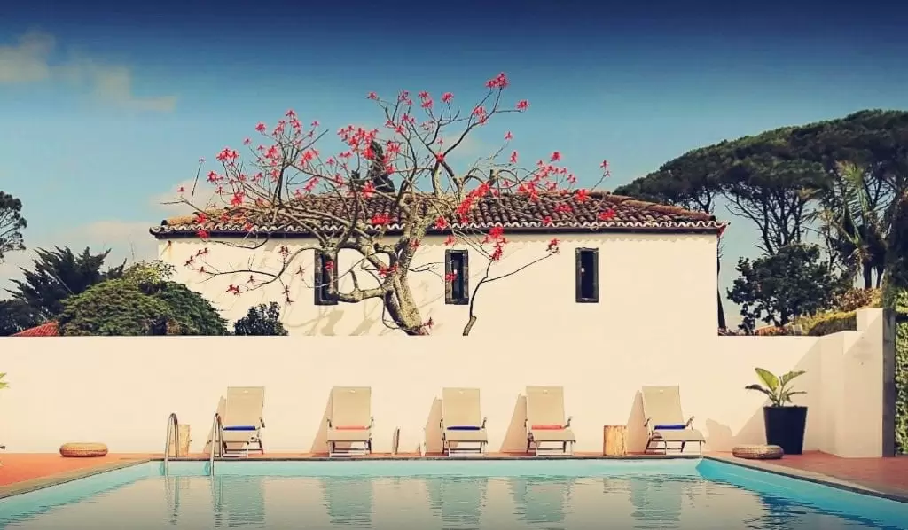
Capelas was an important sperm whale hunting centre with a factory for processing them. Close to the village emerges the Count’s Manor House. The hotel and restaurant in Capelas was once a 17th-century manor house – well worth a visit.
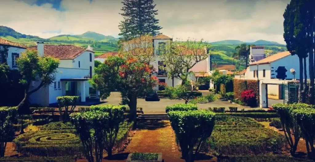
- Coordinates: 37.830294, -25.678346
It has excellent value for money and is 18 minutes from Ponta Delgada airport (via the EN4-1A).
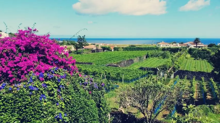
Quinta da Jardinete
- Coordinates: 37.824733, -25.644718
5 km east of Capelas is Quinta da Jardinete. It is a family property that takes advantage of the volcanic soil and the region’s microclimate. Once an orchard, the vines are now lovingly tended.
The owner gives you a guided tour starting in the vineyard, showing you the fermentation process in stainless-steel tanks. In the shop, you will see good quality wine, usually sold to local customers, and a short list of restaurants.
