

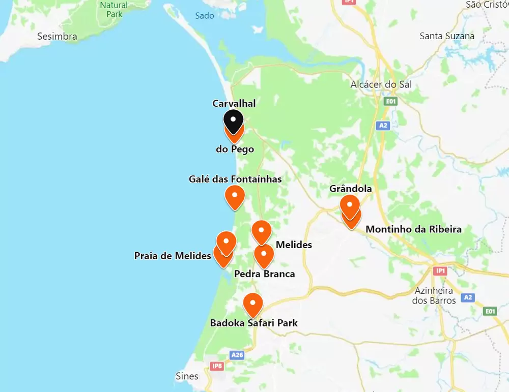
Grândola will forever be associated with the song “Grândola, Vila Morena” by José Afonso. On the eve of the 25th April Revolution, it was played on Renascença Radio as a signal for the army units to advance on Lisbon. For many, it is the anthem of the Revolution.
The town, in the coastal Alentejo, is a modest settlement among the plains and cork oaks. Relaxed. Still a place where people work hard, but agriculture is much less important.
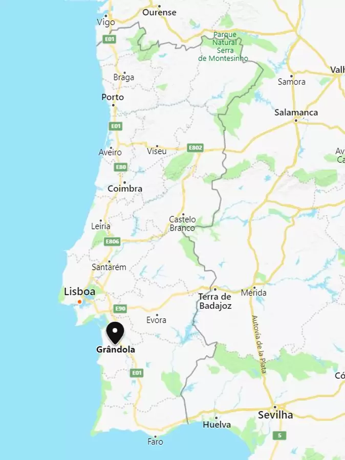
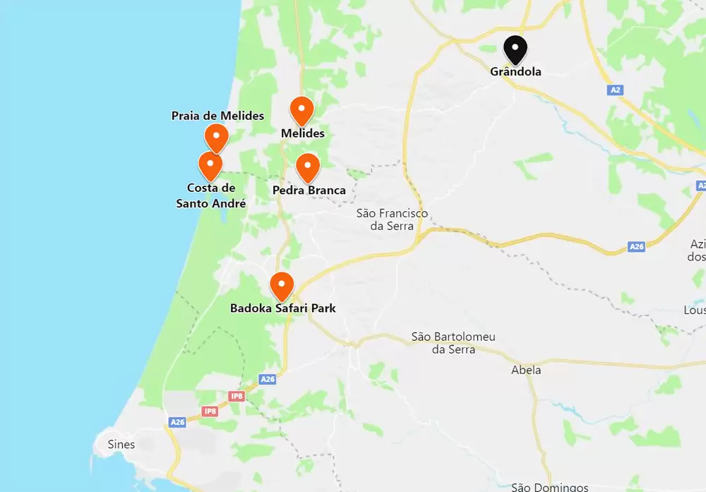
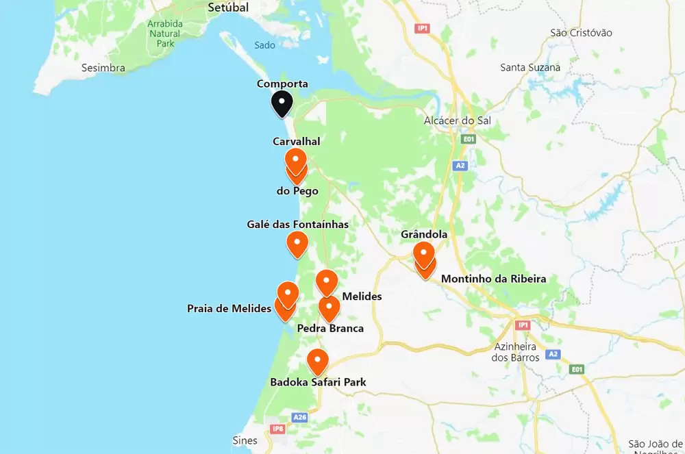
The county seat of the same name, it is bordered by Alcácer do Sal (to the north), Santiago de Cacém (to the south) and Ferreira do Alentejo (to the east). Its beautiful coast attracts many people to Troia and the beaches of Comporta.
As far as cultural heritage is concerned, the Roman archaeological ruins in Troia are the most significant – they date from the early 1st century.
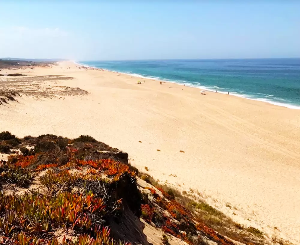
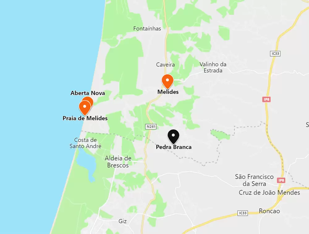
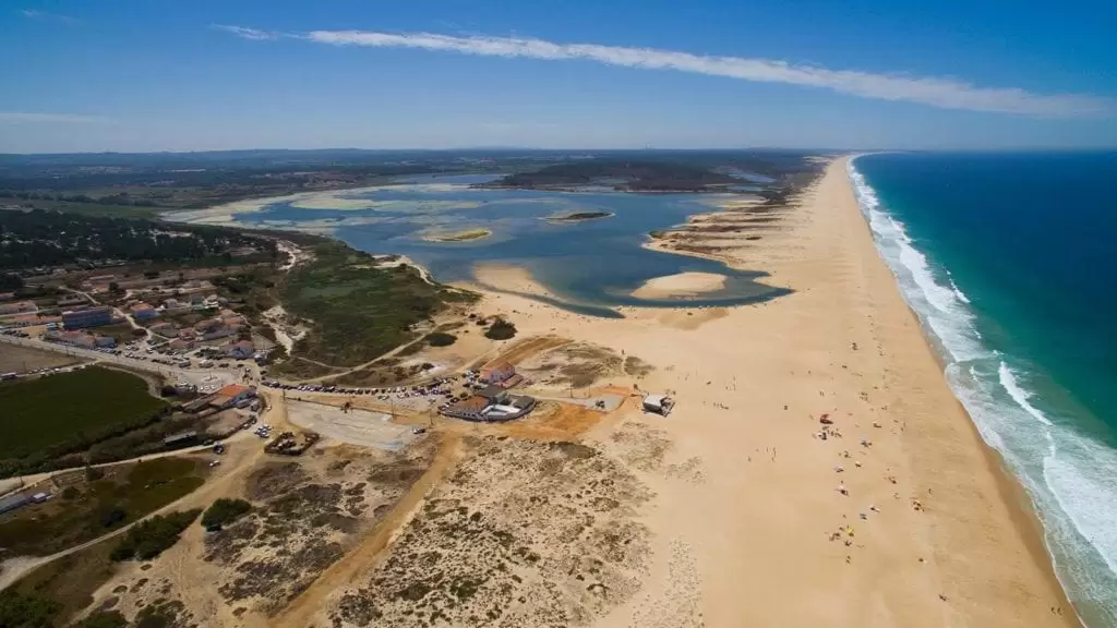
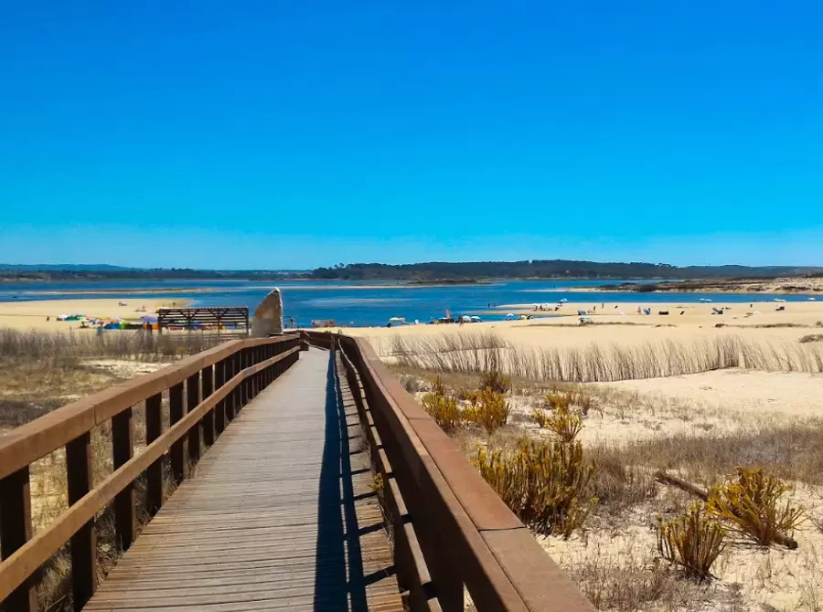
Melides Beach – Melides Lagoon
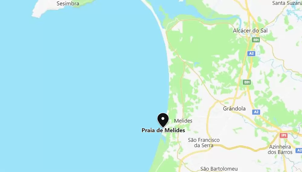
- Coordinates: 38.130844, -8.793419
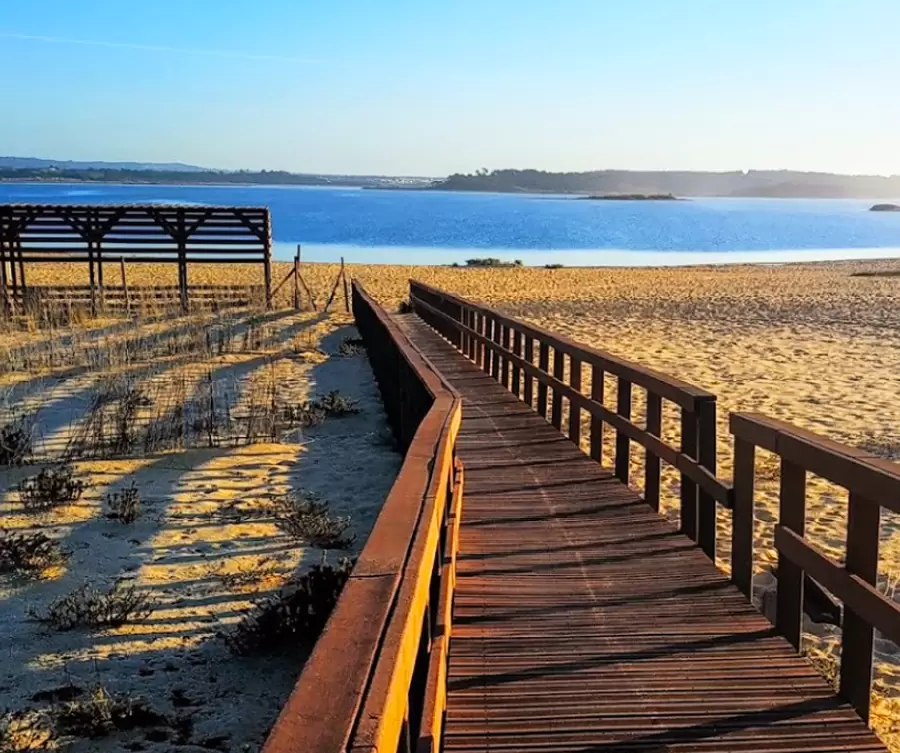
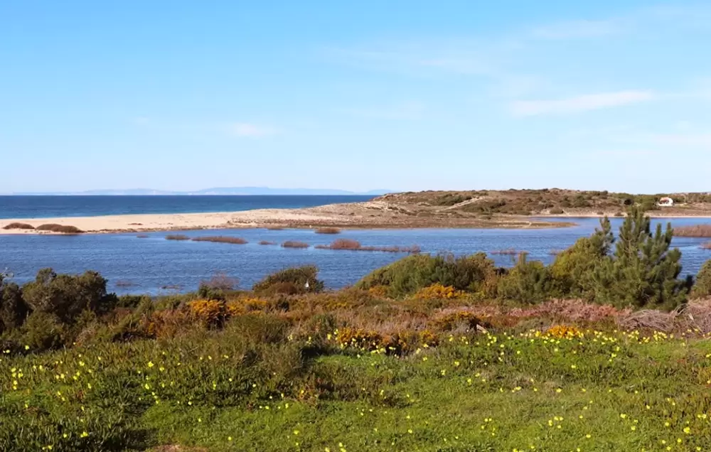
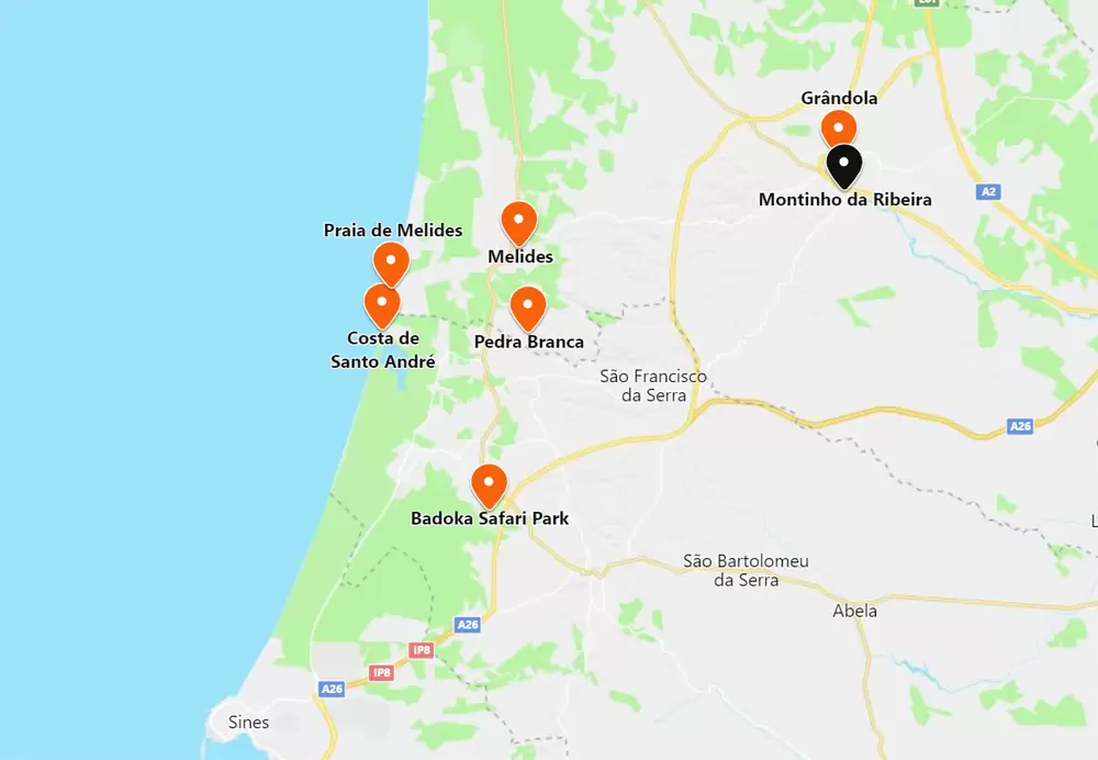
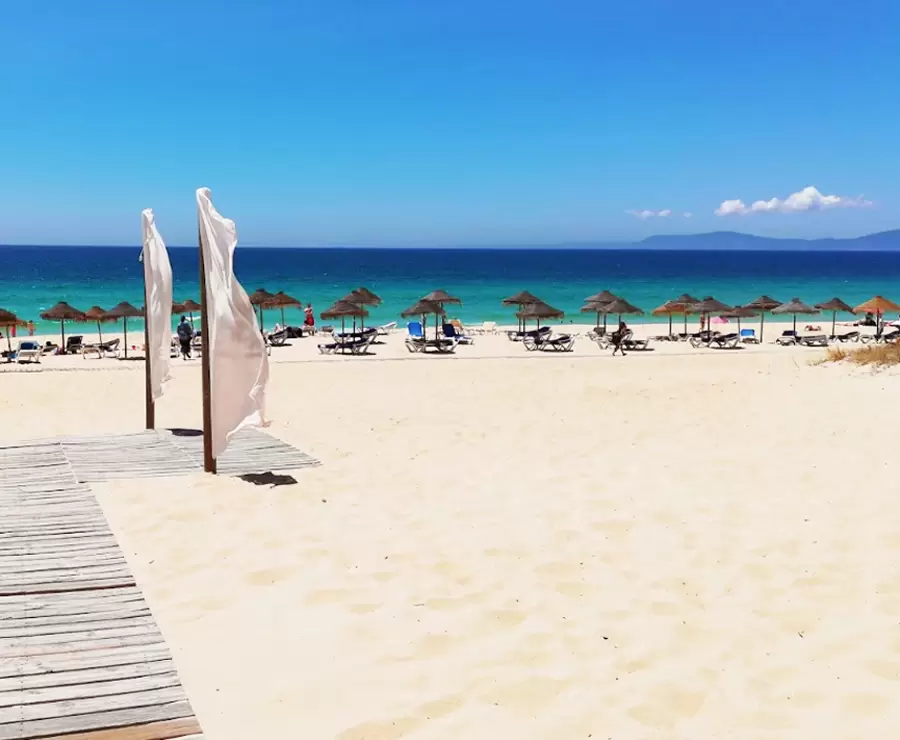
In recent decades, Grândola has grown through tourism on its coastal strip. At the south-western end is Melides Beach and you access it by wooden walkways – with parking, bars and restaurants close by.
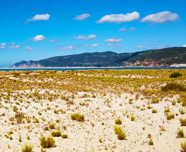
It is one of Portugal’s largest beaches, popular with water sports enthusiasts and paragliders. Next to it is the Lagoa de Melides (twenty-six hectares), which invites us to take a quiet walk in communion with herons and kites.
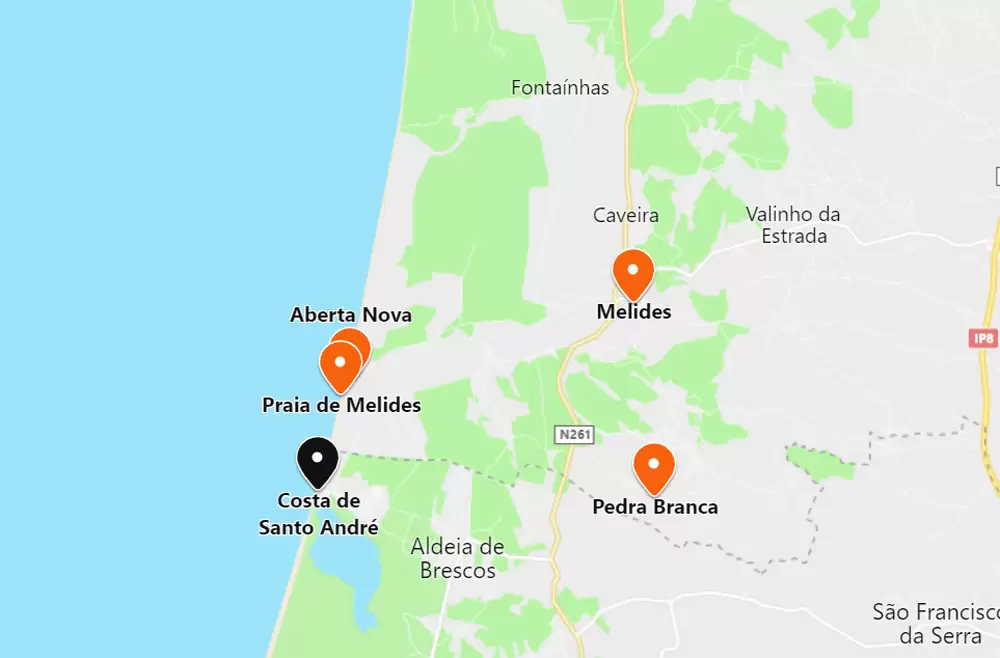
Aberta Nova Beach
Praia de Melides – Lagoa de Melides

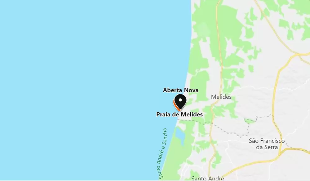

- Coordinates: 38.133272, -8.791363
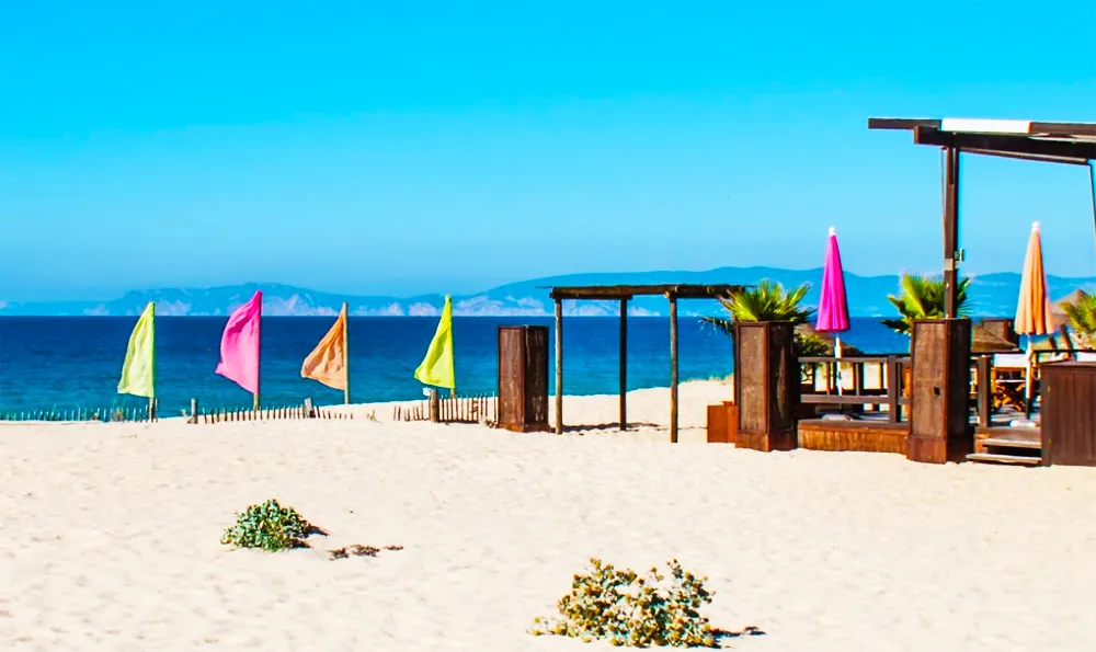
Praia da Aberta Nova is minutes northwards along a dirt road. It looks almost wild, but is supervised in the summer with a bar and parking. Accessed by a wooden walkway – for many it is one of the most beautiful in Grândola.
Melides
- Coordinates: 38.146958, -8.728878
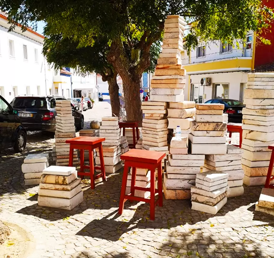
At 5 km (10 minutes drive) to the northeast, you reach the picturesque Melides parish. In the well-preserved centre, discover the small traditional church of São Pedro (18th century) and the market with abundant fresh fish.
You are sure to discover the sculptural ensemble “Culture came out on a day like this” – an interesting representation (in marble from Vila Viçosa) of a pile of books.
- Coordinates: 38.147326, -8.731467
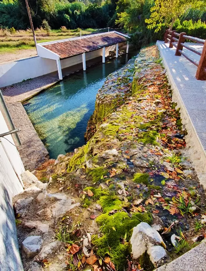
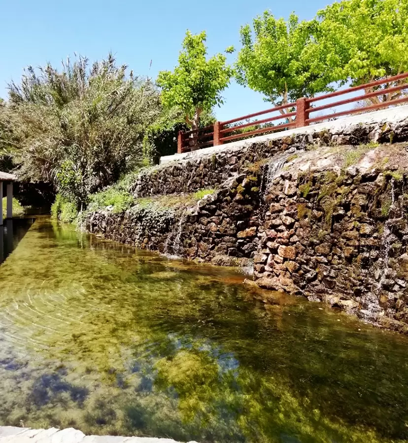
300 metres away, on Rua Comandante Ramiro Correia, is the delightful Olhos de Água park, which in the past was a place for washing clothes.
Pedra Branca Megalithic Monument
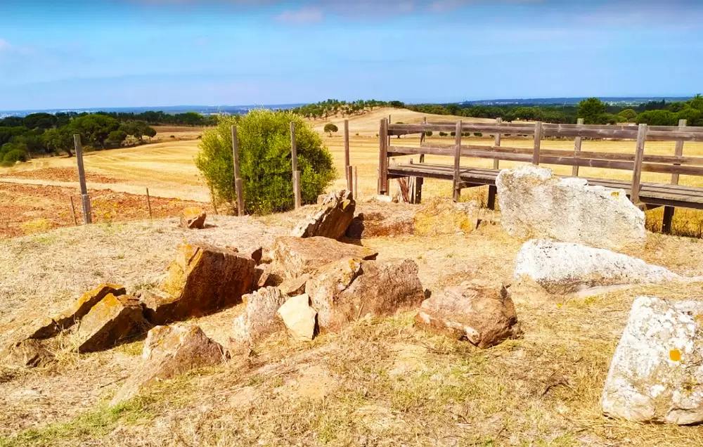
- Coordinates: 38.113160, -8.724313
In the region of Grândola there are several traces left by the Bronze and Stone Age Celts. South of Melides, 15 minutes along the N261, you will see the Pedra Branca Megalithic Monument (dated 3500 to 2600 BC): graves from which copper arrowheads have been found. The Celts probably came by boat from Galicia.
The Greek Strabo (historian and geographer who lived well over two thousand years ago) differentiated the Lusitanians from the other Iberians as Celts from the Oestreminis region (coastal strip from Galicia to the Algarve).
The Romans were terrified of them because they were fierce and physically bigger – the best mercenaries of the Carthaginian general Hannibal.
The Lusitanian was organised by family, tribe, and clan. Only in exceptional cases would the clans converge as one people, but after the conflict, everyone went home without a formal nation and border. Julius Caesar vented: “In the far reaches of Iberia there is a people that neither governs itself nor lets itself be governed.”
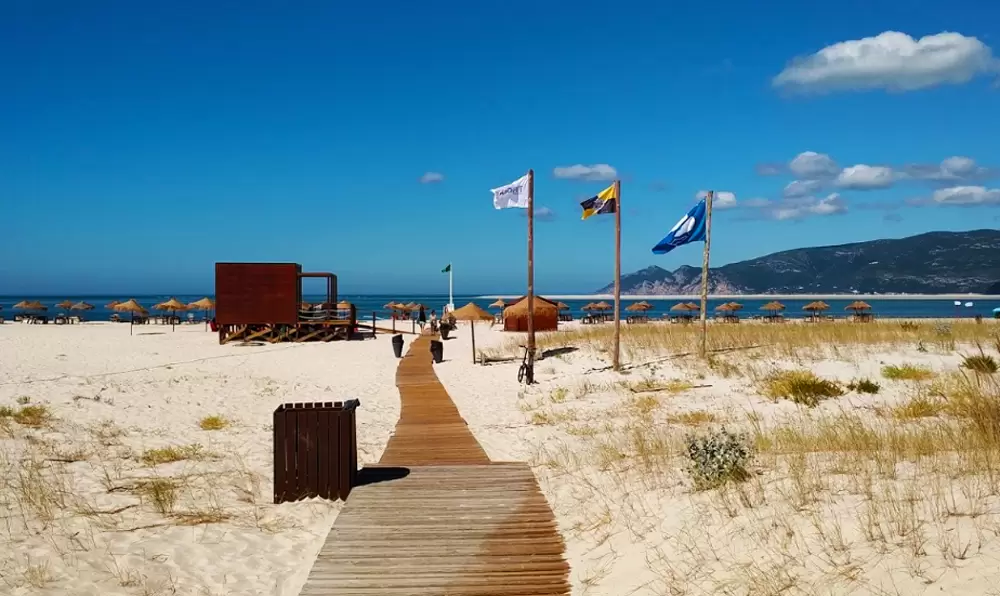
Praia da Costa de Santo André
- Coordinates: 38.114247, -8.798304
10 km from Melides, next to the Santo André Lagoon, emerges the popular Costa de Santo André Beach which is also accessed by a wooden walkway – of stirring sea with parking and showers.
If you crave gentle waters, there’s always the lagoon from where you can see, in summer, windsurfing sails crossing the body of water and the ocean, shimmering, on the horizon.
- Coordinates: 38.112938, -8.790987
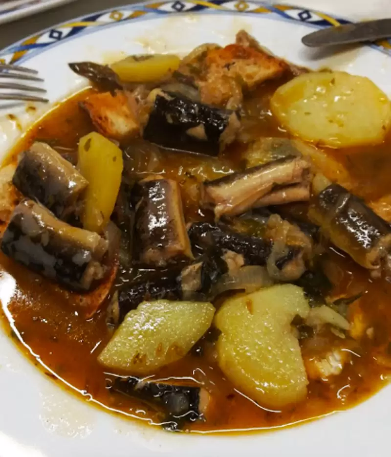
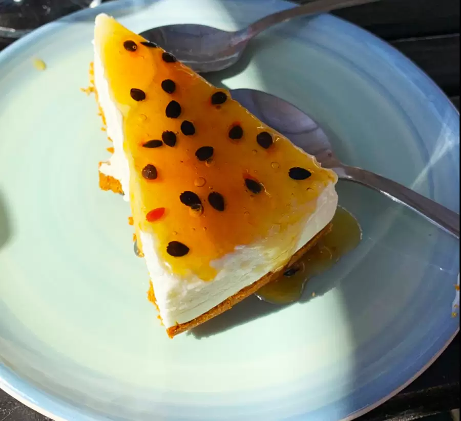
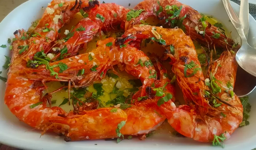
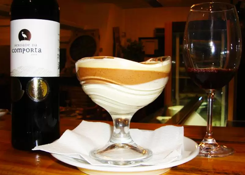
The restaurant Chez Daniel is 1 km away. You can enjoy the eels, caught in the lagoon, being magnificently prepared – all the fish is great, and you are presented with an interesting wine list.
Badoka Safari Park
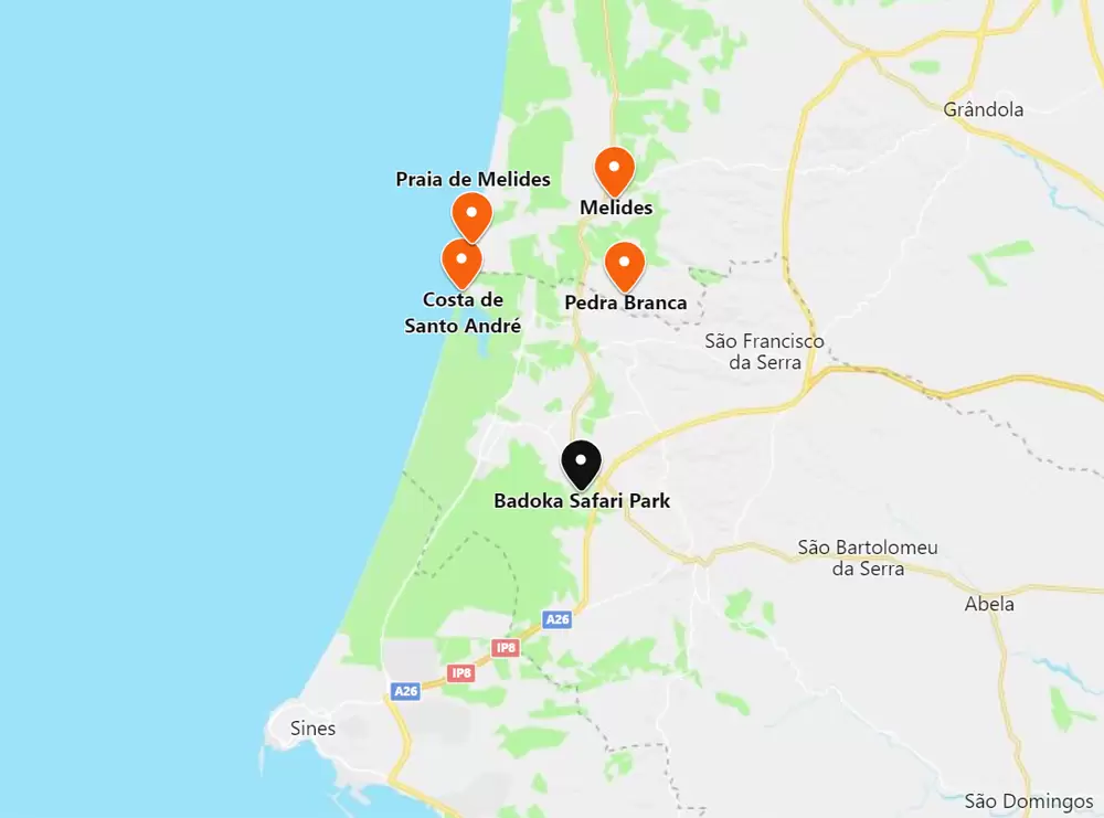
- Coordinates: 38.042571, -8.744066
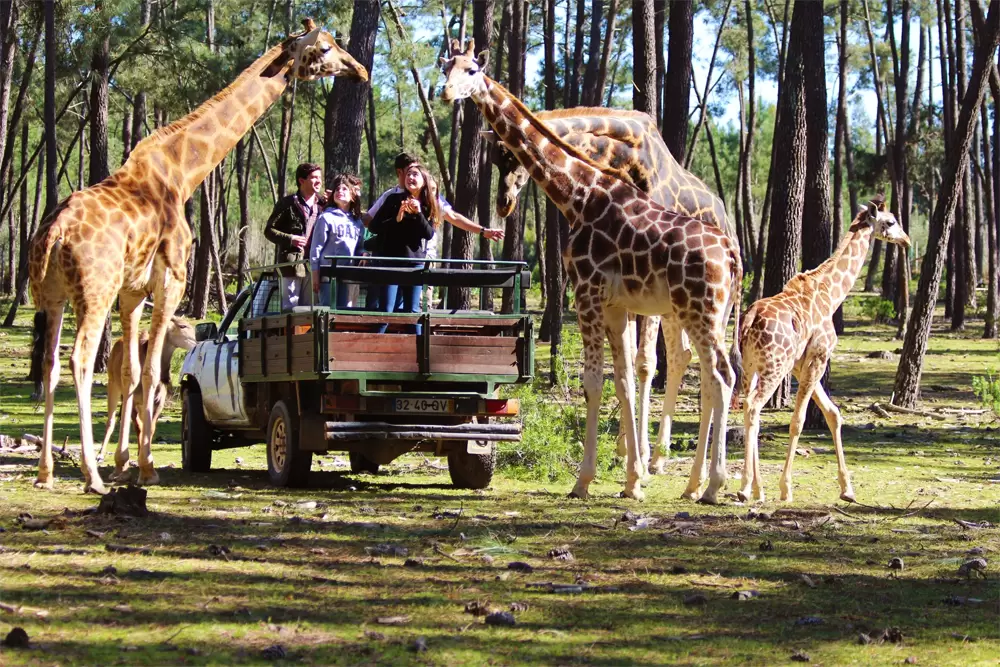
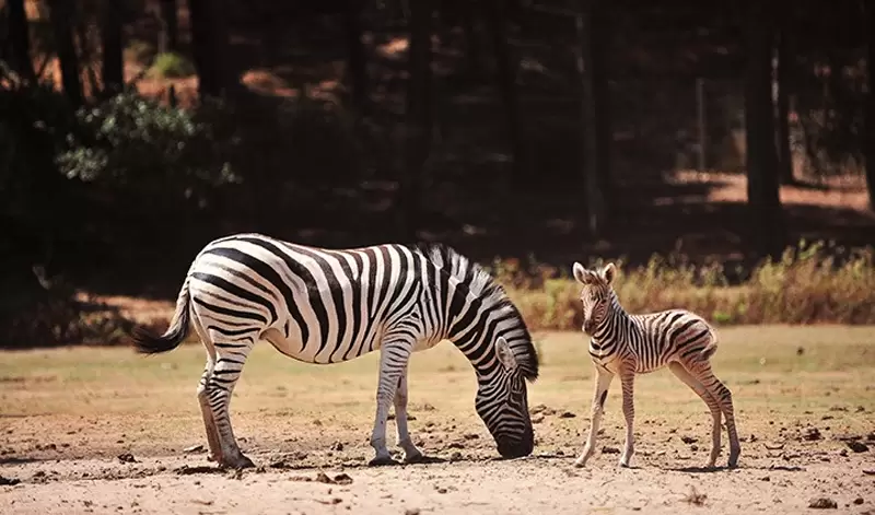
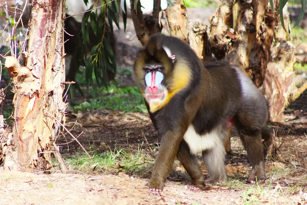
Already in the municipality of Santiago de Cacém has the Badoca Safari Park from where to spend a different day – 15 minutes from the beach of Costa de Santo André. In the park you will live with different species, such as zebras, giraffes, wildebeests and many other animals that will take you to the African continent.
In addition to the safari, the offer includes a raptor demonstration and areas such as the large Primates Island where three species live: a family of chimpanzees, sacred baboons (divinized by the ancient Egyptians) and the mandrills with their very colourful face mask.
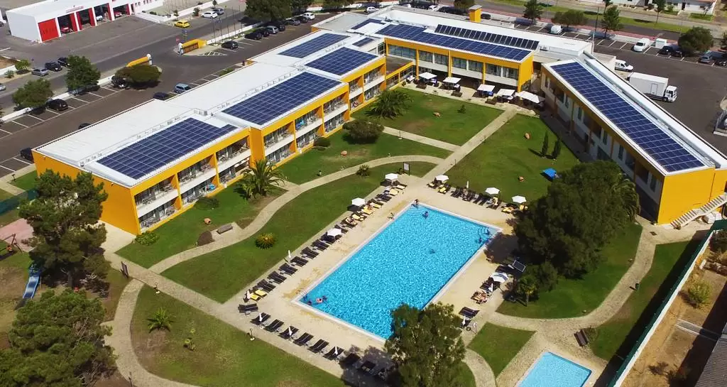
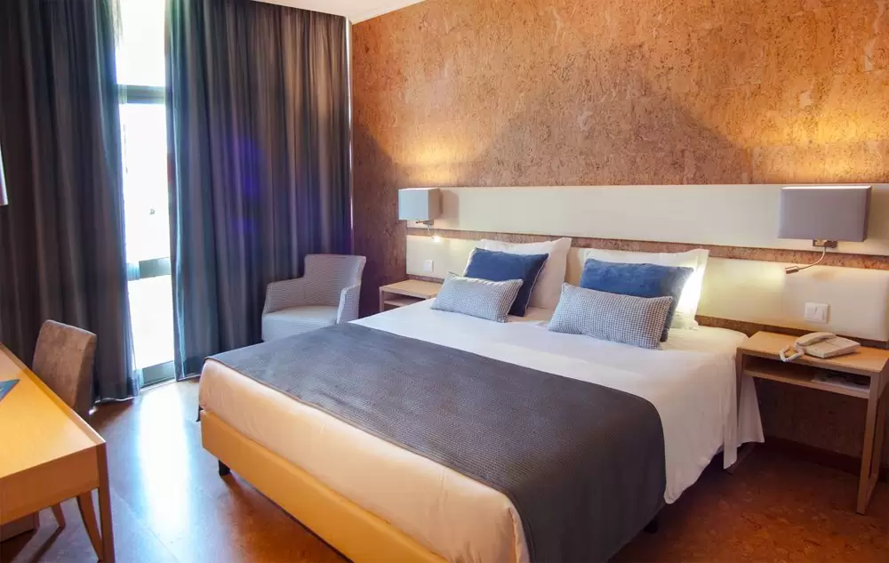
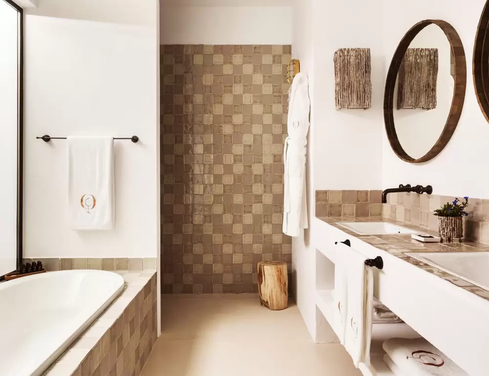
10 minutes away from the park, in Vila Nova de Santo André(Santiago do Cacém), you will find a good option for accommodation: the Hotel Vila Park.
- Coordinates: 38.053098, -8.786900
It is a 4-star hotel (Sines avenue) with free parking, with a good restaurant, two swimming pools and spacious rooms – breakfast is good.
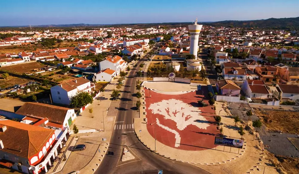
Grândola
- Coordinates: 38.183375, -8.567530
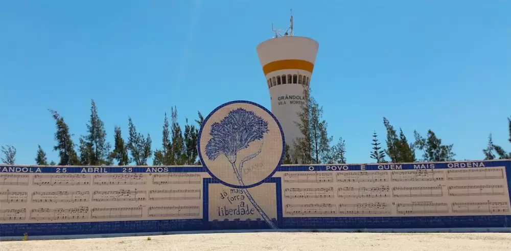
Half an hour from the coast, it is a land that holds remnants of revolutionary comradeship. Coming from Lisbon you can see the Praça da Liberdade and the 25th of April Memorial, which shows the lyrics of the song: “Grândola, Vila Morena” by Zeca Afonso.
In the centre, it has a drawing of a carnation. Sung in the style of choral singing (similar to the cante alentejano), it was used as the starting signal for the Carnation Revolution (25 April 1974).
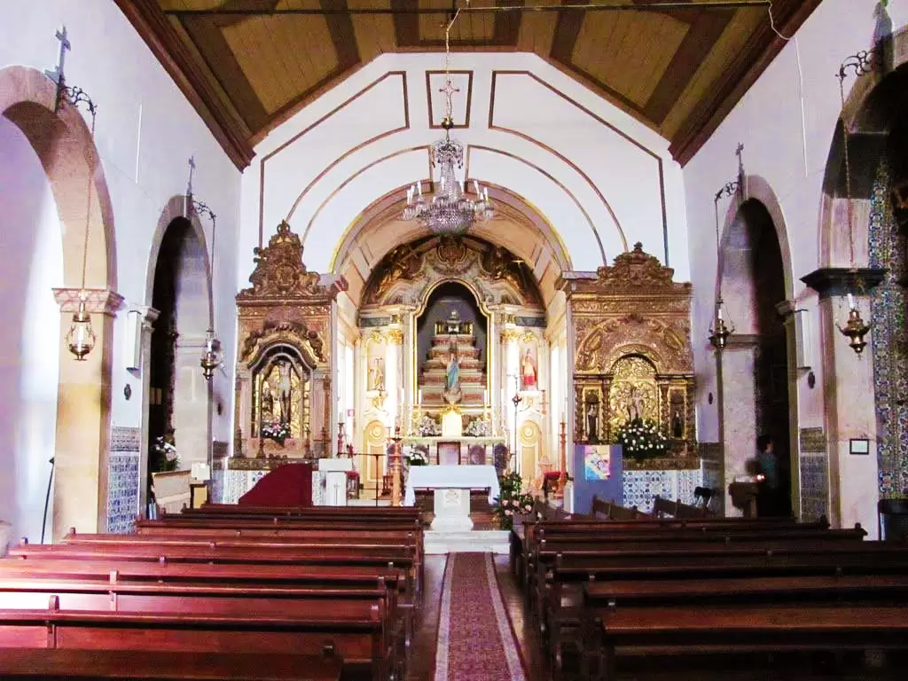
With the end of the dictatorship, rural areas were depopulated and services increased. In the centre of the village stands the Mother Church, the Nossa Senhora da Assunção Church (15th century).
- Coordinates: 38.175749, -8.568573
After the Muslims were defeated by the Christians, the territory of Grândola was part of Alcácer do Sal – the headquarters of the Order of Santiago.
The present church was repaired in the 16th century at the behest of D. Jorge de Lencastre, powerful master of the order of Santiago. He had a love-hate relationship with Vasco da Gama, the most famous knight of the order of Christ (successors of the Templars in Portugal).
- Coordinates: 38.173802, -8.563344
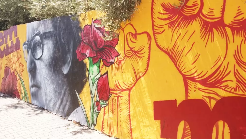
Walking towards the nice garden 1.º de maio, with a central lake, you will soon find the Graffiti Painting allusive to the 25th of April, with the figure of Zeca Afonso in prominence.
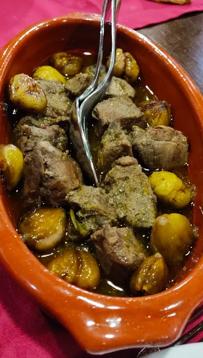
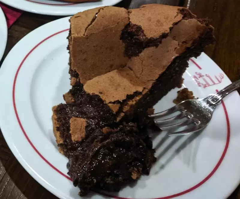
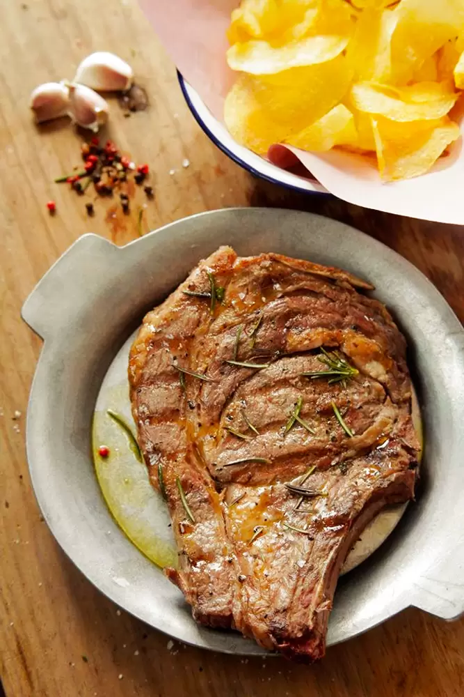
If the walk whets your appetite, there’s an excellent option in the Talha de Azeite restaurant (rua Dom Nuno Álvares Pereira, 17) – a five-minute walk from the town’s central municipal garden.
- Coordinates: 38.176283, -8.566569
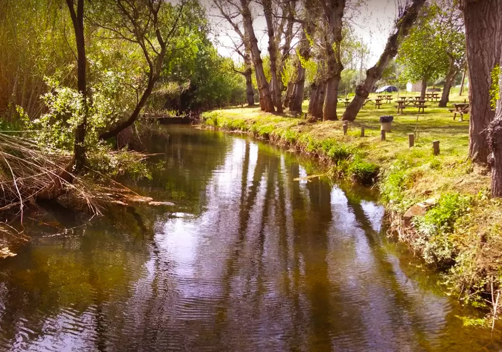
It is a typical, welcoming restaurant: well-prepared food with exceptional meat dishes. To the south of the village, there is a dirt road that leads to the Montinho da Ribeira Eco-Park, a place to rest in full communion with nature and spend good moments with the family.
- Coordinates: 38.169530, -8.564639
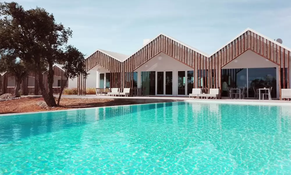
A 10-minute drive south along the N120, discover Sobreiras Alentejo Country Hotel (4 stars) in Santa Margarida da Serra.

- Coordinates: 38.107200, -8.547496
The hotel has a magnificent swimming pool, good restaurant and wide views. The double room is quite spacious and the staff helpful – with good breakfast.
Pego Beach

- Coordinates: 38.292667, -8.778341
Praia do Pego beach is 25 minutes from Galé-Fontaínhas beach, northwards along the N261. It has a calm sea with a magnificent view. It is guarded, spacious, with good support infrastructure and parking.
- Coordinates: 38.292716, -8.777831
Here resides the popular Sal’s Restaurant. It was named among the best beach bar restaurants in the world by Conde Nast Traveler. It is genuinely hearty. You’ll find expertly prepared dishes, particularly seafood and fresh fish.
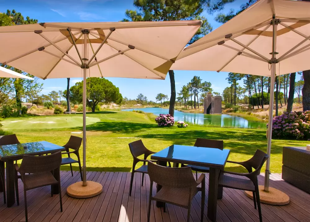
Carvalhal Beach

- Coordinates: 38.305366, -8.780268
Praia do Carvalhal Beach is 4 km from Pego: an extensive blue flag beach. With good bathing support infrastructures, including 2 restaurants, 1 surf school and parking.
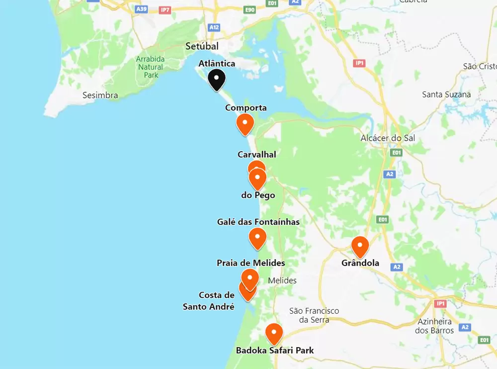
Access to the beach is supervised by wooden walkways. Nearby, 2 km north, is the 5-star Quinta Da Comporta – Wellness Boutique Resort Hotel (rua de Alto de Pina 2), with an outdoor swimming pool.
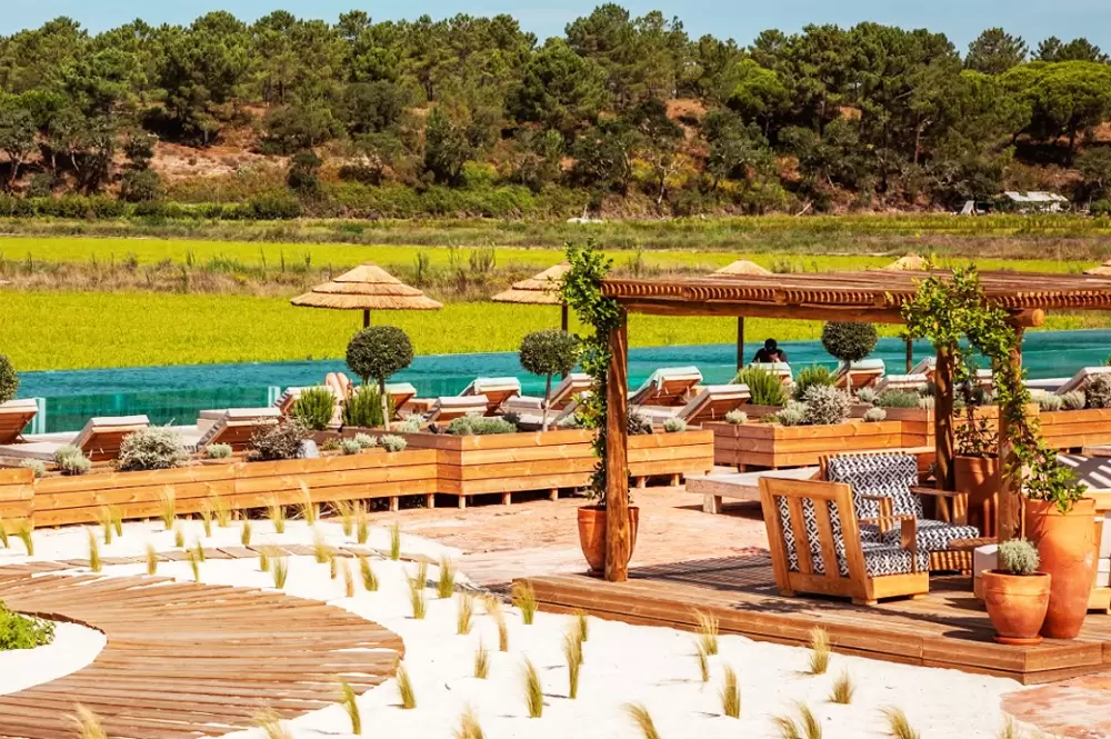
- Coordinates: 38.309353, -8.751303
With garden, restaurant, gym, and spa centre (free parking) The double rooms are comfortable, with balcony and good bathroom. Breakfast is excellent.
As you continue north along the N261 road, you will soon reach the Cavalos na Areia estate – Can you imagine riding a horse on a paradise beach? Well, you can hire a horse for 1:30, half an hour to get to the beach, half an hour to walk on the beach and half an hour back.

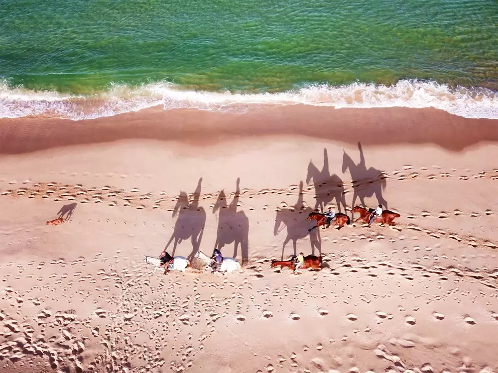
- Coordinates: 38.349108, -8.778132
The company gained particular notoriety when singer Madona shared a video on her Instagram channel doing this programme.
They have several dozen horses on hand, all docile, and the friendly Jose Ribeira is thankfully very patient. Remember that the rein is your steering wheel, if you pull to the left, the horse goes left. To brake, pull both reins. Nearby, 500 metres away, is the cosy restaurant Dona Bia.
- Coordinates: 38.353729, -8.779862
Traditional space and wonderful food, whether fish or meat (try the razor clam rice). With efficient service.
Comporta Beach
- Coordinates: 38.380865, -8.803383
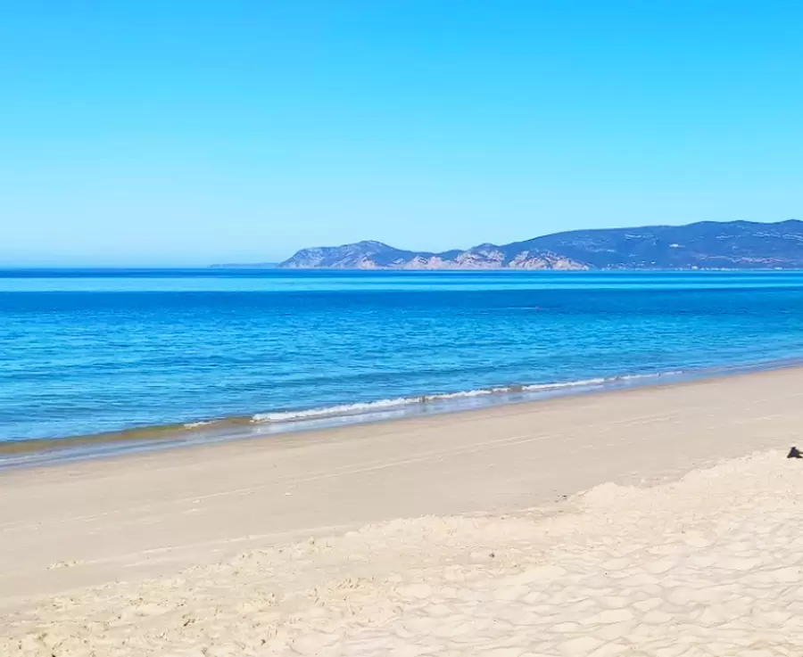
Near Carvalhal Beach, surrounded by pine forest, discover Comporta Beach, already close to the Troia Peninsula. It is a vast sandy beach (3 km) of white sand embraced by the turquoise sea. With good bathing support equipment.

- Coordinates: 38.381147, -8.786519
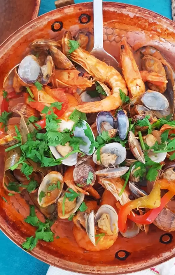
The centre of Comporta is nearby and graces us with interesting restaurants. A great option is the friendly São João restaurant (rua 24 de Junho, 2): pleasant space with tasty food – try the seafood cataplana.
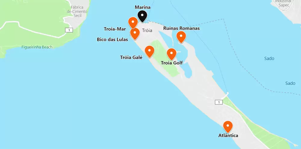
Troia
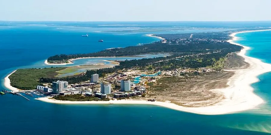
The peninsula has formed over the last five thousand years and is 25 km long. It stretches from southeast to northwest across the Sado estuary and the Atlantic. During the first centuries of our time, it was occupied by the Romans (possibly in their time it was a collection of islands).
Atlantic Beach
- Coordinates: 38.452125, -8.862720
If you’re coming from Comporta, the next beach you spot is Praia Atlantica next to the Soltroia tourist resort. It is wide, almost 5 km of fine white sand. It’s supervised – take note that parking is paid.
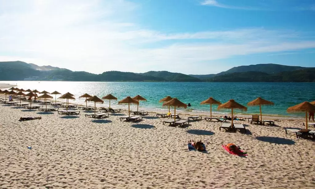
Troia Golf
- Coordinates: 38.479371, -8.889649
Golf is one of the attractions of Troia and just a few minutes away you have Troia Golf. Many people come from the country, and from abroad, to visit this challenging 18-hole course. Surrounded by pine trees and shrubs such as camarinha (produces a white fruit edible from July to September), aroeira and juniper.
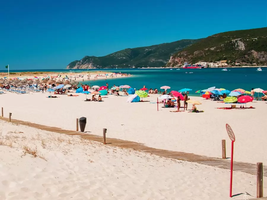
Troia-Galé Beach
- Coordinates: 38.480419, -8.900159
To the east of the field stretches Troia-Galé Beach, quieter than other beaches on the peninsula. It is watched (blue flag) with bar, bathroom, showers and parking. It offers a magnificent view of the Serra da Arrábida. On the other side, to the west, are the Roman ruins.
Roman ruins in Troia
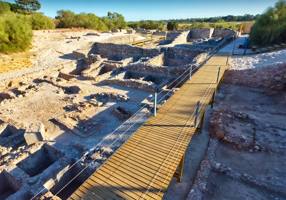
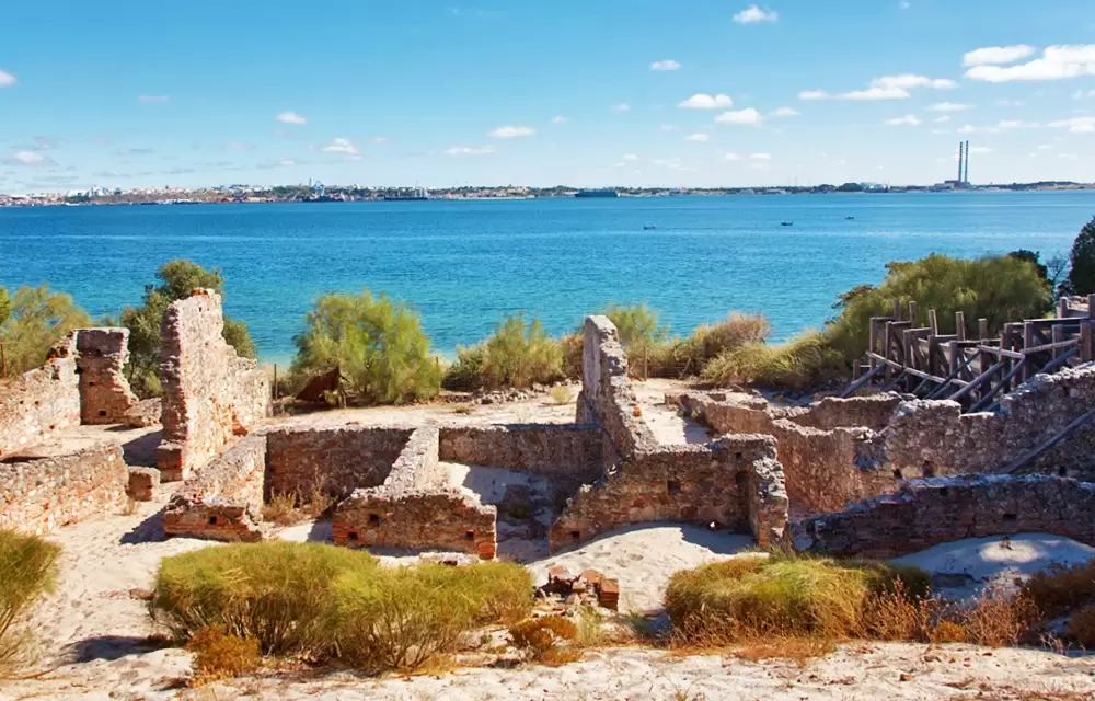
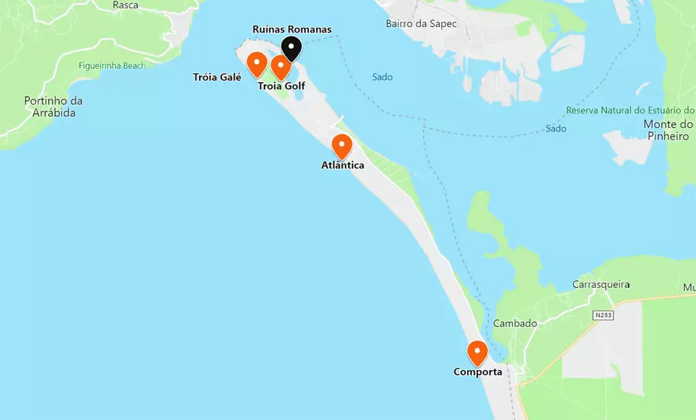
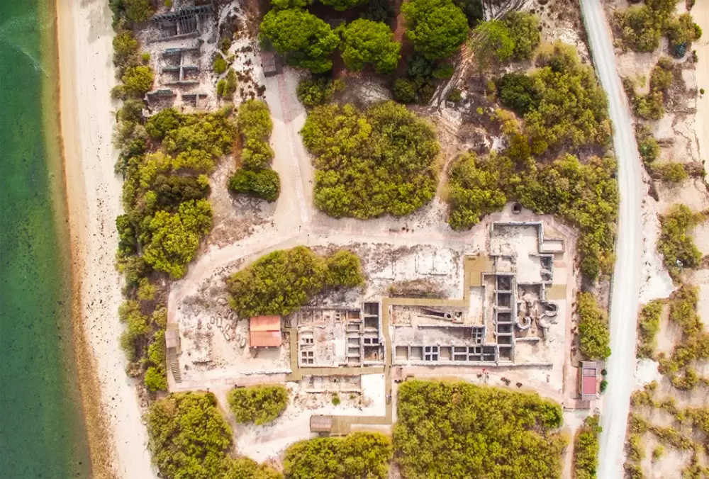
- Coordinates: 38.485810, -8.885106
The Roman Ruins of Troy have been preserved by the dunes, and what you see is only a portion of its extent of the past; much remains to be discovered. Here there was a large manufacturing centre, many fish salting factories.
Wealth attracted people and it became an urban settlement – with hot springs, houses, a necropolis (cemetery) and a paleo-Christian basilica. It was built in the 1st century and was active until the 5th. 1,500 people worked here – fish were salted in the tanks to produce preserves and sauces such as garum.
Garum was appreciated throughout the empire, a sauce they used on everything. When the product was ready, they filled the amphorae and it was shipped down the Mediterranean coast to the whole empire.
Troia-Bico das Lulas Beach
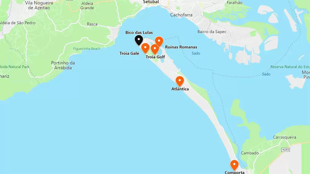
- Coordinates: 38.487071, -8.907108
Bico das Lulas Beach is close to the centre Troia Resort. Guarded in the central area. It is ideal for families. With a magnificent view to the imposing Serra da Arrábida. It has an excellent bathing support structure, including space for the practice of volleyball and football.
Troia-Mar Beach
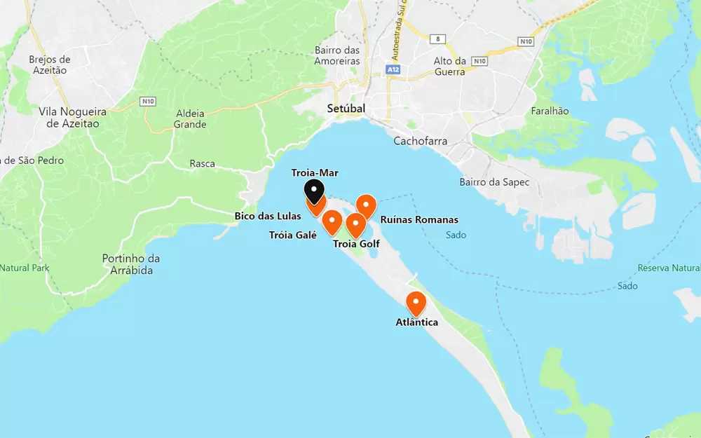
- Coordinates: 38.491092, -8.908051
500 meters to the northwest you will find the Troia-Mar beach and its wooden walkways: with bathrooms, showers, parking and café-restaurant. As it is close to the centre, several leisure facilities are nearby.
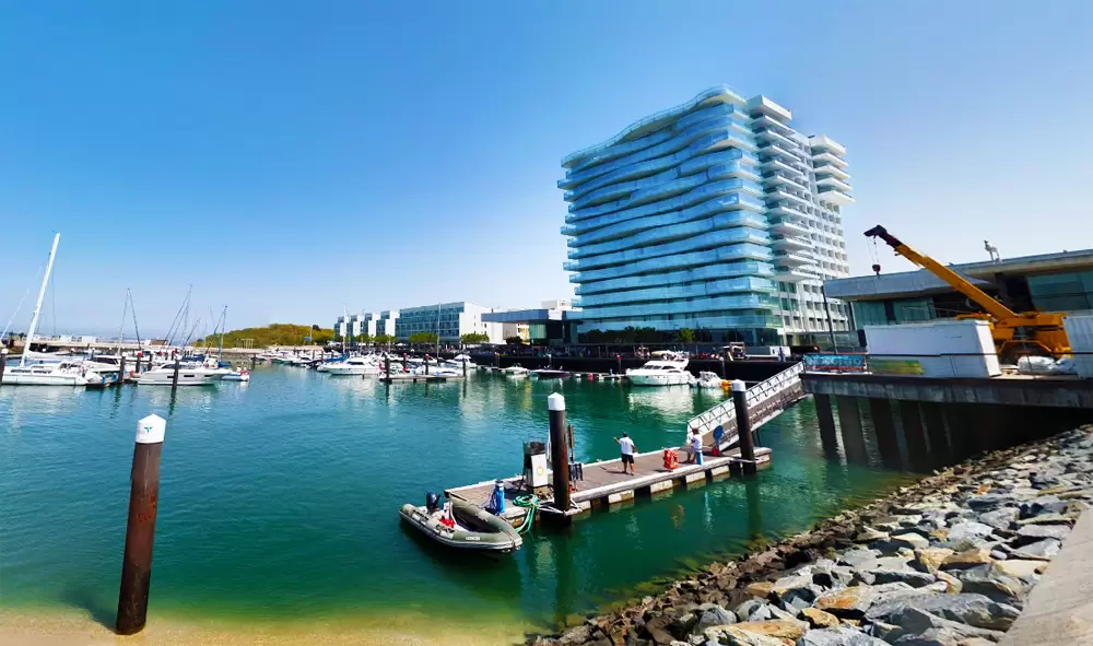
Marina
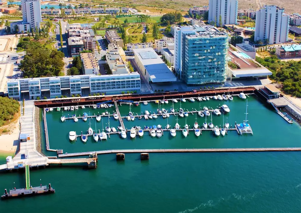
- Coordinates: 38.493643, -8.903639
By the beach you discover the modern Troia Marina, with space for one hundred and eighty boats. You quickly discover boat rental services or a tour to observe the famous dolphins of the estuary.
There are also a couple of restaurants and terraces for a refreshing drink and soak up the views of the Serra and Estuary. It’s hard to ignore the presence of the 5-star Troia Design Hotel. As you explore you shyly observe several works of art inside – with restaurant, two pools and spa.
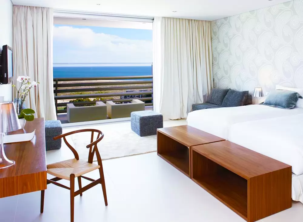
Rooms were tastefully decorated, comfortable, with balcony – great breakfast.
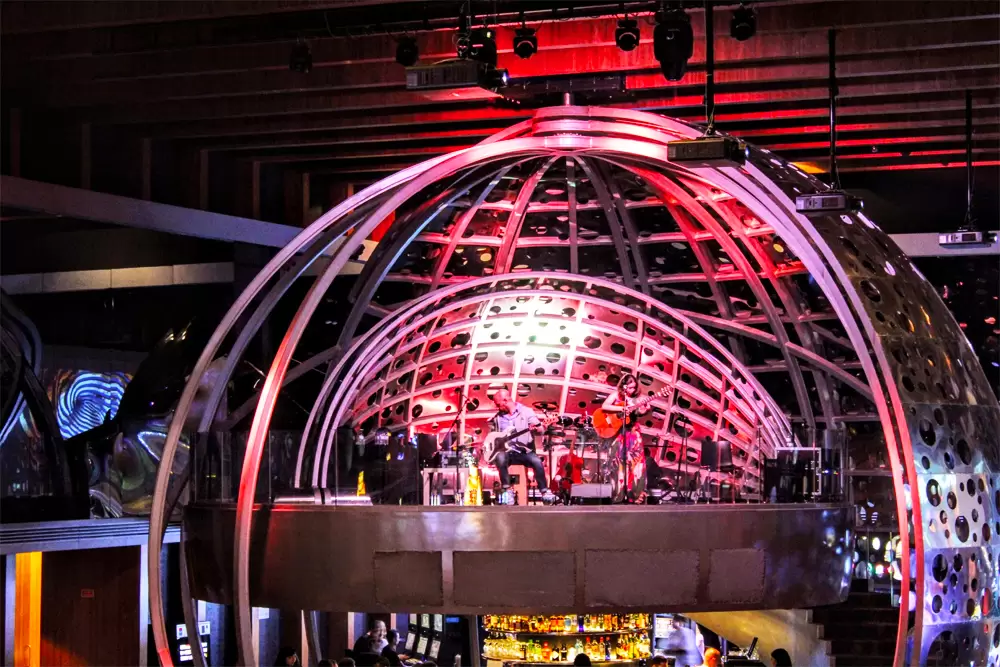
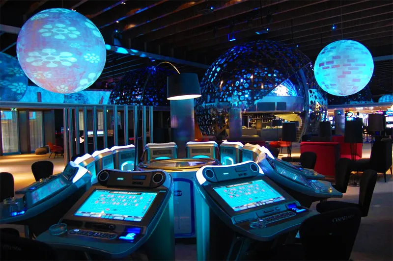
The Hotel is also home to the Troia Casino, with bold architecture, two hundred slot machines, dozens of table games and, at night, live music.
- Coordinates: 38.521772, -8.885785
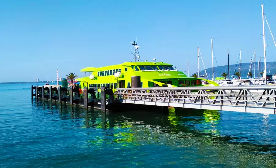
Next to the marina, at the tip of Adoxe, is the catamaran waiting to load you onto the shore of Setúbal town – a 20-minute journey.
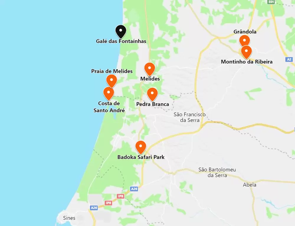
Things to see near Grândola
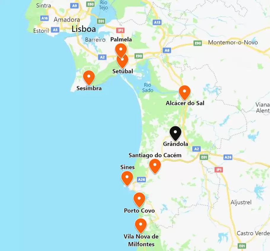
To the north, there’s Alcácer do Sal (25 minutes by IC1), Setúbal (50 minutes), Palmela (50 minutes) and Sesimbra (1 hour 20 minutes). To the south, Santiago do Cacém (half an hour by A26), Sines (35 minutes by A26), Porto Covo (45 minutes by A26) and Vila Nova de Milfontes (1 hour by A26).
