

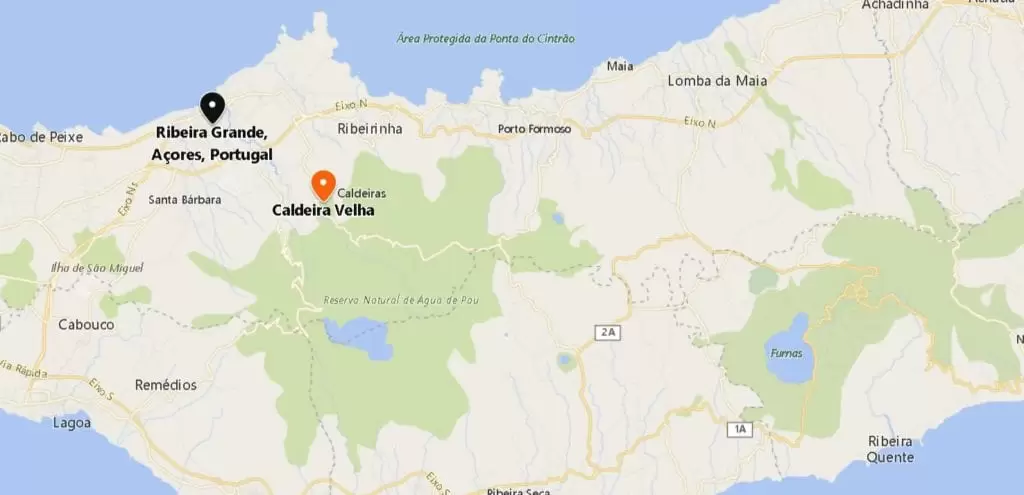
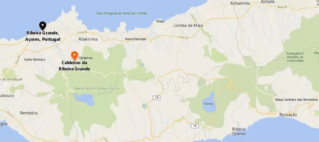
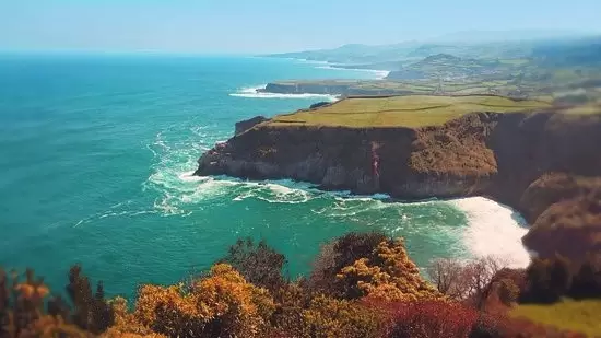
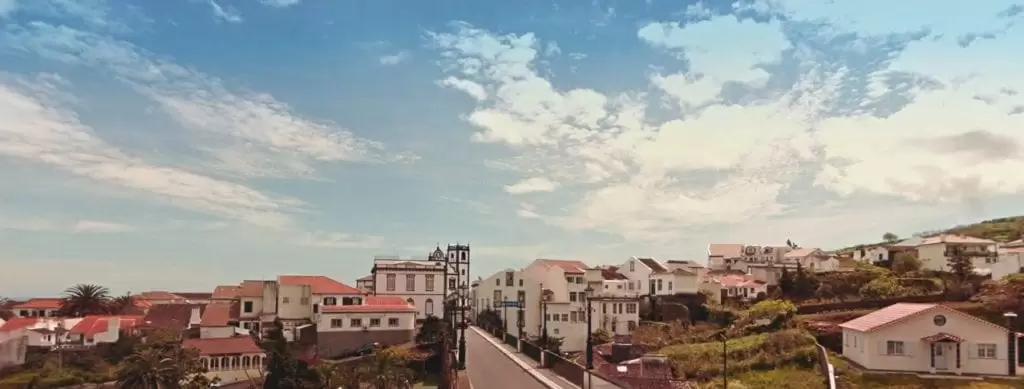
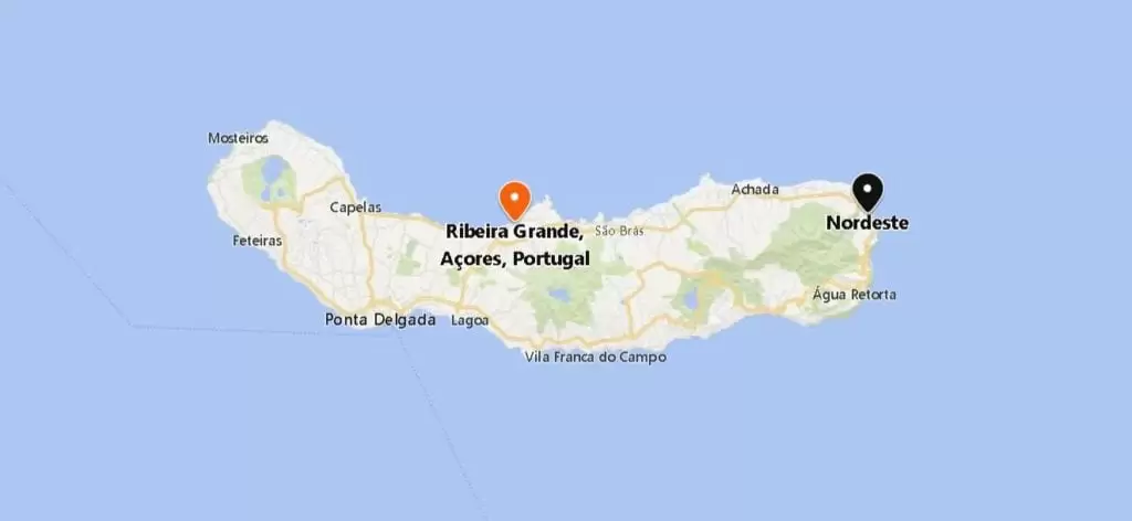
Ribeira Grande
From Ponta Delgada, it is 25 minutes to Ribeira Grande and its 8-arched bridge (19th century) over the stream and garden; it is one of the most beautiful settlements in the Azores, made town by King Dom Manuel I (1507).
Attracted by the big river, here were built the first water mills on the island – some houses and monuments are evidence of their importance in the past.
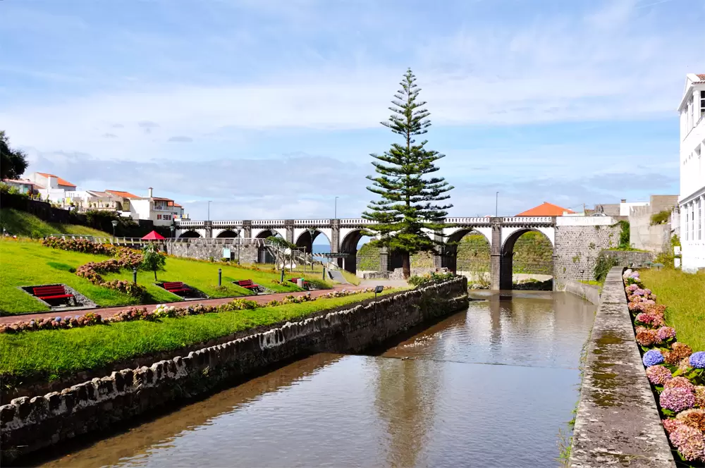
- Coordenadas: 37.818631,-25.523901
The town’s counts were descendants of Zarco, one of the captains who led the settlement of the Madeira Archipelago. In the 18th century, the countess offered the extraordinary reliquary to the Statue of Senhor Santo Cristo dos Milagres.
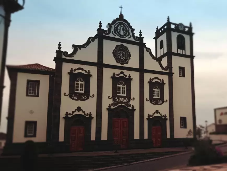
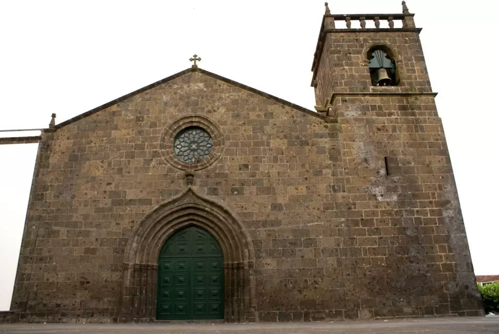
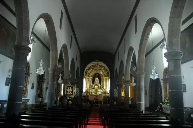
Nossa Senhora da Estrela Parish Church
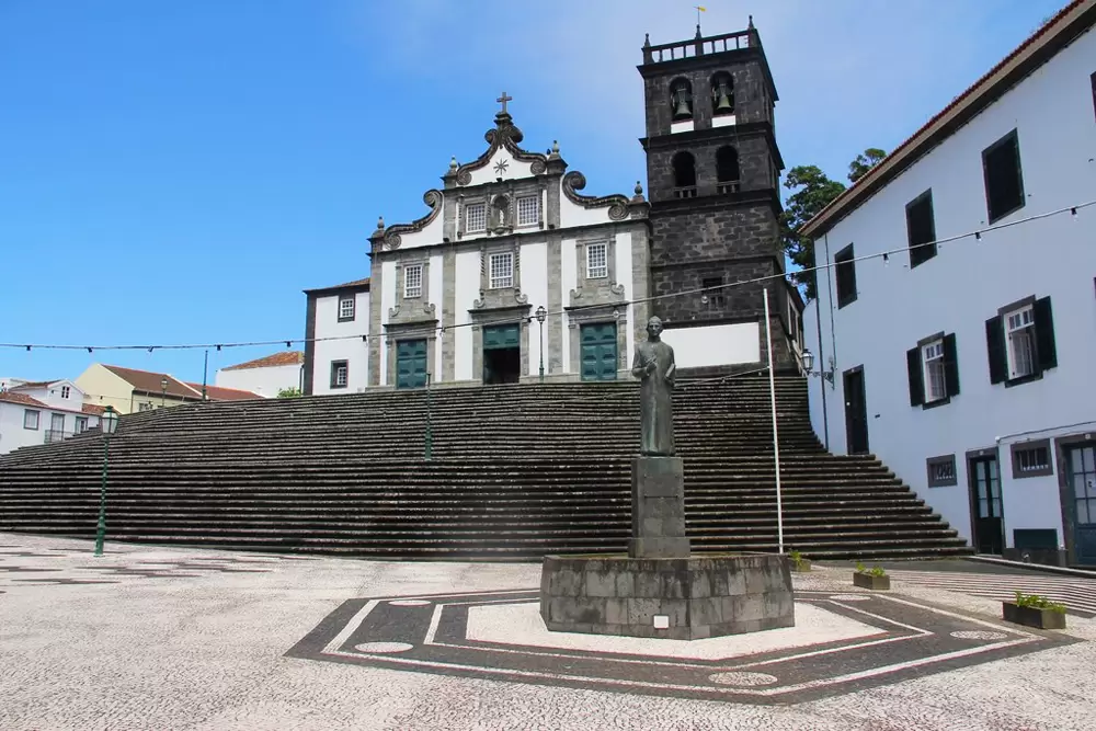
- Coordinates: 37.823779,-25.519502
In the city centre, we find the Nossa Senhora da Estrela Church (16th century), a beautiful sacristy and paintings from the Flemish school. In the 16th century alone, it survived 5 earthquakes. Barely, but it persists.
Gaspar Frutuoso was its parish priest – the greatest chronicler of the Azores, with a statue in the square named after him.
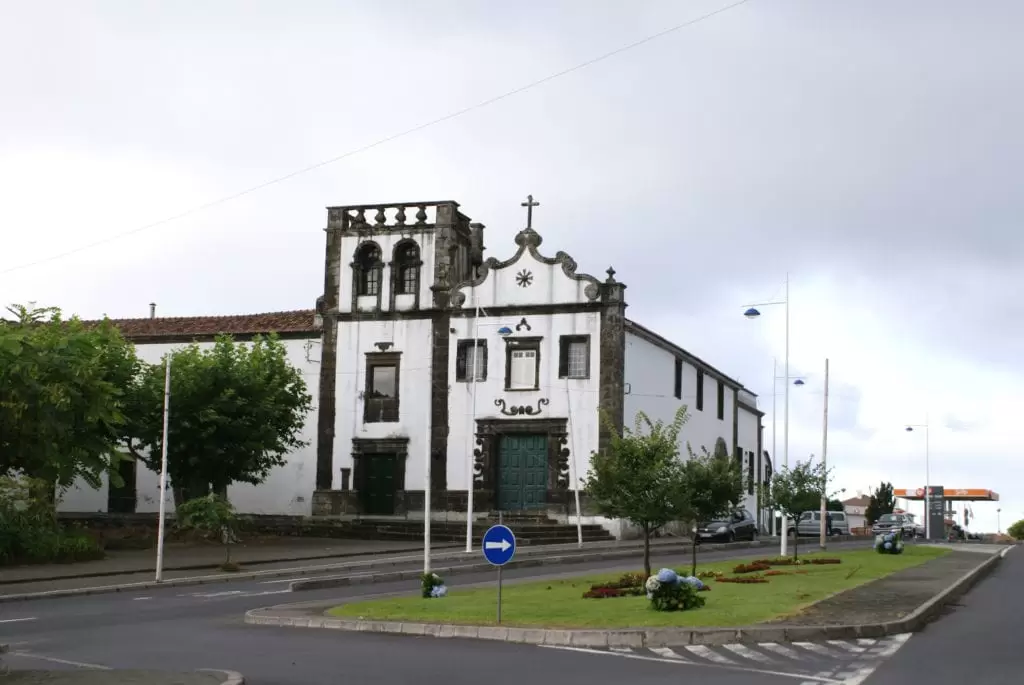
The Church of the Holy Spirit (16th century), known as Igreja da Misericórdia, in the main square, has one of the best baroque façades in the Azores.
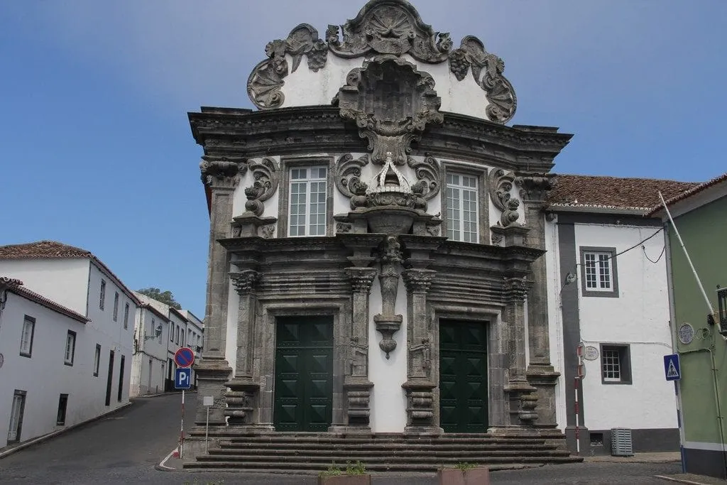
- Coordinates: 37.822328,-25.519326
The municipal museum (Rua São Vicente, 10), located in a small alley, addresses the culture and handicrafts of the municipality, namely grain milling, weaving, and pottery.
- Coordenadas:37.825091,-25.522208
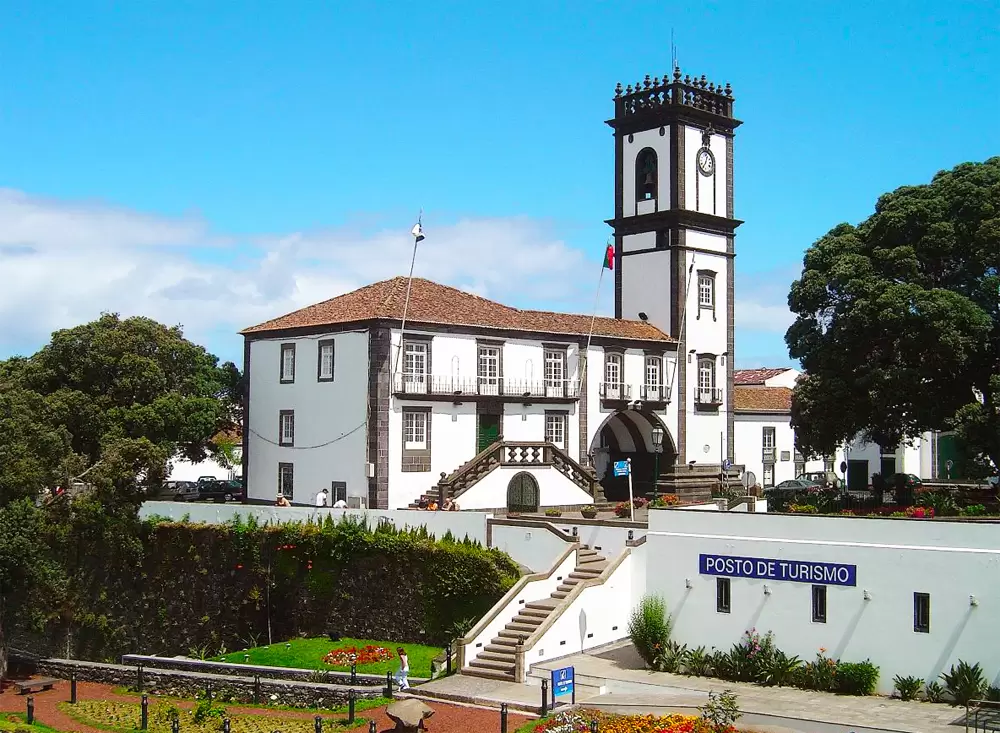
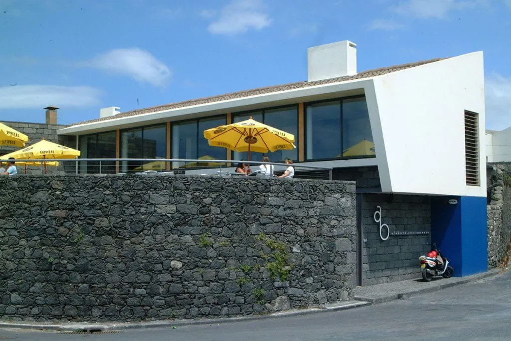
Walking to the sea, passing the Town Hall, you reach the sea promenade, which includes the natural swimming pools (pools) and, nearby, the Alabote Restaurant-esplanade.
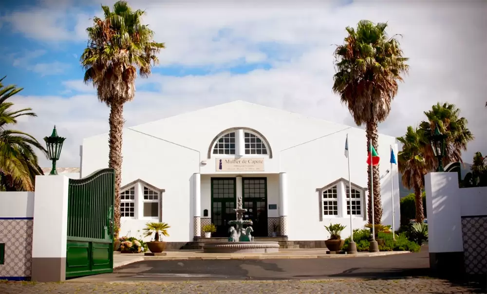
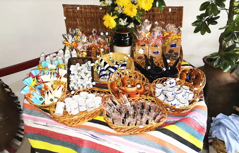
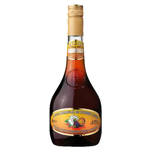
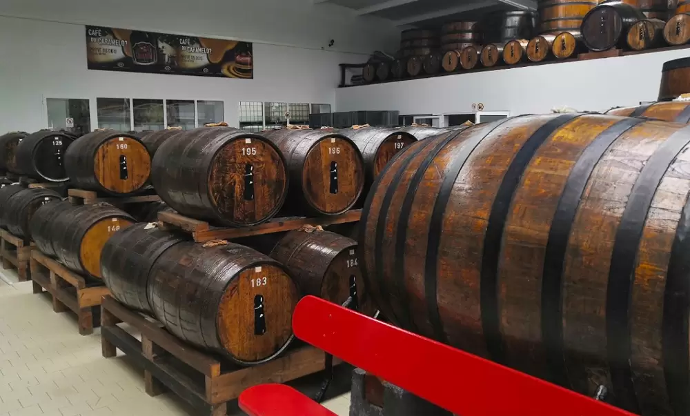
Liqueur “Mulher de Capote”
- Coordinates: 37.814833,-25.519750
To the north, a 5-minute drive, we find Mulher de Capote, the home of the award-winning Ezequiel (passion fruit) liqueur.
The name is an allusion to the costume that tried to hide the beautiful shapes of the female body. We learn about its history with a quick visit to the picturesque factory, tasting various liqueurs.
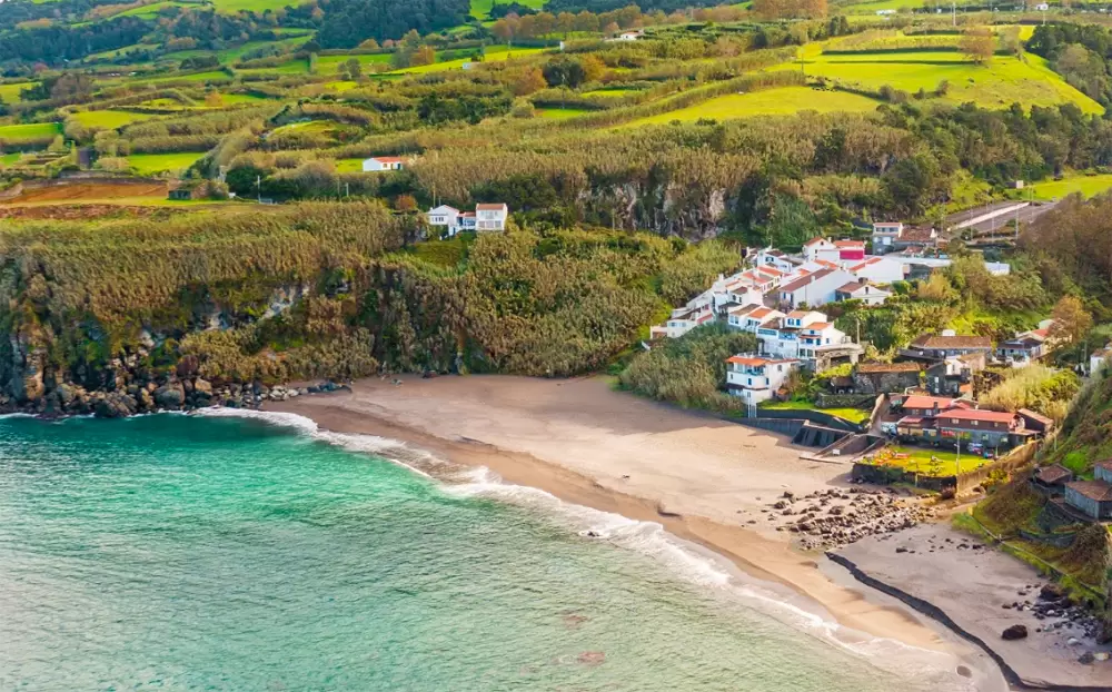
Santa Bárbara Beach
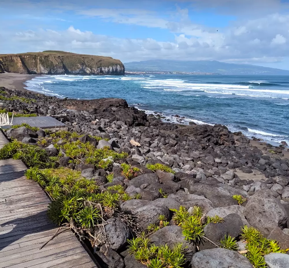
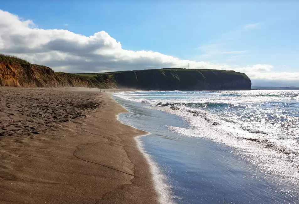
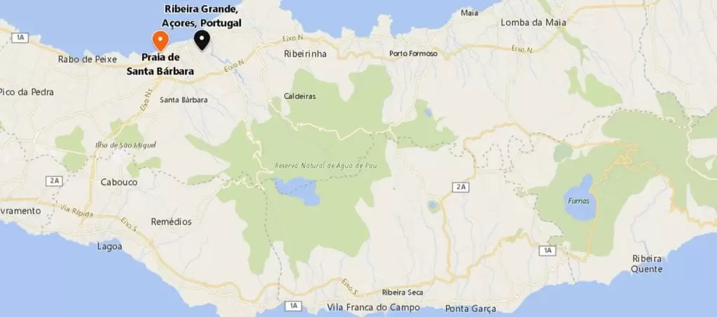
- Coordenadas: 37.817778,-25.544667
Near Ribeira Grande, 5 minutes to the west, lies the beautiful Santa Bárbara Beach. Facilities include parking, changing rooms with showers and a restaurant with sea views. Don’t forget your sunscreen.
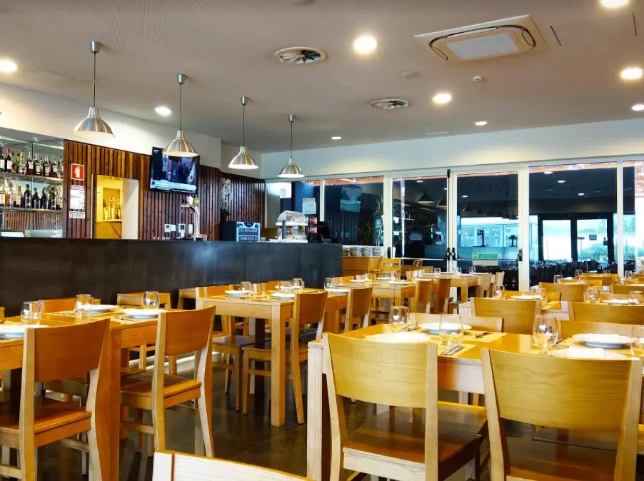
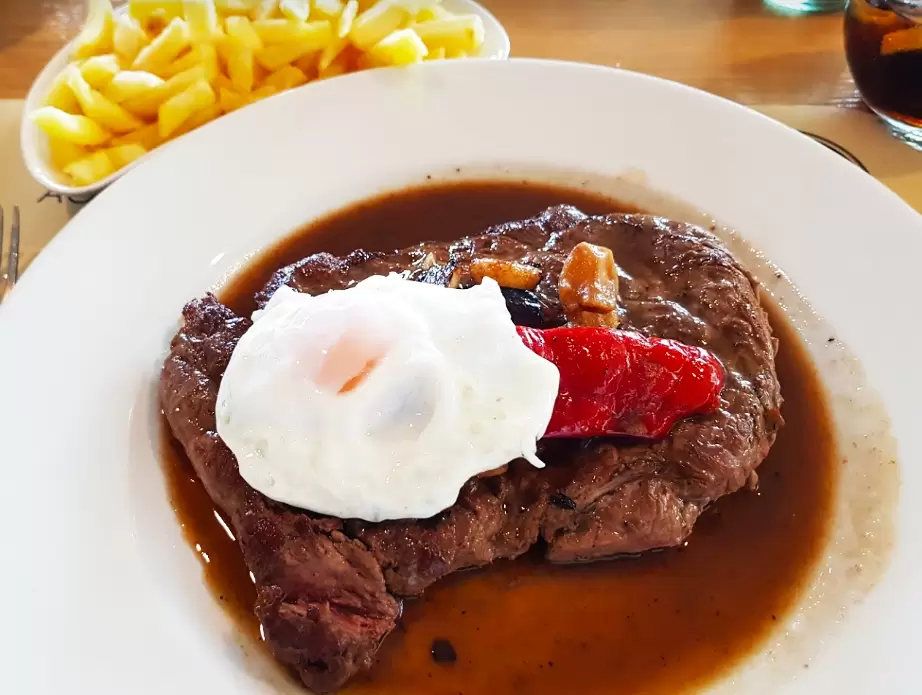
São Miguel Agricultural Association Restaurant
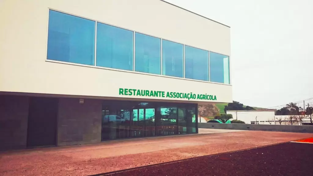
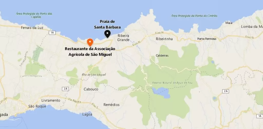
- Coordinates: 37.808981, -25.566757
Continuing west for a quiet five minutes, you arrive in Santana, from where the Associação Agrícola restaurant emerges – one of the best places for a steak. Try the Association’s steak, with slightly excessive portions, but a rare opportunity to eat a delicious steak on the island.
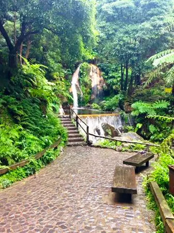
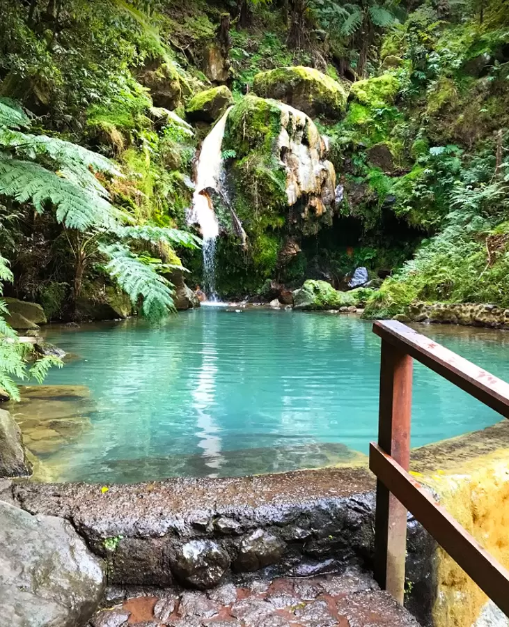
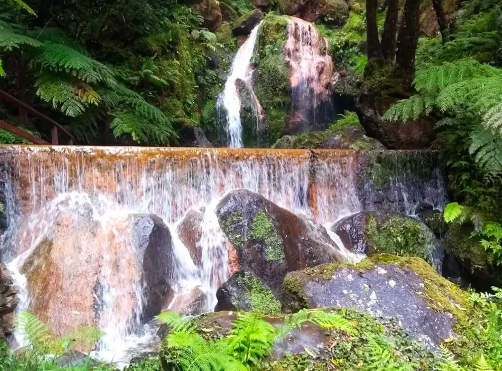
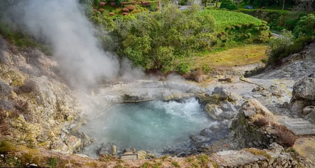
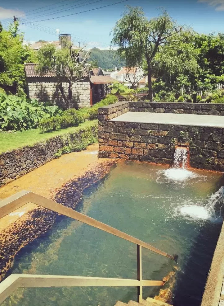
Caldeira Velha
- Coordenadas: 37.797861,-25.487306
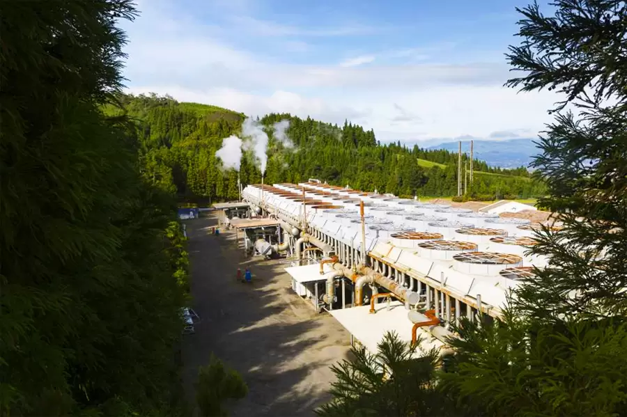
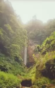
Choosing the main road that runs from the town centre to Lagoa de Fogo, in 10 minutes, you spot Caldeira Velha. This waterfall culminates in a pool with abundant iron deposits and sulphurous odours. It is an idyllic place for a relaxing swim: with changing rooms, toilets, and picnic tables.
The same energy that heats the earth’s interior and the old boiler causes the steam that produces electricity at the Ribeira Grande Geothermal Power Station – on its way (right) to Caldeira Velha.
- Coordinates: 37.802328,-25.504669
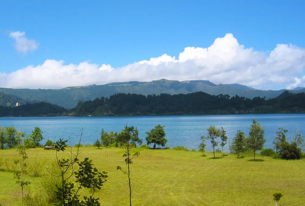
Fogo Lake
Continuing along the same road, in less than 10 minutes, you spot the aptly named Lagoa de Fogo (Fire Lake). Silence is part of the splendour of the landscape.
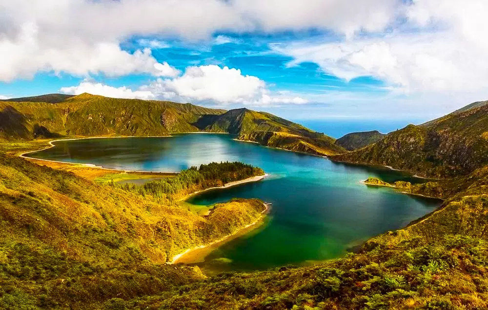
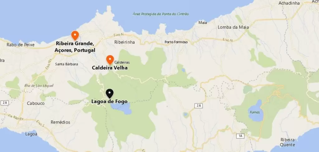
- Coordenadas:37.769757, -25.487643
There is a steep path to the lower part, a protected area with several endemic plant species.
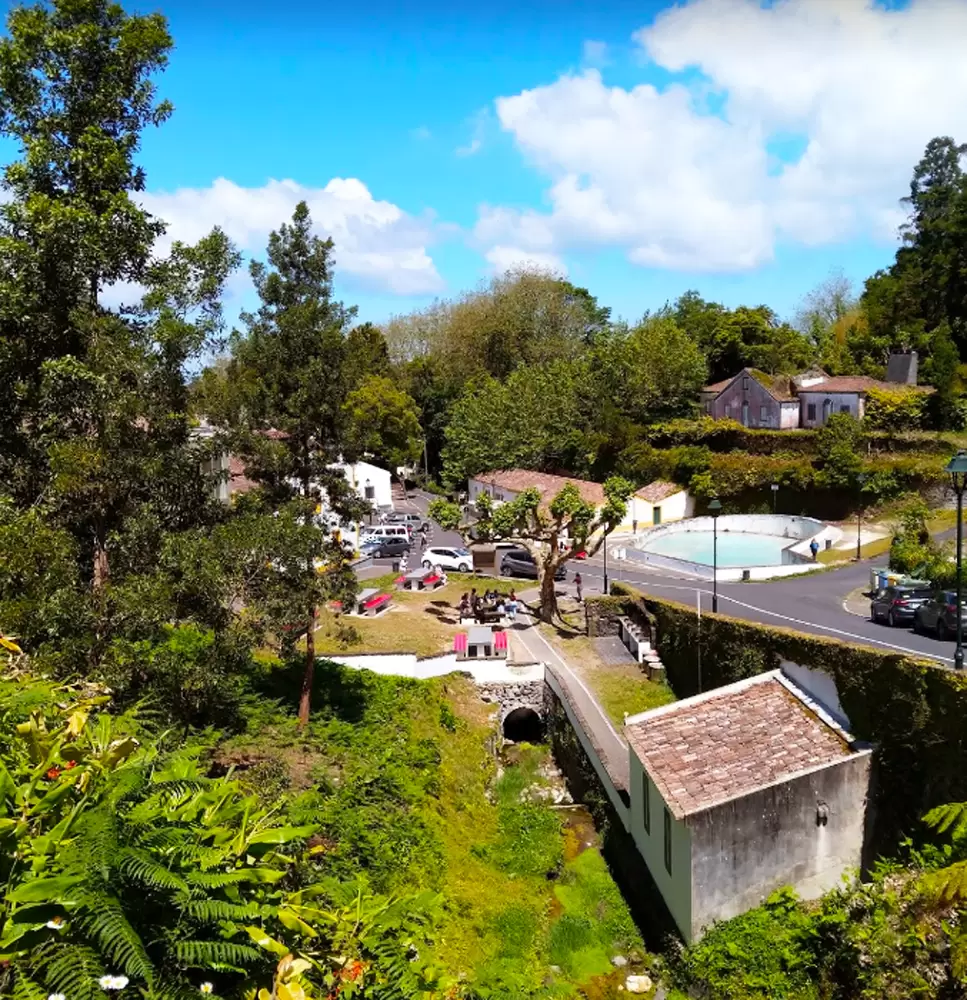
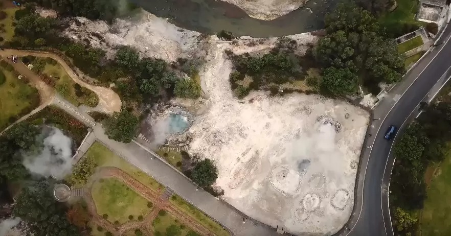
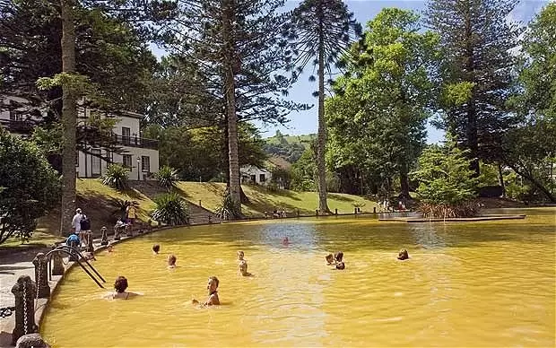
Ribeira Grande Caldeiras
- Coordenadas: 37.797861,-25.487306
It’s a 5km walk inland from the island to the small centre of old summer houses. Under the central square is a hot spring and small lake – known as Ribeira Grande Caldeiras.
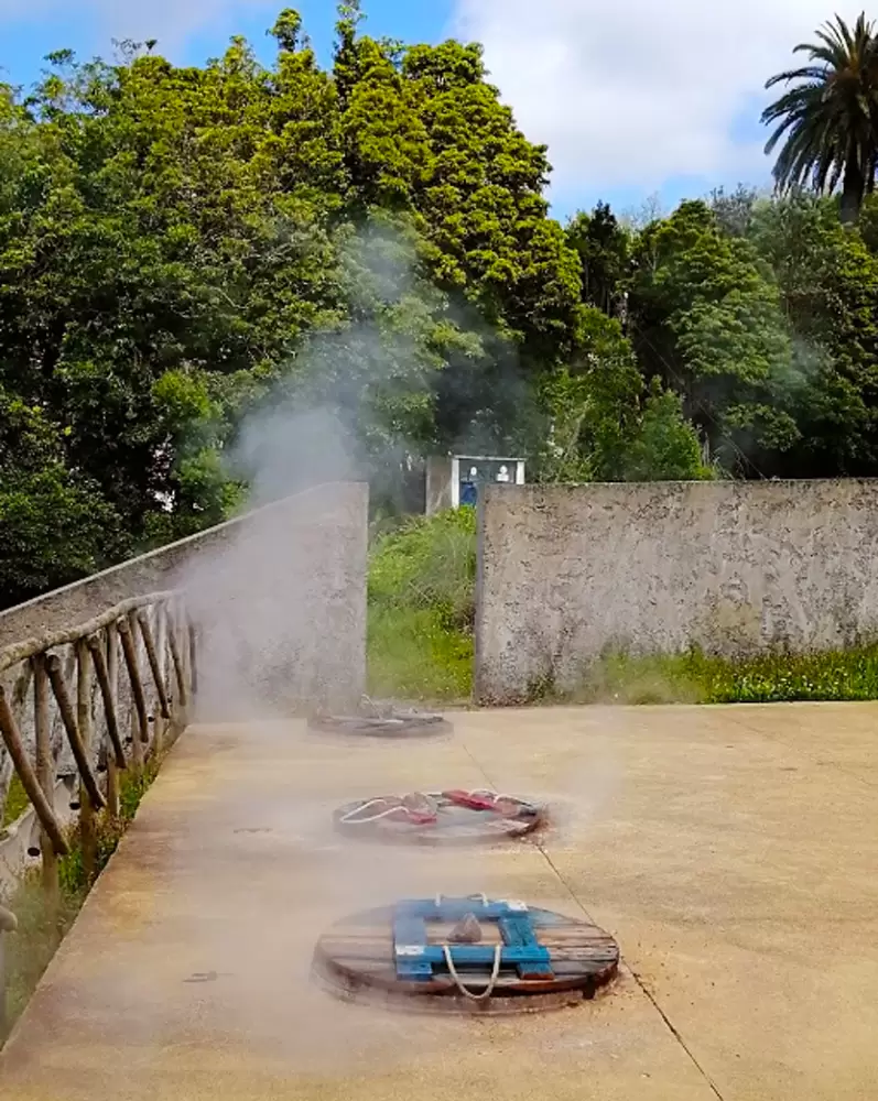
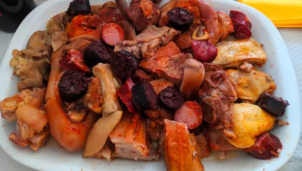
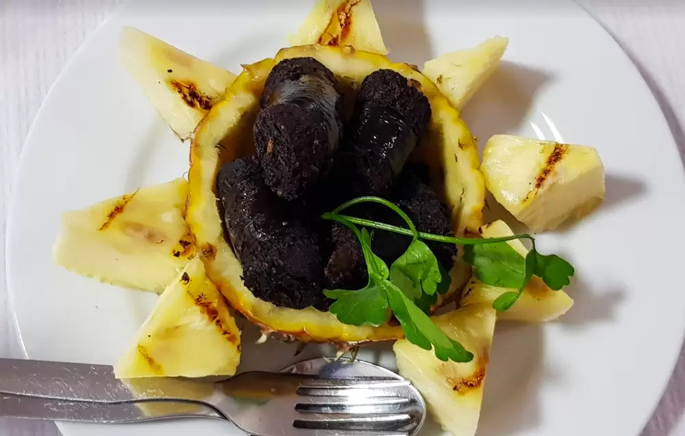
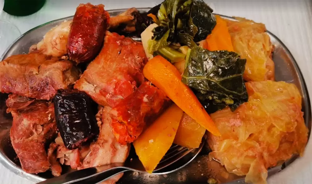
Here, the Caldeiras Restaurant offers regional dishes, including the popular cozido à portuguesa – geothermal steam cooking buried in the ground for 5 to 7 hours, making the food more succulent – the traditional is in Furnas, but here it is equally delicious.
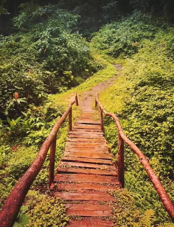
Around the Ribeira Grande Caldeira is a beautiful footpath that culminates at the Salto do Cabrito waterfall and the hydroelectric power station – to reach it, you pass a metal walkway.
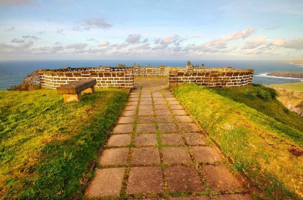
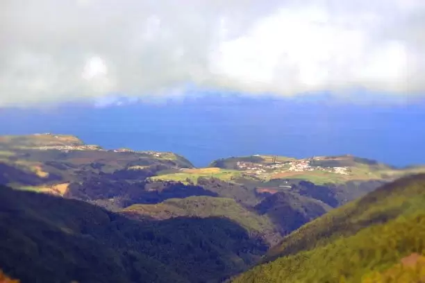
Santa Iria Viewpoint
- Coordenadas: 37.823201,-25.462757
If you have just arrived in the Azores and are travelling to Furnas, stop here. Enjoy one of the most beautiful viewpoints along the north coast. From the centre of Ribeira Grande, it is an 8-minute drive.
Porto Formoso and São Brás
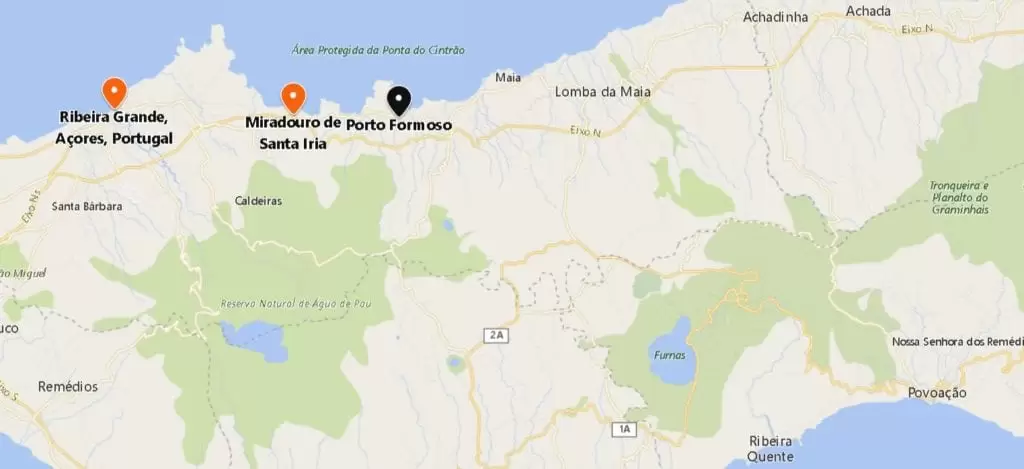
- Coordenadas: 37.822565,-25.426805
Head towards the coast of Porto Formoso – at the junction, turn right until you reach the typical village of São Brás, where you discover an excellent fish restaurant, Cantinho do Cais (Rua Ramal).
- Coordinates: 37.820400,-25.413585
At 10 minutes, you have Moinhos Beach (Porto Formoso) at the foot of an old mill converted into a café-restaurant. The beach is ideal for those who love the coast and swimming.
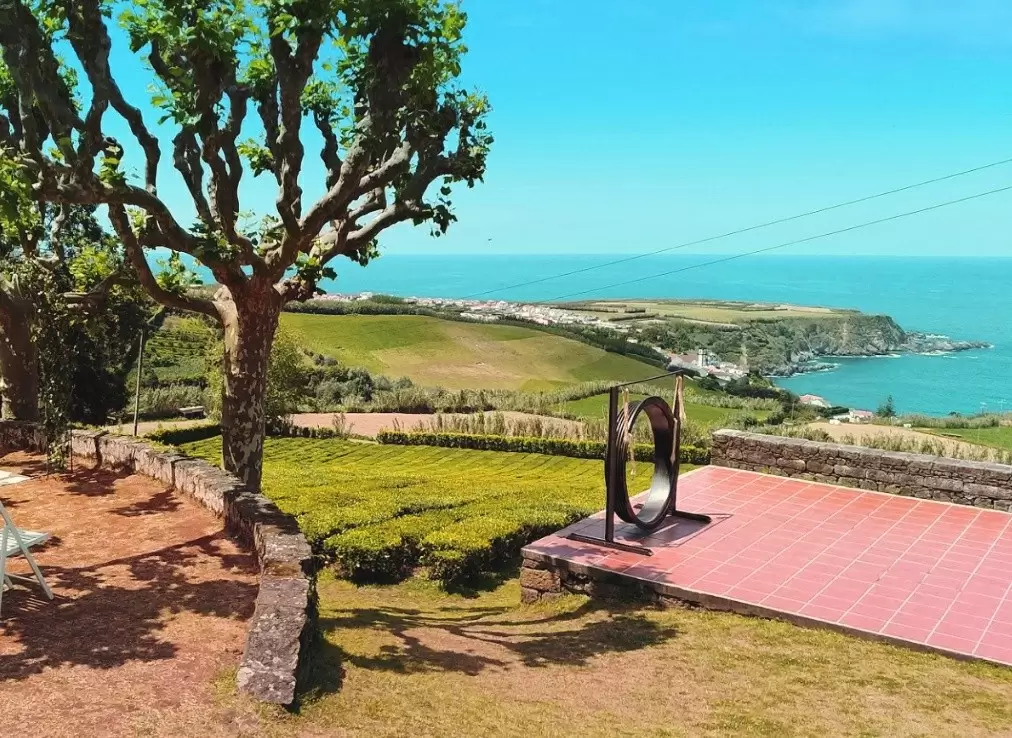
Gorreana Tea Plantations
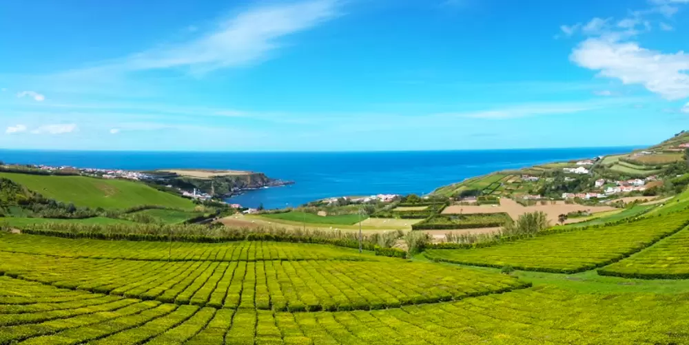
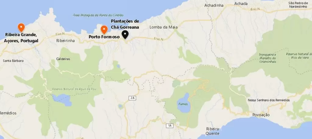
- Coordenadas: 37.818309,-25.402417
Returning to the road in a northeastern direction, you will find the Gorreana estate – the oldest tea plantation in Europe, founded in 1883; 50 hectares remain and produce tonnes of tea yearly.
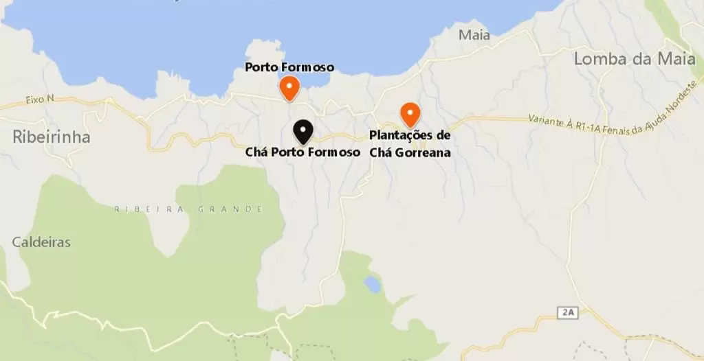
- Coordinates: 37.815531,-25.424022
Another small estate exists nearby, Fábrica de Chá Porto Formoso. It has a beautiful tearoom and expansive views. The first plants were introduced to the island in 1874 from seeds brought directly from China.
Ribeira dos Caldeirões Natural Park
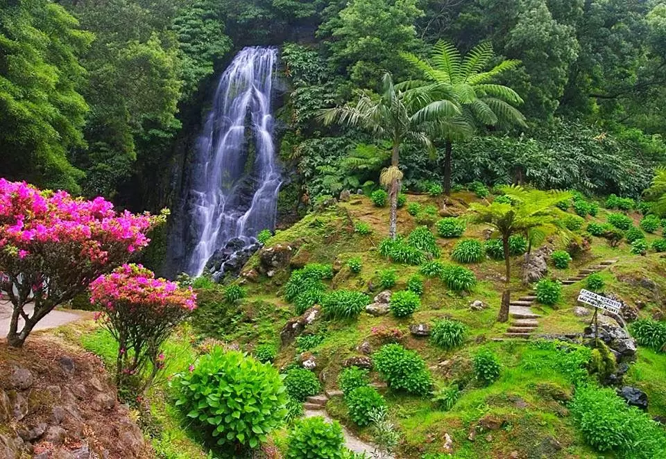
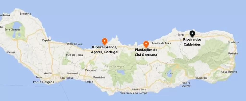
- Coordinates: 37.842216, -25.267006
Continue for 15 minutes to the Ribeira dos Caldeirões Natural Park, just before Achada – don’t miss the lovely valley at the foot of the road, with beautiful ferns and a watermill. In 1986 severe flooding destroyed most of the mills in the North East, and one mill has been restored as a museum with a café.
Nordeste
- Coordinates: 37.832366, -25.146695
The county of Nordeste (https://cmnordeste.pt/) is so far from the rest of the island that boat was the preferred means of travel until the late 19th century (roads in terrible condition). It was always charming.
It awoke with a regional road connecting Nordeste to Ponta Delgada. The centre is dominated by the São Jorge Church (18th century)
Below the left side of the church, uncovers a small museum with old ceramics from Lagoa and Vila Franca.
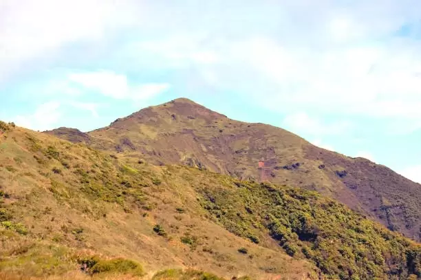
At the time of the Discoveries, ships took advantage of the wind blowing from the northeast to reach the island, so Pico da Vara in Nordeste would be the first significant point they sighted.
The highest elevation of São Miguel (1103 metres), Nordeste stands on a cliff, more protected from the attacks of corsairs and pirates than Ponta Delgada (needed forts to protect it from foreign greed).
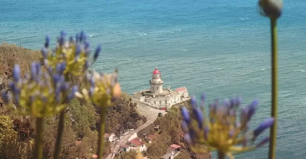
Arnel Lighthouse
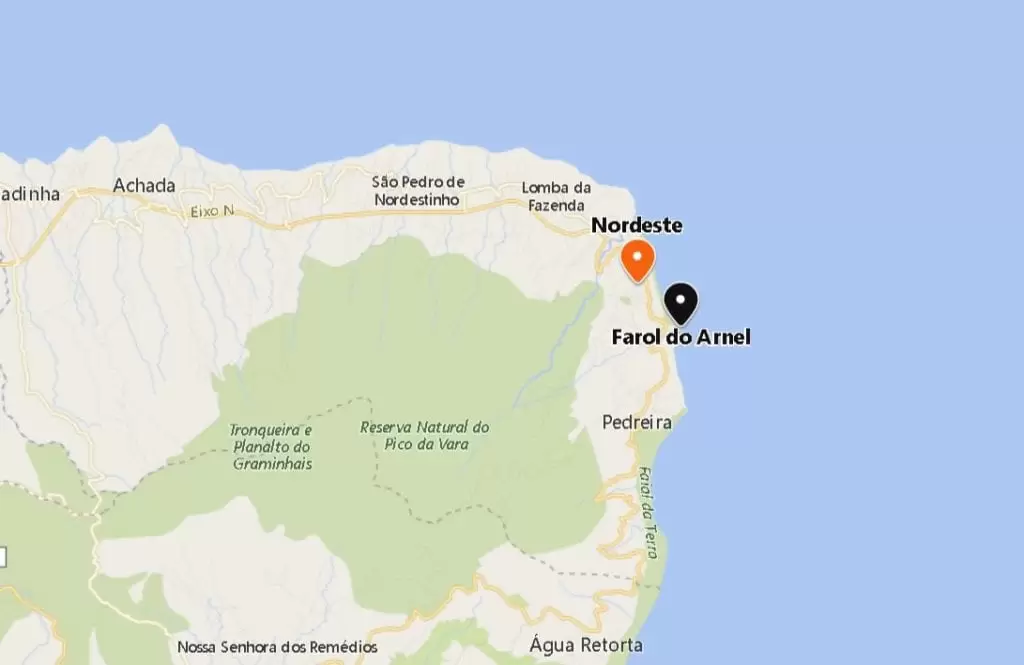
- Coordinates: 37.824092, -25.135965
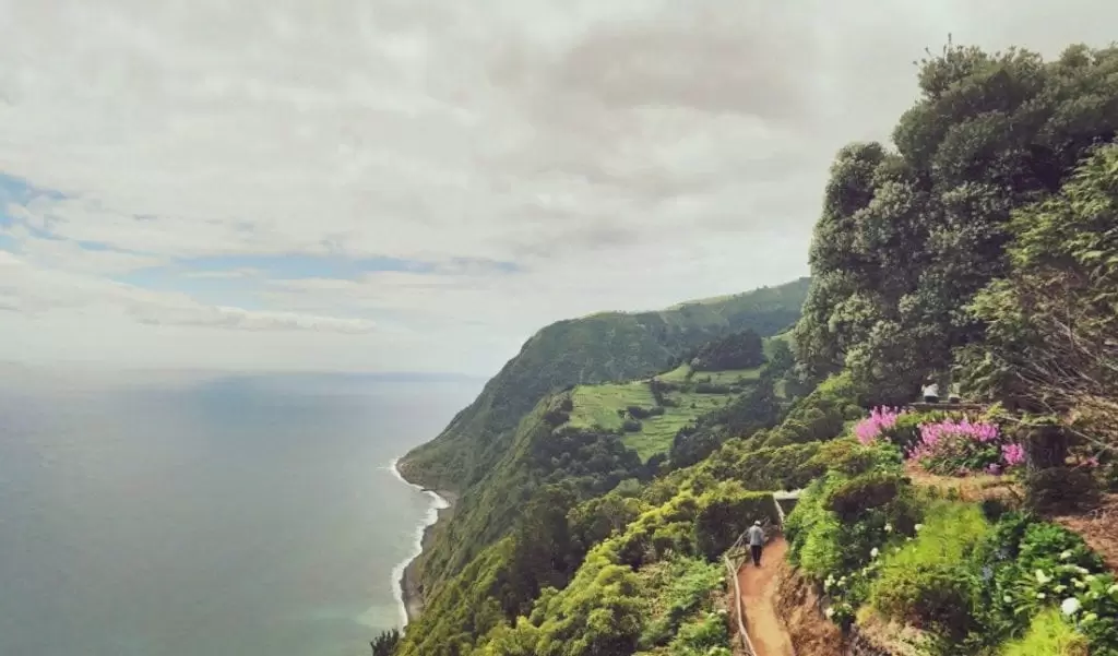
Leaving the village and continuing southwards, you arrive, in five minutes, at the Arnel Lighthouse (19th century) – open on Wednesdays.
Leaving the car in the road park is advisable as the descent is steep. With great views, the region is breathtakingly beautiful – with several viewpoints from which to enjoy it.
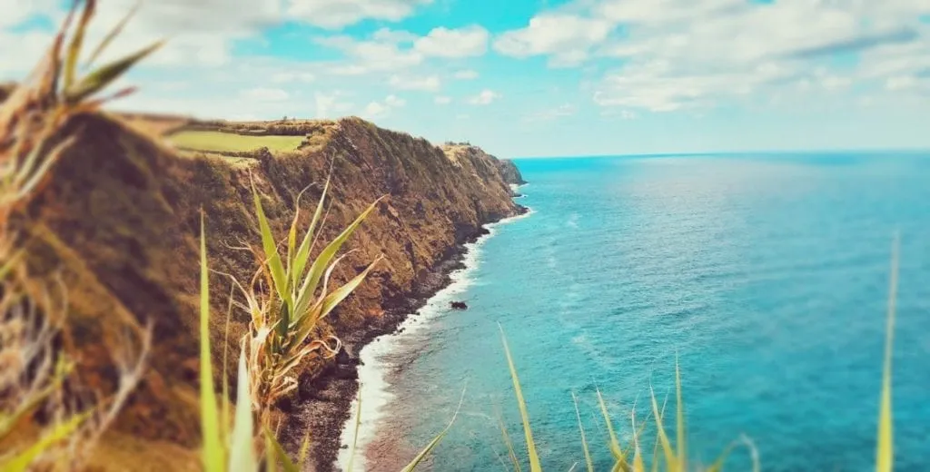
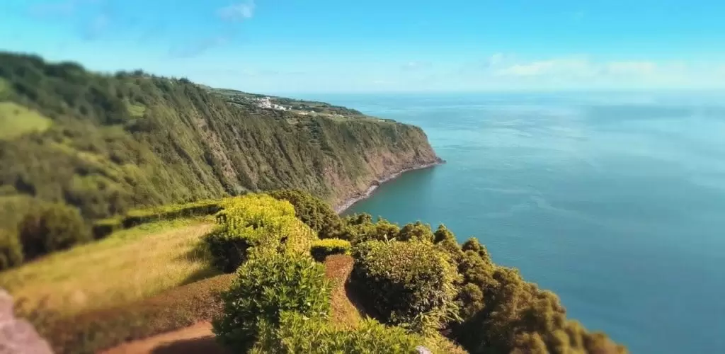
Ponta do sossego viewpoint
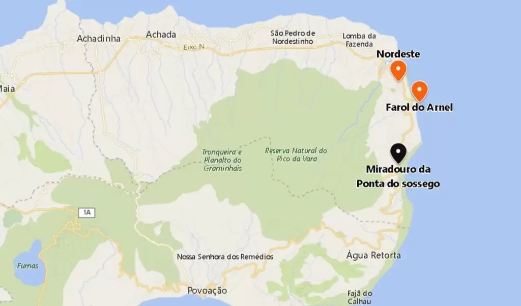
- Coordinates: 37.799266, -25.146688
It is ten minutes from the lighthouse to the beautiful Ponta do Sossego Viewpoint on the coast of São Miguel, with a splendid garden.
Ponta da Madrugada Viewpoint
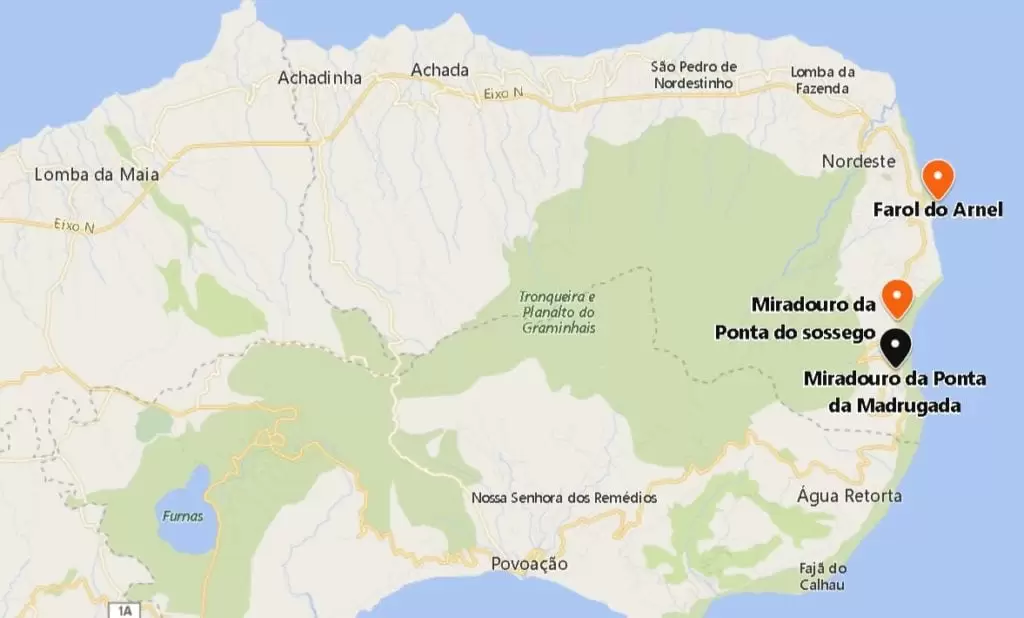
- Coordinates: 37.789122, -25.147263
Continuing along the road, you reach the Ponta da Madrugada Viewpoint in five minutes, with stunning views. Excellent for a picnic. There are more viewpoints and, if you like, explore them on the way to Povoação, a 25-minute drive away.
Salto do Prego
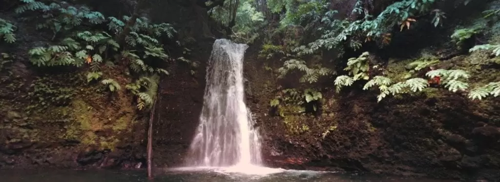
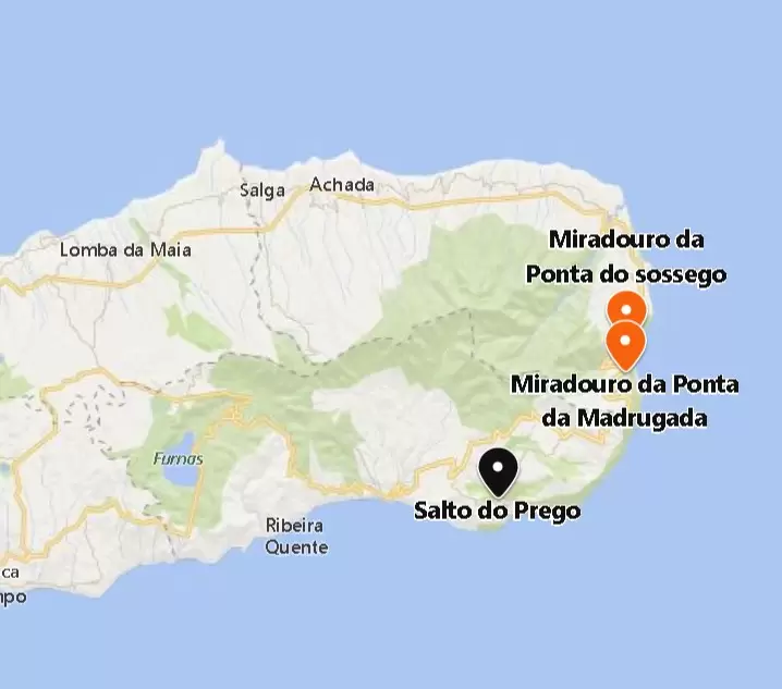
- Coordinates: 37.747018, -25.200759
To visit the Salto do Prego Waterfall (with cold water), before the small Faial of the land, follow the Salto do Prego trail (take note: it’s two hours) – it starts at the bus stop. The terrain is not very hilly and well signposted.
Povoação
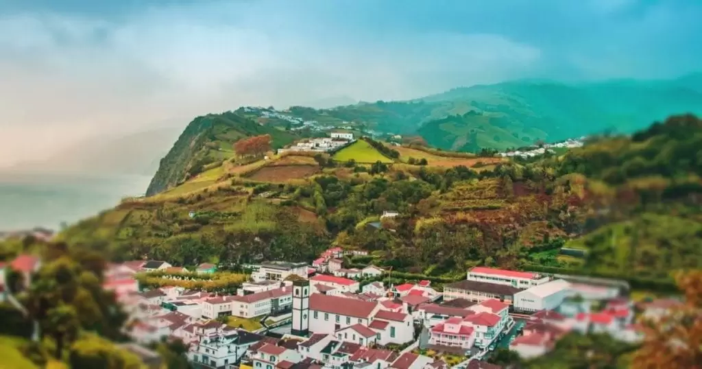
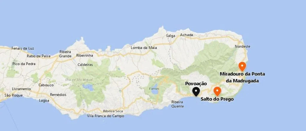
- Coordinates: 37.746647, -25.246030
The municipality of Povoação is the site of the first settlement in São Miguel. The Nossa Senhora do Rosário Church, built in the 15th century, was the first temple on the island.
The chronicler Gaspar Frutuoso tells us a peculiar story about the settlement: At first, 12 knights are sent, veterans of the fierce battles in North Africa, and with their partners, they create the first settlement with the blessing of Prince Henry the Navigator.
They thought they were the first but detected trails made by humans. Skilled in the art of tracking, they quickly climb the dense forest until they find the remains of a bonfire.
Soon they come across a couple who had disappeared from Santa Maria (the first island to be populated): the man had fallen in love with his partner and murdered her husband.
In a “conversation” with the knights, they confess that they convinced a fisherman to transport them clandestinely to São Miguel. Then the man murdered the fisherman.
After pondering, the knights end up executing the man. It is an example of stories that fade away in time; however, Frutuoso was prodigious in recording them.
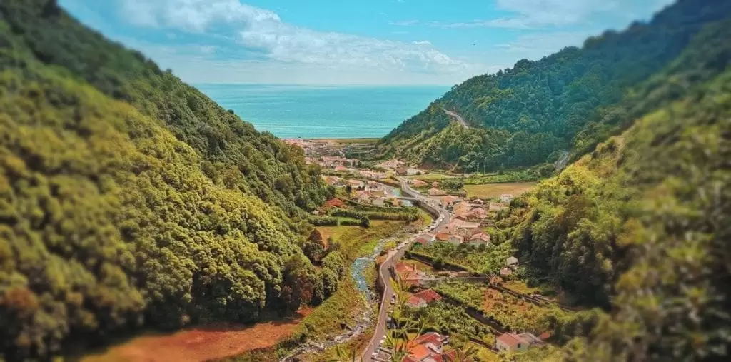
Ribeira Quente

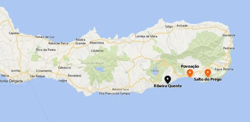
- Coordenadas: 37.733474,-25.302619
As you move through the vibrant valley approaching the parish of Ribeira Quente you pass through 2 tunnels from which, in the middle, there is a waterfall.
There is an excellent sandy beach, Ribeira Quente Beach, with all the amenities – locals tell you where the water is warmest. You will see the refurbishment of the old port for tourism.
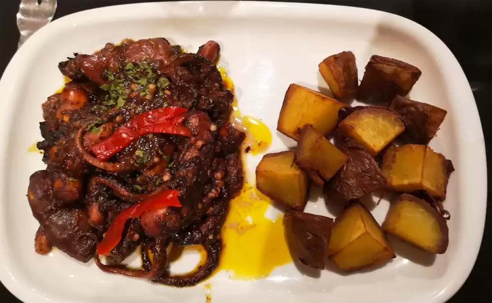
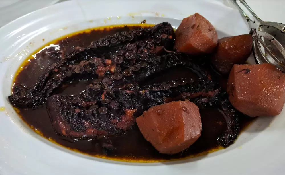
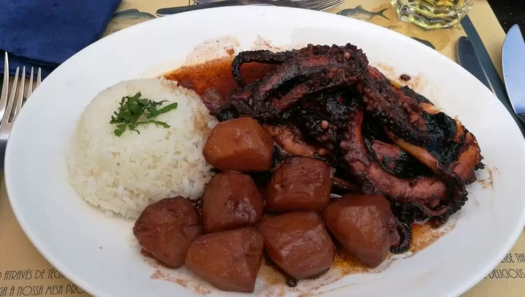
There are several fish and seafood restaurants – try the octopus at Restaurante Ponta do Garajau (Rua Doutor Frederico Moniz Pereira 9).
- Coordinates: 37.735949, -25.298910
Furnas
Pico do Ferro Viewpoint
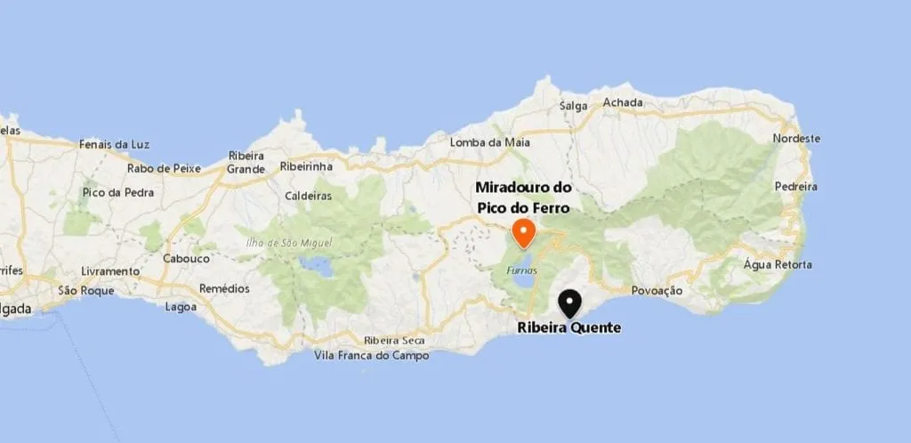
- Coordinates: 37.771992, -25.334108
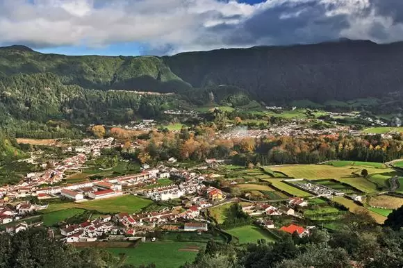
North of the parish of Ribeira Quente, 20 minutes inland, is Lagoa das, Furnas. On the way down, you will see the signposted Miradouro Pico do Ferro – one of the best views over the lake and valley.
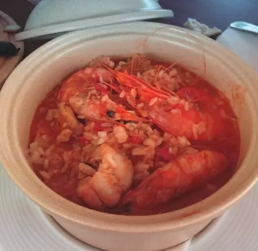
Furnas is where, for generations, the famous boiler stew has been cooked – try it at Tony’s Restaurant (at Largo do Teatro 5), in the centre of the village.
- Coordenadas: 37.773632,-25.310269
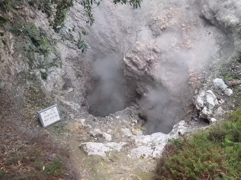
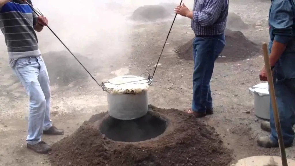
Furnas Boilers
Five minutes from the restaurant, unveil the various boiling hot water boilers steaming with steam and a distinct smell of sulphur – there’s parking nearby.
- Coordinates: 37.773027, -25.303963
One of the boilers is called Pêro Botelho – the name of the father of one of the first settlers of São Miguel. Both father and son were knights of the Christ Order (successors of the Knights Templar in Portugal). There are fountains of mineral water nearby.
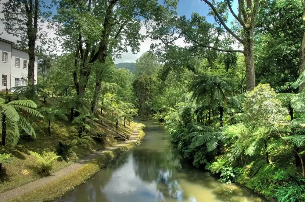
Terra Nostra Garden Hotel
- Coordinates: 37.772938, -25.314441
In the centre of Furnas are old summer houses from the 19th century, some with beautiful gardens. The Terra Nostra Garden was erected by the Boston merchant Thomas Hickling – in the early 18th century.
He added a mansion (now a hotel) and an outdoor swimming pool. It is possible to visit trees still planted by Hickling.
The Terra Nostra park is part of the 250 most beautiful parks in the world. For about 10 euros you can visit the garden and revitalise yourself in the thermal waters of the swimming pool. With changing rooms.
Poça da Dona Beija
- Coordinates: 37.769348, -25.319363
5 minutes from Terra Nostra Garden, you will find Poça da Dona Beija, which corresponds to 5 pools of hot water (39 degrees) from a natural spring. For less than 10 euros, you can relax in full communion with nature.
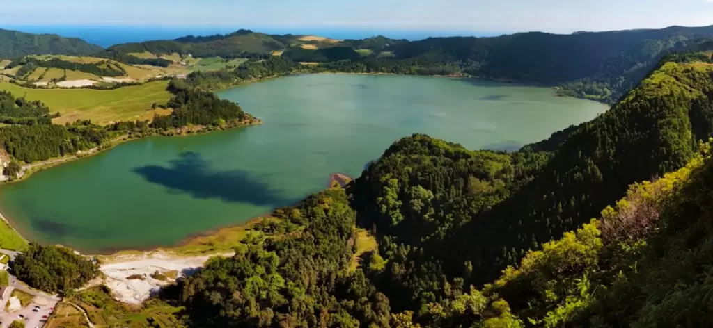
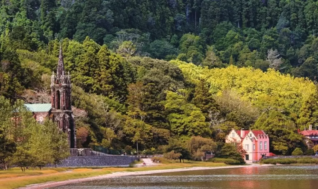
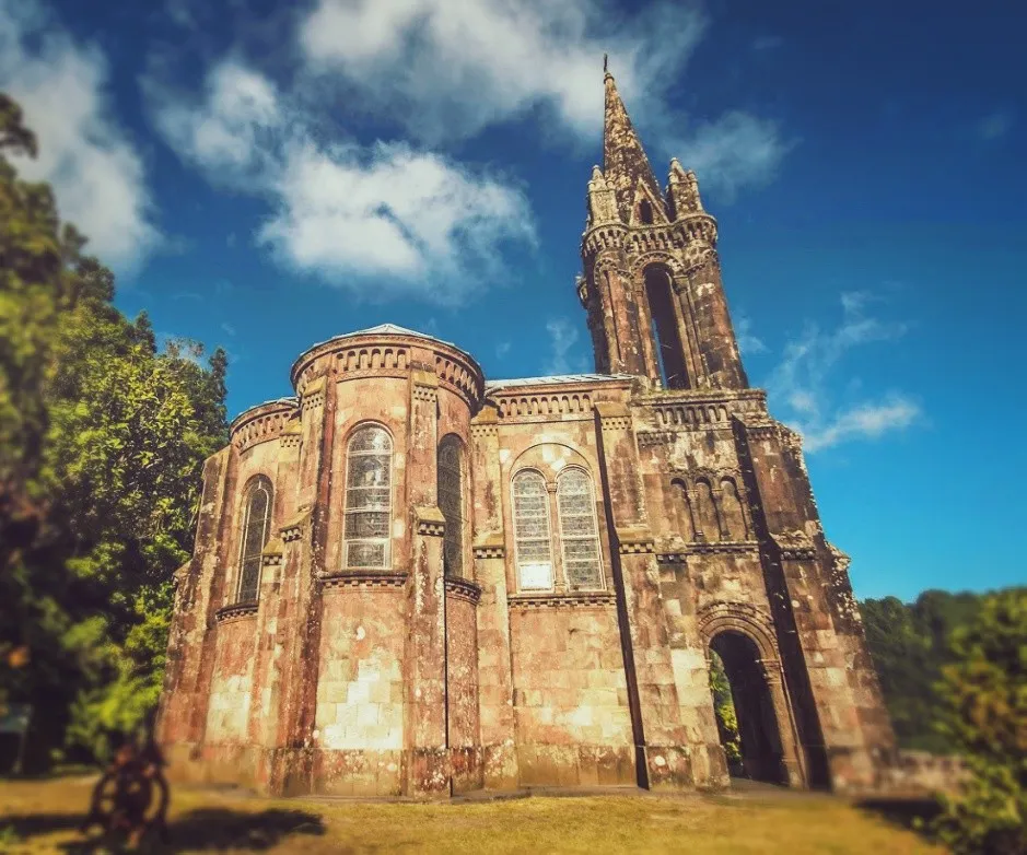
Furnas Lake
- Coordinates: 37.768305, -25.331184
From the centre of Furnas, it is a 15-minute drive to the lagoon; the beauty of the place hits you on arrival. It is also where a pot is introduced with different meats and some vegetables (mainly cabbage, cabbage, and potatoes) in a pit 1 meter deep.
Everything is simmered for 5 to 7 hours; all the delicious juices and flavours are preserved and intensified. Nearby is the beautiful Nossa Senhora da Vitória Chapel, in neo-Gothic style.
It was erected at the behest of José Canto 19th century, by vow related to his wife’s illness. José do Canto was a landowner who studied in Paris – gifted with enormous culture and even greater curiosity. He was a pioneer in the production of tea on São Miguel Island.
Furnas Golf Course
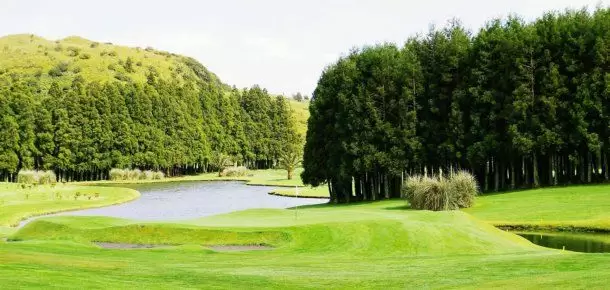
- Coordinates: 37.778550, -25.341180
At Achada das Furnas, www.azoresgolfislands.com, we discover Golf Furnas Course, set in a glorious fern landscape. It was designed by MacKenzie Ross (who was responsible for the course at Estoril, near Lisbon). Built-in 1939 with 9 holes and enlarged in 1990 (by Cameron Powell) to 18 holes.
Castelo Branco Viewpoint
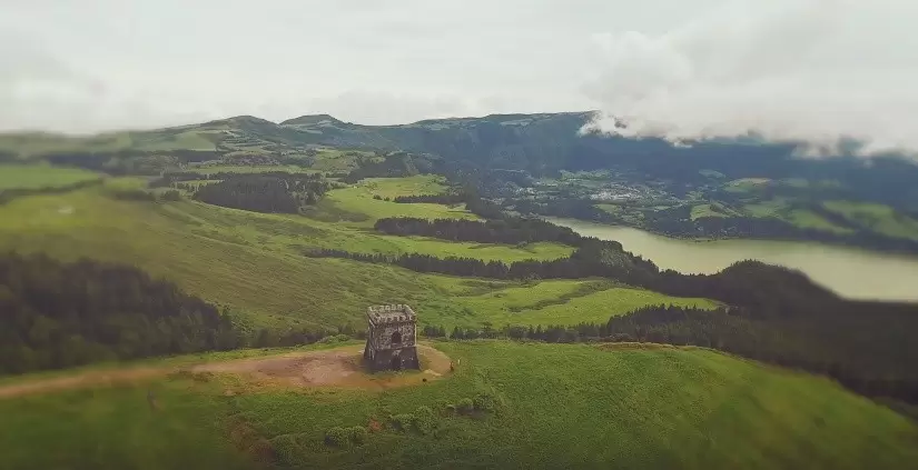
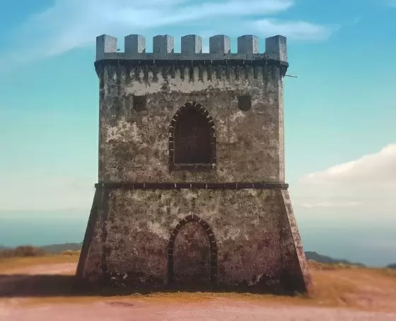
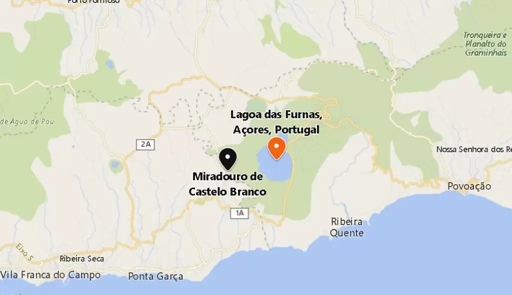
- Coordinates: 37.754288, -25.355487
It’s a few minutes along the regional road between Furnas and Vila Franca de Campo until you turn to the Castelo Branco Viewpoint.
At the top of the elevation appears a tower retired from the watchtower function. A viewpoint with astonishing views: of the Lagoa and Vila Franca de Campo on the other side.
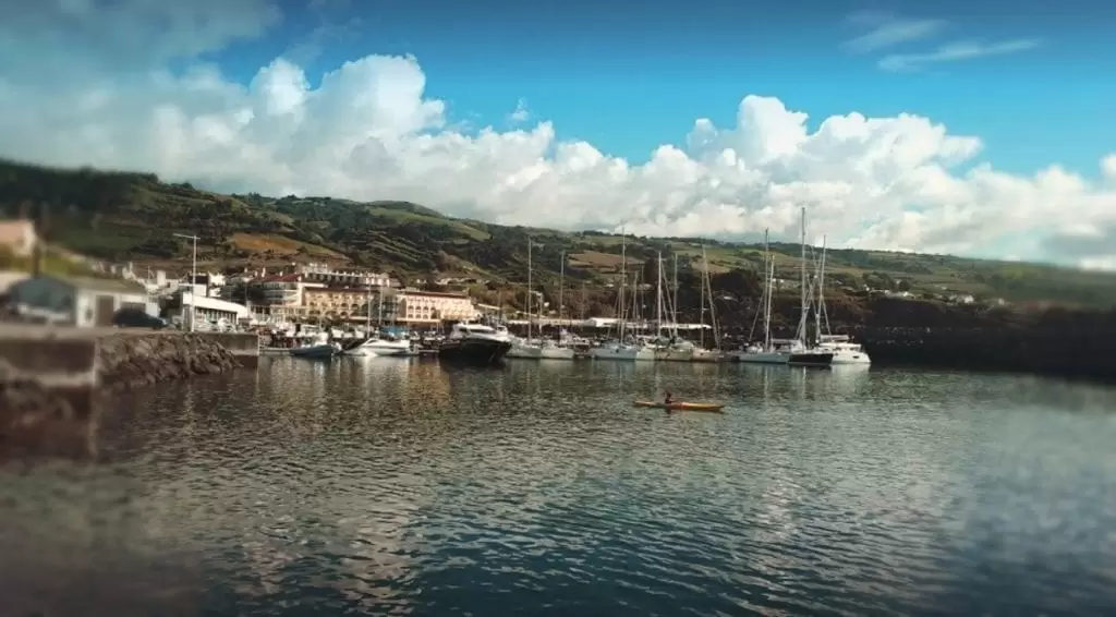
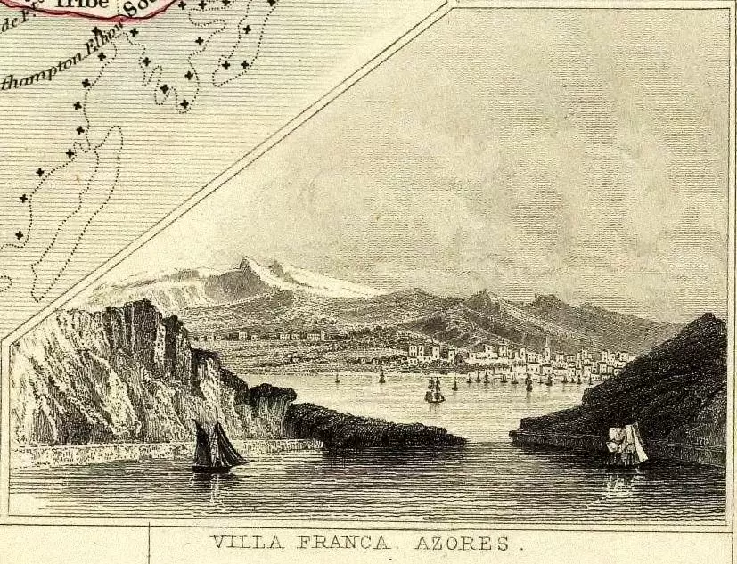
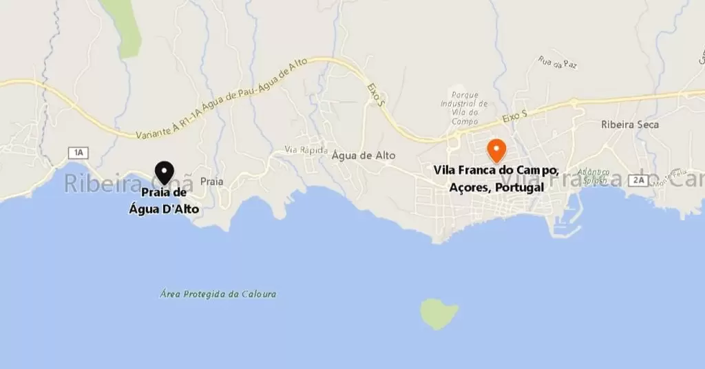
Vila Franca do Campo
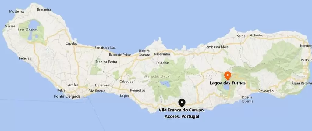
- Coordenadas: 37.720542,-25.435989
The municipality of Vila Franca de Campo, located on a fertile plain, was once a free zone whose residents were exempt from taxes.
It was the first capital, a place of beautiful Divine Holy Spiriti festivities and where most of the knights of the Order of Christ settled – until the great earthquake of 1522 with enormous human consequences.
Shortly afterwards, the people here created the Movimentos Romeiros – they travel around the island on foot while praying. The members call each other brother.
Close by is the original home of Nosso Senhor Santo Cristo dos Milagres (Convent of Nossa Senhora da Conceição in Caloura). Due to the attacks by corsairs, they decided to send the statue to the convent of Mother Teresa da Anunciada (Ponta Delgada). Mother Teresa was seen by the locals as a saint and seer.
- Coordinates: 37.714240, -25.430673
There is now a plan for tourism which includes a marina, a small fishing boat harbour and the naval club.
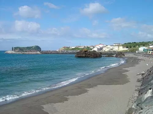
- Coordinates: 37.717335, -25.426521
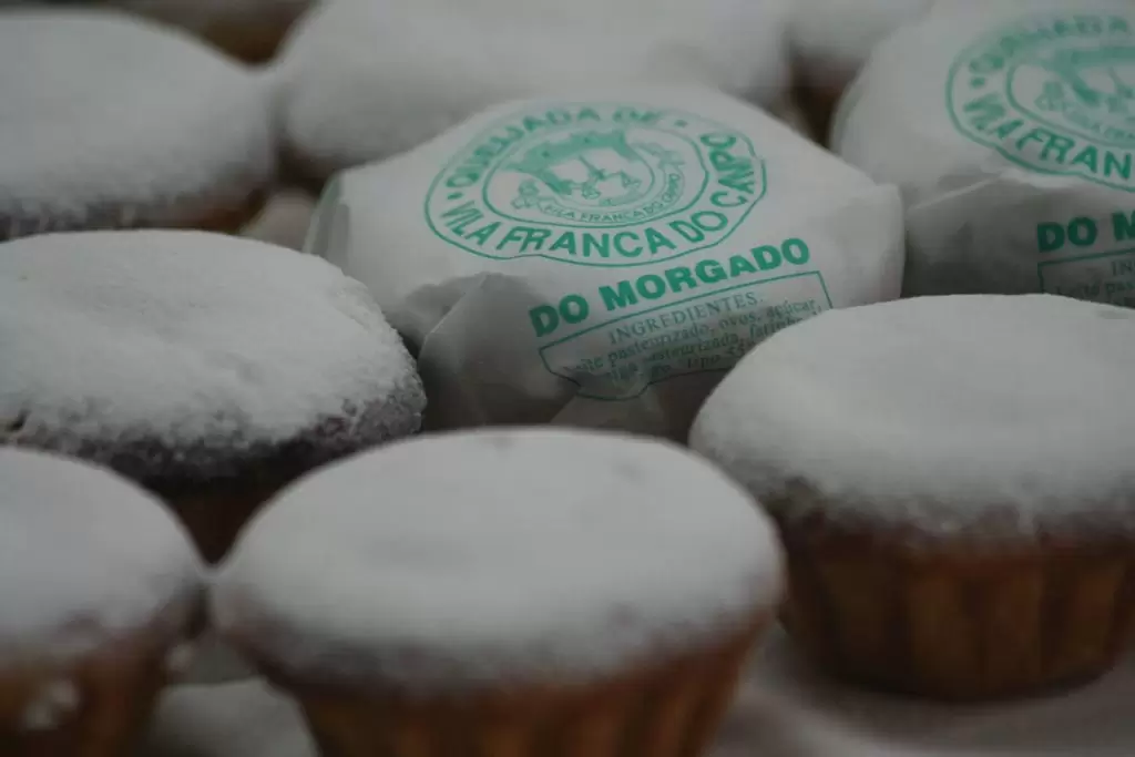
Try the Praia Café restaurant, right by the beautiful Vinha d’Areia beach – it’s the place to go for Queijadas da Vila – ideal with a coffee.
São Miguel Arcanjo Church
The St. Michael Church, with a Gothic portal, stands out among the buildings of architectural value. Completed in 1537 with an impressive facade built of basalt. On the edge of the town, you can see the old church and Convent of São Francisco (1525) in a small public garden – now a refined hotel.
- Coordinates: 37.716274, -25.441261
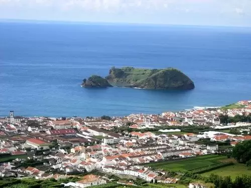
Off the coast, the Ilhéu is a constant presence, the remains of an ancient volcano active for over 4 thousand years.
Vila Islet
It is trendy and accessible by boat between June and September (10 minutes) from the marina. The weather on the islet is almost always better than on the rest of the island: it is sunnier, and its water is warmer.
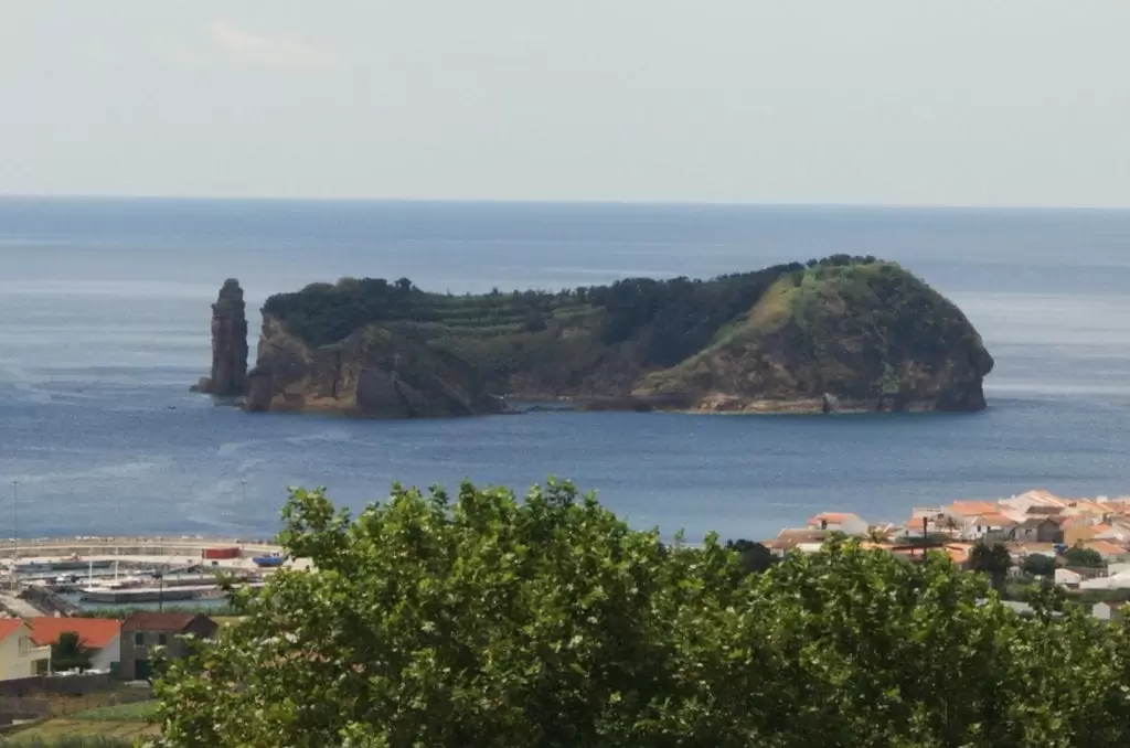
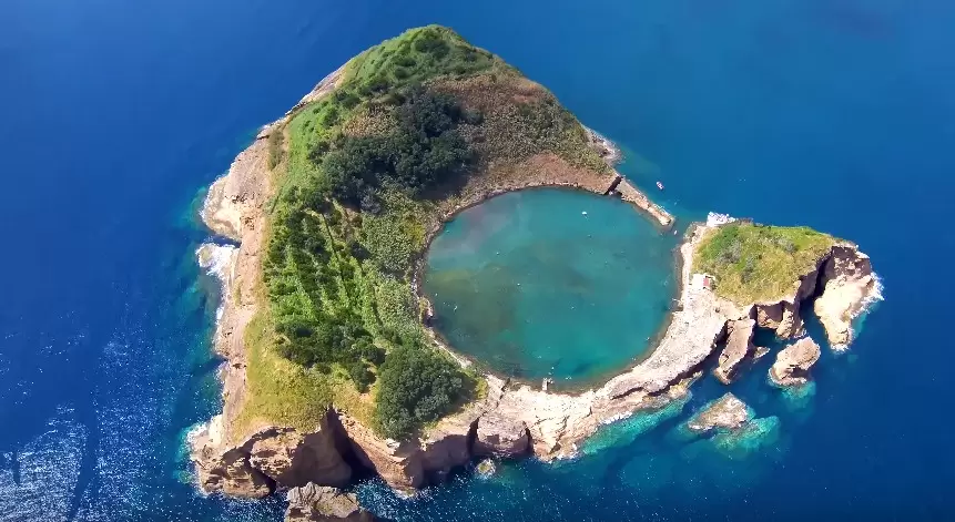
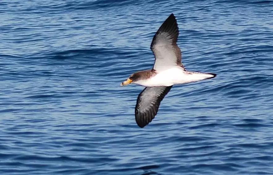
It is a nature reserve where several species of birds, such as Cory’s shearwater nest. There is an apparent concern about balancing conservation and recreation – a daily quota of visitors cannot be exceeded.
Ermida da Nossa Senhora da Paz
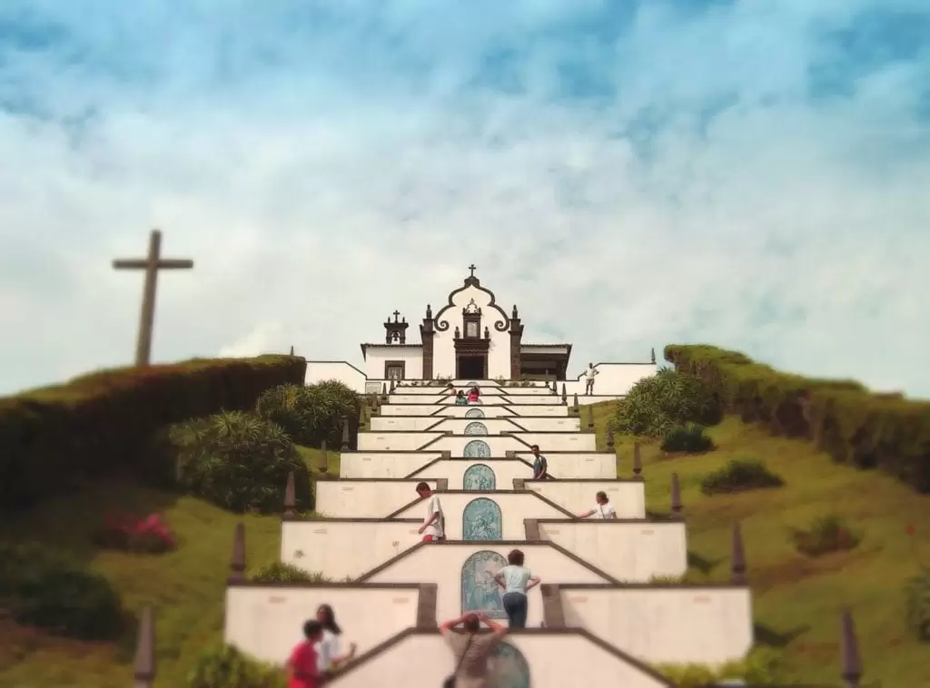
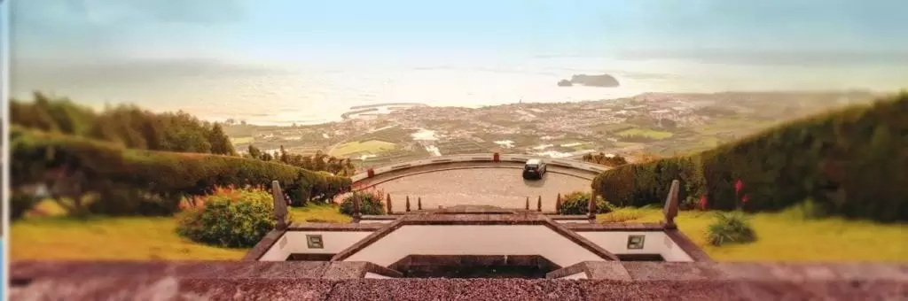
- Coordinates: 37.728047, -25.431676
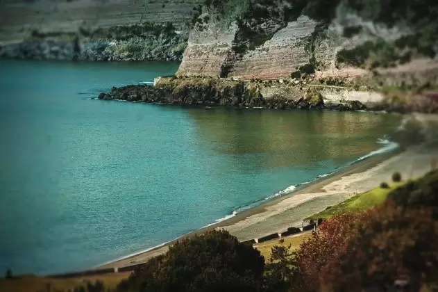
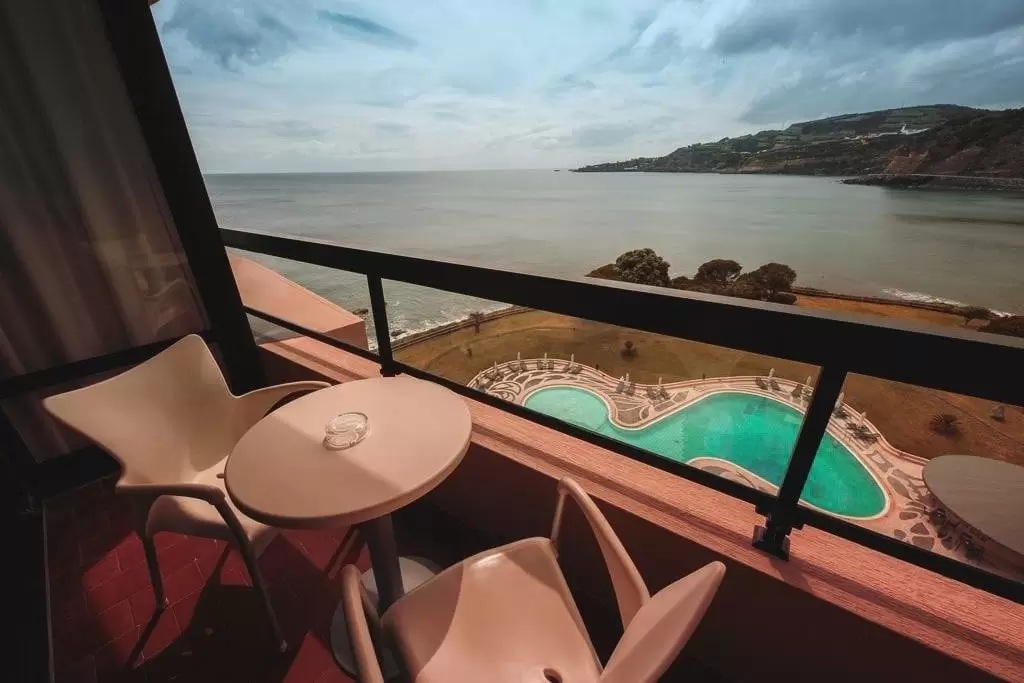
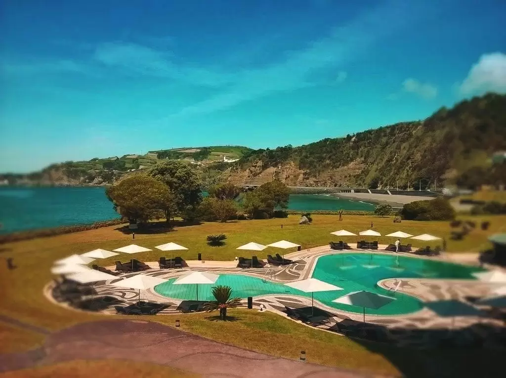
If you have time, it is worth driving to the Ermida da Nossa Senhora da Paz. A splendid view of the village and vivid nature are on the horizon. In the next parish, Água D’Alto, is one of São Miguel‘s best beaches, Praia de Água D’Alto – and on its edge is a 4-star hotel, Pestana Bahia Praia, with an excellent outdoor pool.
- Coordinates: 37.716642, -25.472425
