

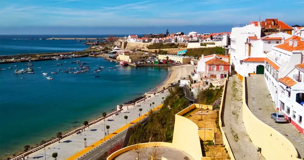
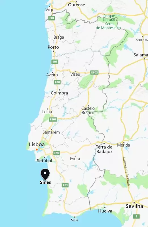
Sines have been shaped by the sea. With a picturesque historic centre, deep-water port, it lies 160 km south of Lisbon, at the tip of the cape that separates the Alentejo coast into 2 parts.
To the north are the long sandy beaches up to Troia, and to the south are the inlet beaches that are part of the Natural Park of Southwest Alentejo and Vicentine Coast.
The Phoenicians were the first to explore the region and the Romans made Sines a port near Miróbriga (Santiago do Cacém) – the origin of the word Sines comes from the Latin Sinus (bay).
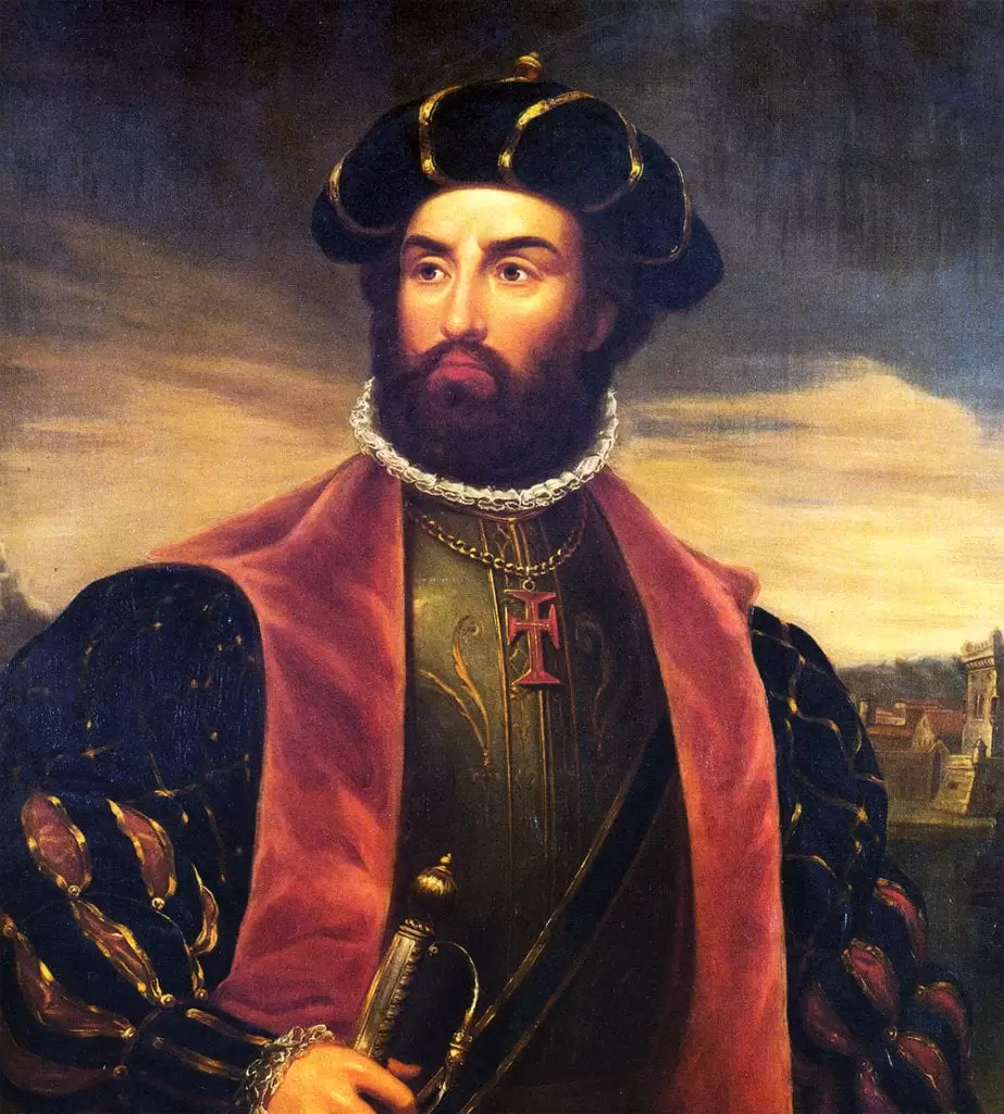
The best-known son of Sines is the navigator Vasco da Gama, a knight of the Order of Christ who made history by discovering the sea route to India (end of the 15th century).
In the first two-thirds of the 20th century, fishing and the cork industry were the basis of the economy, but in the 1970s the port and industrial complex emerged.
Vasco da Gama Beach
- Coordinates: 37.952865,-8.864783
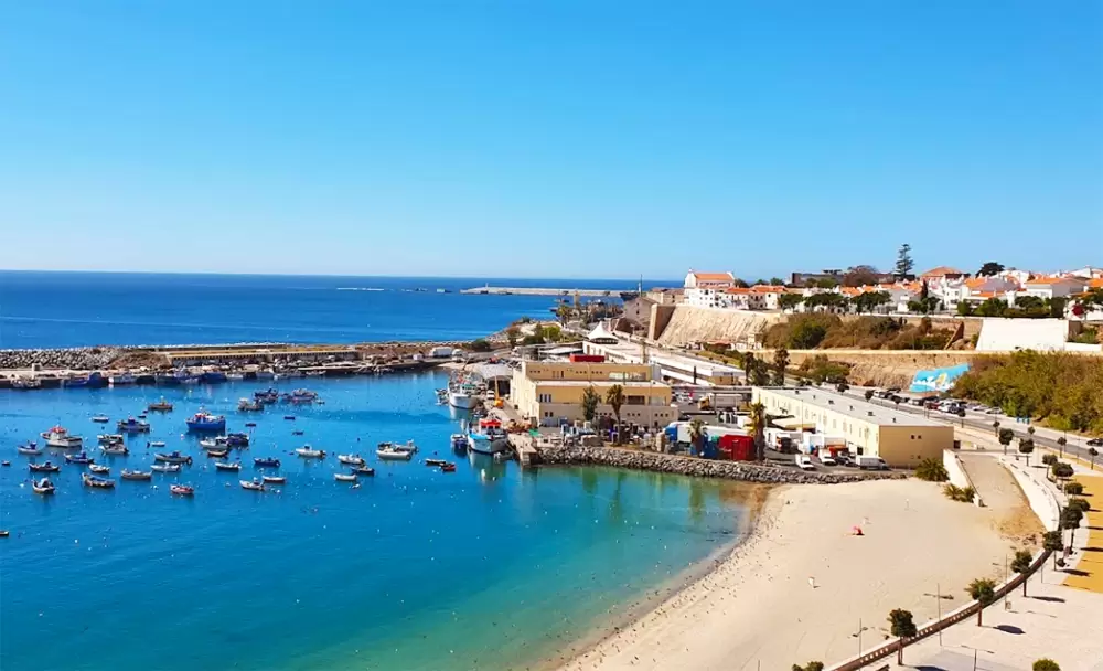
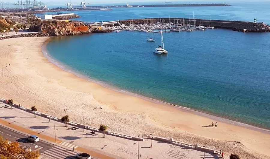
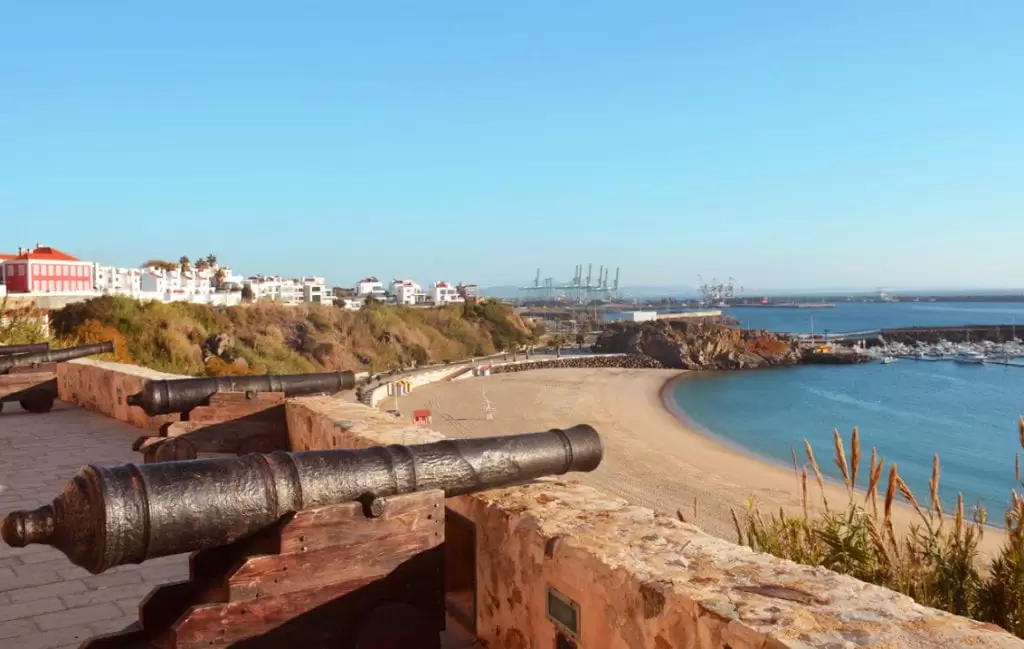
In the centre of the bay is the wide Vasco da Gama beach, tucked between the pontoons. It is guarded, easily accessible and its promenade offers peaceful walks.
Next to the beach occurs the gastronomic festival Tasquinhas Sines in July. From this beach, the absolutist Dom Miguel (19th century) left for exile on a British warship – he lived out his last days in Baden-Württemberg (Germany) where he married a princess.
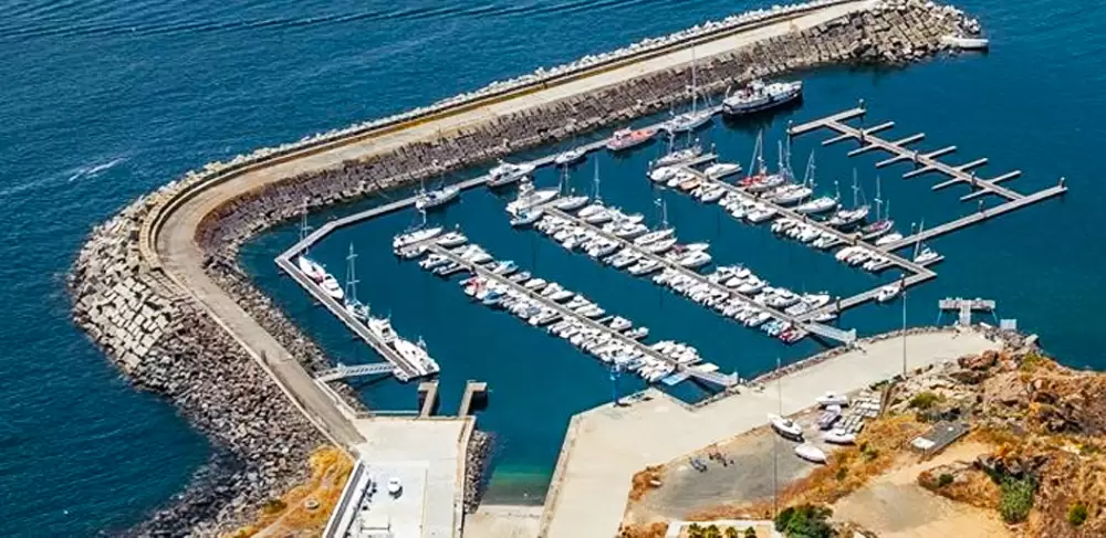
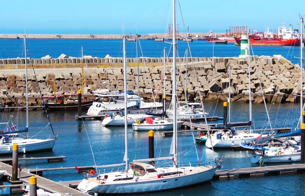
To the east, you can see the friendly Porto de Recreio, the last one to the Algarve coast. With 250 seats, electricity, wi-fi, sanitary facilities, laundry, petrol station.
- Coordinates: 37.952391, -8.873490
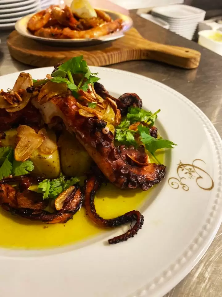
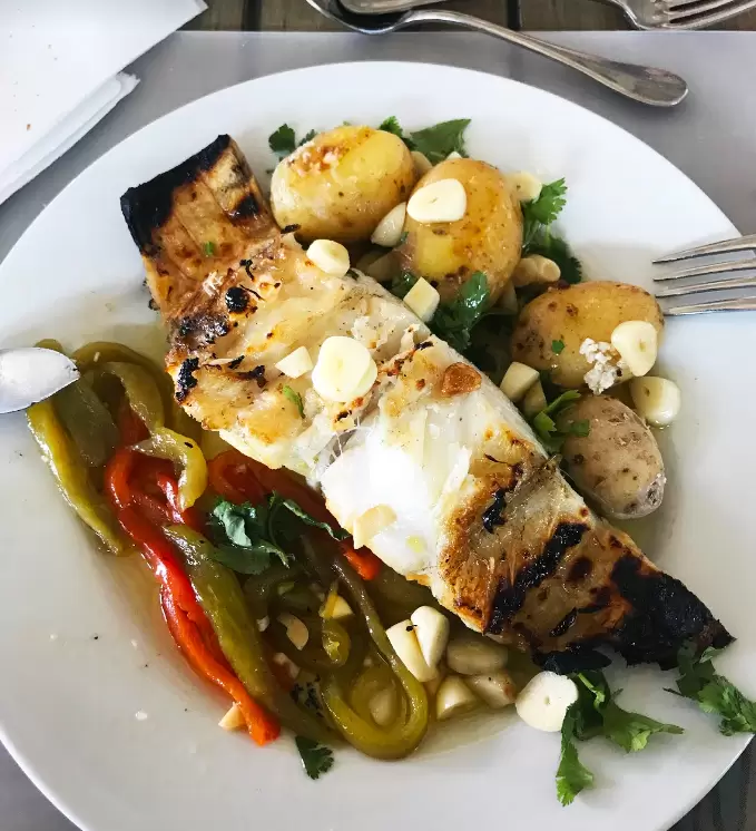
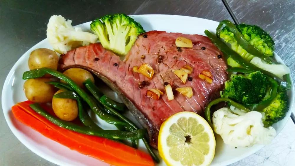
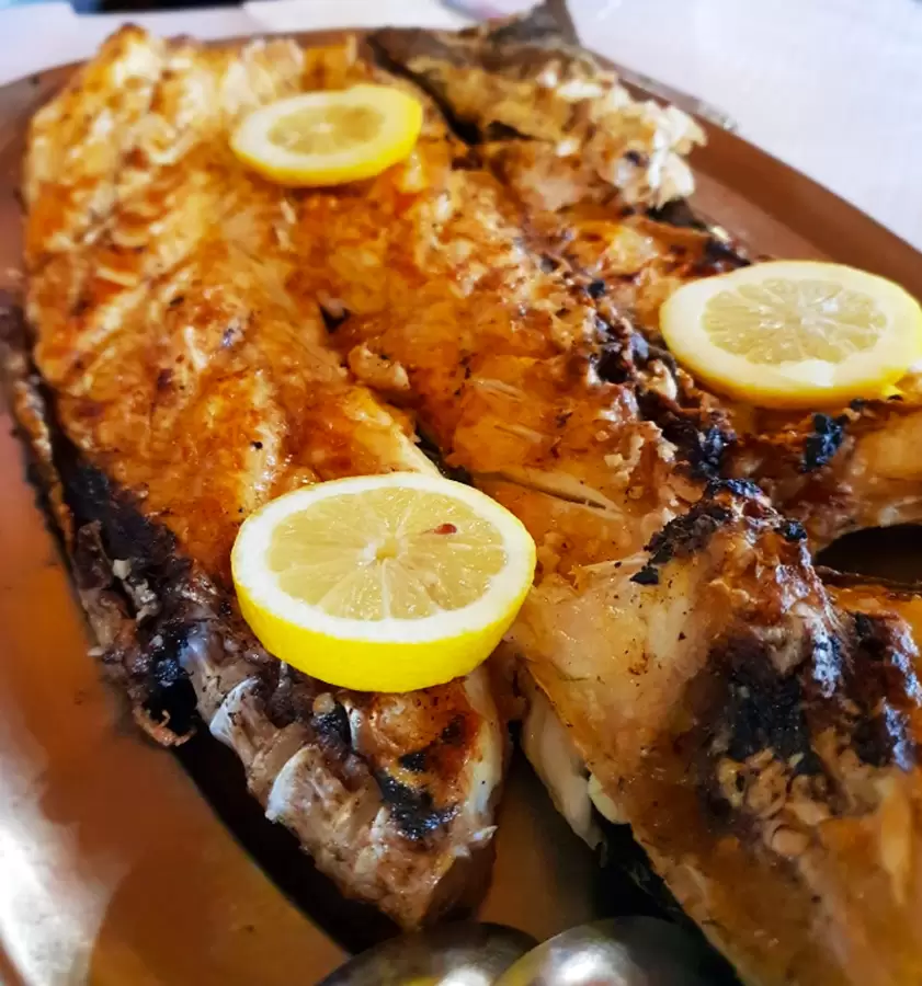
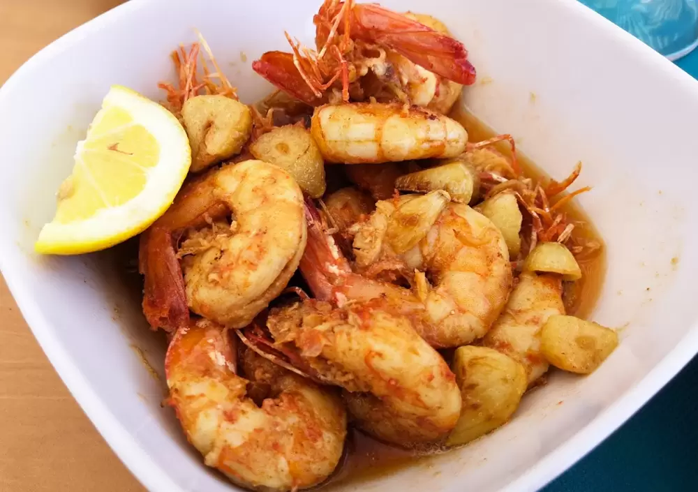
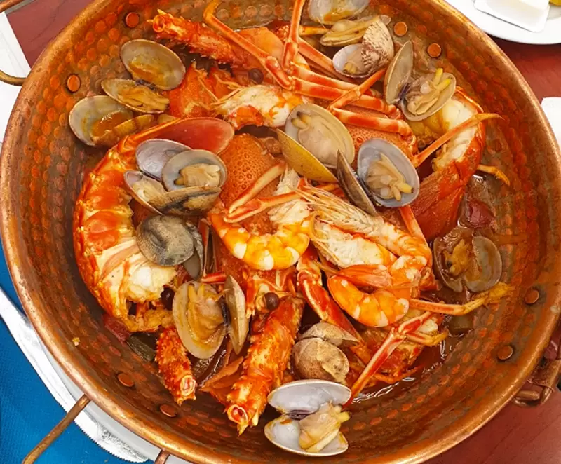
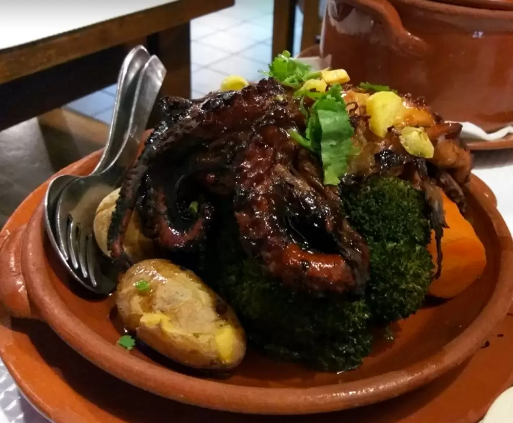
On the other side, near the Lota de Sines, discover the traditional O Beijinha – with great grilled or baked fish. Fish and seafood are at the heart of the local cuisine, which comes straight from the fish auction.
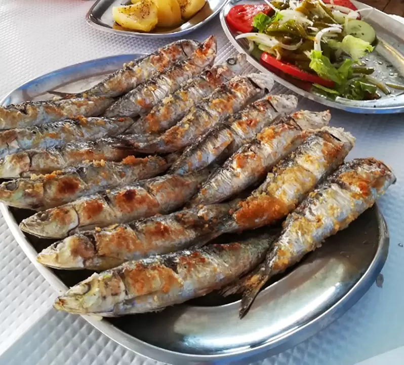
Dishes like açorda de marisco and feijoada de búzios are typical examples of the influence of a more rural Alentejo. The deep port of Sines has a centuries-old fishing tradition. It grew dramatically with the creation of the container terminal (2004).
It is a critical port for the development in Europe of the Chinese megaproject: New Silk Road – the other is the Spanish port of Algeciras, in Cadiz.
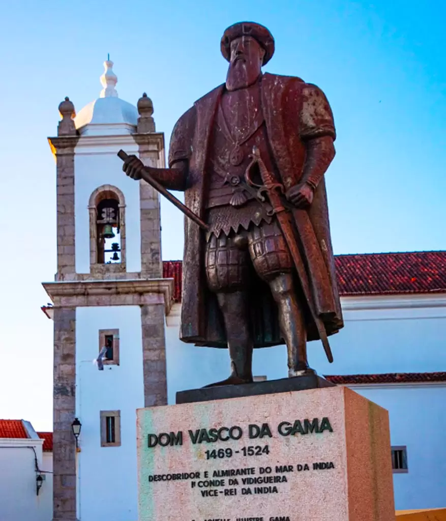
Vasco da Gama Monument
- Coordinates: 37.954865, -8.867123
No Portuguese land is so closely linked to Vasco da Gama. His voyage directly linked Europe to the Orient. He dreamed of being Count of Sines – it is said that his father, Estevão da Gama, was alcalde of the castle of Sines and commendator of the order of Santiago. There is a good chance that he was born in the castle.
A few metres from the main church, you can see the Vasco da Gama statue, which was inaugurated in 1970 on the occasion of his 500th birthday. The first voyage to India took two years: he stopped off in Cape Verde, then sailed near Brazil to take advantage of winds known only to the Portuguese.
Then he rounded the Cape of Good Hope (South Africa) into the unknown – from this point the journey was very difficult. When he arrived in Calicut (20 May 1498) he was nearly 30 years old – the first meeting with the local authorities did not go well, but he was allowed to leave some of his people to establish trade.
The return journey is dramatic: they are unaware of the winds, sail through inhospitable lands and, malnourished, fall victim to scurvy… In short, they throw corpses overboard daily and by the time they reach Lisbon there are just over 50, nearly 35% of the original crew – the rest are sacrificed on the mission.
The 2nd expedition to India is led by the Knight of the Order of Christ Pedro Álvares Cabral, with a powerful armada. On the way he officially discovers Brazil.
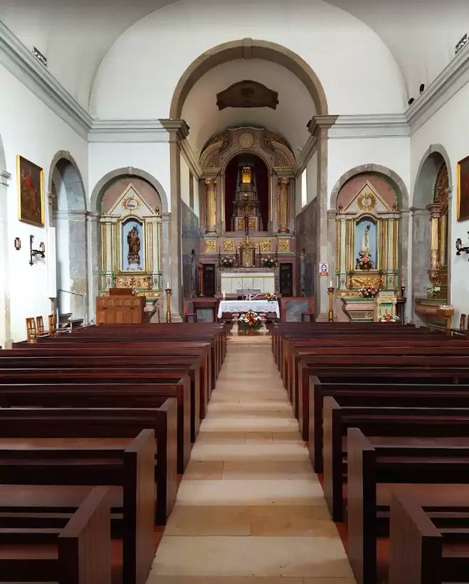
Matriz do Salvador Church
- Coordinates: 37.955214, -8.867309
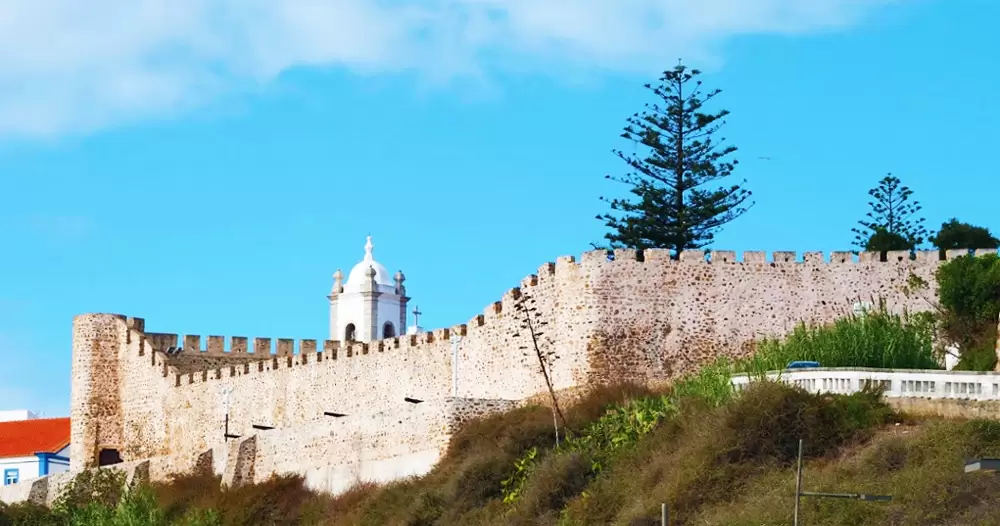
Beneath the statue, practically leaning against the castle wall, stands the medieval Church of the Saviour – rebuilt in 1730 at the behest of the order of Santiago, with a Baroque period façade.
In the 8th century, Islamic forces occupied Sines, but when it was recaptured (12th century) it came under the rule of the Order of Santiago (whose headquarters were in Alcácer do Sal).
There, Vasco da Gama, aged 11 or 12, and his older brother Paulo become members of the order of Santiago. Paulo will accompany his brother on the voyage to India, but will never see Sines again, as he dies after the garrison sighted Portuguese land – he was not even forty years old.

Vasco had great physical stamina, something Paulo didn’t have, but both were tremendously dedicated to the mission – history will glorify Vasco, who will never forget his brother’s sacrifice.
Vasco da Gama leaves the Order of Santiago to become a Knight of Christ (successors to the Templars in Portugal). Not surprisingly, he clashed several times with the master of the order of Santiago (Dom Jorge), who treated him as an unwelcome person. Dom Jorge was the lord of Sines and illegitimate son of Dom João II.
He could have been a monarch, but Rome did not look kindly on this. He had many notable knights, such as Afonso de Albuquerque. When the new king Dom Manuel wanted to give the village of Sines to Vasco da Gama,
Dom Jorge refused any exchanges, no matter how advantageous they might be – Vasco bought Vidigueira (130 km east of Sines, near Cuba).
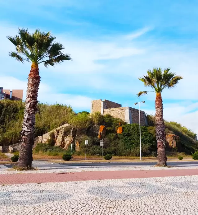
Sines Castle
- Coordinates: 37.955228, -8.866535
After the Portuguese conquest of the Algarve, Islamic pirates patrolled the waters. Thus, at the most strategic point over the bay, stands the small Castle of Sines (1480) erected for the protection of the locals.
It is still the best viewpoint of the bay. According to tradition, Vasco was born in the keep, which houses the main nucleus of the Sines museum. With various interesting objects (such as the Carthaginian treasure of Gaio), but focuses above all on the famous navigator. His father, Estevão da Gama, was a man of acknowledged courage and talent – he became a trusted member of Dom João II.
He was a spy in North Africa, walked around Anafé (present-day Casablanca in Morocco) dressed as a fig seller and took part in the conquest of Tangiers (Morocco) with King Afonso V and the young King João II. At this time there was talk of the Indies: rich lands that produced precious spices for food, medicine, and the manufacture of paints.
These precious spices reached Europe via routes controlled by the Islamic empire. They either came via the Persian Gulf, or they went around the Arabian Peninsula, up the Red Sea, Sinai, until they reached the Mediterranean.
Dom João II planned the journey and appointed Stephen as leader of the expedition. However, both died before the expedition was ready. The new king, Dom Manuel, gives the commission to the young Vasco, who accepts it.
- Coordinates: 37.955737, -8.866612
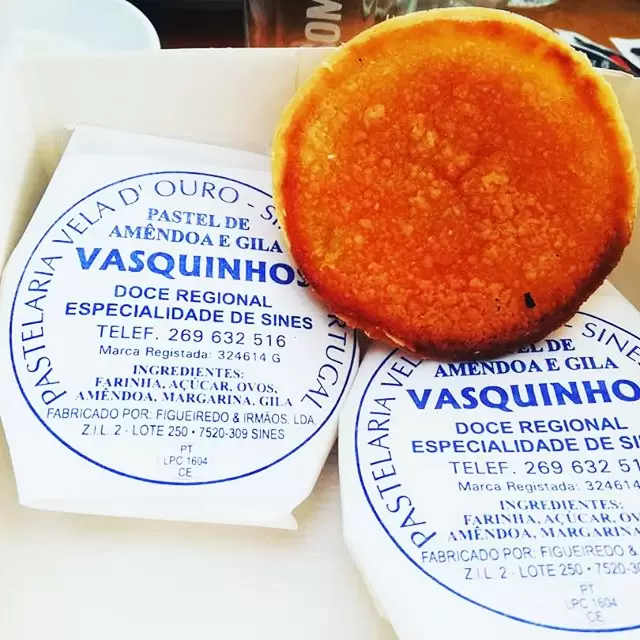
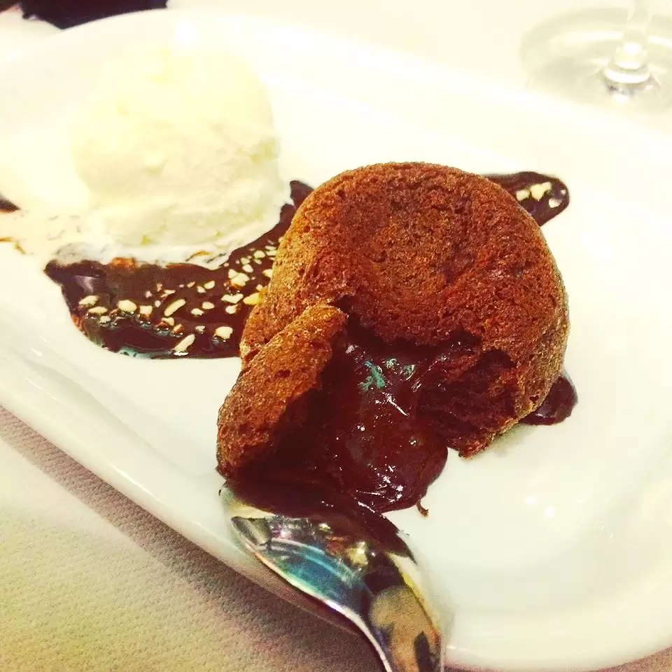
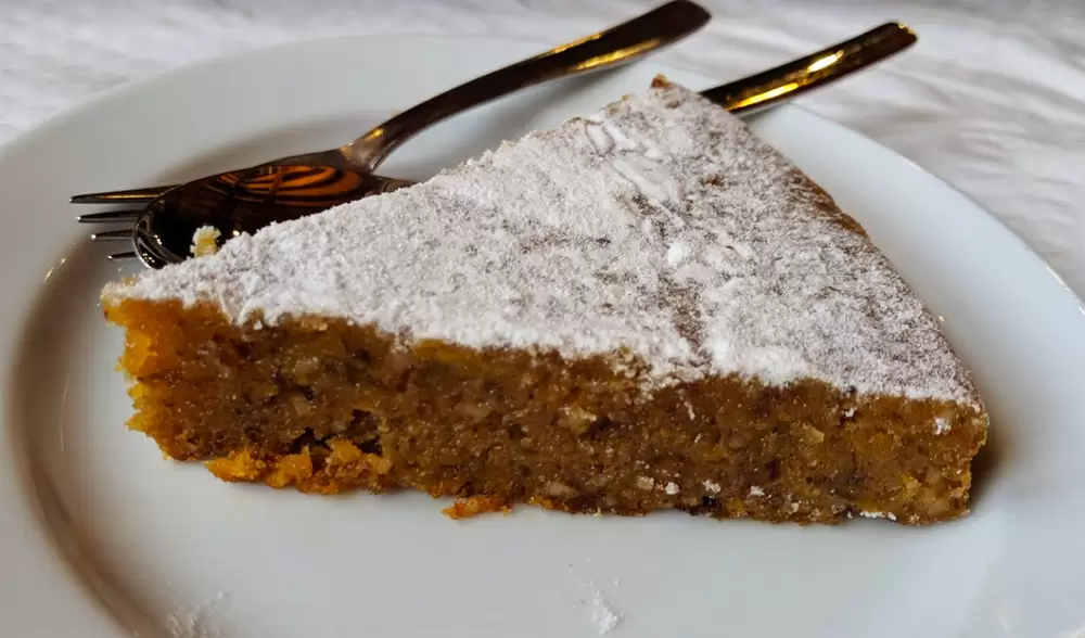
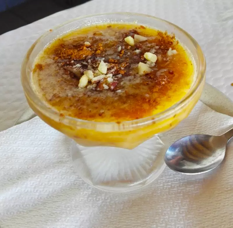
Beneath the Castle, spot the Pastelaria Vela D’Ouro (Largo do Castelo 2), from where you discover the regional sweet Vasquinhos with almond, egg, and gila filling.
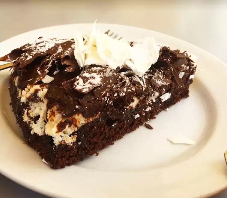
Other specialities are the Worst Chocolate Cake in the World, Doce da Jardoa, Pastéis de nata de bacalhau.
The historic centre continues west to the Revelim Fort. Stroll along the shopping streets (Rua Teófilo Braga, formerly Rua direita and Rua Cândido Reis). Rua Vasco da Gama was the place the navigator dreamed of for his home – the master of the order of Santiago does not allow it.
Church of Nossa Senhora das Salvas
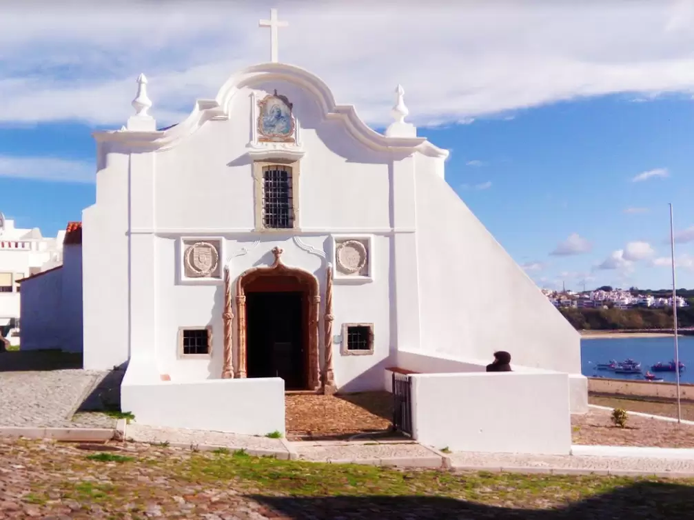
- Coordinates: 37.952727, -8.874476
1 km from the Castle, to the west, you reach the ancient Church of Nossa Senhora das Salvas. The temple was erected at the behest of Dona Vataça Lascáris, aunt of Queen Isabella of Aragon (wife of Dom Dinis – 14th century).
Dona Vataça was the granddaughter of a Byzantine king whose capital was Nicaia (present-day Iznik in Turkey). In the middle of the 14th century, her entire kingdom was conquered by the Turks and her family took refuge in Aragon, where she met Princess Isabella.
The order of Santiago donates Sines to Dona Vataça Lascáris and after her death she returns to the order. Already in the 16th century, the simple temple is in poor condition but of great dedication by the locals.
Vasco da Gama wants to pay for the reconstruction, but the master of Santiago declares that this will not be allowed. The local confrères understand that the navigator’s intention was noble and useful – they ignore the master and rebuild the temple in the Manueline style with Vasco’s support.

On the façade are two tombstones revealing in portuguese that it was built by “the magnificent gentleman Dom Vasco da Gama, Count of Vidigueira, Admiral and Viceroy of the Indies”. Not even the mighty Master of Santiago could ruin a Christian temple out of envy – here it is to our delight and Vasco’s pride.
Inside, the gilded carved main altar, with the image of Nossa Senhora das Salas (17th century), stands out. The celebrations in honour of the patron saint take place on 14th and 15th August.
Revelim Fort
- Coordinates: 37.951490, -8.876407
When a threat was identified, the people were guided inside the castle. In 1629, brave Turkish pirates even sank a ship in the port of Sines.
As the threats increased, fortifications were added along the coast. One kilometre to the west is Fort Revelim, or Forte da Nossa Senhora das Salas (17th century), which protected the riverside area.
If you start to get hungry, head north-east (2 km by the Alameda da Paz Garden) and discover the friendly Cais da Estação in a former warehouse of the Sines railway station. With great service, good fish, seafood and an interesting wine list.
- Coordinates: 37.958995, -8.864255
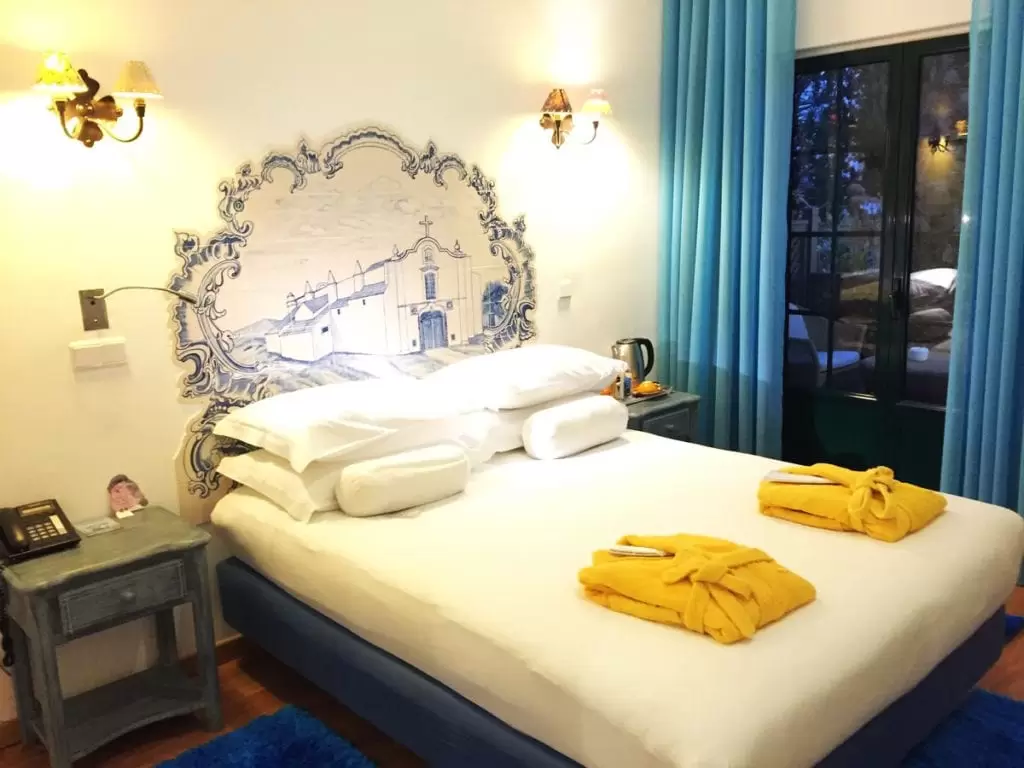
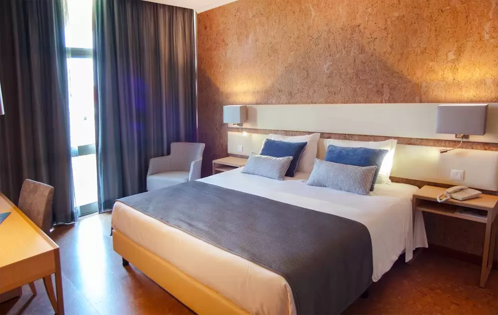
If you are looking for accommodation, probably the best would be the Hotel Dom Vasco (Rua do Parque 13, near the Municipal Stadium, 1 km from the castle) with a swimming pool, restaurant, gym, and garden. The rooms are spacious, clean – breakfast is good.

- Coordinates: 37.957756, -8.875289
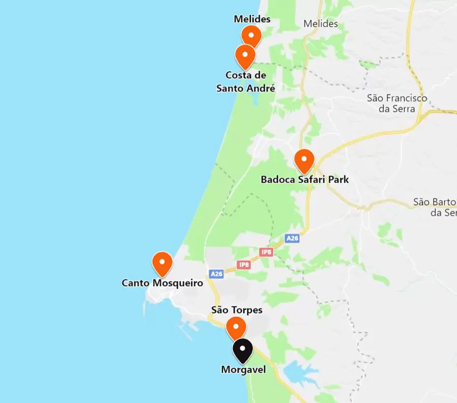
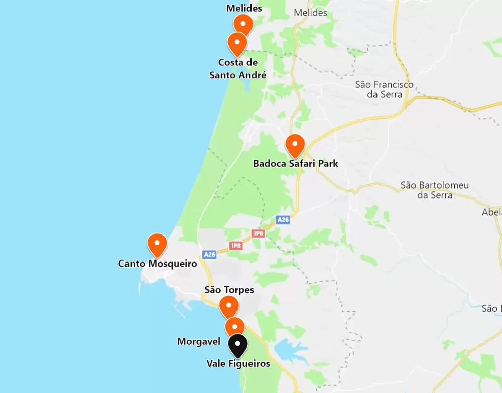
North of Sines
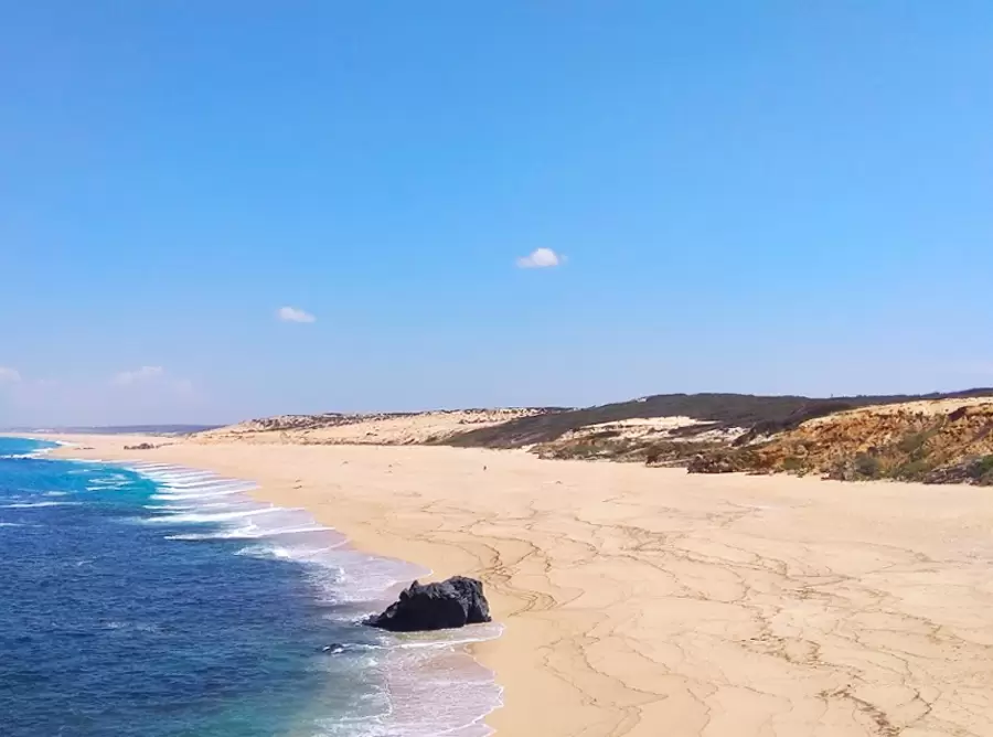
Canto Mosqueiro Beach
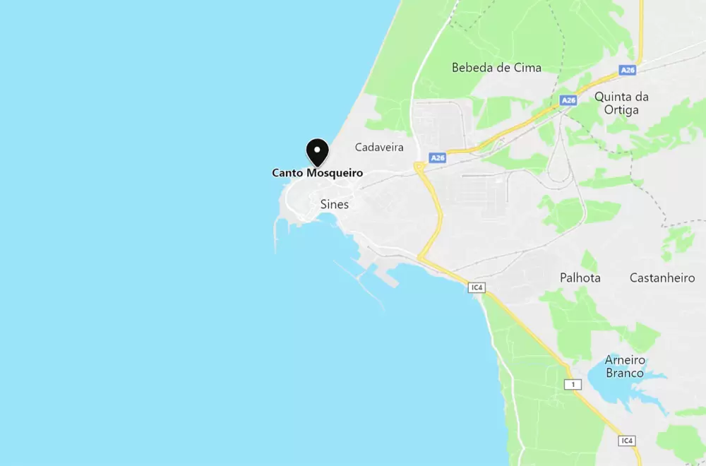
- Coordinates: 37.968519, -8.872139
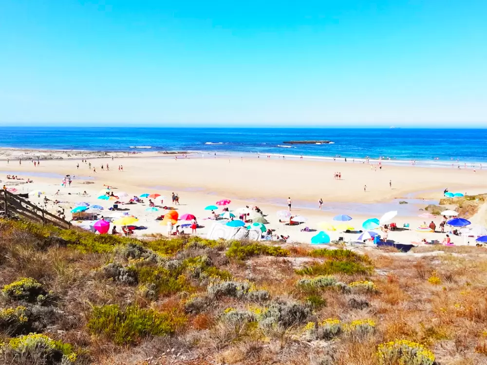
On the outskirts of the town, 5 km from the castle, comes Praia do Canto Mosqueiro, a vast sandy beach with rough waters. It is beautiful, quiet, with a parking area and restaurant nearby – it is not guarded.
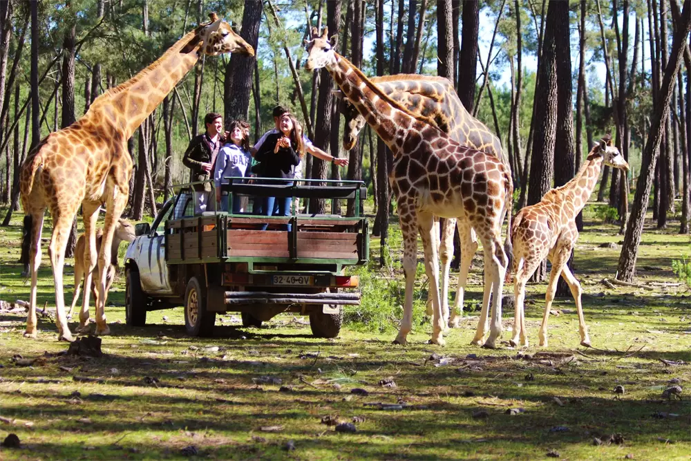
Badoca Safari Park
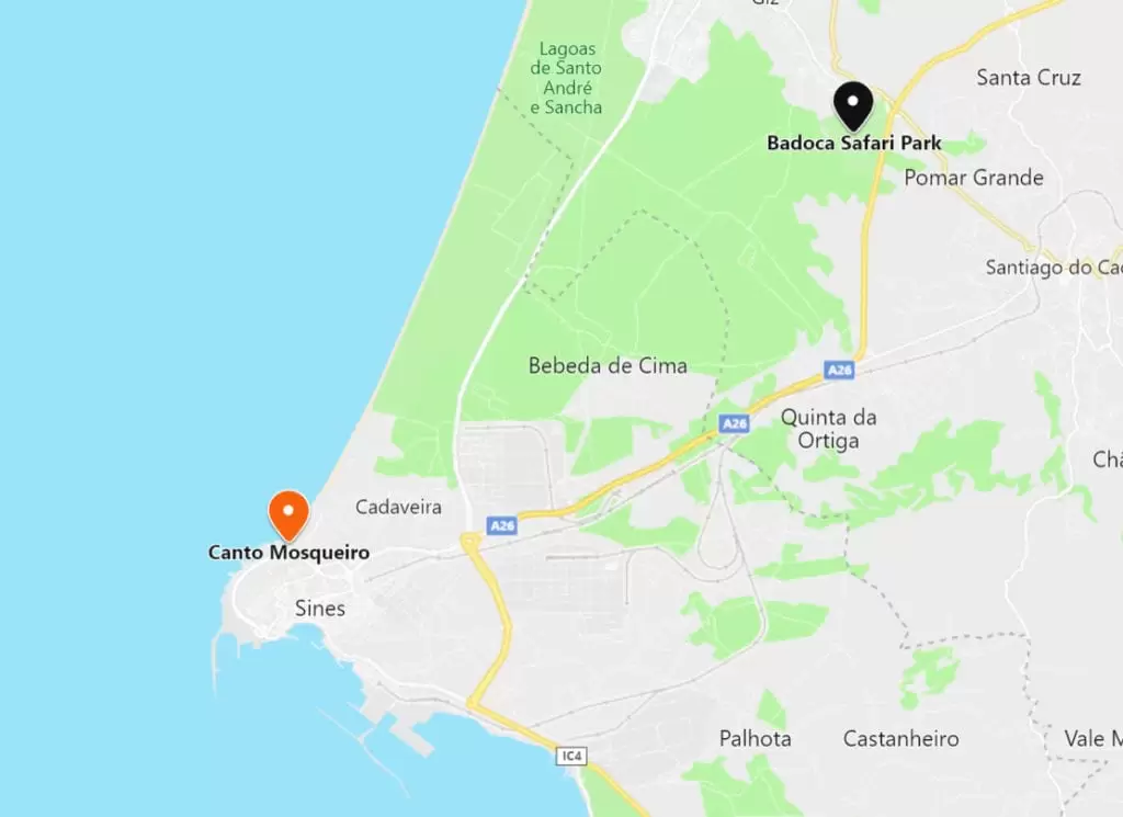
- Coordinates: 38.041533, -8.744196
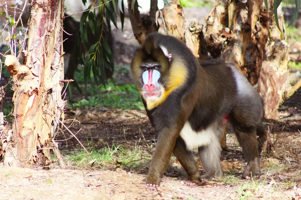
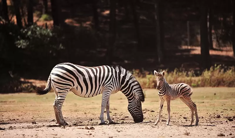
20 km north on the A26, discover a small park (90 hectares), the Badoca Safari Park, already in Santiago do Cacém territories. Explore the property in communion with the animals (giraffes, buffalos, ostriches, wildebeests, lemurs, in short, various species) that live in a semi-free regime, unlike zoos.
- Coordinates: 38.052591, -8.786821
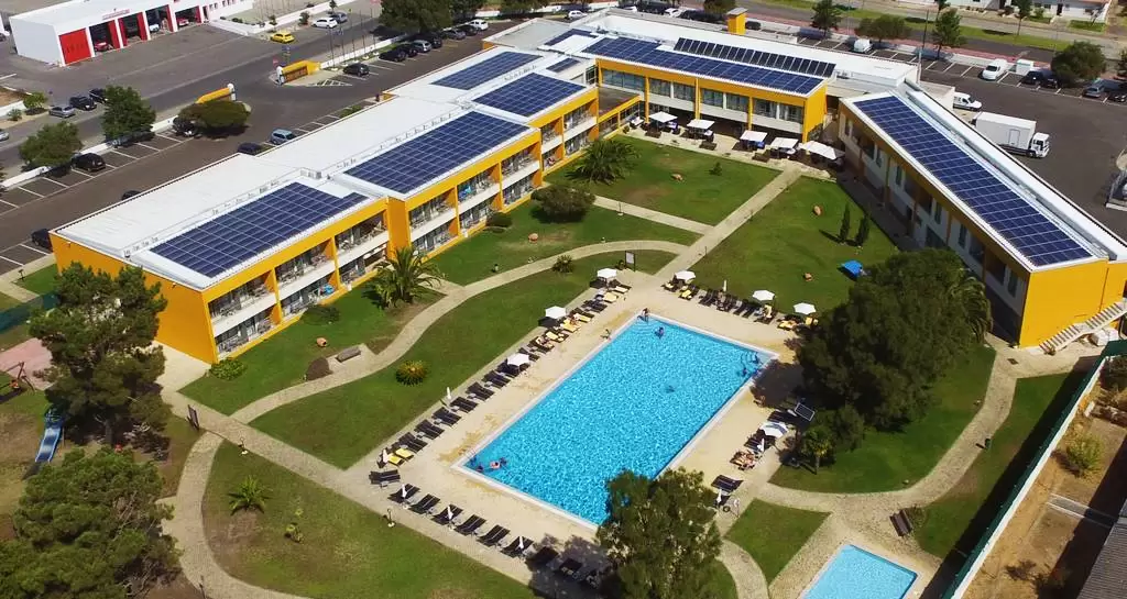
The nearest town is the quiet Vila Nova de Santo André, a 20-minute drive northwest, with supermarkets and restaurants. Beneath the roundabout on the avenue of Sines stands the Hotel Vila Park (4 stars) with swimming pool and restaurant (parking is free). The rooms are spacious and the staff attentive.
Praia da Costa de Santo André (Santiago do Cacém)

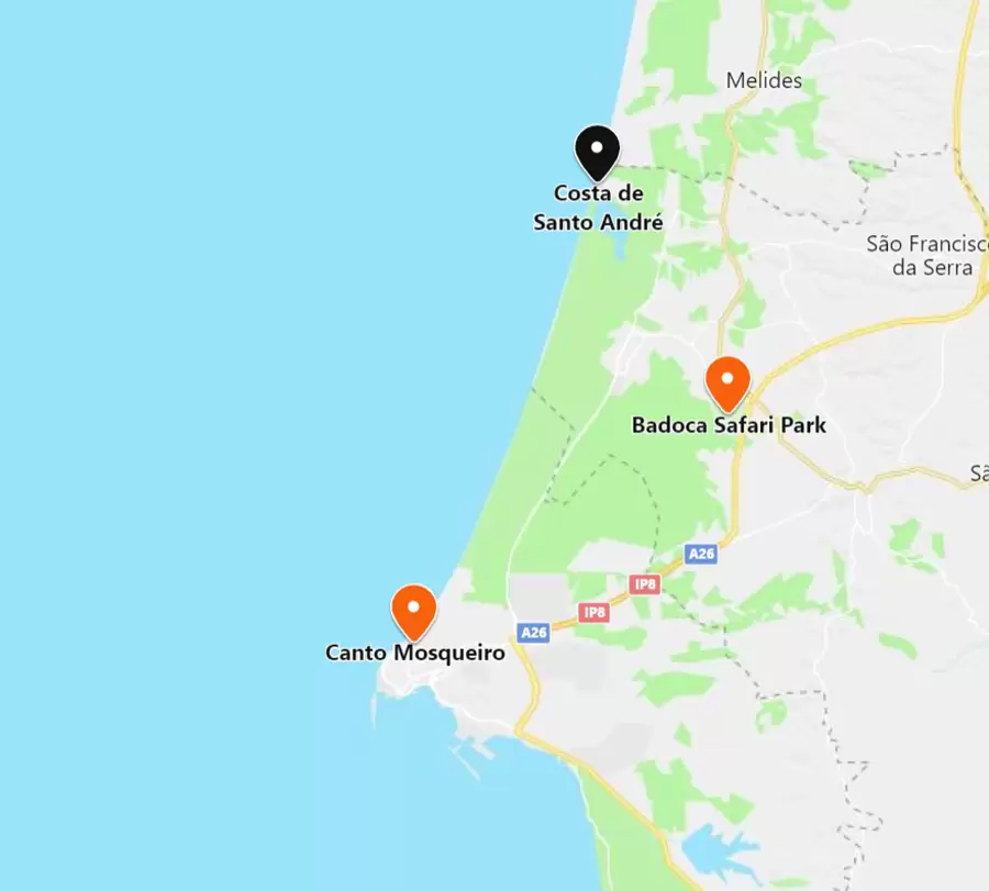
- Coordinates: 38.115586, -8.797531
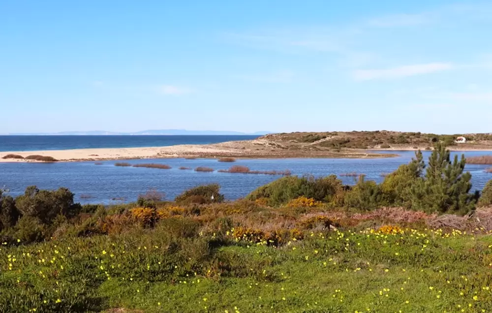
Praia da Costa de Santo André is 10 minutes from Vila Nova de Santo André, to the northwest by the A26-1 and EM544. The sea is rough, next to the sleepy Santo André lagoon.
It is watched, blue flagged, with showers. The lagoon is a shelter for many species, with excellent conditions for canoeing or windsurfing.

- Coordinates: 38.112923, -8.791141
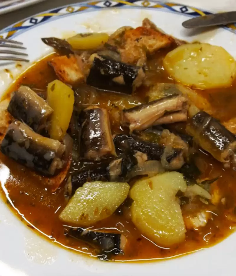
Half a mile from the beach, discover the restaurant Chez Daniel, a friendly space from which to taste eels caught in the lagoon. With several remarkable fresh fish dishes, meat dishes and good Alentejo wine. You will be pleased.
Melides Beach (Grândola)

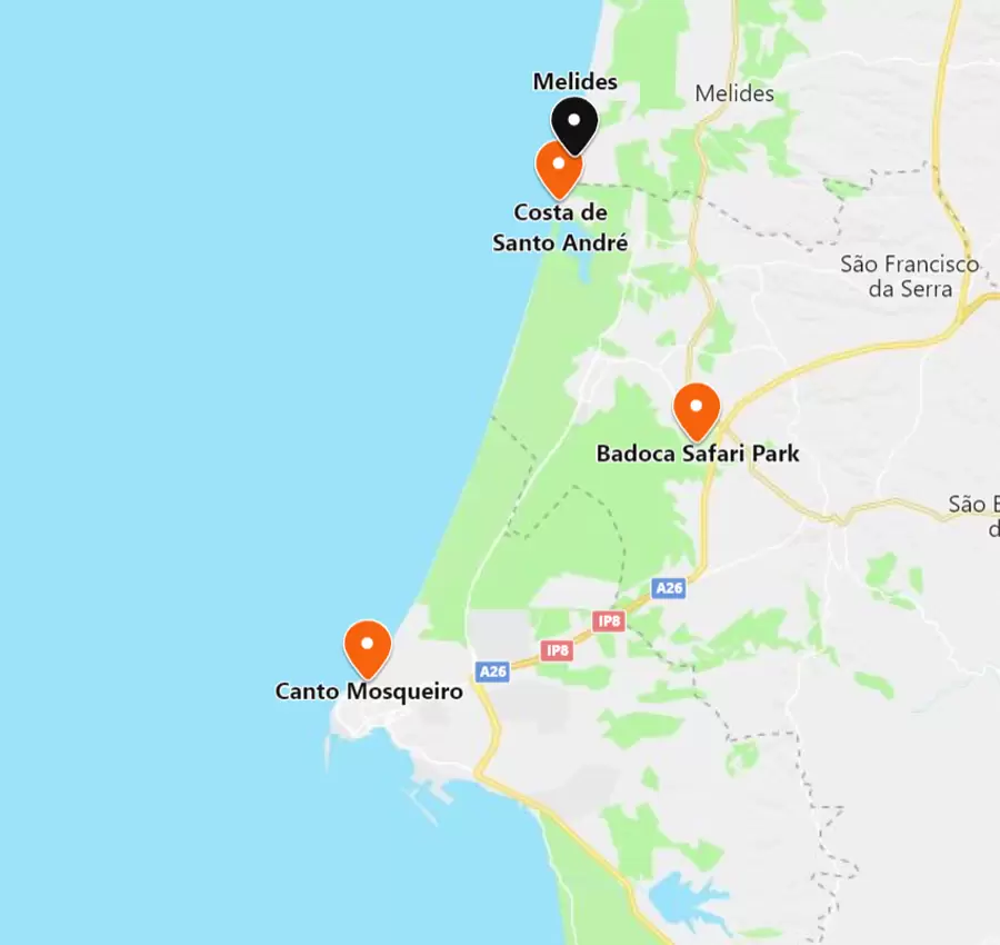
- Coordinates: 38.128962, -8.791895
Continuing 3 km north along the EM544, you will see Praia de Melides, an extensive sandy beach by the Melides Lagoon and one of Grândola‘s beautiful beaches. With parking and good bathing infrastructures, including a restaurant-bar – supervised in the summer.
Nearby is the Camping Park of Melides. The centre of Melides is 5 km away by the straight road to the beach, with many mini-markets and restaurants.
South of Sines
São Torpes beach
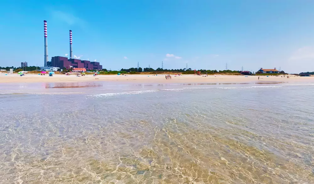
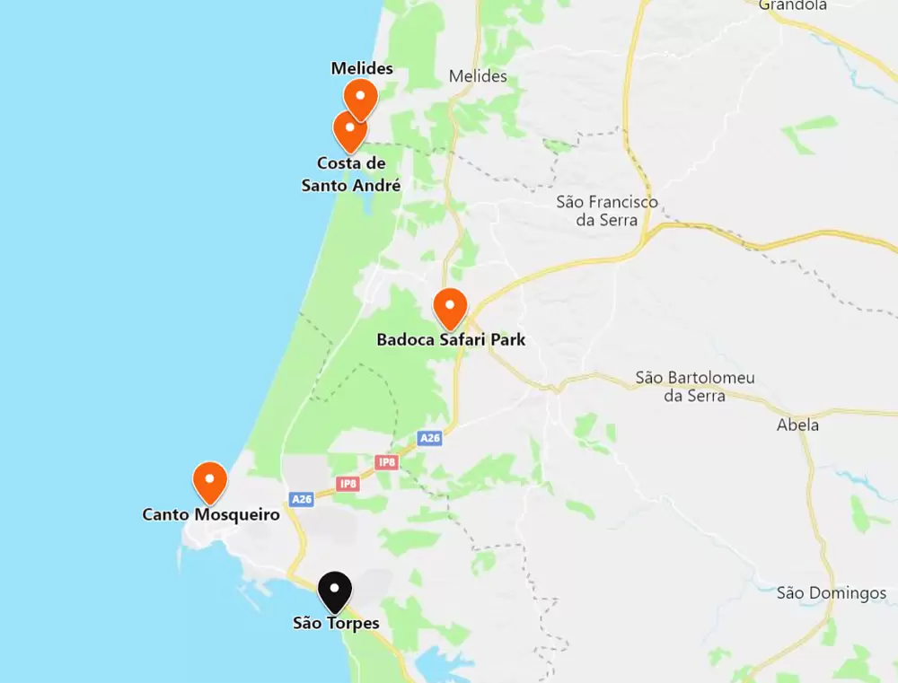
- Coordinates: 37.922962, -8.805526
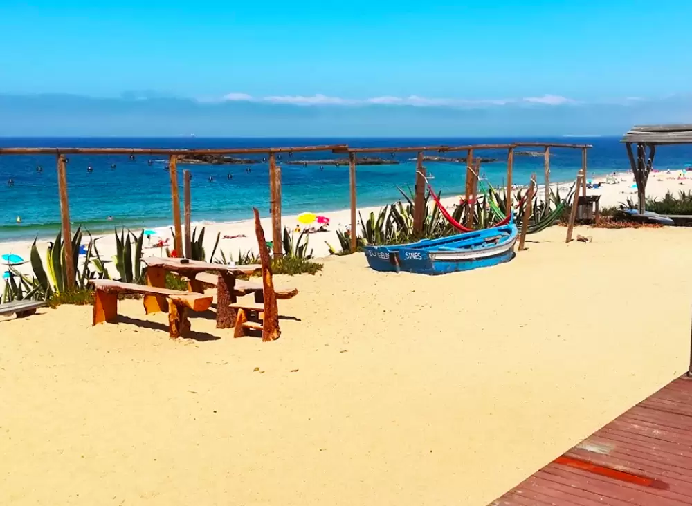
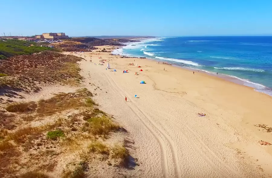
São Torpes Beach is a 10-minute drive from the centre of Sines. Here begins the Parque Natural do Sudoeste Alentejano e da Costa Vicentina. It is popular because the water is warm, due to the activity of the Sines Thermoelectric Power Plant – the water has low pollution indices. It is a vast sandy beach with some rocks, easily accessible.
There is a surf school nearby (Kalux Beach Bar & Surf). Many water sports enthusiasts enjoy the regular waves. The beach’s name is associated with the legend that the body (without the head) of São Torpes was found near the beach.
Saint Torpes was converted by Saint Paul and beheaded during Emperor Nero’s persecutions of Christians. Close to the beach is the Monument of São Torpes that identifies the place where he was buried.
- Coordinates: 37.925234, -8.806443
Next to the beach, discover the restaurant Trinca Espinhas. With a good atmosphere, well kept interior and friendly staff – with fresh fish and interesting seafood cataplana.
Morgavel Beach
- Coordinates: 37.907189, -8.799663
2 km to the south you will find Morgavel Beach, one of the cleanest beaches on the Alentejo coast, where the Ribeira de Morgavel flows into. Easy access, with parking and watched in the summer.
- Coordinates: 37.907635, -8.798205
Nearby, on the other side of the road, is the popular Bom Petisco, with a good variety of dishes: grilled meat, caldeiradas.
Vale de Figueiros beach
- Coordinates: 37.895082, -8.797238
Continuing south, 5 minutes along the M1109, you arrive at Vale Figueiros Beach with rough seas (nearby is the Costa Azul Surf school). On the horizon you can see the islet Salta Manitos. To the south flows the Ribeirinha da Oliveirinha.
- Coordinates: 37.897934, -8.796875
The friendly Pedra da Casca is near the northern area of the beach, with great value for money: good seafood, snacks, and fast service.
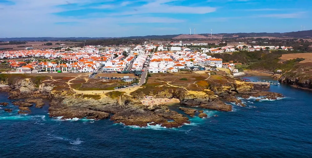
Praia da Samoqueira (Porto Covo)
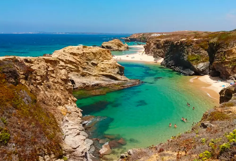
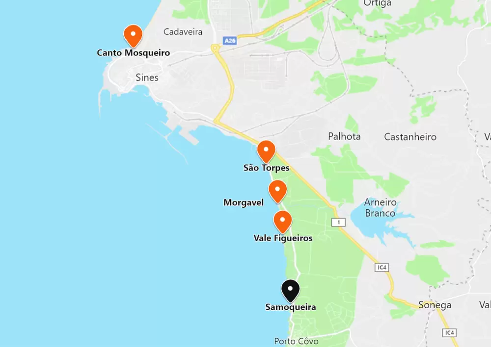
- Coordinates: 37.867862, -8.793370
Praia da Samoqueira is 5 minutes south by the M1109. It is small, bordered by cliffs and easily accessible, but is not guarded. It is one of the most cinematographic beaches on the coast of Porto Covo, the other parish of Sines.
Praia Grande de Porto Covo Beach

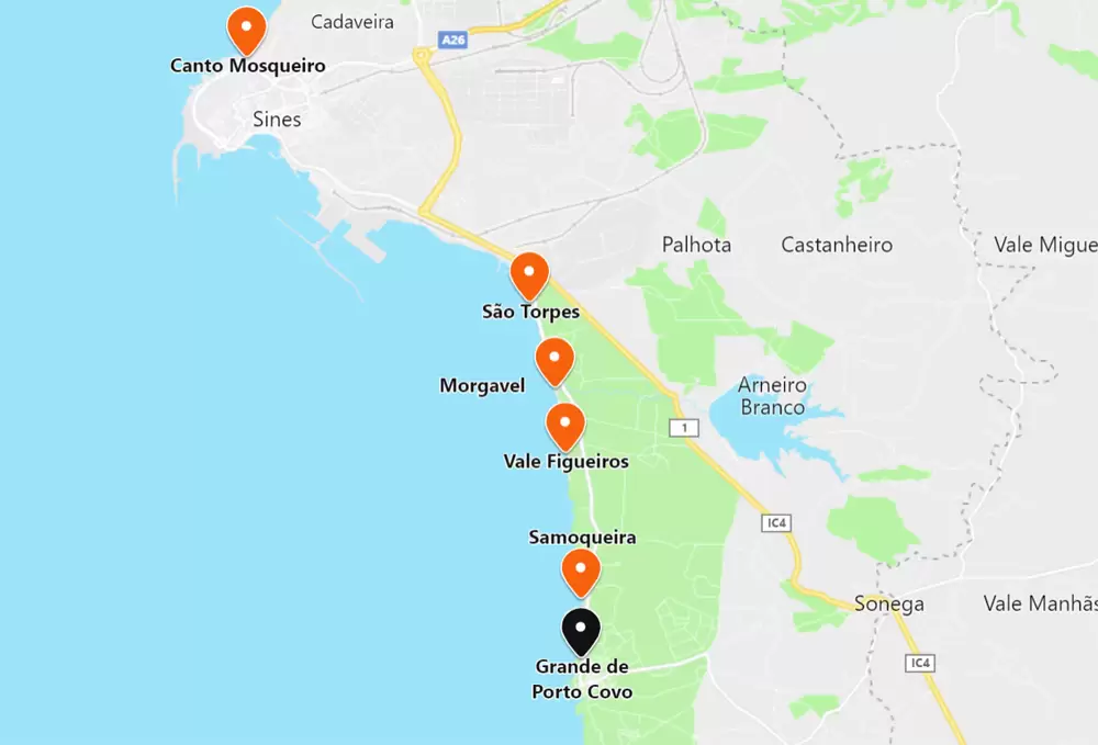
- Coordinates: 37.856909, -8.793500
A 1.5 km south, you can see Praia Grande de Porto Covo, near the centre of Porto Covo which was born in the 18th century and still preserves its charm.
It is a wide sandy beach, easily accessible, with parking and a good bathing support structure (watched over in the summer). With fine sand and rough sea, it seduces some surfers – one of the most popular beaches in Porto Covo, with room for everyone.
Praia do Banho (Porto Covo)

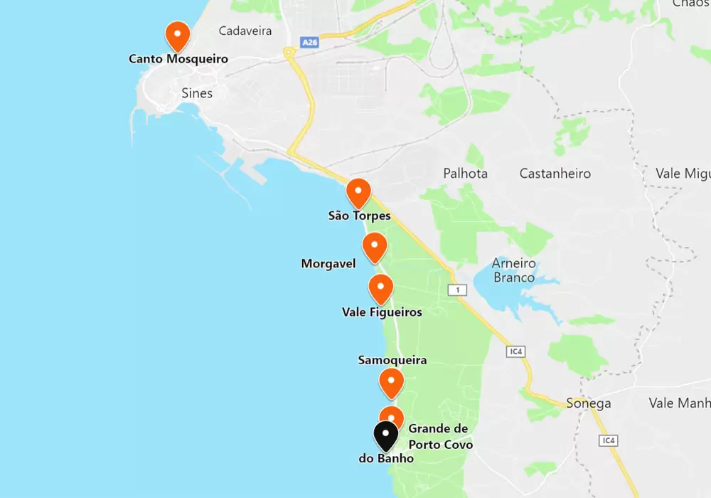
- Coordinates: 37.852527, -8.795533
Venturing south, 1 km, you can see Praia do Banho (Bath Beach), near the urban front of Porto Covo where the traditional baths of 29 August take place; an ancient ritual. It is small, surrounded by cliffs and sheltered from the wind. You can reach it by a few steps in the southern area.
Praia dos Buizinhos Beach (Porto Covo)
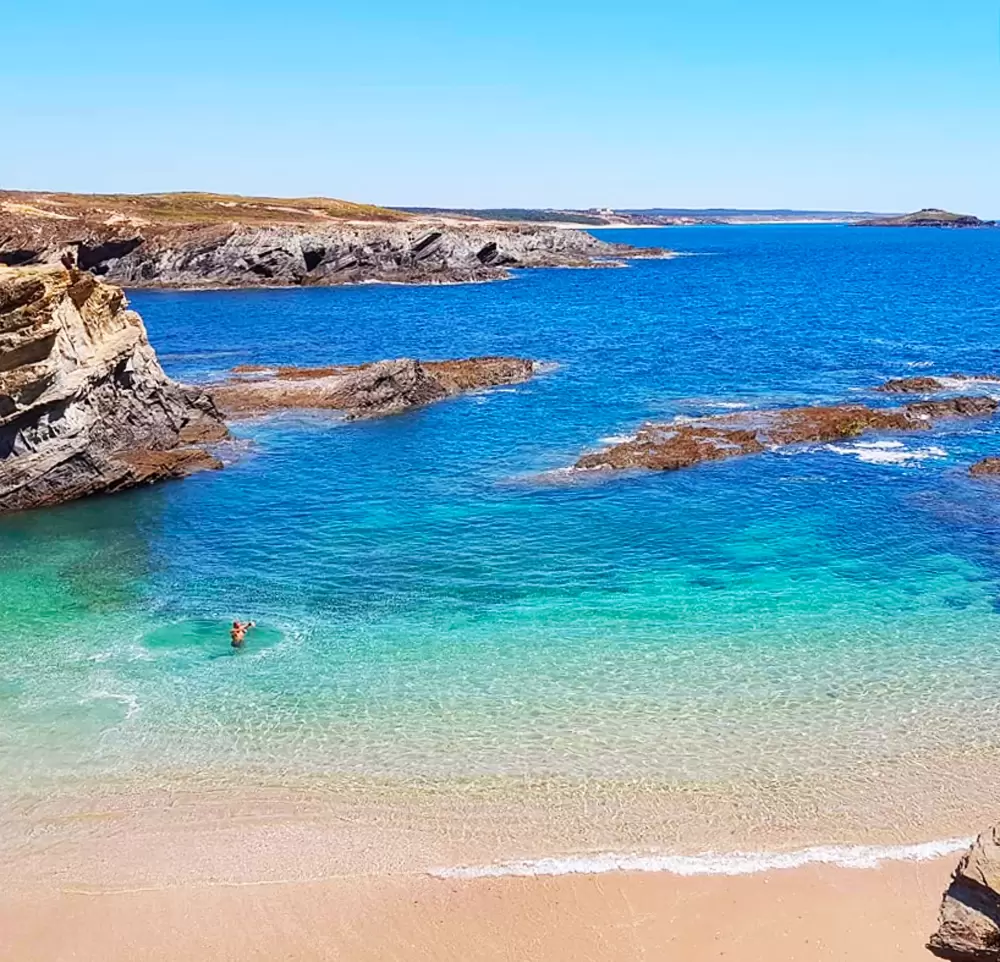
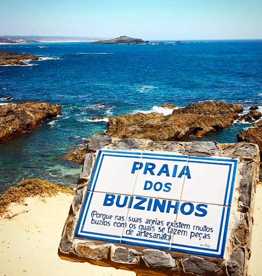
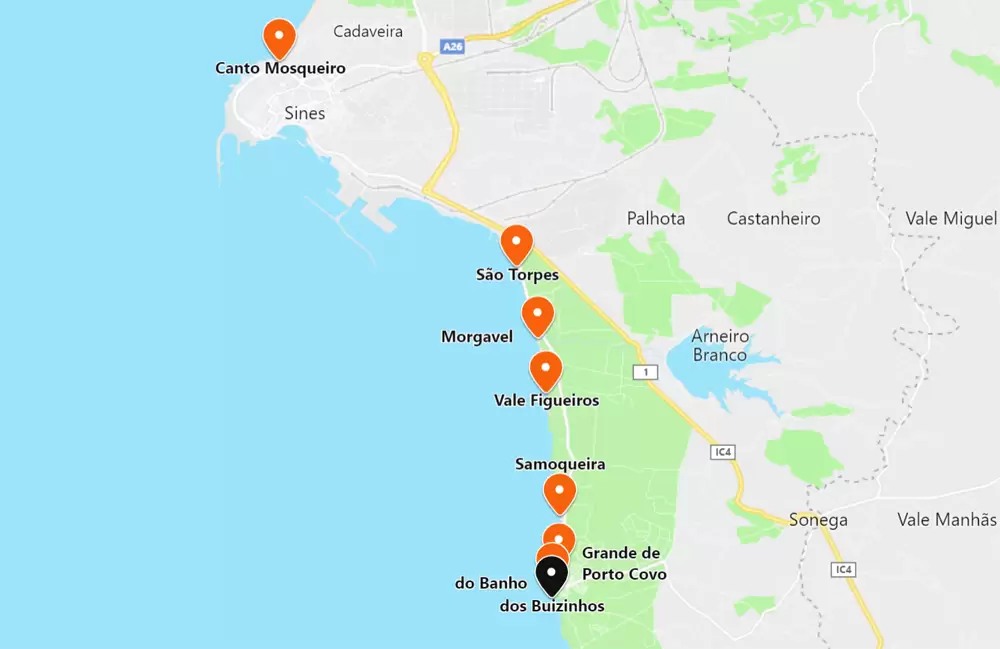
- Coordinates: 37.849632, -8.795733
Praia dos Buizinhos beach got its name from the shells on the sands, small whelks that nourished the local handicrafts. The small beach is on the southern slope of Porto Covo and at high tide it almost disappears.
- Coordinates: 37.850934, -8.793472
Wandering around Porto Covo invariably ends up in the Largo de Marquês de Pombal, inspired by the pombaline style. Between the square and the beach is the familiar Zé Inácio (rua Vasco da Gama) – excellent food, but in summer booking is advisable.
Ilha dos Pessegueiros Beach (Porto Covo)
- Coordinates: 37.830675, -8.792174
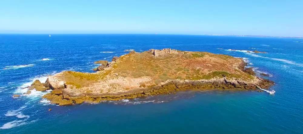
10 km southwards along a road that has seen better days, you reach Praia da Ilha do Pessegueiro and the extraordinary view of the island on the horizon.
It is watched over in summer, with toilets, restaurant, and parking. In the distance you can see the ruins of a fort on the top of the island, the Fort of Ilha de Fora, whose construction began in the 16th century.
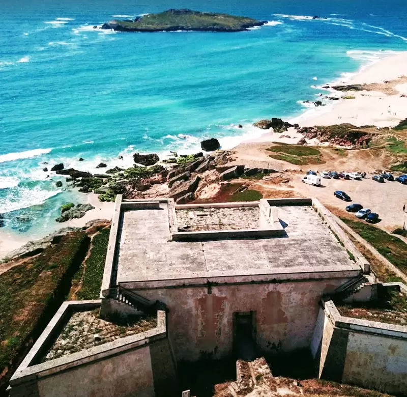
- Coordinates: 37.828253, -8.791048
This fort crossed fire with the Fort of Ilha de Dentro (17th century) at the top of the hill on the south side of the beach (near the restaurant A Ilha).
In this way they protected the coast from the pestilent attacks of pirates and corsairs. 1 km away you will discover Herdade do Pessegueiro. Enjoy an hour-and-a-half horse ride along the Alentejo coast.
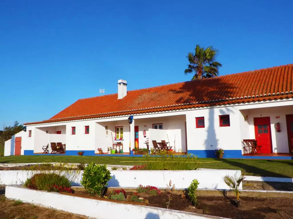
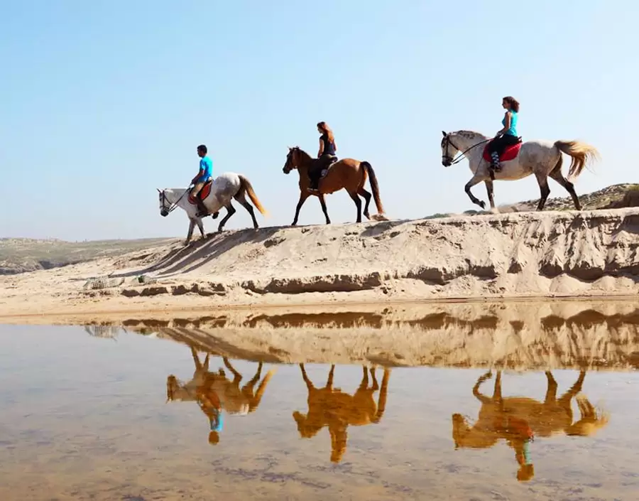
- Coordinates: 37.830471, -8.781077
What to visit near Sines:
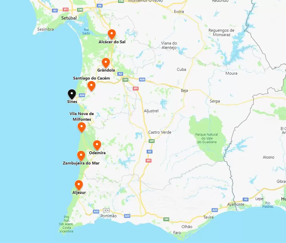
To the north, you have Santiago do Cacém (20 minutes by A26 and N261-3), the town of Grândola (35 minutes by A26) and Alcácer do Sal (1 hour by A26 and A2). To the south, discover Vila Nova de Milfontes (40 minutes via the CM1072), Zambujeira do Mar (50 minutes via the N393) and Aljezur (1 hour and 20 minutes via the N120). The centre of Odemira is 1 hour away by the N393.
