

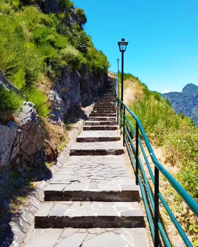
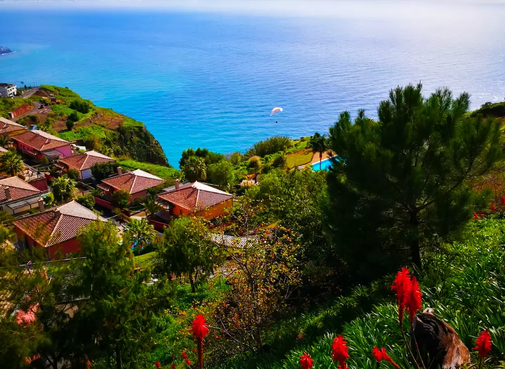
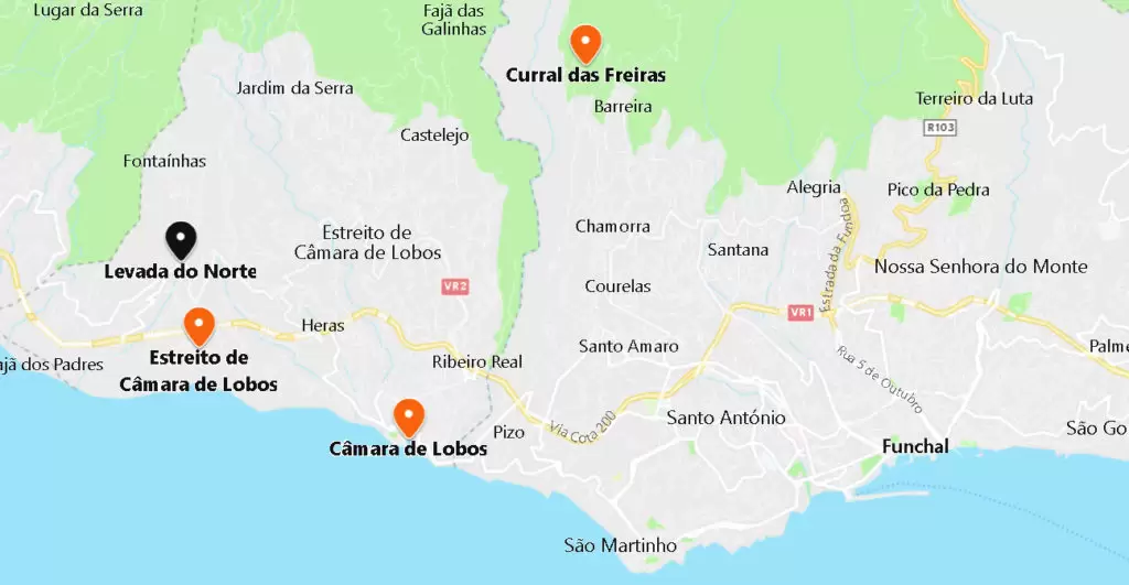
Eira do Serrado Viewpoint
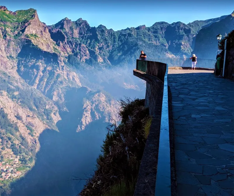
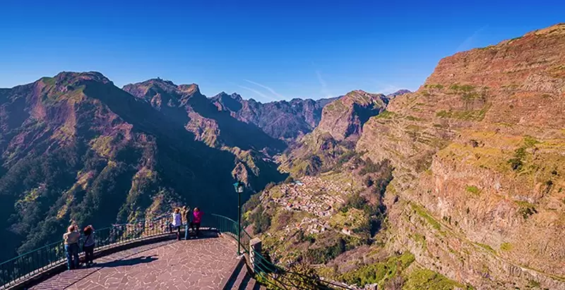
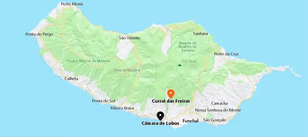
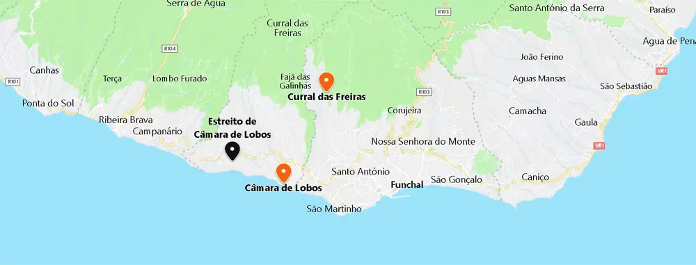
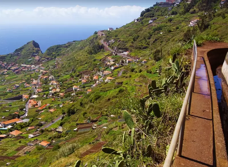
Many arrive at Curral das Freiras via the new tunnel. Still, it is worth taking the old road for the fantastic Eira do Serrado Viewpoint at the foot of the Estalagem Eira do Serrado – by car, it is 25 minutes from Funchal.
- Coordinates: 32.689223,-16.952053
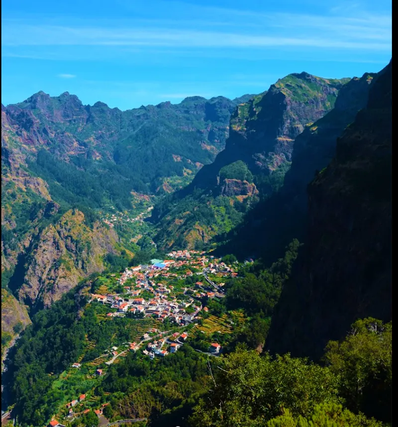
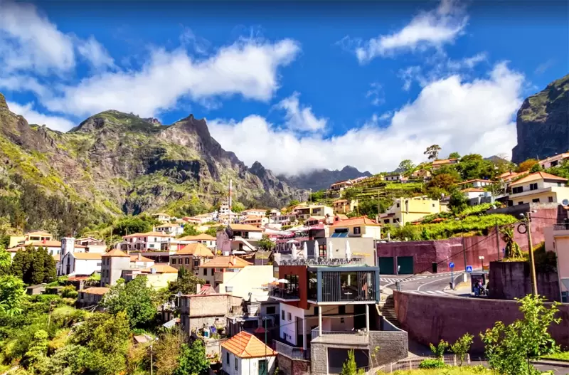
Leave the car in the car park next to the inn, and from the viewpoint, you will have spectacular views of Curral das Freiras – a colossal amphitheatre surrounded by towering peaks. Back on the road, it winds for 10 minutes to Curral das Freiras – where the nuns of Santa Clara Convent(Funchal) took refuge after the attack of French privateers (1566).
- Coordinates: 32.720320, -16.965374
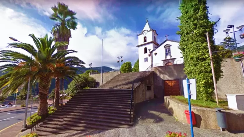
Life revolves around the cafes and bars in the central square, surrounded by a pretty cluster of houses. At the foot is the Nossa Senhora do Livramento Church (19th century) which replaced a temple built by nuns.
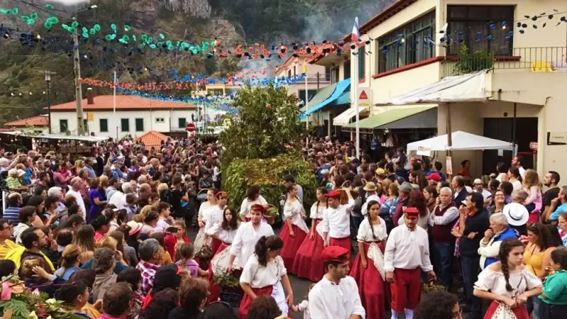
One of the best times to come here is during the lively Chestnut Festival (November 1 and 2).
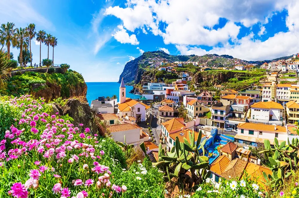
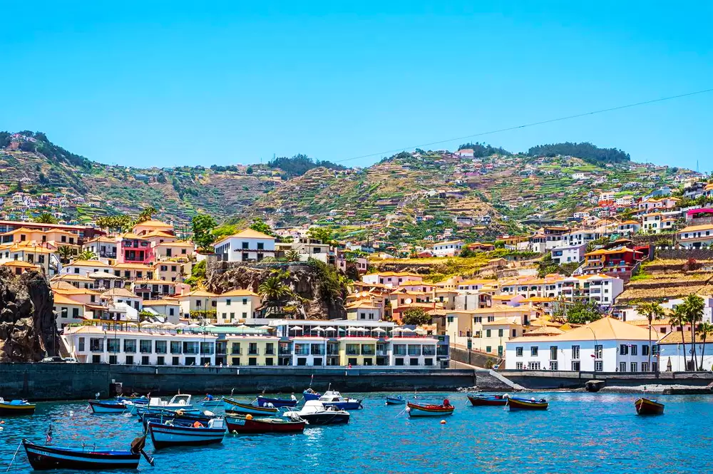
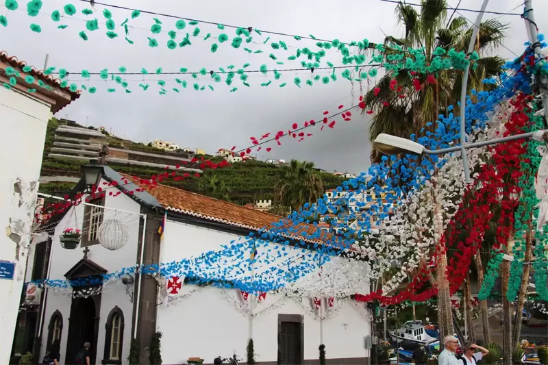
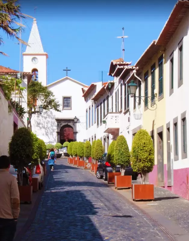
Câmara de Lobos Town Centre

- Coordinates: 32.647829, -16.975348
A 20-minute drive from Funchal, the town centre remains picturesque; traditional whitewashed houses and colourful bars close to the harbour. When João Gonçalves Zarco arrived in this bay of black sand, there was a massive colony of sea lions.
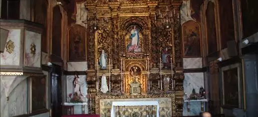
Hundreds of metres away are the Chapel of Nossa Senhora da Conceição, the 2nd oldest on the island, with figures from the 15th century.
- Coordinates: 32.648172, -16.975312
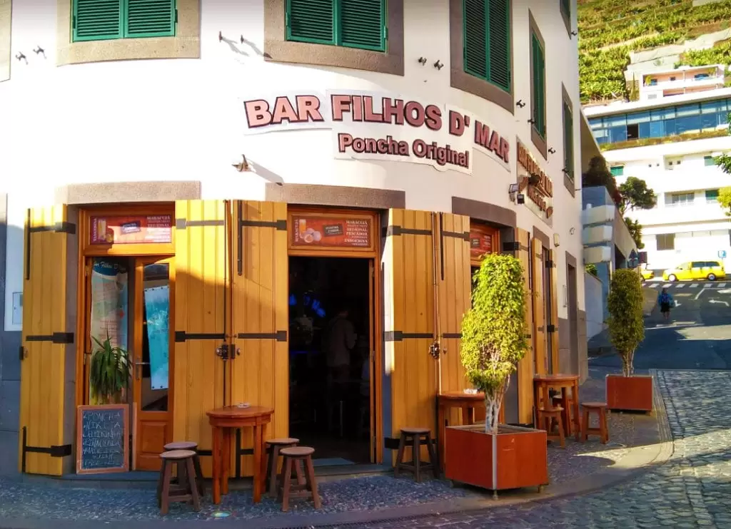
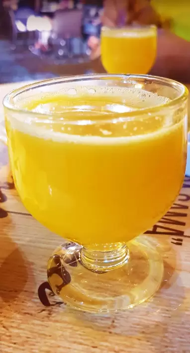
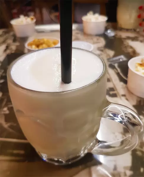
In Largo do Poço, Bar Filhos do Mar is THE place to try one of Madeira‘s most traditional drinks – Poncha.
- Coordinates: 32.648547, -16.975224
The village fishermen invented the drink to gain the extra strength they needed in their daily life. Traditionally, it contains cane brandy, lemon juice and sugar cane honey. Another Câmara de Lobos drink, but of less consensual taste, is Nikita (white wine, white beer, vanilla ice cream and sugar – mixed until creamy).
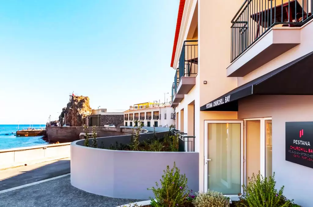
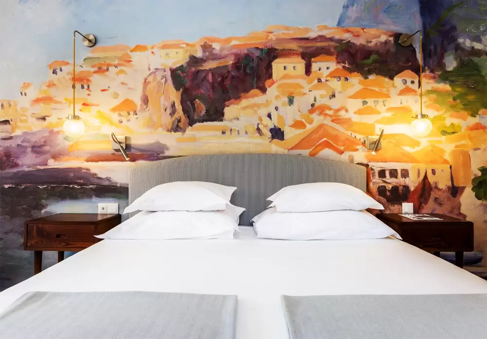
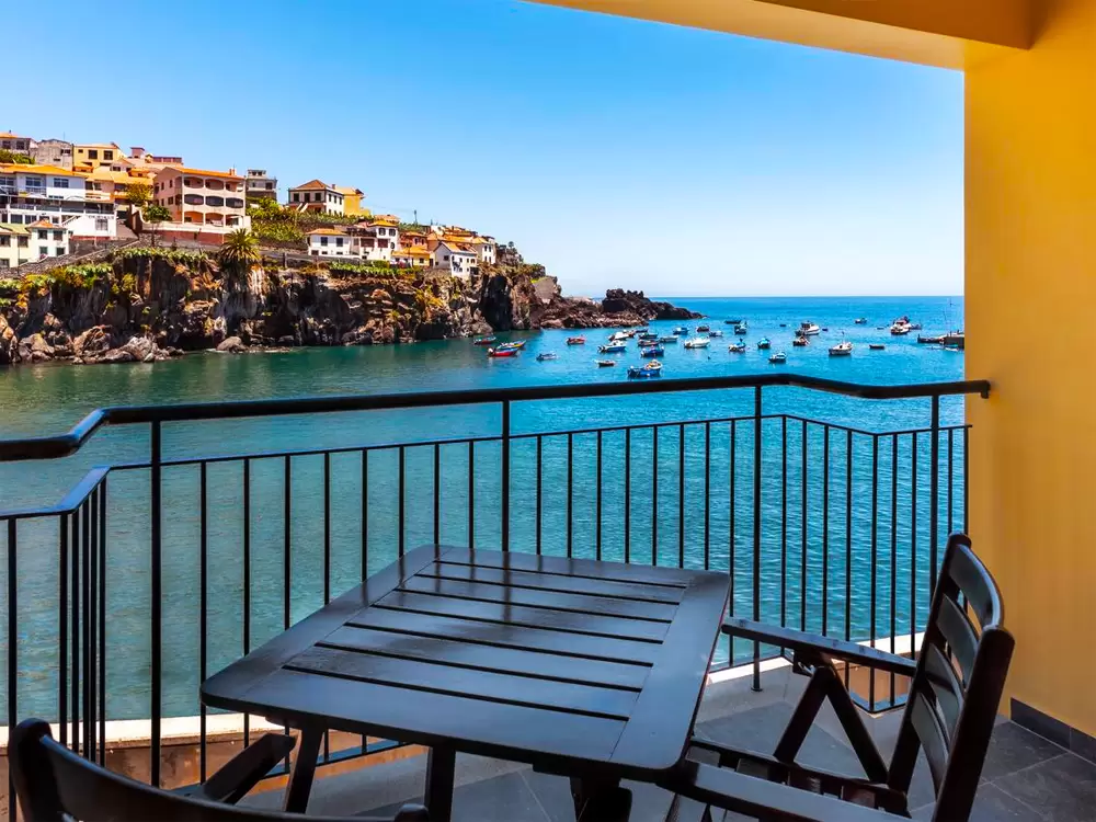
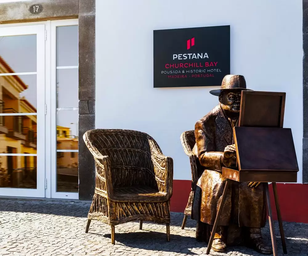
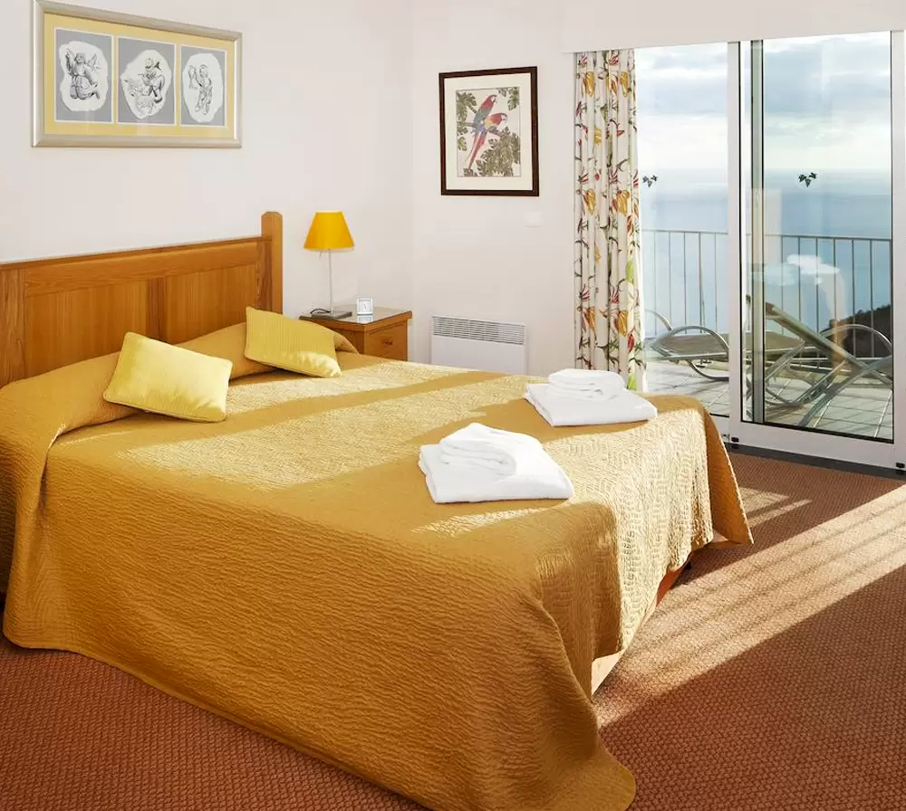
A few meters from the Bar Filhos do Mar, the Pestana Churchill Bay(Rua Nossa Senhora da Conceição) is a 4-star hotel by the bay. The rooms are comfortable, with balconies that provide superb views – a good breakfast (buffet).
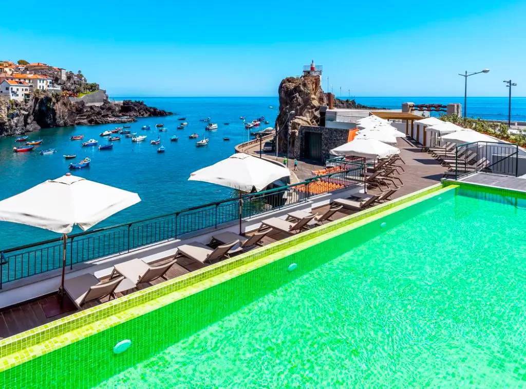
- Coordinates: 32.648201, -16.975304
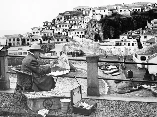
Winston Churchill came here many times to paint the harbour.
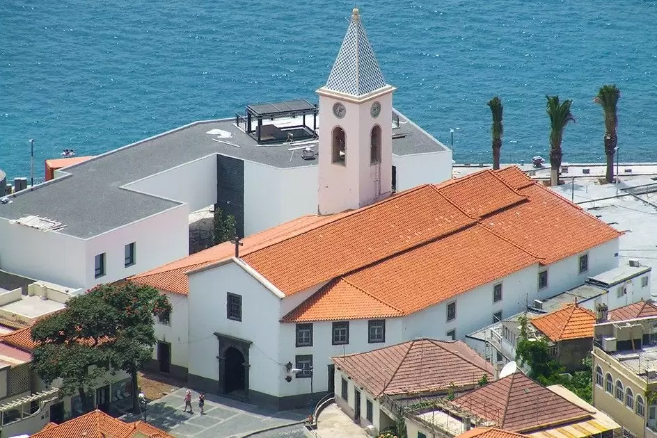
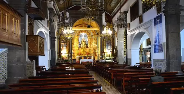
Five minutes from Largo do Poço, at the top of Rua São João de Deus is the São Sebastião Church (15th century) – on the façade, it has the coat of arms of Zarco..
- Coordinates: 32.648669, -16.977922
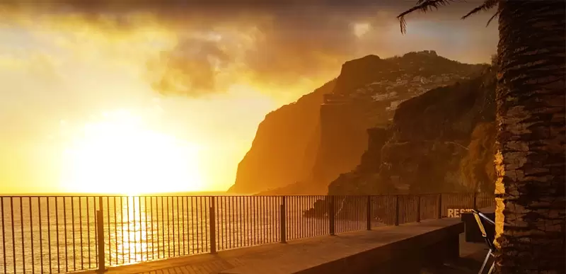
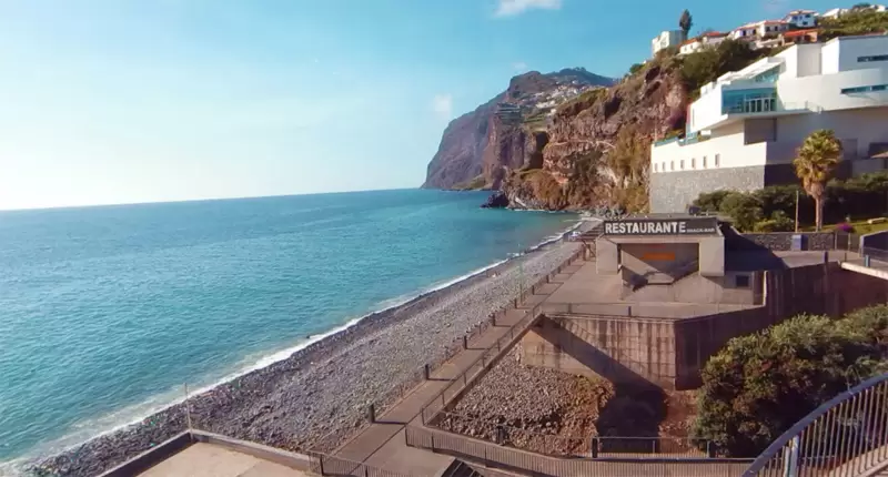
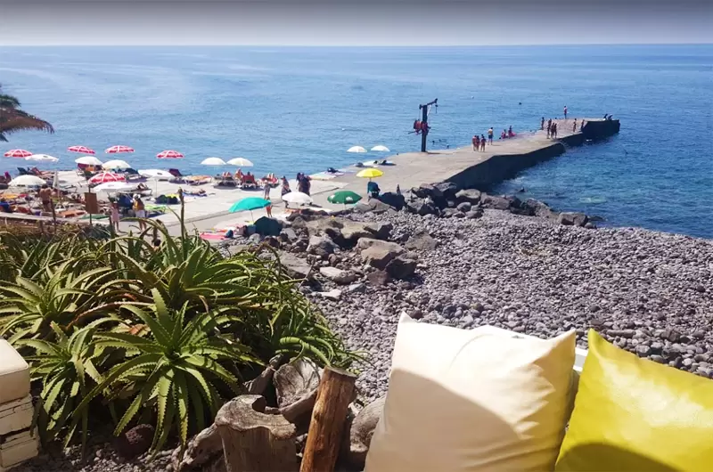
Certain parts of the church date from the 15th century, although most dates from the 18th century – the baroque altar, the chandeliers and the ceiling painted sky blue with clouds stand out. Vigário beach is about a hundred metres away: a great place to enjoy the sunset.
- Coordinates: 32.649017, -16.979760
Estreito de Câmara de Lobos
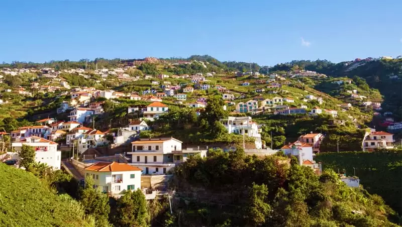
Estreito de Câmara de Lobos is a 10-minute drive to Estreito de Câmara de Lobos, passing through fantastic views. It is one of the most important wine-producing areas in Madeira.
- Coordinates: 32.657943, -17.002929
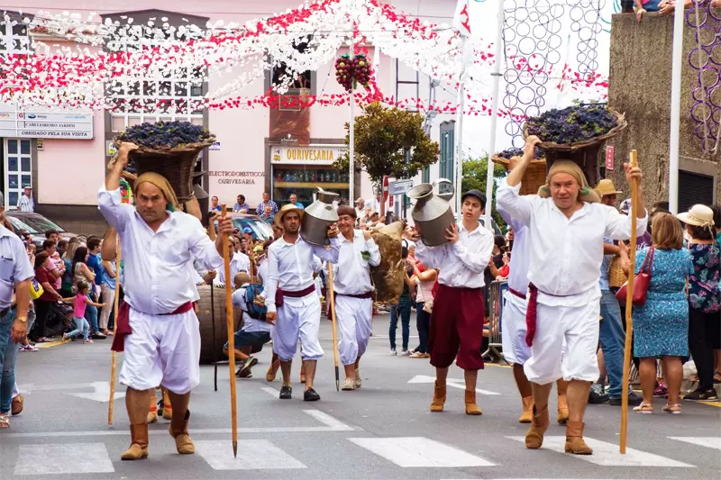
The village comes alive during the Madeira Wine Festival (August 25 to September 1) with the traditional wine treading.
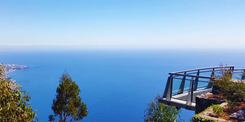
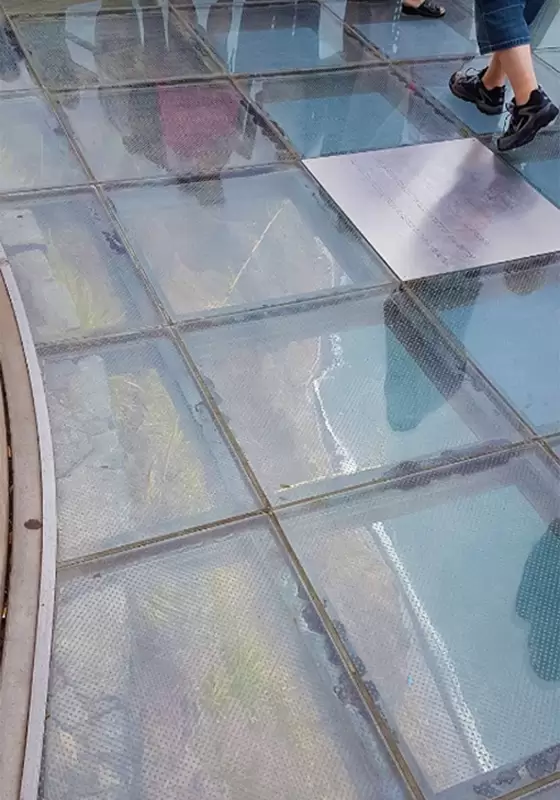
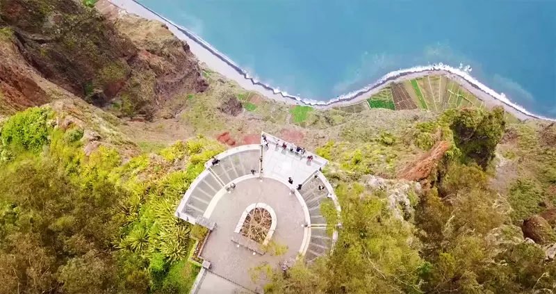
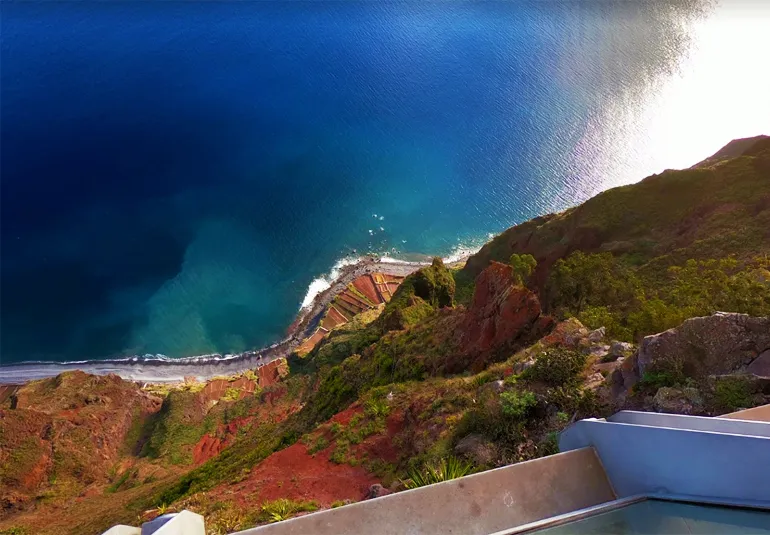
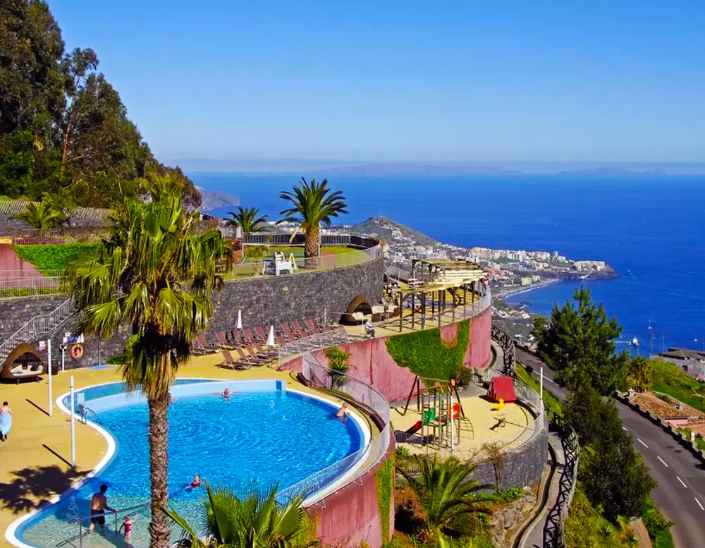
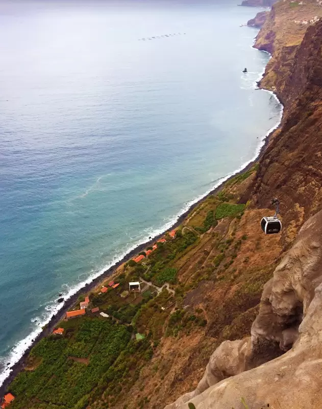
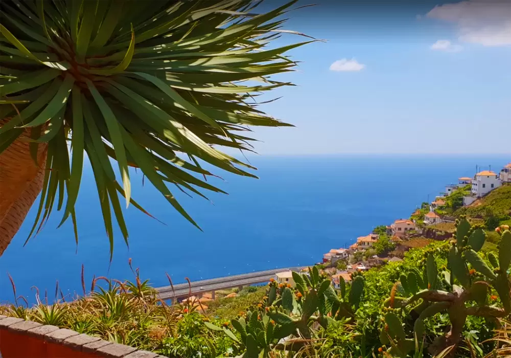
At other times it is quiet. Its church (Igreja de Nossa Senhora da Graça) dates from the 19th century and offers superb views over the surrounding valleys. At 300 metres, the cliff of Cabo Girão Skywalk is one of the world’s highest, almost vertical cliffs. João Gonçalves Zarco, in his first exploration, made a half-turn here (Girão), returning to Funchal.
- Coordinates: 32.656657, -17.004561
From the Cabo do Girão viewpoint, you giddily admire the sea and the beautiful views in all directions. The cultivated fields you see below were accessed, in the past, using ropes.
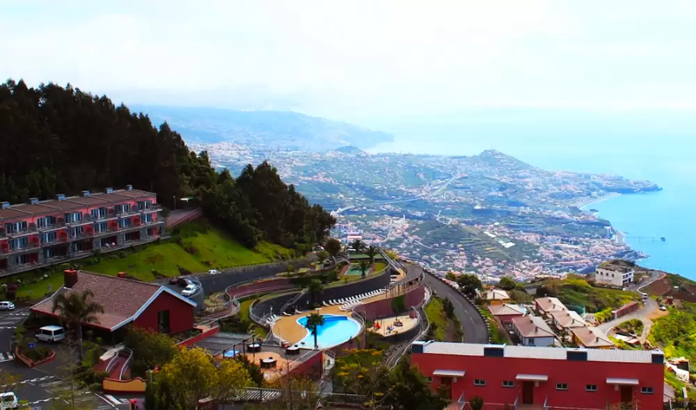
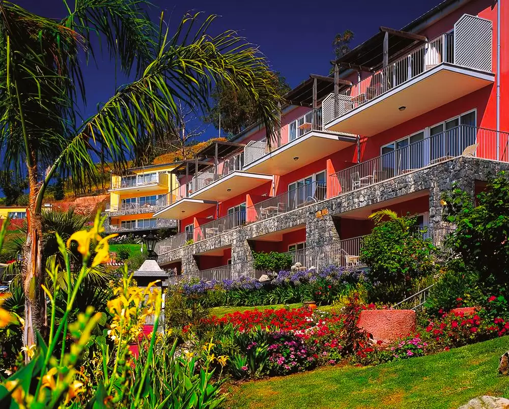
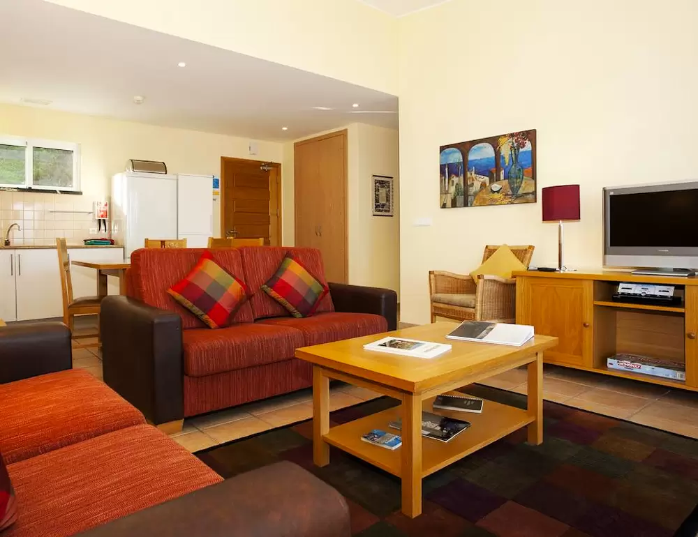
There is a tiny café with an exhibition about the cliffs in the neighbourhood. Village Cabo Girão Hotel is two hundred metres away, offering villas and flats with balconies. The apartments provide a tiny kitchenette, a large living area, and a bedroom. You can use both indoor and outdoor pools.
- Coordinates: 32.658403, -17.003854
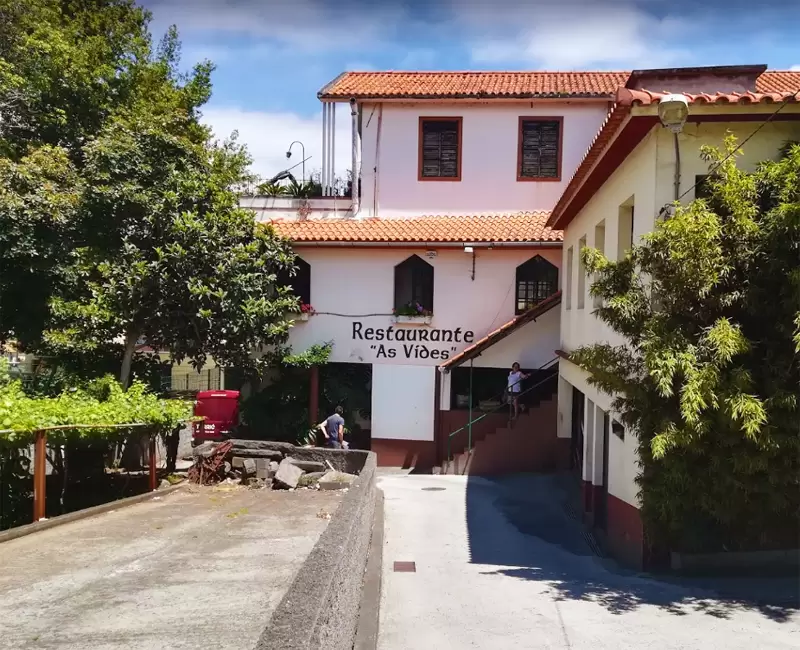
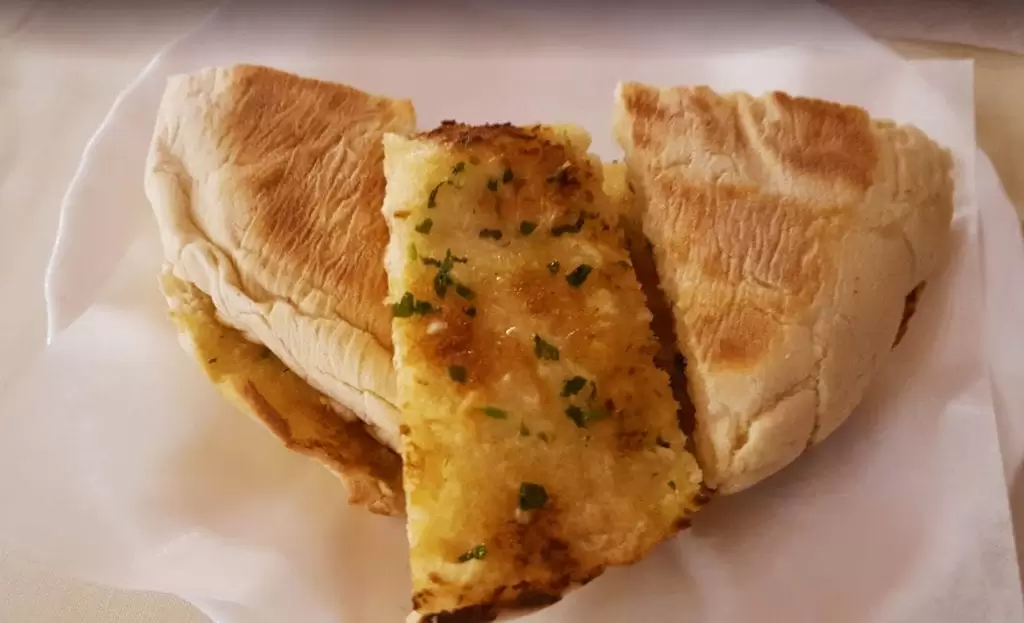
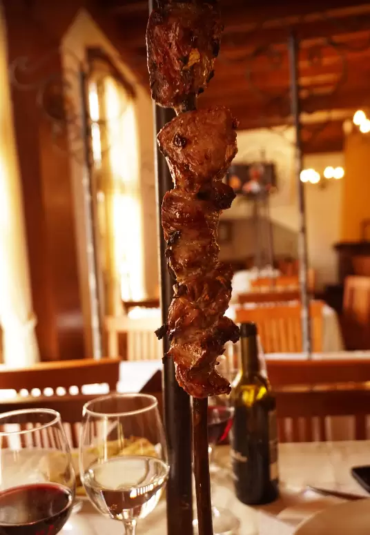
Minutes from the hotel, to the north, there’s As Vides Restaurant (Rua da Achada). The speciality is bolo do caco and the Espetada de Carne (loin meat cut into cubes and seasoned with salt and garlic) on a bay leaf stick.
- Coordinates: 32.670798, -16.978803
The restaurant’s owner is the son of the founder of the Espetada da Madeira (mid-20th century), accompanied with fried potatoes, mixed salad, fried diced corn, and the bolo do Caco with garlic butter.
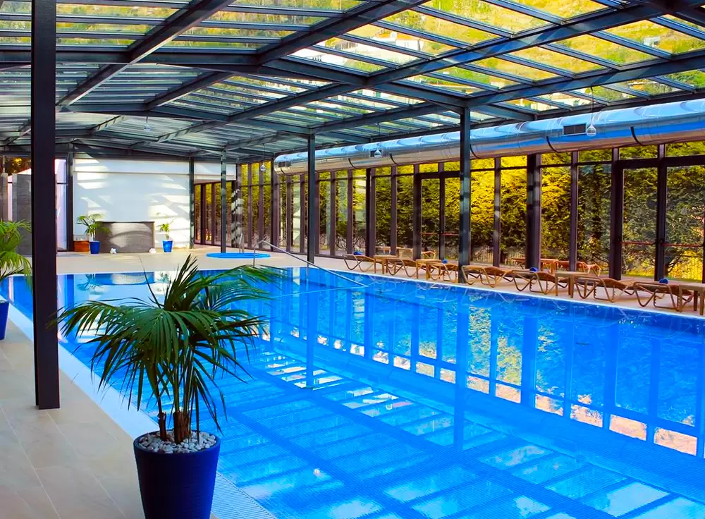
For Jardim da Serra, inland, discover Quinta da Serra, a 5-star hotel (Estrada do Chote, 4). It’s excellent for those seeking peace and revitalisation: with an indoor pool and wellness centre.

- Coordinates: 32.692883, -16.995800
Levada do Norte
- Coordinates: 32.667485, -17.005335
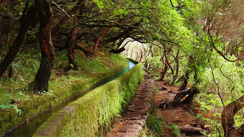
The Levada do Norte is close by – you’ll see signs from the main road. Levada is a small channel directing water from north to south, of the type introduced by the Moors in Al-Andalus and similar to the acéquia carried by the Spanish to Latin America.
It provides fantastic walking crowned with glorious views. The easiest route is towards Campanário (1 hour 30 minutes) and Quinta Grande (2 hours 30 minutes).
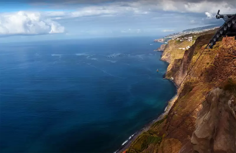
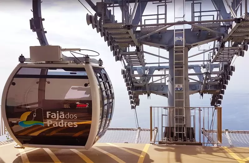
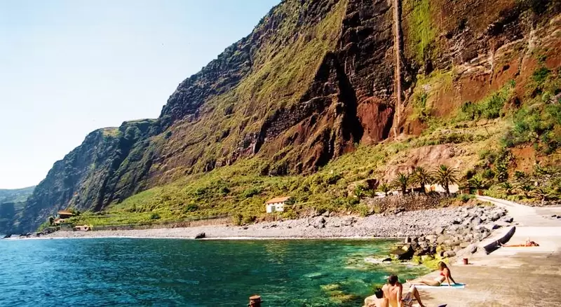
Fajã dos Padres

- Coordinates: 32.657022, -17.021608
South-west of Cabo Girão, 10 minutes along the Padre António Dinis Henrique road, you reach Fajã dos Padres, which culminates in a beautiful rocky beach. Park at the top of the cliff and take the cable car.
The fajã was part of an estate of the descendants of Zarco (Quinta Grande). It was sold to the Jesuits. As Marquês de Pombal firmly believed that all evils in Portugal were due to the Jesuits, he expelled them in 1759, and the fajã passed into private hands.
When you return to the road (in the direction of Ribeira Brava), you will soon pass the parish of Campanário (5 km) and the beautiful Campanário Viewpoint: an ideal place to test your photographic skills and capture the lonely road over the immensity of the sparkling sea.
- Coordinates: 32.668116, -17.033614