

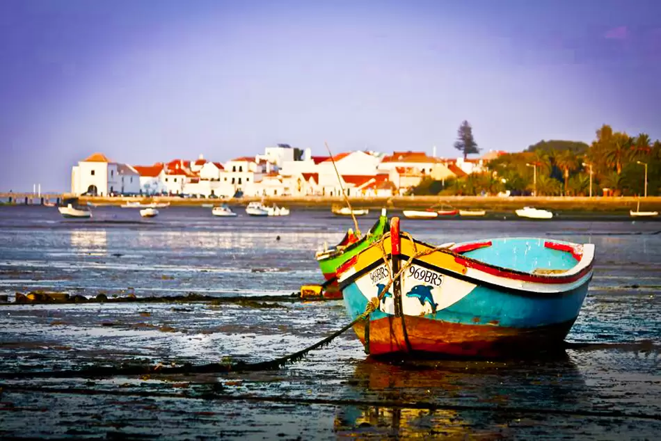
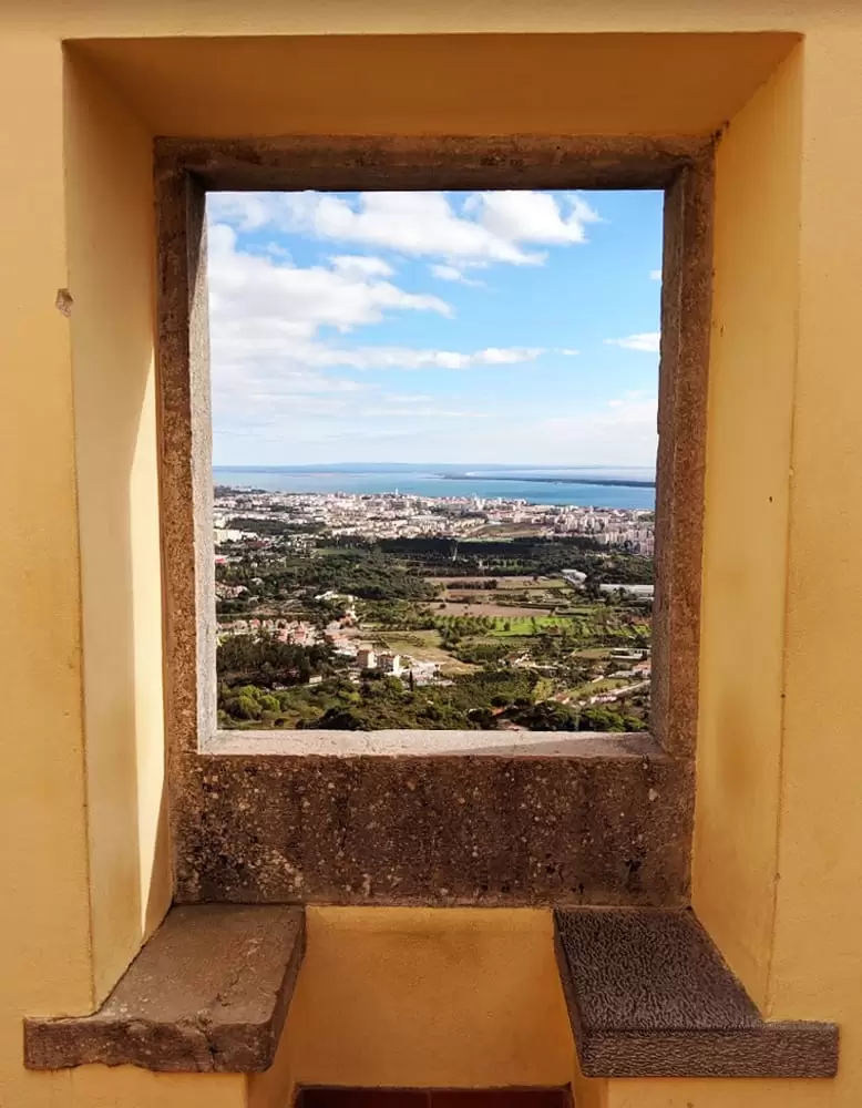
Alcochete has an undeniable charm – overlooking the river at the point where the Tagus Estuary reaches its maximum width (over 10 km).
The word Alcochete has an Arabic origin and means ovens – the Romans had large ceramic ovens here to make amphorae used to transport wine, sauces, honey, olive oil, and almost everything.
After the Christian reconquest, it became the land of the Order of Santiago from the time of the warlike Dom Sancho II (13th century).
It has always been a land of humble and resistant people. The town’s noblest son was Dom Manuel, born in 1469 and acclaimed king in Alcácer do Sal (1495) – he was 26 years old and reigned for 26 years, Portugal’s most brilliant period.
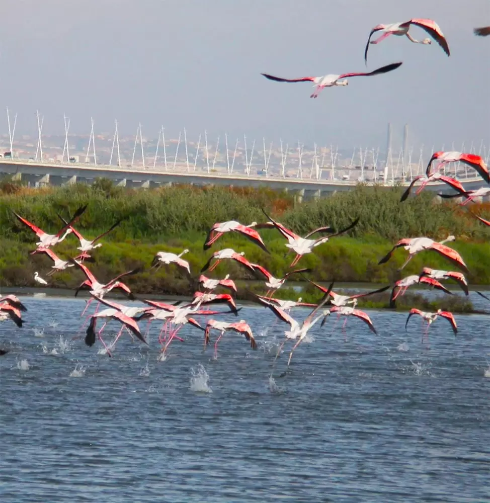
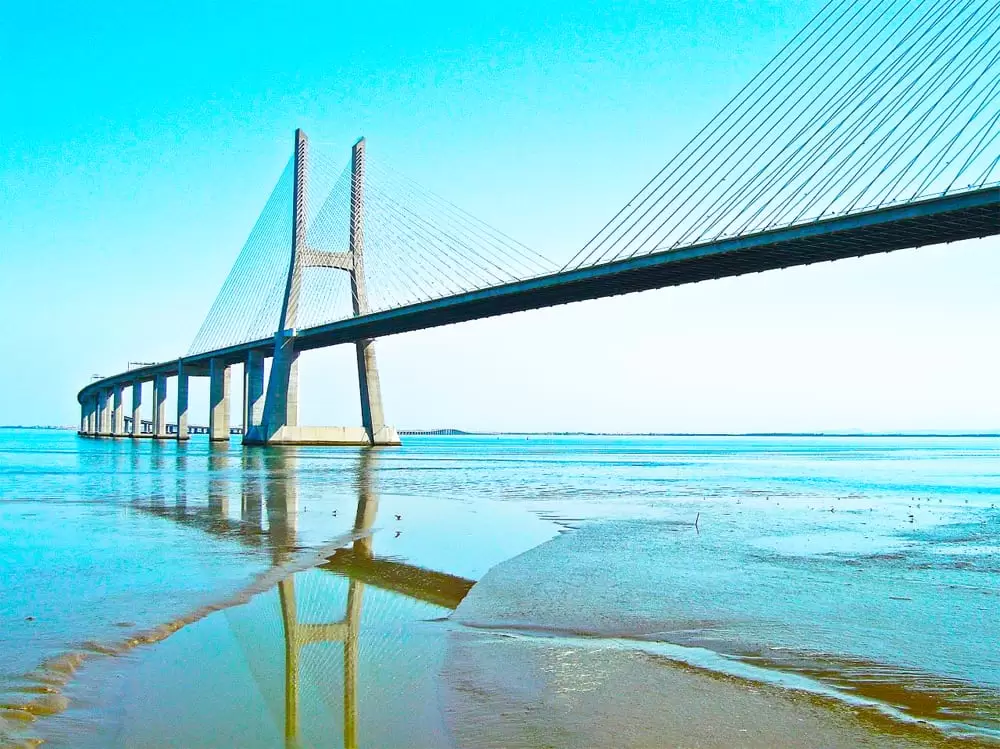
A large part of the estuary is a protected area, from where hundreds of thousands of birds recover their energy. The Vasco da Gama bridge (1998) greatly valued Alcochete – many people live here and work on the other side of the shore (Lisbon). Several developments are flourishing.
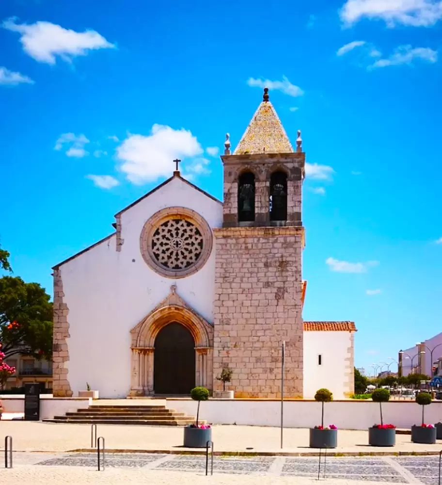
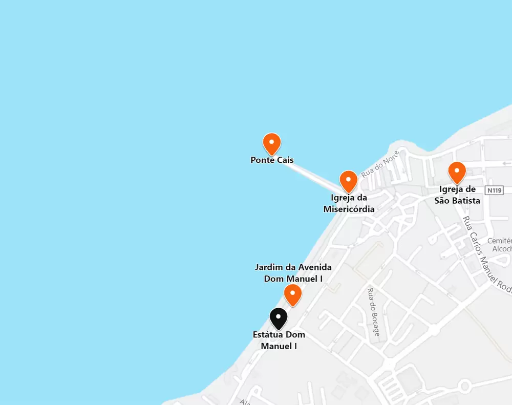
Church of São João Batista
- Coordinates: 38.756156, -8.960297
The elegant 3-nave Church of St Baptist is from the 16th century, and at the time, there were not enough people to fill the temple.
It is the former site of a mosque and later a Christian chapel. Dom Manuel ordered the entrance and the rose window.
The monarch was born here during the plague, and his parents (dukes of Viseu and Beja) quietly took refuge here.
He grew up hearing about Asia, as his father received the Master of the Order of Christ from the hands of Prince Henry the Navigator. He did not imagine being king, his cousin (Dom João II) had one son, and Manuel had older brothers.
- Coordinates: 38.755822, -8.962264
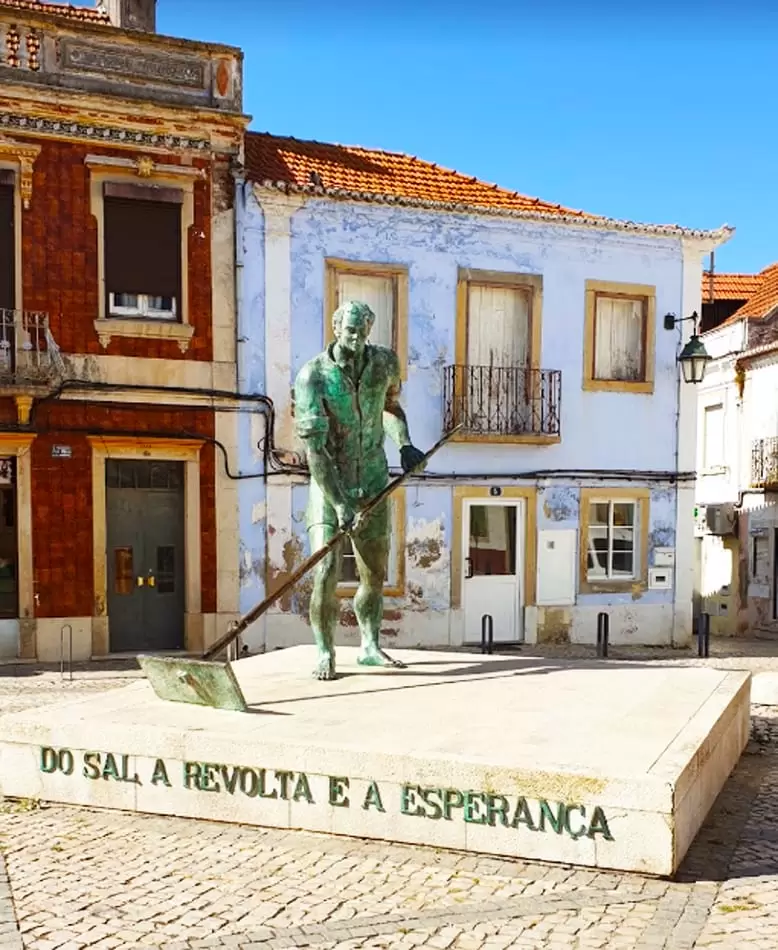
200 metres away, in Largo da República, discover the Monument to the Salineiro, which perpetuates in bronze the work of the Salineiro.
There was a Manueline pillory here (16th century) with elements of the order of Santiago. As it was a symbol of the old order, and there is always one who likes to break things, it was broken in the 19th century.
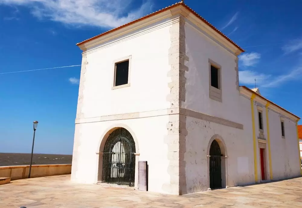
Misericórdia Church
- Coordinates: 38.755941, -8.963775
Some 150 metres away, the Igreja da Misericórdia (16th century) appears with simple and sober lines. According to oral tradition, he was baptised here. It was a difficult birth (his mother was Nuno Álvares Pereira’s great-granddaughter) until the procession celebrating Corpus Christi stopped by his house.
At this point, the baby is born without any further suffering for Dona Beatriz. The name Manuel means God is with us. The building houses the museum of sacred art.
Inside, you can see an ancient altarpiece from the 16th century, a beautiful work.
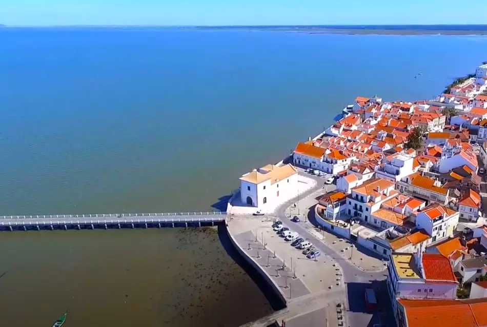
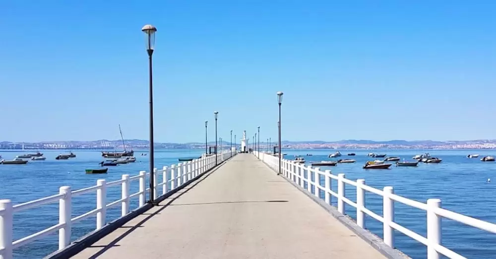
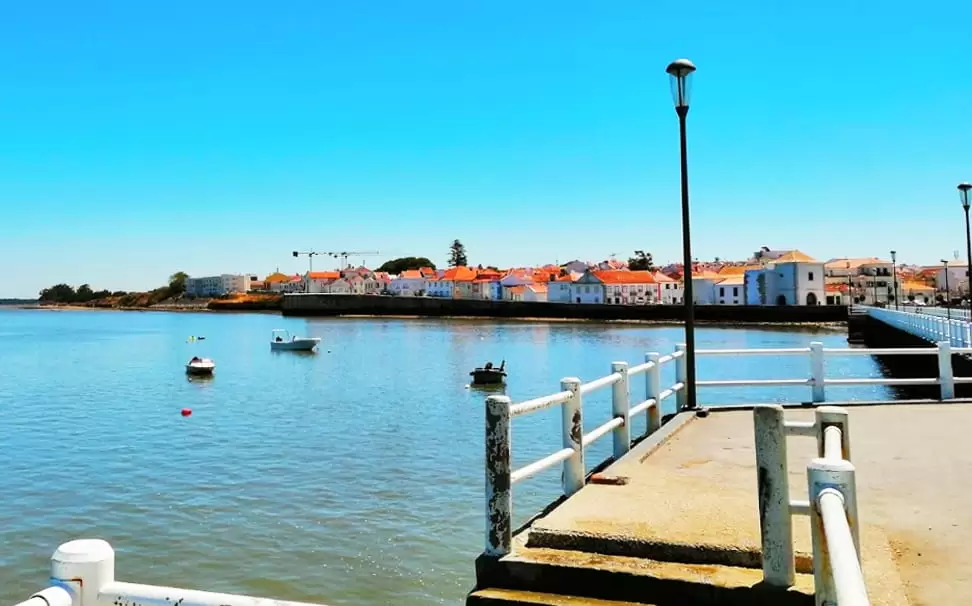
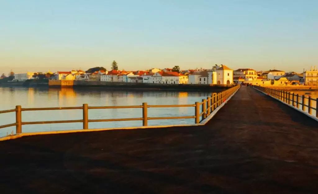
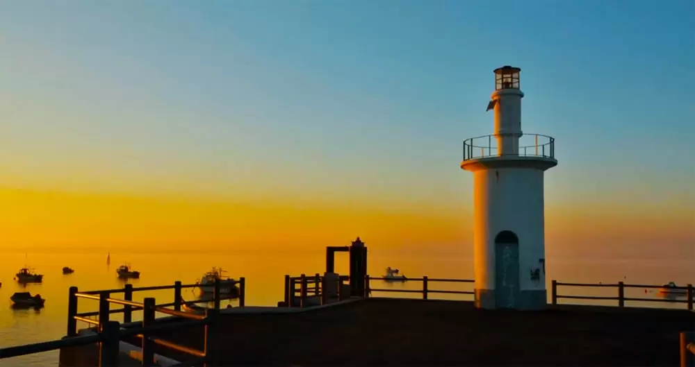
Quay Bridge
- Coordinates: 38.756000, -8.964188
Beneath the church stretches like a carpet the Ponte Cais, a space for delightful walks beside the mesmerising Tagus.
It culminates at the lighthouse that still lights the way for the boats. From here departs the Bote Leão, a replica of an 18th-century vessel that used to ply between Alcochete and Lisbon before dethroned modernity.
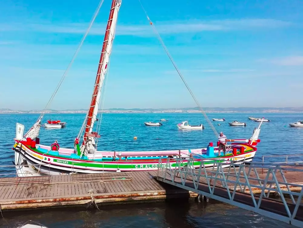
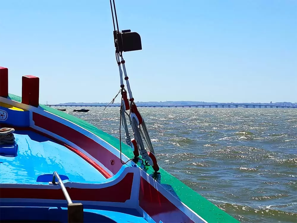
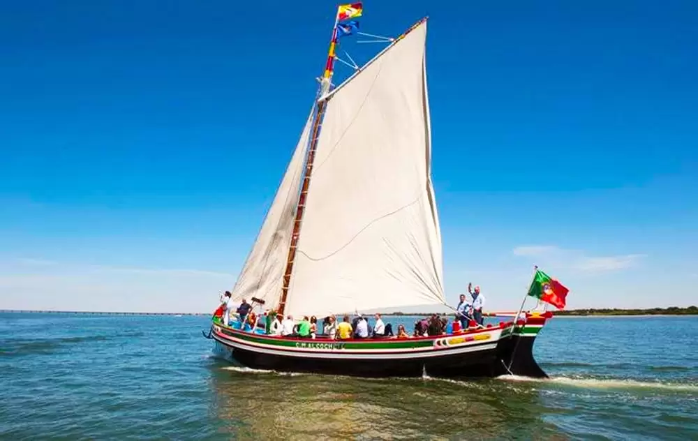
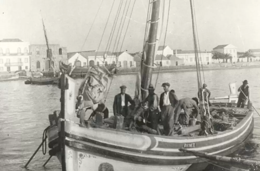
It has a capacity of 45 people and is the great pride of the population, built from scratch but according to the old techniques.
The Alcochete Town Hall promotes the trips between Vasco da Gama bridge and the Tagus Estuary Natural Reserve (for more information: posto.turismo@cm-alcochete.pt).
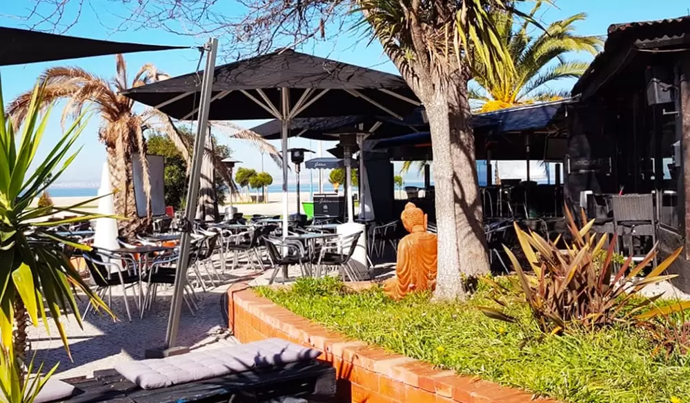
Close to the pier, you will find the nice Alcochetano in the Misericórdia square, with a lovely terrace that invites you to enjoy the glorious day.
- Coordinates: 38.755887, -8.963300
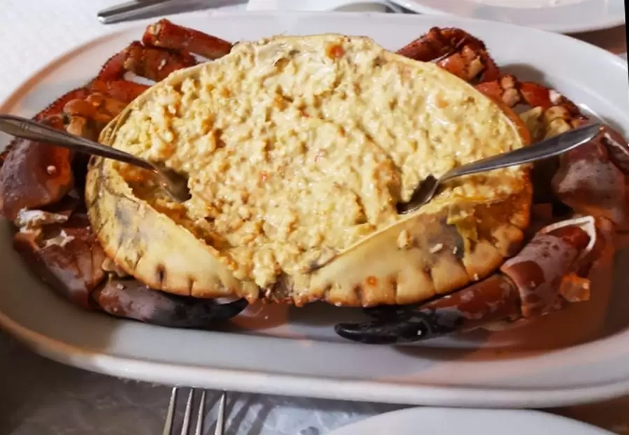
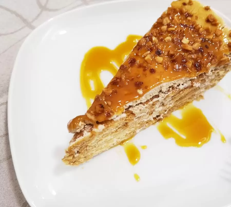
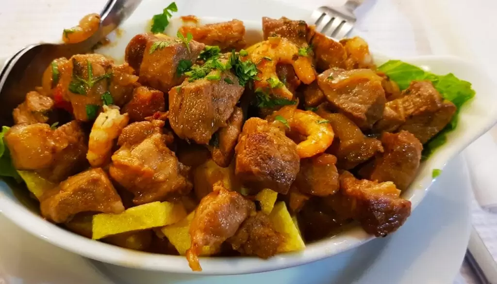
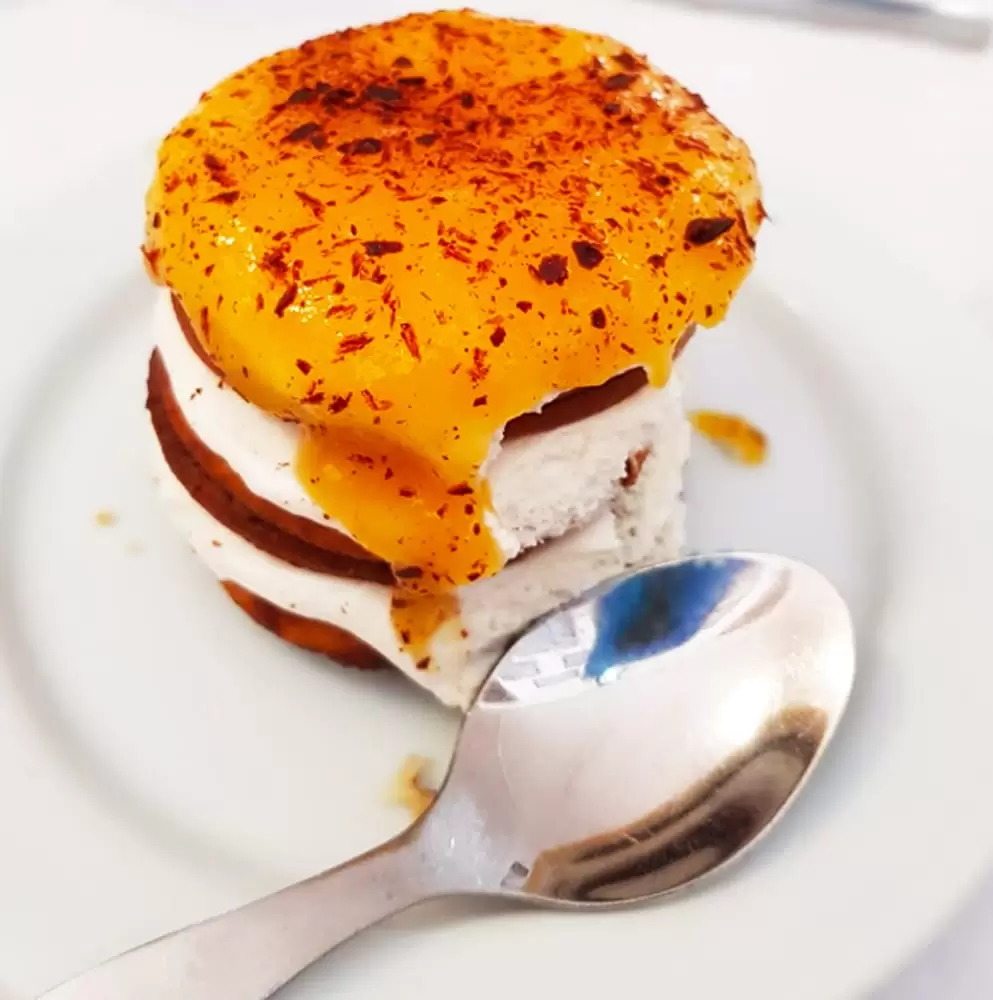
The food is well made and the fish fresh. Another suitable option, a short-distance away, is the Aposento do Barrete Verde association: traditional food in generous portions (with options for vegetarians) – try the biscuit cake.
The walls pay homage to bullfighters and forcados. For the locals, the most important thing is the bulls. For centuries, the ritual of facing the bulls meant facing the great beast, fear, and cultivating this was essential in the past.
Two amateur groups of forcados in Alcochete follow in the footsteps of the locals Júlio Coradinho and António Carraça, who faced bulls until he was 70 years old.
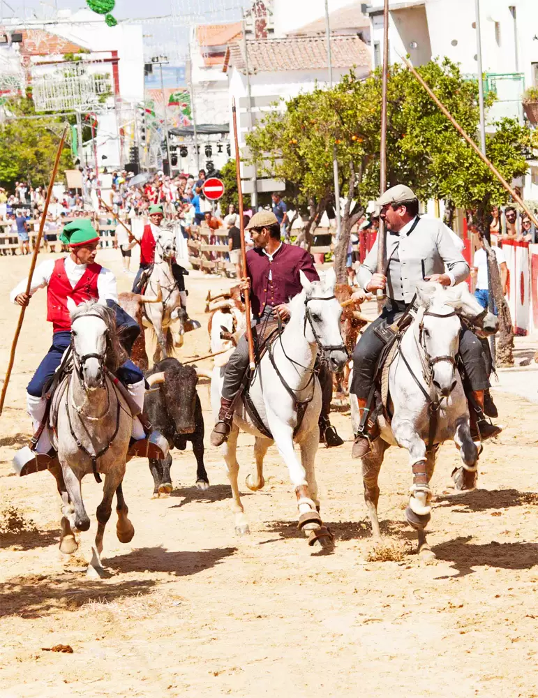
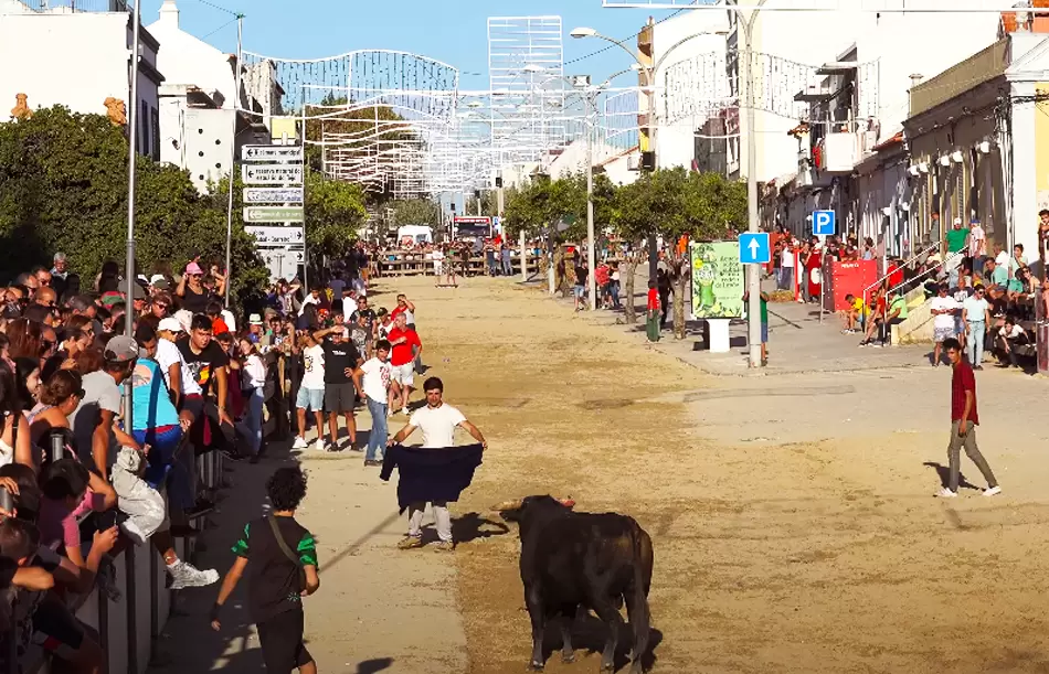
In the 2nd week of August, the village is transformed into a street arena, with the release of bulls accompanied by the equestrian who later collects them. The Barrete Verde and Salinas Festivities is celebrated for 7 days, honouring 3 figures: the Campino, the Forcado and the Salineiro.
Garden of the Avenida Dom Manuel Primeiro
- Coordinates: 38.753100, -8.965557
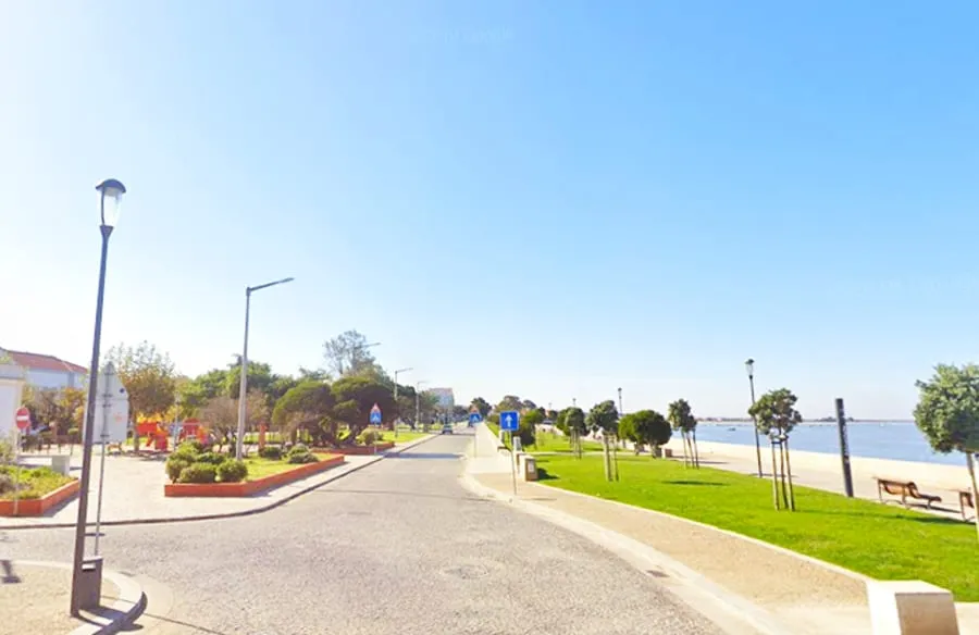
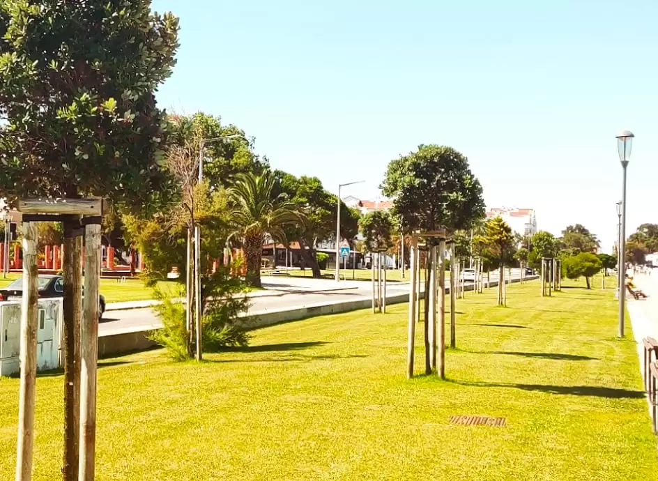
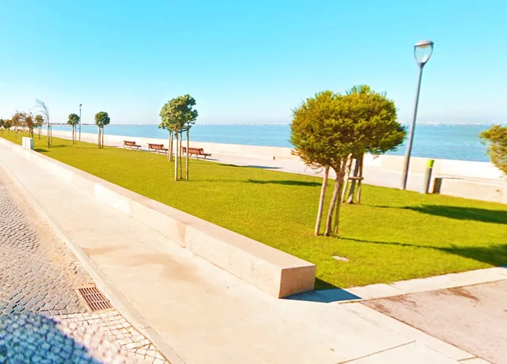
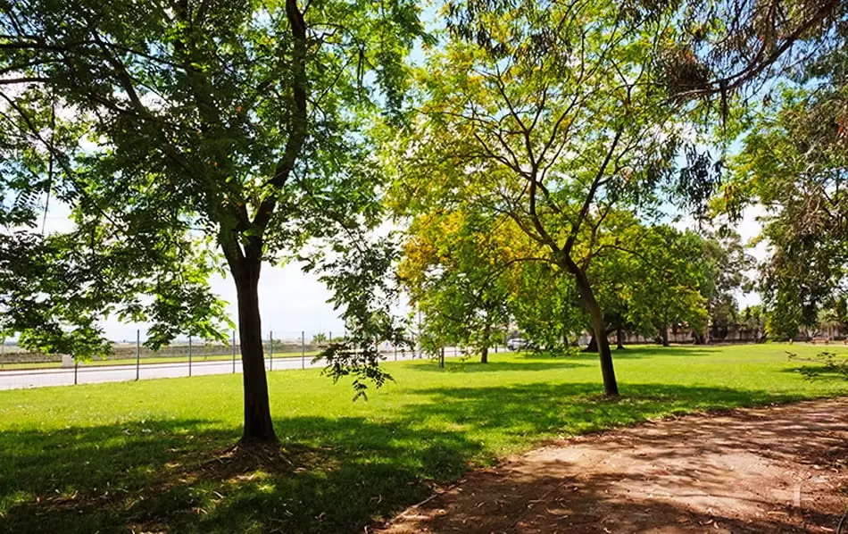
To the south, the pleasant Jardim da Avenida Dom Manuel I appears in the riverside area, from where families walk.
Soon you will see the relaxed Alcach Bar, which tempts you with refreshing cocktails while you soak up the town – on Fridays and Saturdays, they are open until dawn.

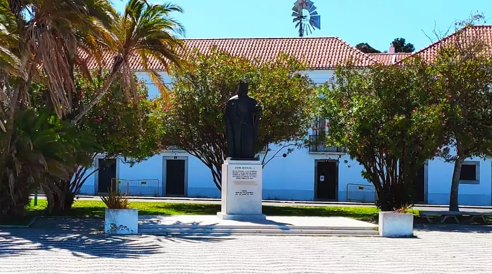
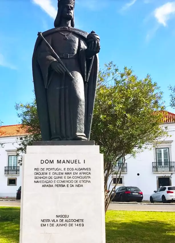
A short distance, you see the Statue of Dom Manuel I (1970), erected on the occasion of the 500th anniversary of his birthday. Dom Manuel will forever be linked to discovering the sea route to India.
Although it was Dom João II’s project, the voyage took place during his reign (it was he who chose Vasco da Gama as captain). The impact is evident in its title: King of Portugal and the Algarves, Lord of Guinea, Navigation and Trade of Ethiopia, Arabia, Persia and India.
- Coordinates: 38.752517, -8.966021
During his reign, the discovery of Brazil was celebrated, and Afonso de Albuquerque dominated the Indian Ocean, establishing relations with China. In fact, Albuquerque was born relatively nearby, in Alhandra (Vila Franca de Xira).
One frankly negative aspect of Dom Manuel’s reign: was the forced conversion of the Jews. Although it was not his idea, he accepted the condition of expelling the Jews to marry the daughter of the monarchs of Spain.
Manuel sought harmony with Rome and Spain, but no agreement was worth the soul of a country, and he deprived the kingdom of the talent it needed.
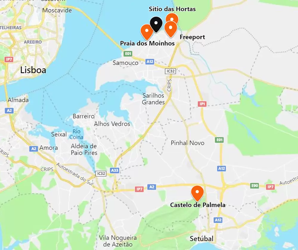
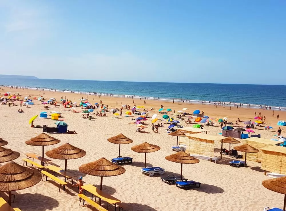
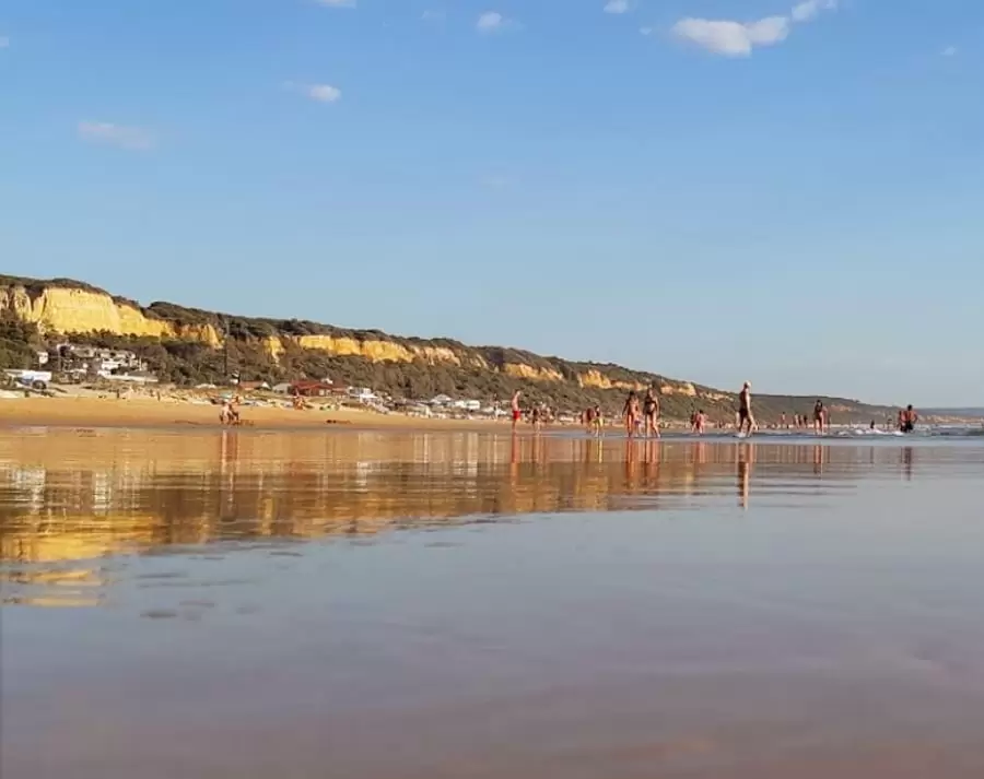
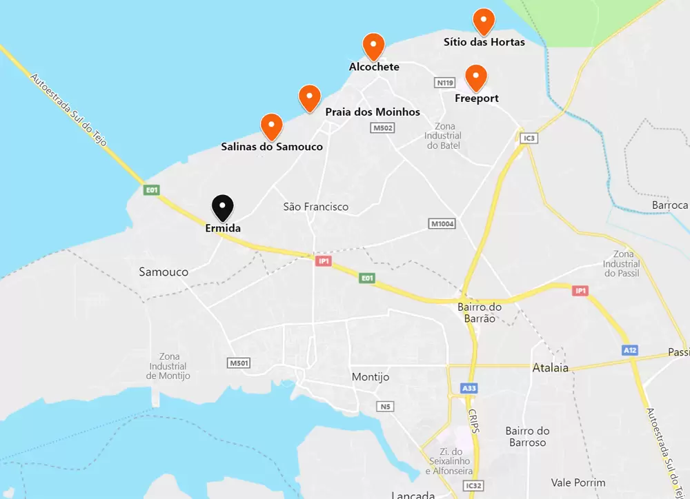
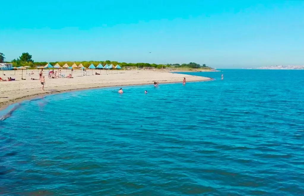
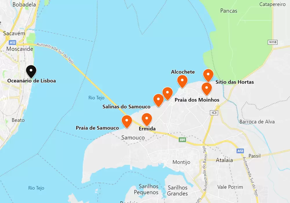
Praia dos Moinhos
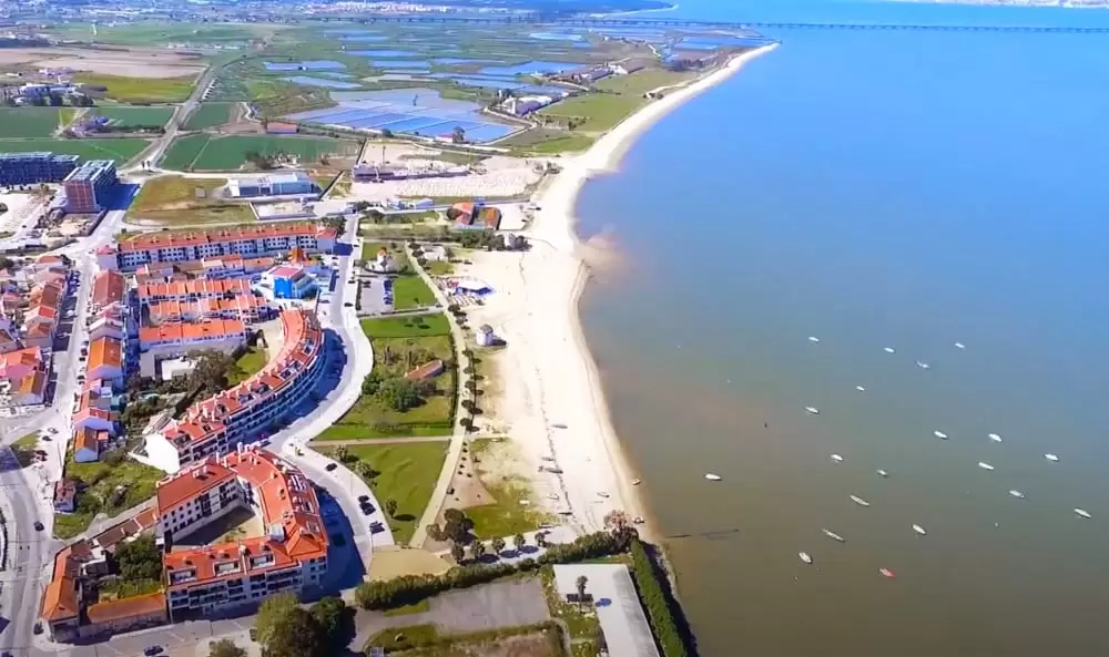
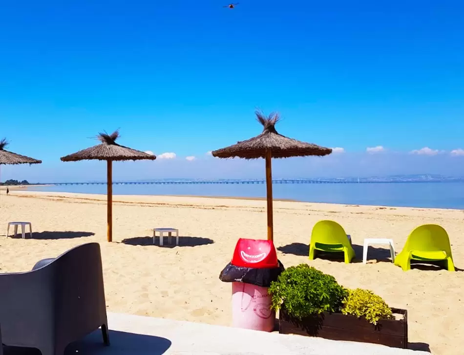
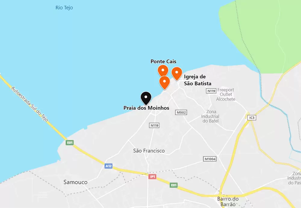
- Coordinates: 38.747821, -8.973538
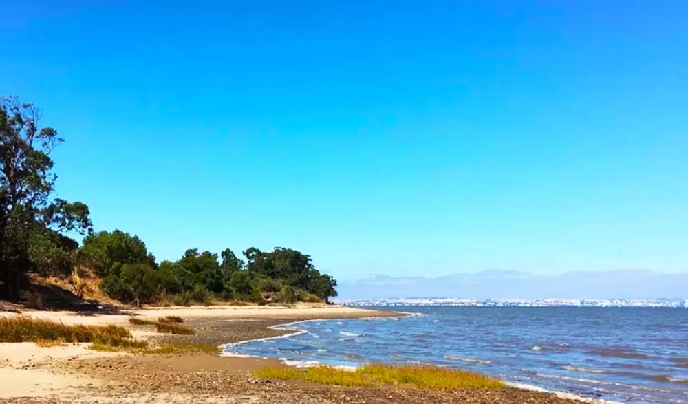
2 km to the south you can see the extensive Praia dos Moinhos beach, also known as Praia de Alcochete. It’s quiet, fine sandy with showers and a terrace service – don’t forget your sunscreen.
It is windy, much to the delight of kitesurfing and paddle surfing enthusiasts – it usually hosts the Alcochete International Parrot Festival.
- Coordinates: 38.747306, -8.972924
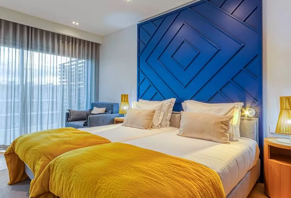
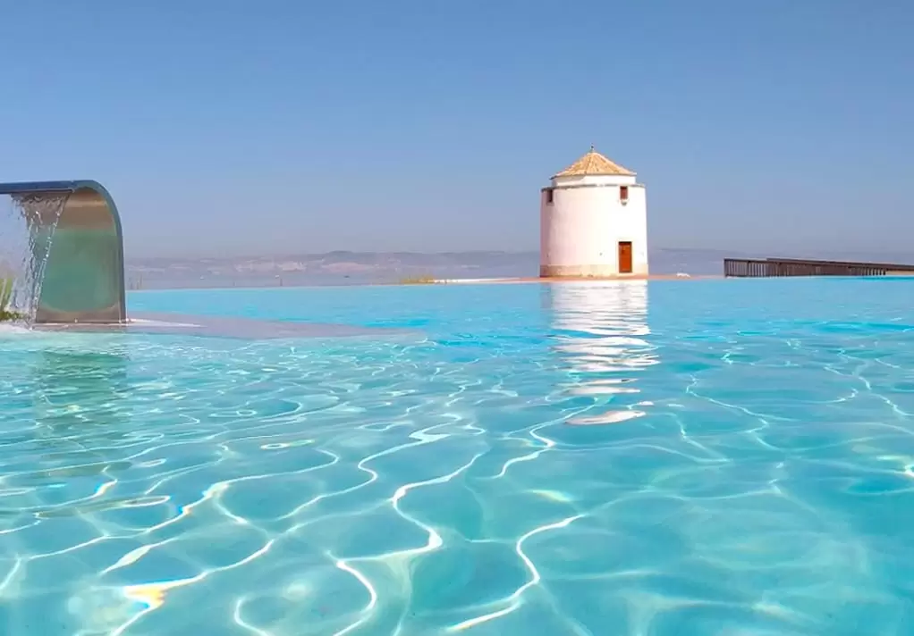
Next to the beach emerges the Praia do Sal Resort (4 stars), a private condominium designed for well-being with 3 pools and beautiful views. The spacious flats, from 1 to 3 bedrooms, are tastefully decorated and culminate in terraces overlooking the river.
Environmental Centre of Sítio das Hortas
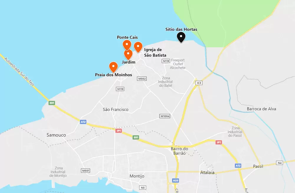
- Coordinates: 38.760210, -8.937440
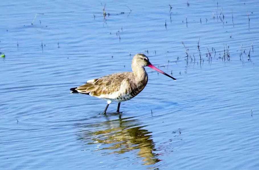
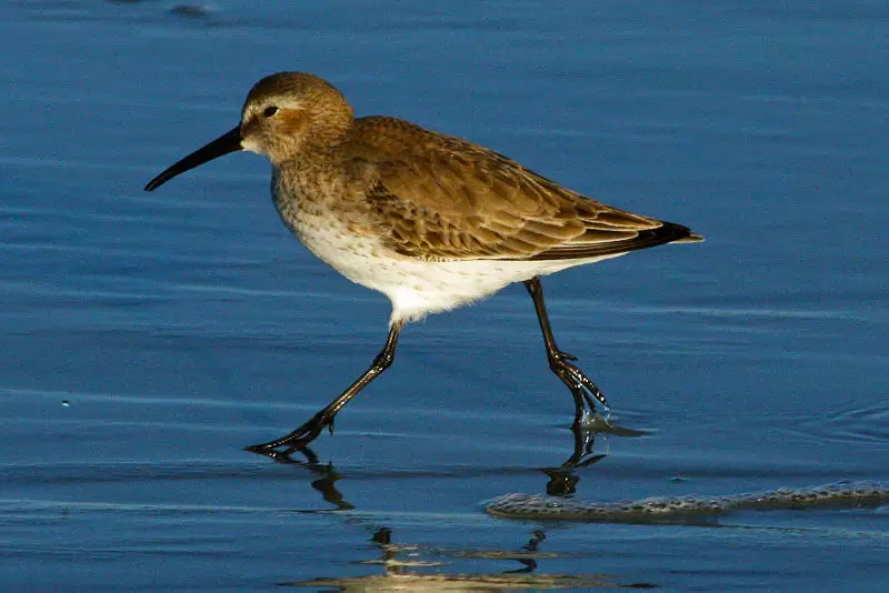
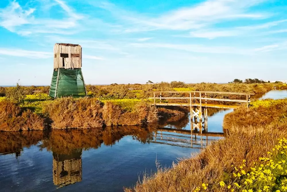
2 km from the village, by the “horas” road, is the Polo Ambiental do Sítio das Hortas, a fascinating place where aquatic birds offer us their joyful presence.
Many of them have travelled thousands of kilometres between wintering and breeding areas, as is the case of the Black-tailed godwit and the Dunlin.
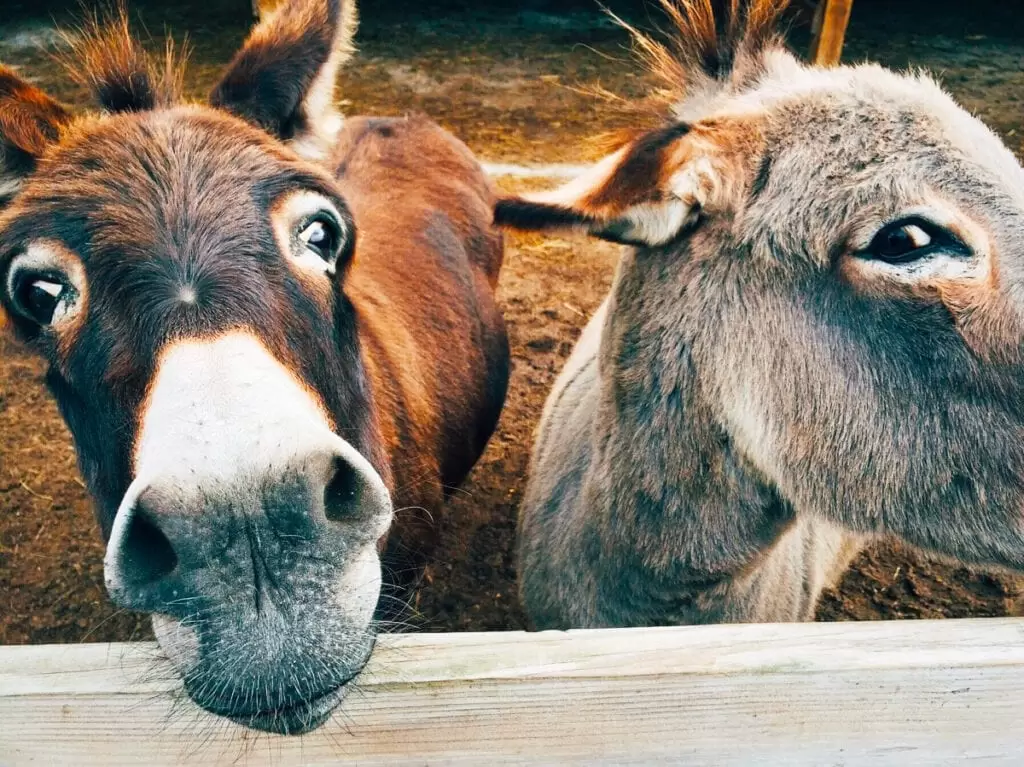
The space is open from 10am with 2 distinct areas: the vegetable garden site and the pine forest of the sands from where the “Long-eared Friends” appear, whose enthusiasm is only held back by the fence.
Our collaboration with these animals is very ancient; they were vital in establishing land commerce in Ancient Egypt – millennia before the birth of Christ.
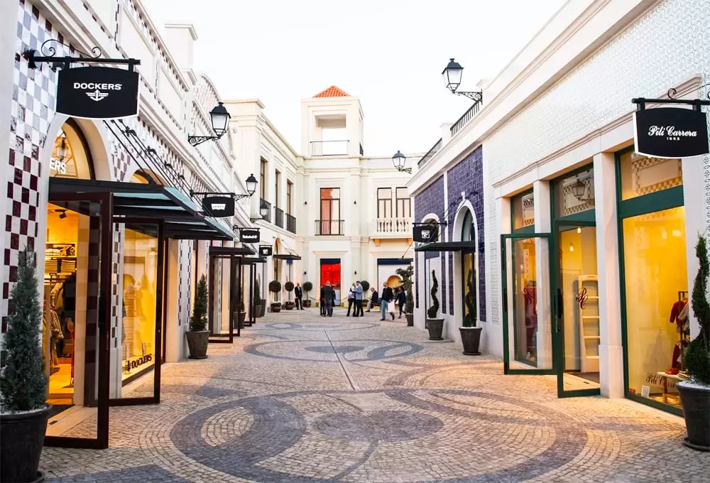
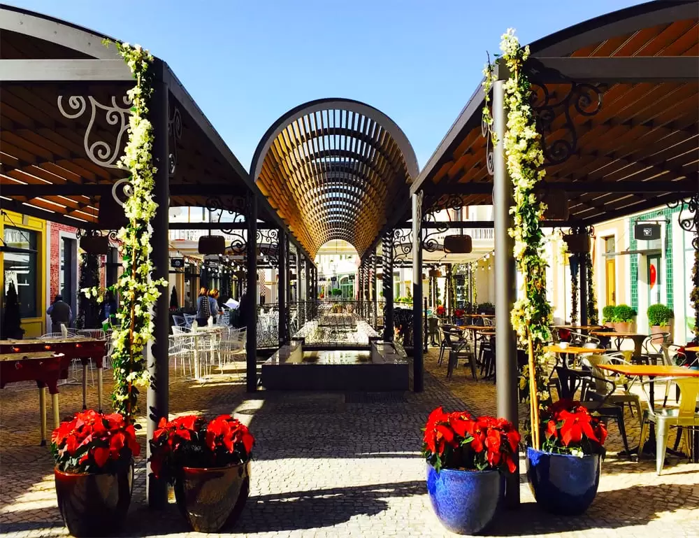
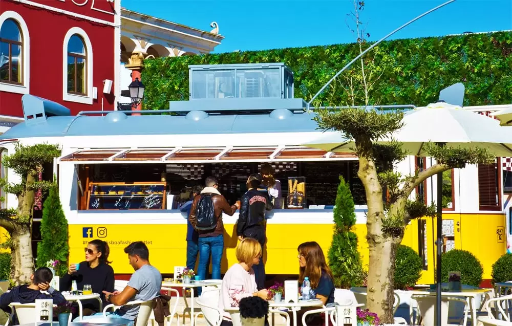
Freeport Lisboa Fashion Outlet
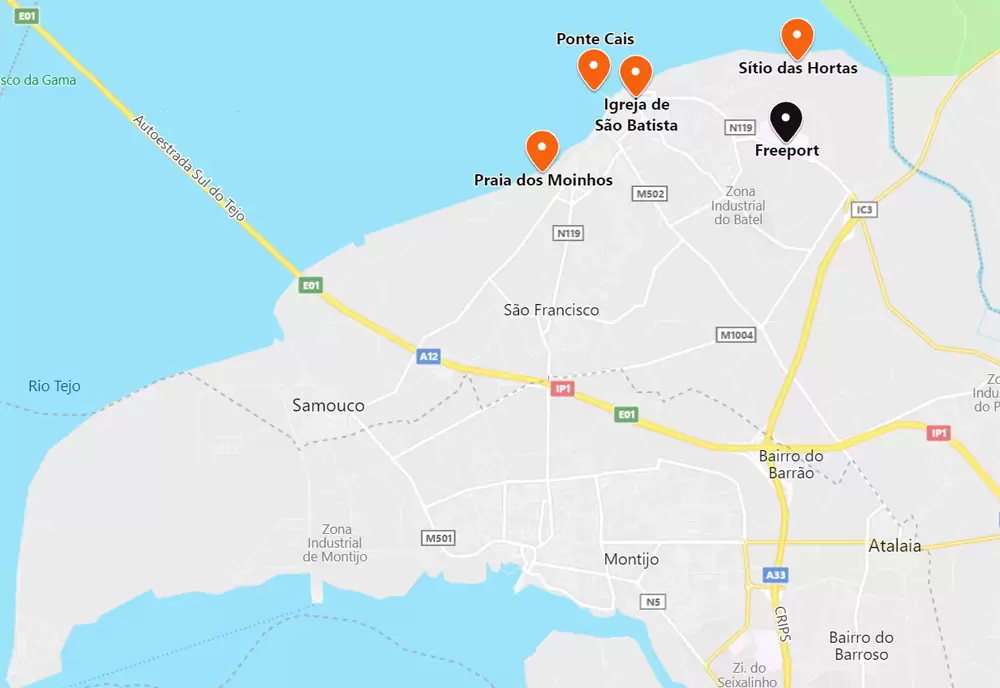
- Coordinates: 38.751090, -8.938962
5 minutes away (2.5 km via the N119) emerges the Freeport Lisboa Fashion Outlet, the most famous in Portugal, from where many buy their most emblematic pieces. With an open-air concept, walk along the broad avenues lined with palm trees while you explore the shops and restaurants.
The list of brands is enormous: Adidas, Carolina Herrera, Calvin Klein, Dolce & Gabanna, Levi’s, Hugo Boss, Samsonite; in short, there are over 100 competing for your attention and seducing you with prices lower than the retail ones – it opens at 10:00 and closes at 20:00.
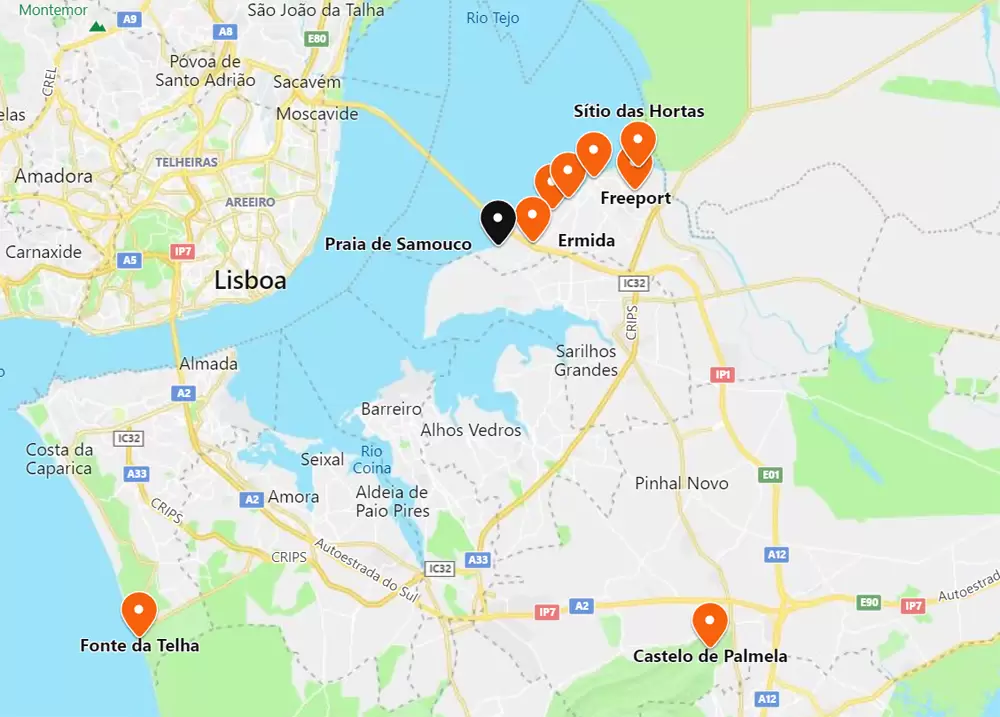
You can take the A12 (and then A33) from the outlet to the magnificent Palmela Castle (20 min trip), with beautiful views of the Sado estuary. It was the headquarters of the Knights of Santiago (from the 15th century).
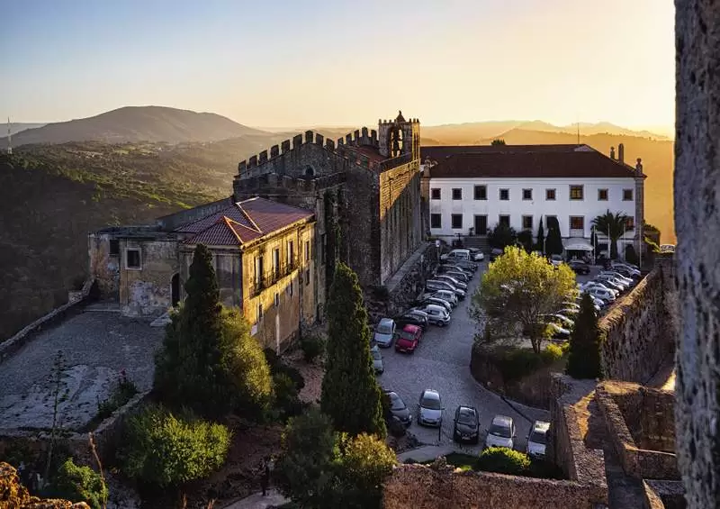
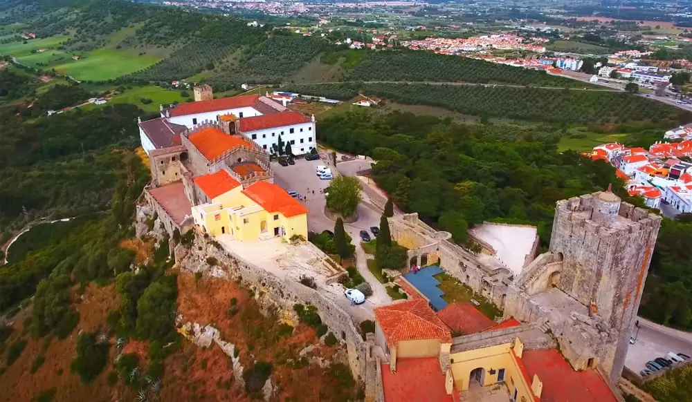
- Coordinates: 38.566304, -8.900456
The castle is ancient, dating back to the Islamic occupation (early Middle Ages). It currently houses a beautiful inn.
Venturing south, you reach the port town of Setúbal, with more treasures to be discovered. Another suitable option is to take the A33 west near Praia da Fonte da Telha (half an hour’s drive).
- Coordinates: 38.570639, -9.195057
It is an idyllic sandy beach backed by the Arriba Fossil of Costa da Caparica. The beach is supervised during the bathing season, with good support infrastructure. Along the coast, several restaurants, such as the famous Kailua Fonte da Telha, have a delicious and diverse menu.
To the north, there is a sequence of beaches until you reach Costa da Caparica town centre. A mini-tour (Transpraia) passes over dozens of beaches. To the south, head to Cabo de Espichel (Sesimbra), which reveals the Sanctuary of Nossa Senhora do Cabo (18th century).
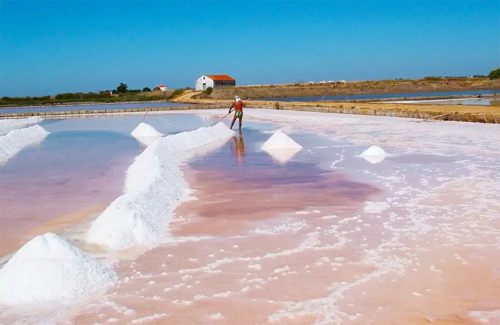
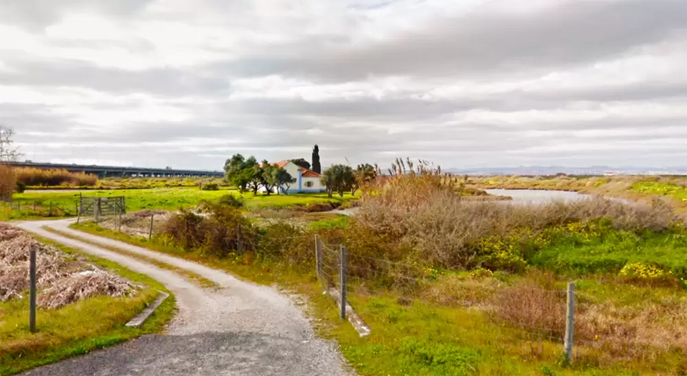
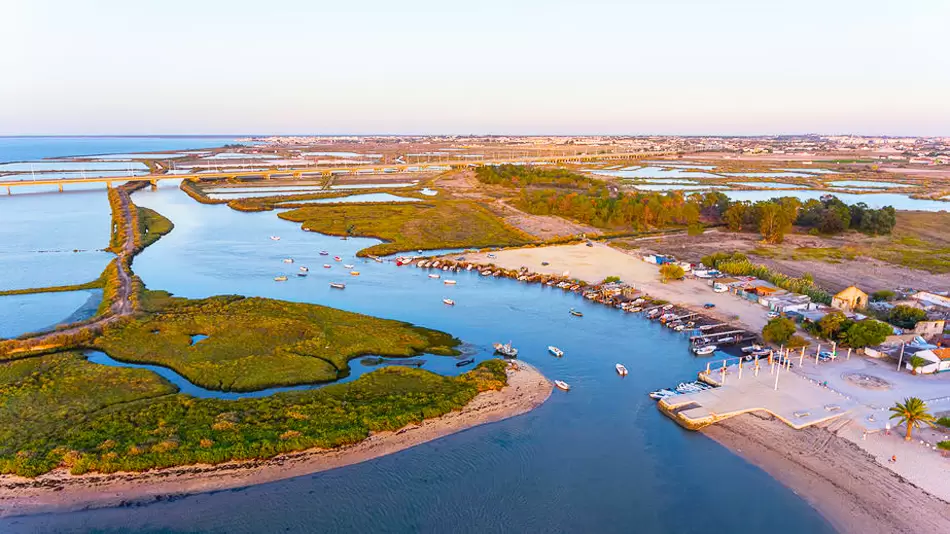
Salinas do Samouco Foundation
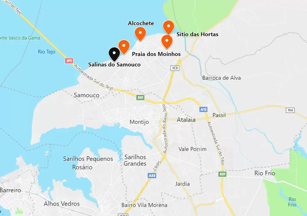
- Coordinates: 38.743179, -8.981511
A 10-minute drive southwest arrives at the Fundação Salinas do Samouco, a complex comprising 56 century-old salt pans. It opens at 8 am and closes around 5 pm. The first records of salt production in Alcochete date back to the 13th century, but it was gradually abandoned from 1970 onwards.
The foundation has an immense diversity of habitats: pine forest, marsh, and dunes and offers excellent conditions for bird watching. There are countless them, many herons, and you never tire of seeing the flamingo.
Chapel of Nossa Senhora Conceição dos Matos
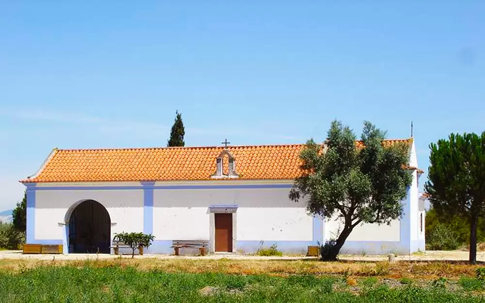
- Coordinates: 38.730017, -8.991693
At 3 km, along the EN101, pass near the Ermida de Nossa Senhora da Conceição (16th century) which goes unnoticed. On the floor of the main chapel there are 2 graves with the portuguese inscription “Here lies Tristão da Cunha and Dona Antónia da Silva his wife…”
Tristan, the cousin of Afonso de Albuquerque, was an explorer and commander immortalized by discovering 1 group of islands (Santa Helena, Ascension, and Tristan da Cunha near South Africa) in 1506.
Shortly after, the armada joins Albuquerque in Melinde (Kenya) to attack the Islamic empire Ajuran in the cities Oja, Lamu (Kenya) and Barawa (Somalia) at the request of the Sheikh of Melinde (an ally of Portugal) –
Tristão was severely wounded. Later, as ambassador, he presents exotic discoveries to the Pope.
The long procession in Rome includes 1 white elephant (albino), 2 leopards, 1 panther and many other animals. The elephant is said to have kneeled 3 times, sucked up water and sprayed the crowd – the Pope simply adored the elephant. Its name (Hanno) is a tribute to the Carthaginian (6th century BC) who explored the West African coast.
Samouco River Beach
- Coordinates: 38.728579, -9.009449
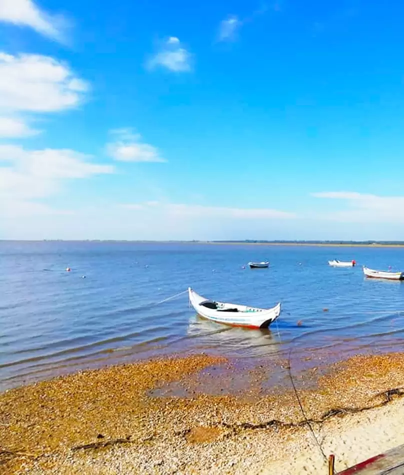
Continuing 5 km westwards, you reach the car park of Samouco Fluvial Beach, which is small and charming, with tranquil waters and stunning views of the Vasco da Gama bridge.
At low tide, it almost disappears, and the shellfish gatherers start their quest – near, we see the small Cais Palafitico de Samouco.
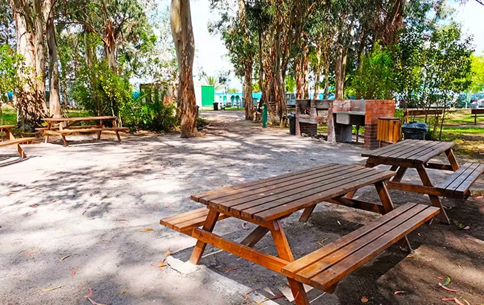
The suburbs have a popular restaurant and the Picnic Park, where families take a refreshing meal in communion with nature. With bathrooms and a children’s playground.
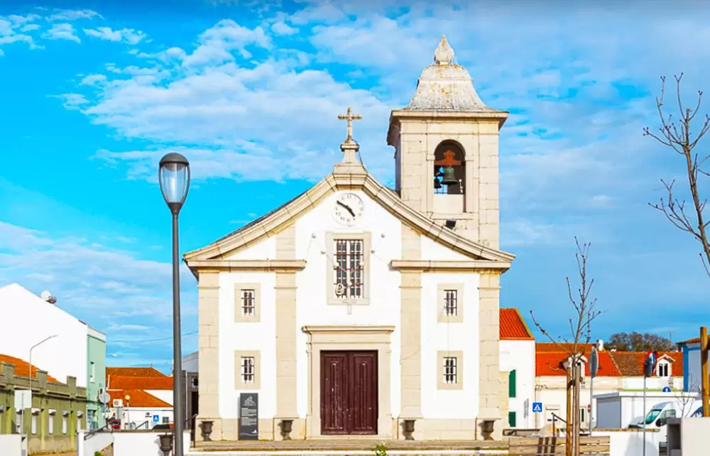
The centre of Samouco is a couple of kilometres from where the São Brás church (16th century) emerged. The interior is lined with tiles recounting the life of São Brás. It has been renovated several times, with a baroque façade.
- Coordinates: 38.720724, -9.003308
The Vasco da Gama Bridge is a constant presence, and if you take it in 25 minutes, you reach the eastern part of Lisbon, next to Parque das Nações. It was completed 500 years after Vasco da Gama arrived in India.
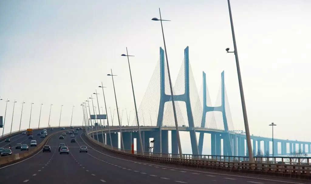
- Coordinates: 38.735993, -9.007742
It was inaugurated at the end of March 1998, 1 week ahead of schedule, and celebrated with a beanie of biblical proportions – 15,000 people along its 12.3 kilometres. The bridge was built to withstand an earthquake more potent than that of 1755 – to have one is the place it wants to be.
The Parque das Nações is modern Lisbon. Almost everything was built from scratch for Expo 98, highlighting the era of great navigations. It is just a few minutes from the centre, with access to transport at Oriente Station (metro, train, and buses) and 10 minutes from the airport.
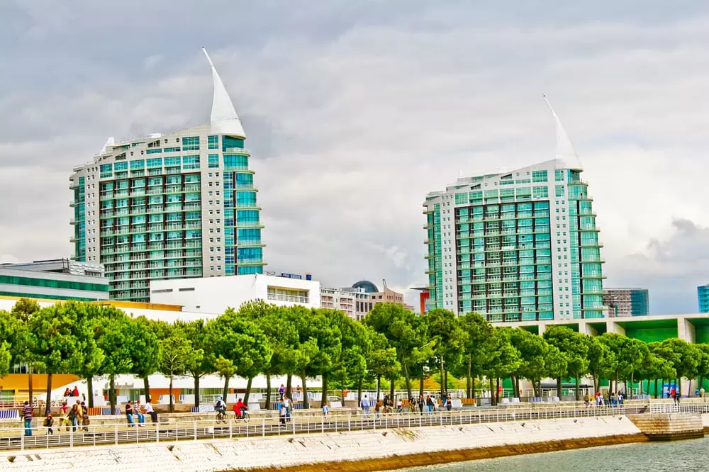
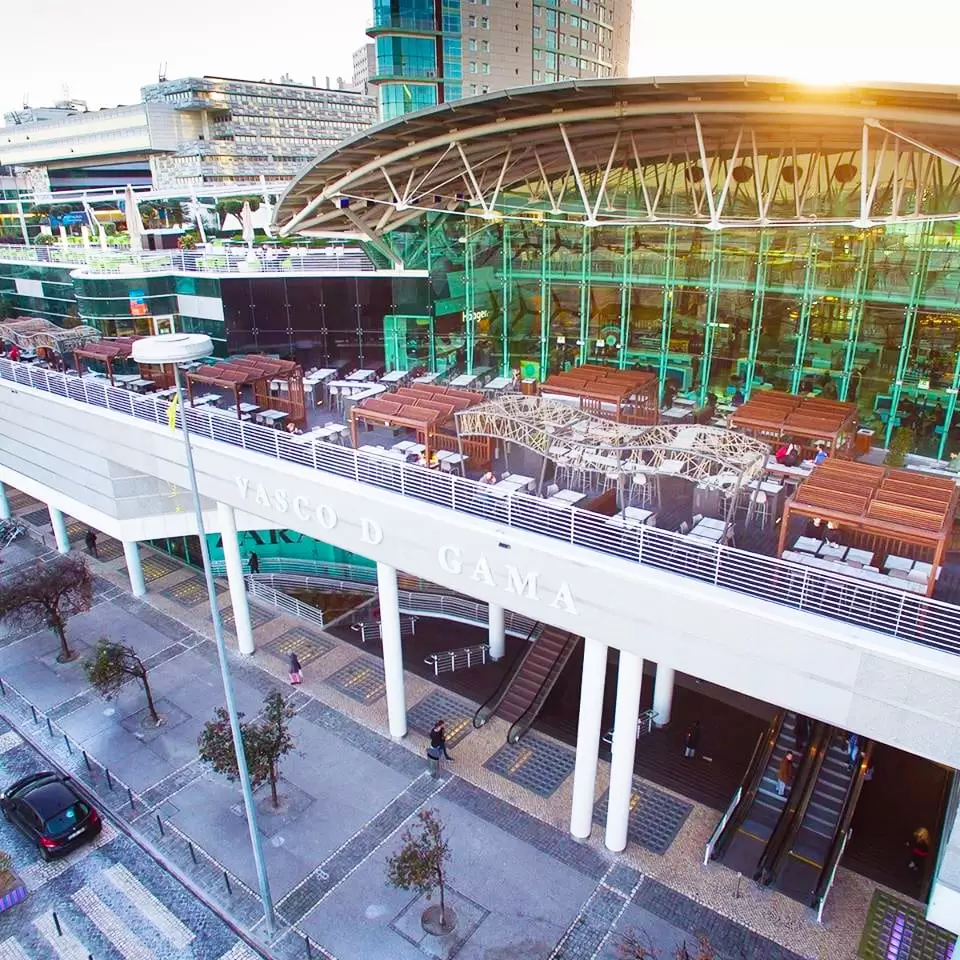
Several buildings and streets make allegories to the time of the Discoveries, such as the Vasco da Gama Shopping Centre, on Avenida Dom João II, accompanied by 2 condominiums that look like 2 large ships.
- Coordinates: 38.768132, -9.097640
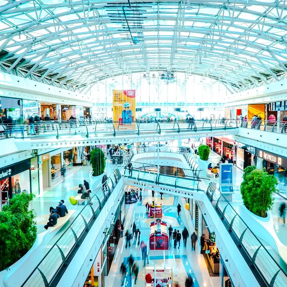
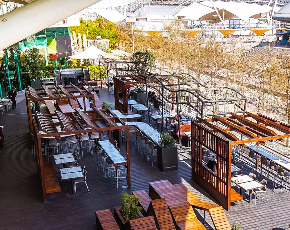
The shopping centre is elegant, with almost 200 shops, 30 restaurants, 6 cinemas, a hypermarket and a gym. The top floor is the restaurant area overlooking the river and the Altice Arena.
- Coordinates: 38.768364, -9.095304
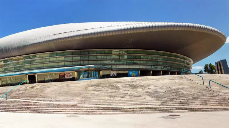
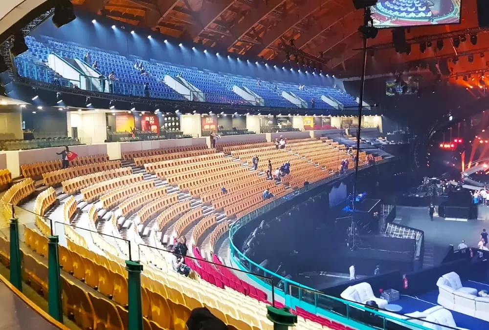
It is one of the largest performance halls in Europe, with a futuristic look. With a capacity of 20,000 people, it is the stage of choice for the biggest music stars.
If you head north, you will pass through a terrace area beneath a small garden (Garcia de Orta). You will see the cable car terminal (the ticket costs around €6).
- Coordinates: 38.774690, -9.091455
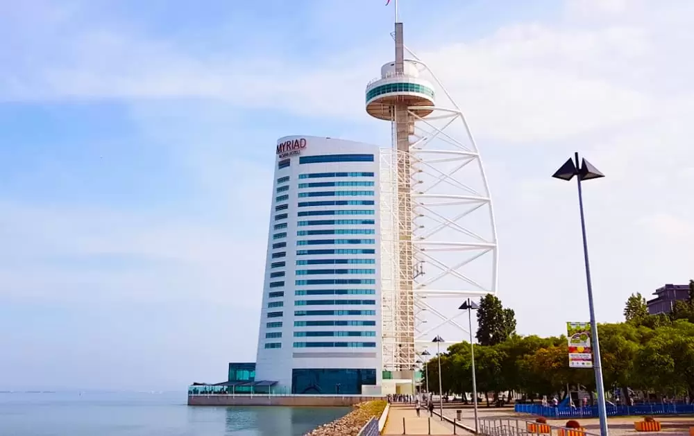
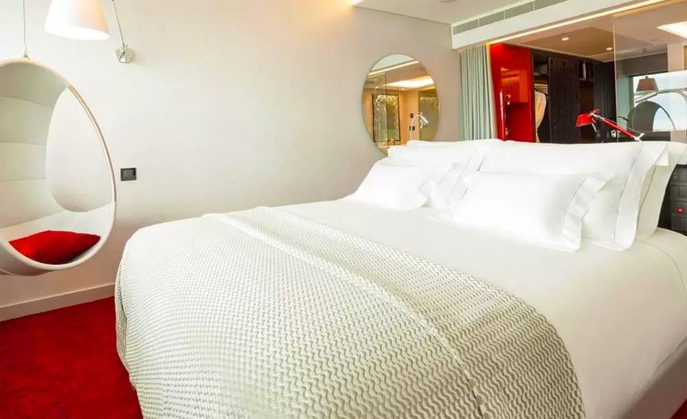
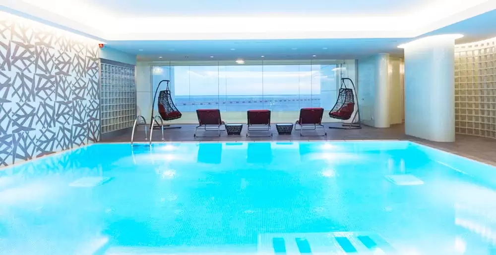
A few metres away, we discover the Myrad By Sana(5 stars) of unique architecture, which aims to be a resort in the city. It has a great spa on the 23rd floor, with views over the Tagus.
With excellent service, the customer feels welcome and eager to return. We continue north to a garden that invites us to test our photographic skills with the Vasco da Gama bridge as a model.
To the south, there is a modern casino: with more than 700 slot machines, 20 gaming tables and a showroom with a capacity for 600 people.
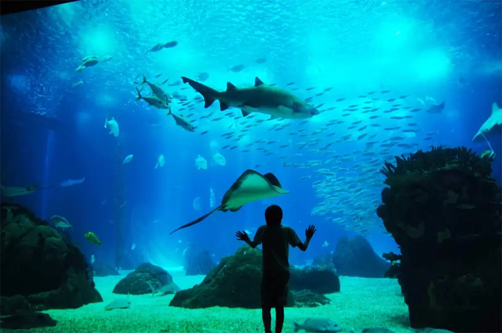
Invariably, everyone goes to the bold Lisbon Oceanarium, several times considered the best in the world and one of the most significant sights in Lisbon.
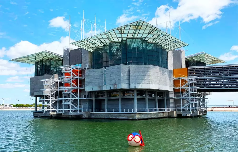
- Coordinates: 38.763012, -9.093724
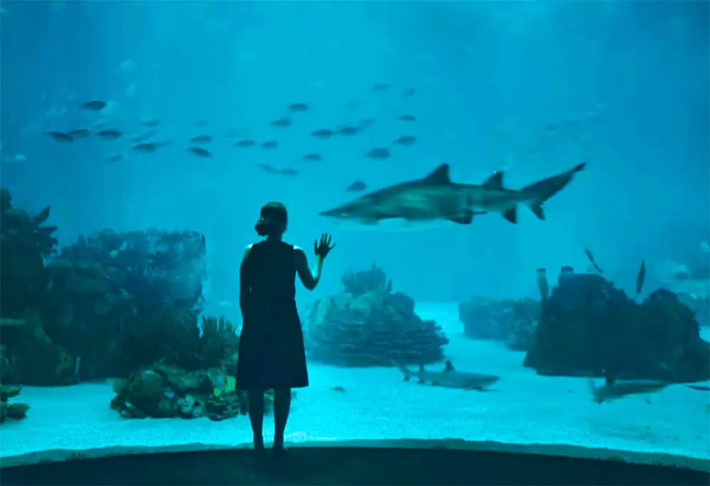
The central tank represents the ocean as a whole; various species live in total harmony – in fact, all oceans are interconnected and are a single body of water. It is an unforgettable tour, not only for children but also for adults.
It is enchanting to look at the otters already used to being the centre of attention, the Magellanic penguins, the stingrays – it is astonishing, and everyone enjoys it.
What to visit near Alcochete
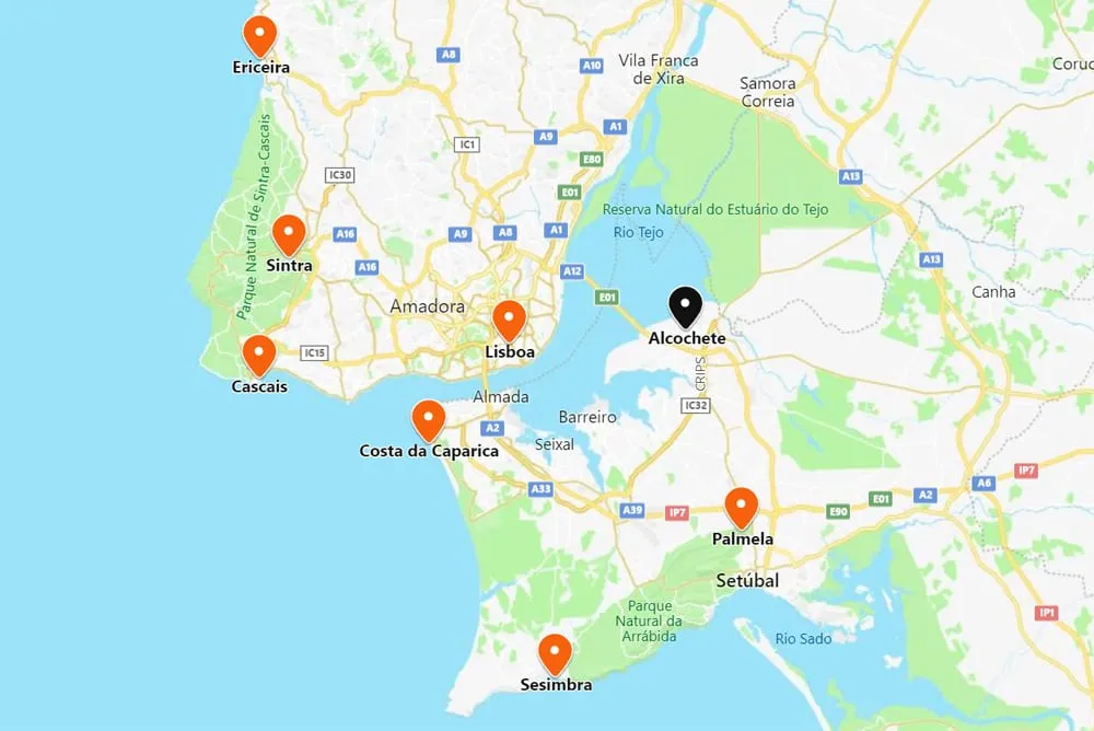
Lisbon is 35 km away (35 minutes, crossing the Vasco da Gama bridge). To the northwest, there is Sintra (40 minutes by A12), Ericeira (45 minutes by A21) and Cascais (50 minutes by A36 and A5).
To the east, discover Almada and Costa da Caparica (35 minutes). Sesimbra is 45 minutes by the A33, from where begins the Arrábida Natural Park that culminates in Palmela and Setúbal (25 minutes by the A12).