

About 600 years ago, João Gonçalves Zarco and Tristão Vaz Teixeira arrived in Porto Santo at the behest of the young Prince Henry the Navigator (24 years old).
Bartolomeu Perestrelo was chosen as the donatory’s 1st captain, and on the 2nd voyage, he brought people of various origins and animals, including rabbits, that became a plague.
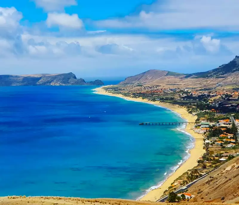
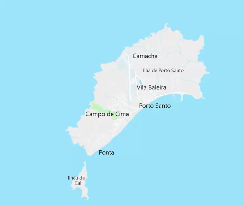
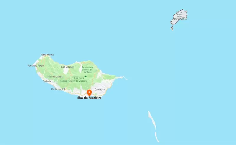
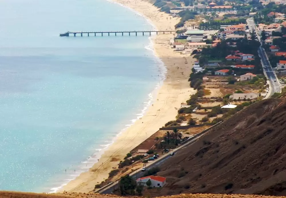
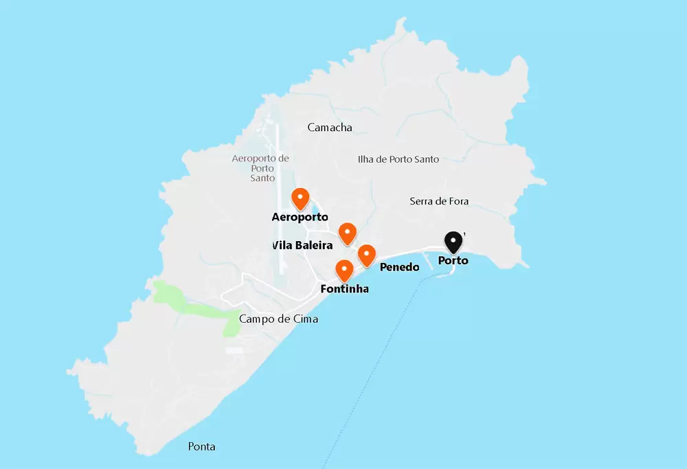
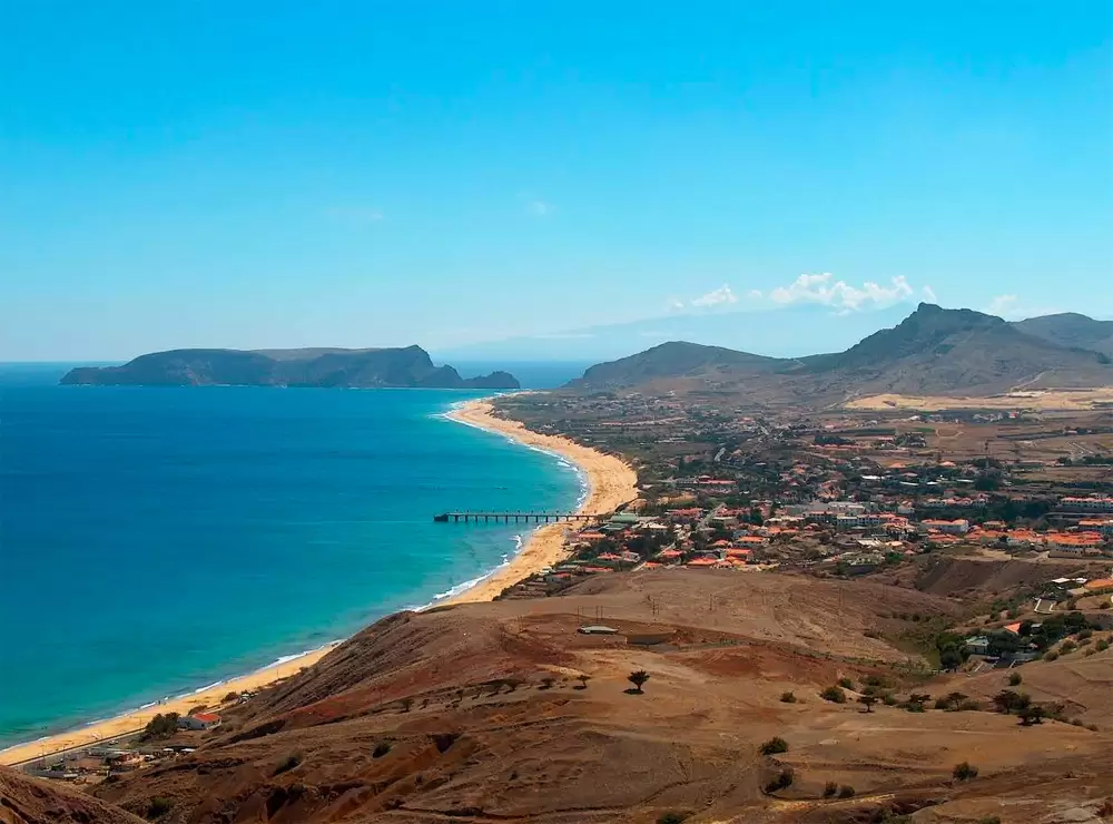
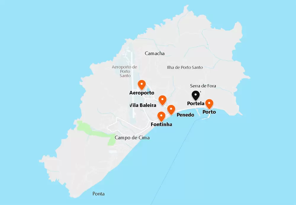
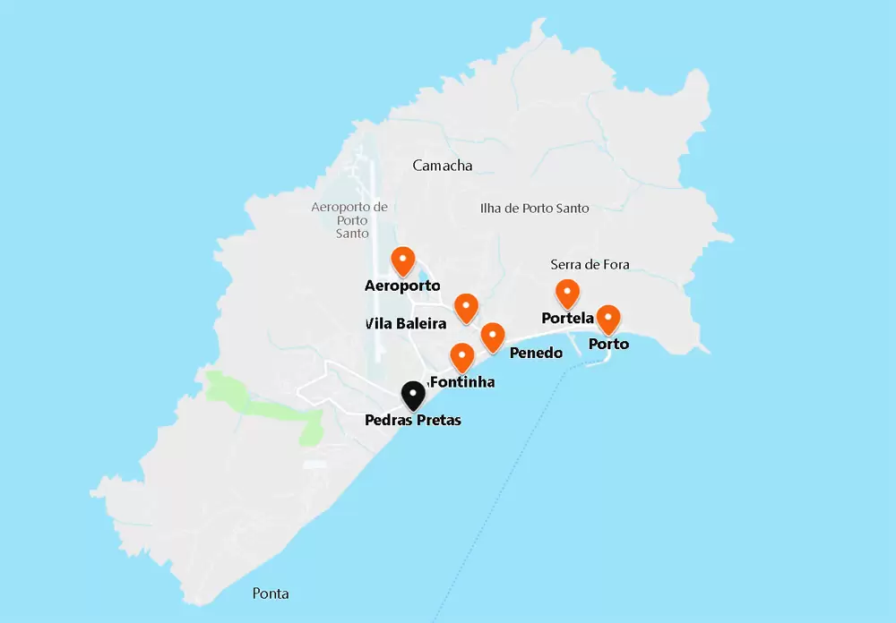
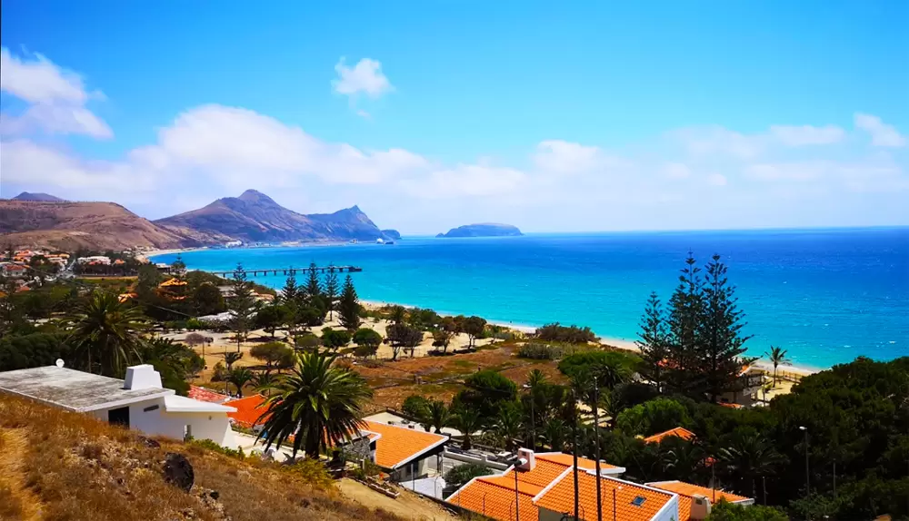
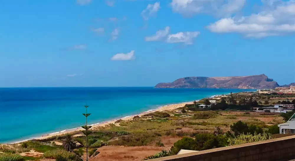
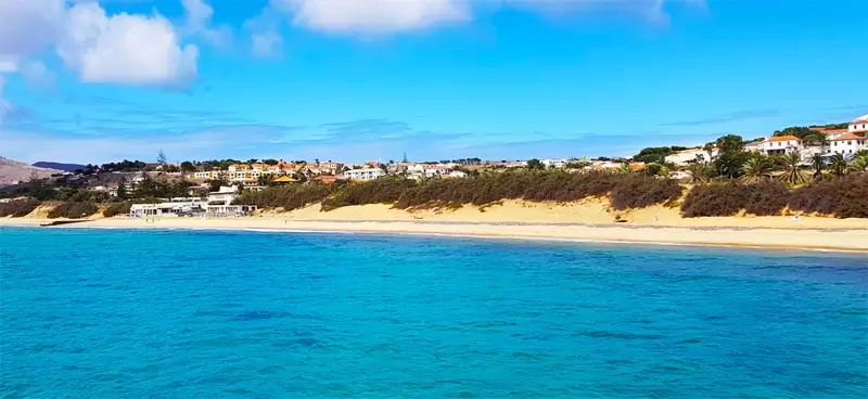
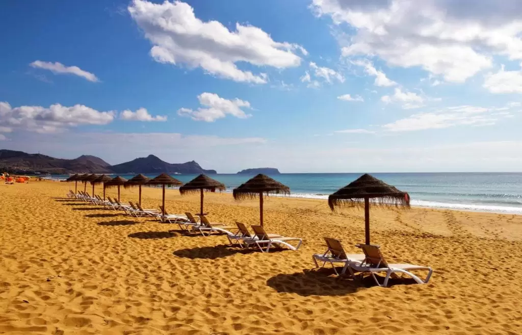
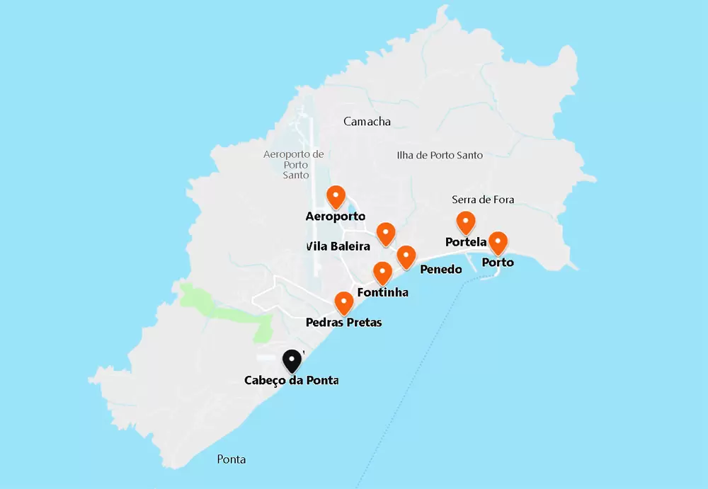
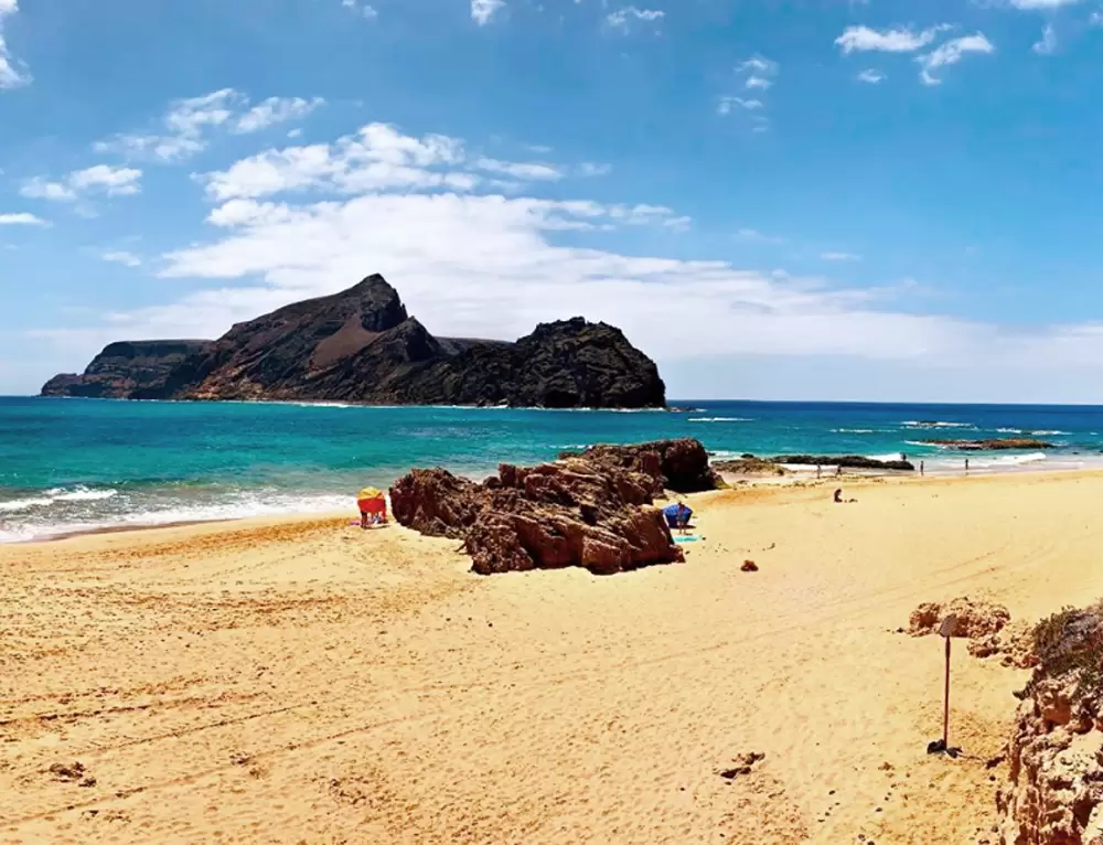
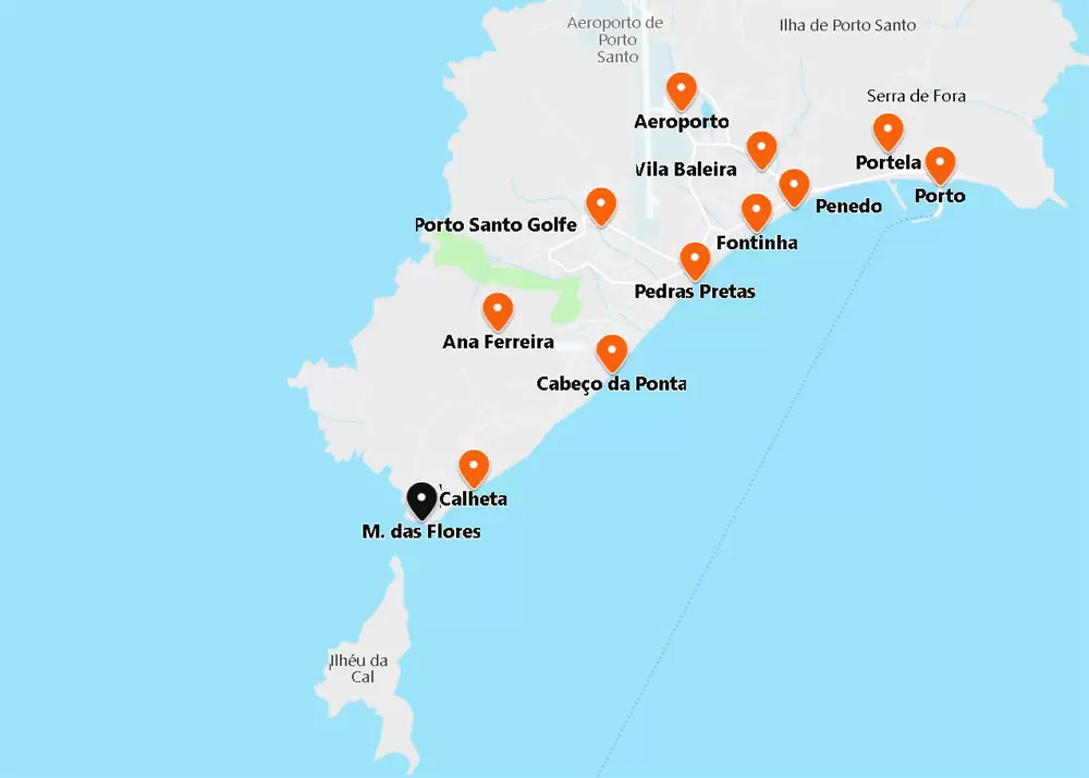
Porto Santo Island, 11 km long and 6 km wide, is 75 km from Madeira. It’s relatively flat, with a long stretch of sand (9 km) attracting a summer crowd. Its sand is said to have healing properties for eczema sufferers and varicose veins – so some people visiting Porto Santo can be seen buried up to their necks on the beach.
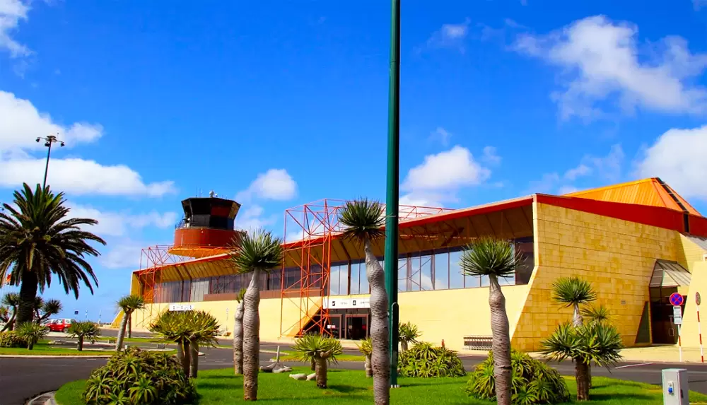
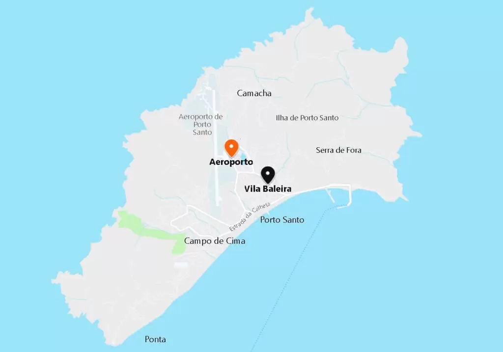
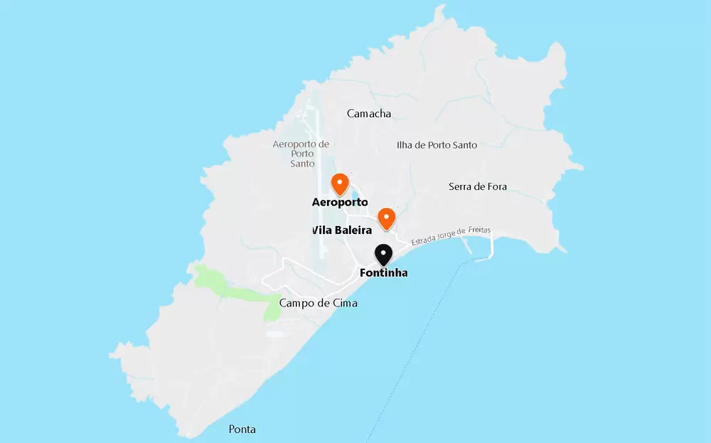
Porto Santo Airport
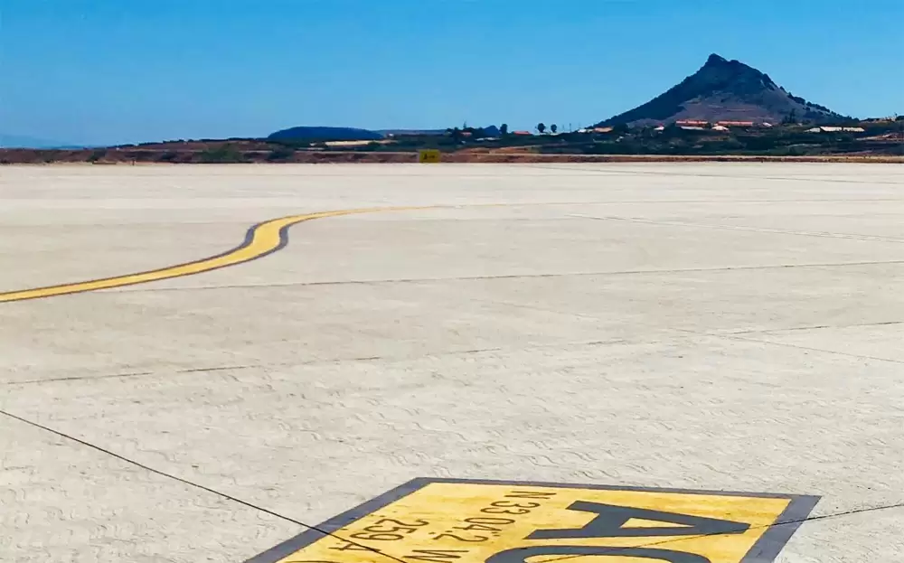
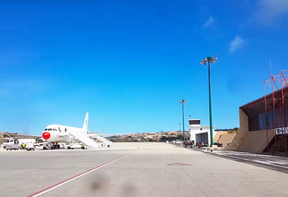
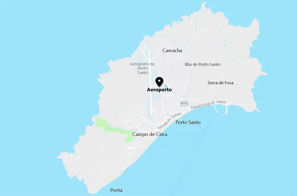
- Coordinates: 33.070677, -16.345161
Porto Santo Airport is inland and was built on the archipelago (in 1960, 4 years before Madeira airport).
From Lisbon to Porto Santo, non-stop, is one hour and forty-five minutes (direct flight).
From Madeira to Porto Santo it is 25 minutes. At the airport, there are various services such as a cafeteria, currency exchange and car rental agencies – it is 5 minutes from the centre of Vila Baleira.
Vila Baleira
- Coordinates: 33.064044, -16.334478
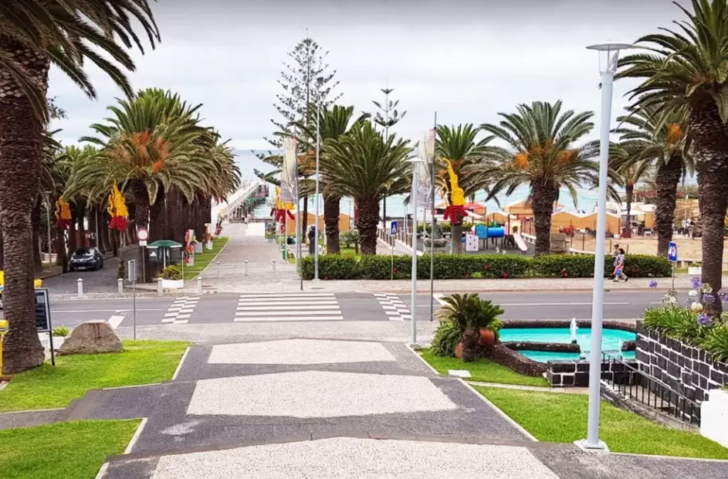
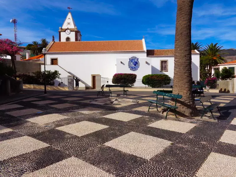
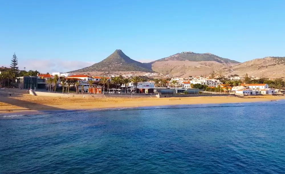
The old quay is famous for evening walks in the island’s only town, particularly among young lovers. It’s a short walk to the main square (Largo do Pelourinho) and the town hall flanked by beautiful trees.
Nearby is the 16th-century Church of Nossa Senhora da Piedade (rebuilt after being attacked by French privateers in 1667).
- Coordinates: 33.059151, -16.335578
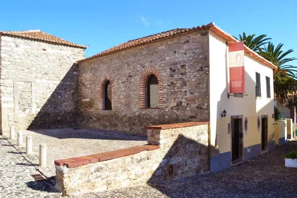
Christopher Columbus House
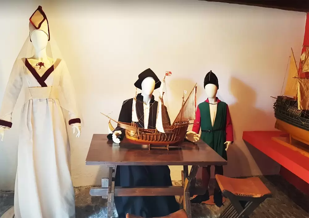
A few metres away is the island’s most famous building, the Christopher Columbus House. Now restored, it is a house-museum exhibiting artefact connecting Don Cristobal Colon with the island’s history.
- Coordenadas: 33.059366,-16.3357
Columbus lived and married here. Filipa de Moniz, his wife, was the daughter of Bartolomeu Perestrelo (captain of the island), and her great-grandparents were from Placencia (Italy).
According to oral tradition, Colon lived in this house, and his marriage had to be authorised by Dom João II. Perestrelo’s other daughter married the 1st captain of Graciosa Island (Azores), Pedro Correia da Cunha – a nobleman descendant of the great Master Paio Peres Correia (who conquered a large part of the Alentejo and Algarve).
In the last room, outside the central patio, there are 2 deposits of grain and small precious items from the Carrock – a Dutch ship of the East India Company that sank off the northern coast (1724).
Fontinha Beach
- Coordinates: 33.057081, -16.335145
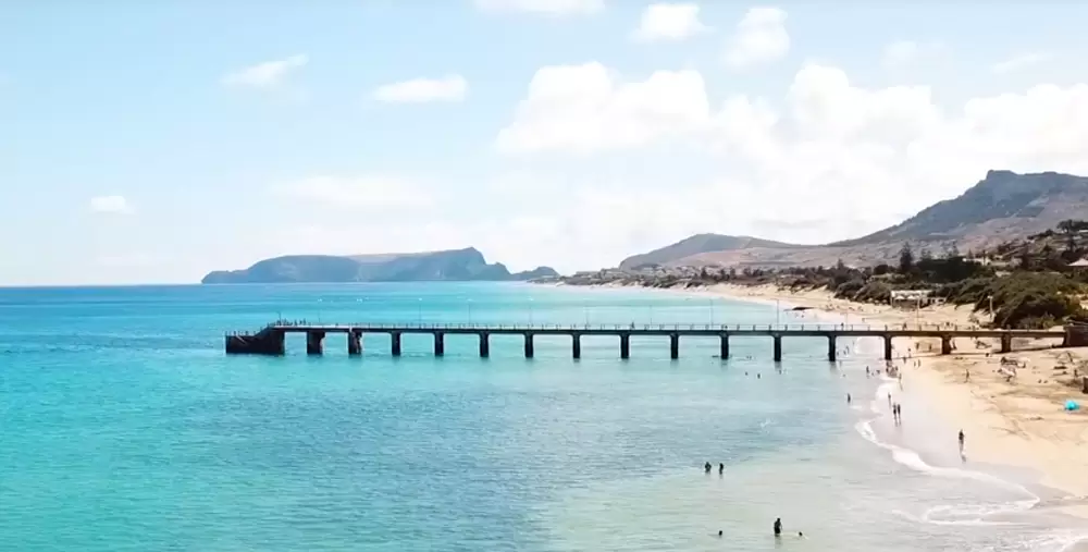
A few minutes walk to the coast reaches the island’s greatest treasure: the Porto Santo sandy beach. Near the centre is Praia da Fontinha, which ends next to the Hotel Torre Praia. It has lifeguards, changing rooms, toilets and access for people with physical mobility problems. Don’t forget the sun cream.
Penedo Beach
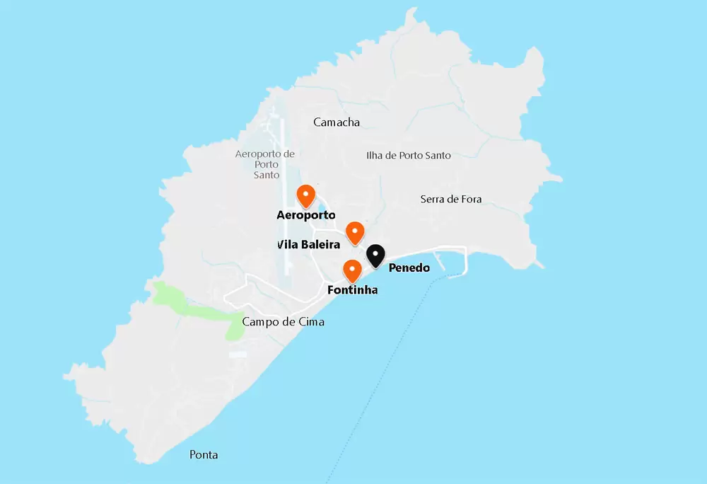
- Coordinates: 33.059887,-16.330071
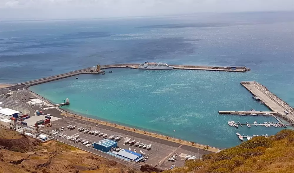
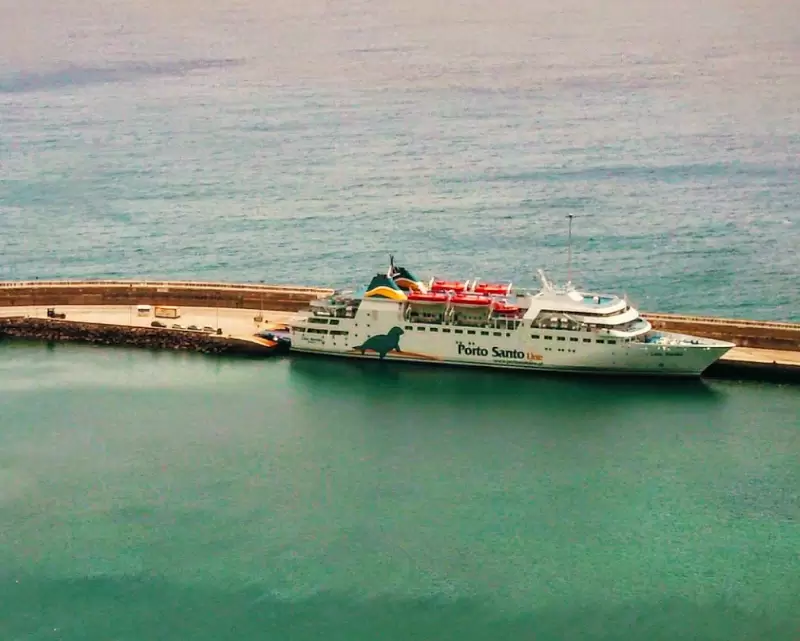
To the east, you can see Penedo beach. Also blue flagged, more isolated, with bar and terrace service. It ends near the port, where the ferry leaves for Funchal in Madeira. It’s a 2-hour and 15-minute trip (about €60 – round trip).
- Coordinates: 33.062382, -16.310535
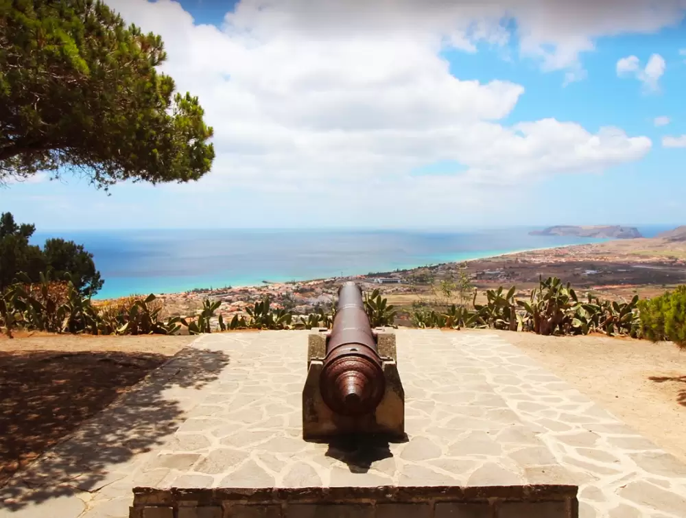
North of the port, on top of a hill, we discover one of Porto Santo’s ex-libris, the Moinhos de Vento (windmills ) used for grinding grain.
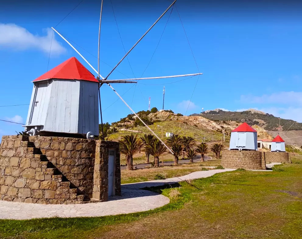
- Coordinates: 33.067725, -16.317334
Food production on the island is scarce, especially in the past. Corn and fish were essential. When there was abundant rain, they had more options: lentils, potatoes and beans.
Portela Viewpoint
- Coordinates: 33.066078, -16.317472
Close by, 100 metres away, is the Portela Viewpoint which offers a beautiful panorama of the harbour and sandy beach
Pedras Pretas Beach
- Coordinates: 33.051648, -16.343409
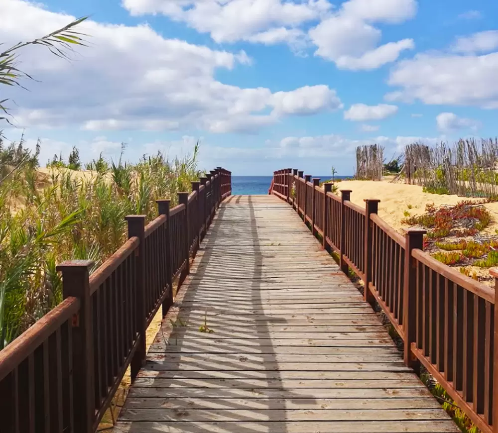
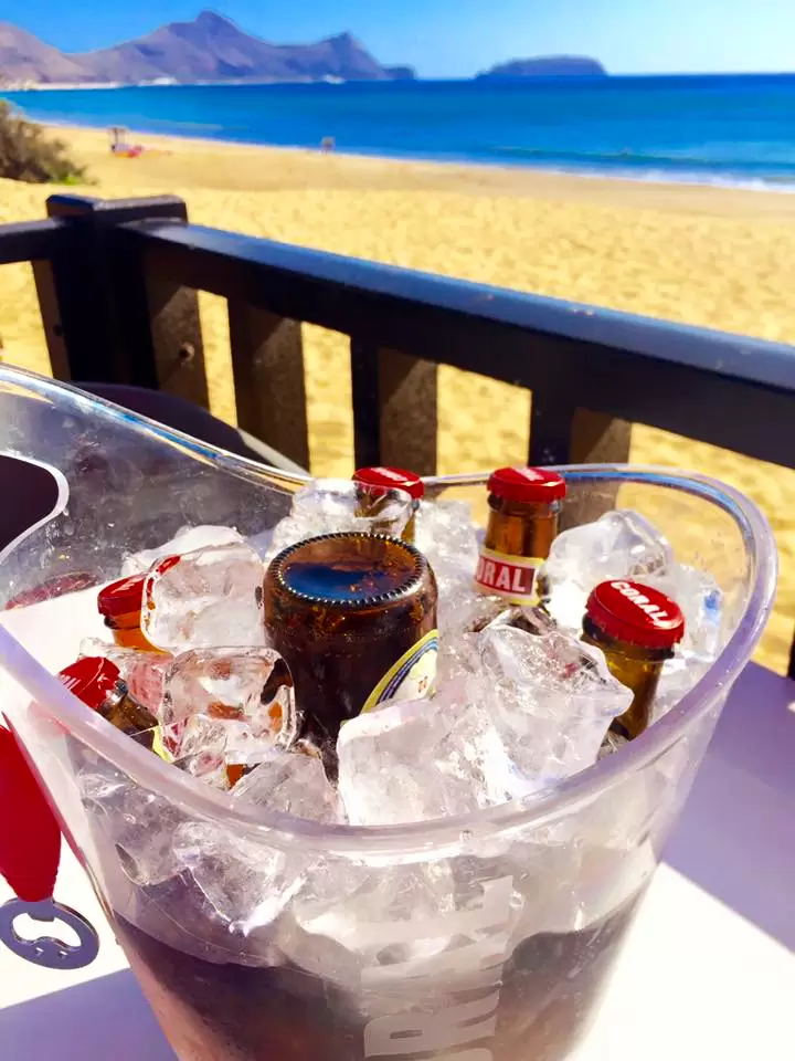
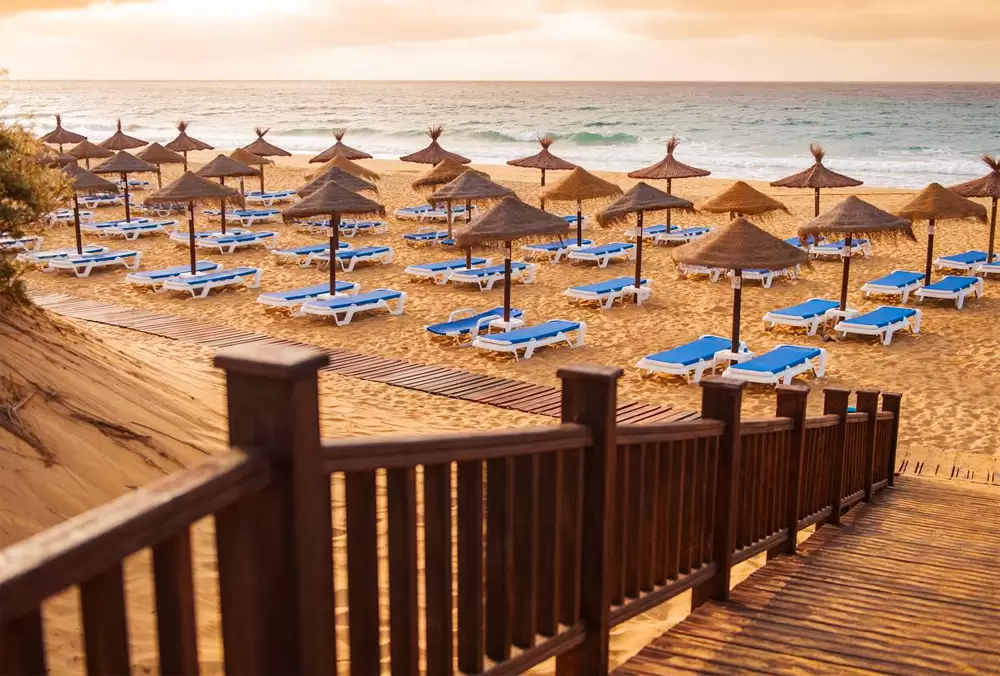
To the west of Fontinha Beach, passing the Hotel Torre Praia, Pedras Pretas Beach begins and is accessed by a wooden walkway. Enjoy a Madeiran beer (Coral) or a gin and tonic at Henrique’s Bar.
Lombas Viewpoint
- Coordinates: 33.055139, -16.342023
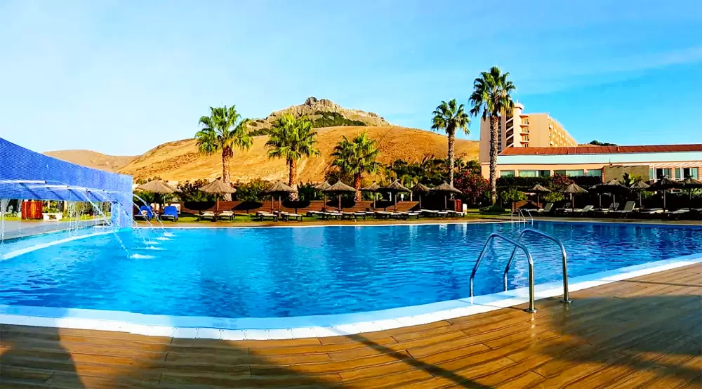
Climbing up from the beach, you will soon spot a small mill converted into a bar (Moínho das Lombas) and the Lombas Viewpoint, a grandiose balcony over the Atlantic. Close to the beach is the Hotel Porto Santo & Spa4-star hotel.
- Coordinates: 33.050470, -16.346413
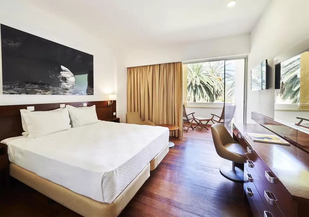
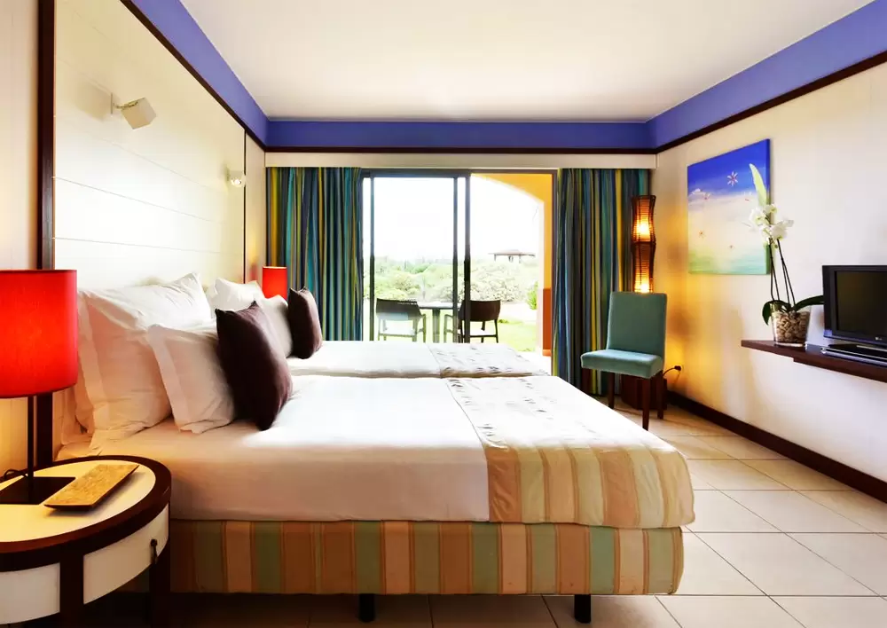
The rooms are comfortable (with a balcony) and serve a good breakfast. Good value for money.
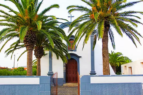
Holy Spirit Chapel
- Coordinates: 33.049465, -16.351728
4 km from Vila Baleira, to the west, is the village of Campo de Baixo with a beautiful 18th-century chapel, Espírito Santo Chapel, erected when there was a vital farming community here.
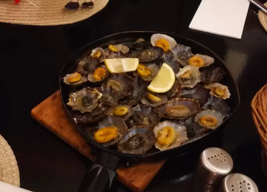
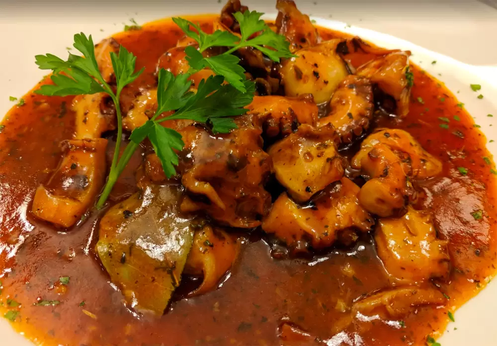
A short distance away, on the same street, is the Casa d’Avó restaurant (Estrada da Calheta, Campo de Baixo) – with a calm atmosphere and great food – try the Octopus à Moda da Avó.
- Coordinates: 33.049140, -16.352277
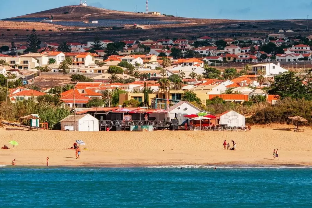
Cabeço da Ponta Beach
The coast of Campo de Baixo is blessed with the Cabeço da Ponta beach surrounded by a cluster of flats, restaurants and 2 large hotels. It is excellent, and guarded, but after dark the entertainment options are limited.
- Coordinates: 33.041283, -16.354517
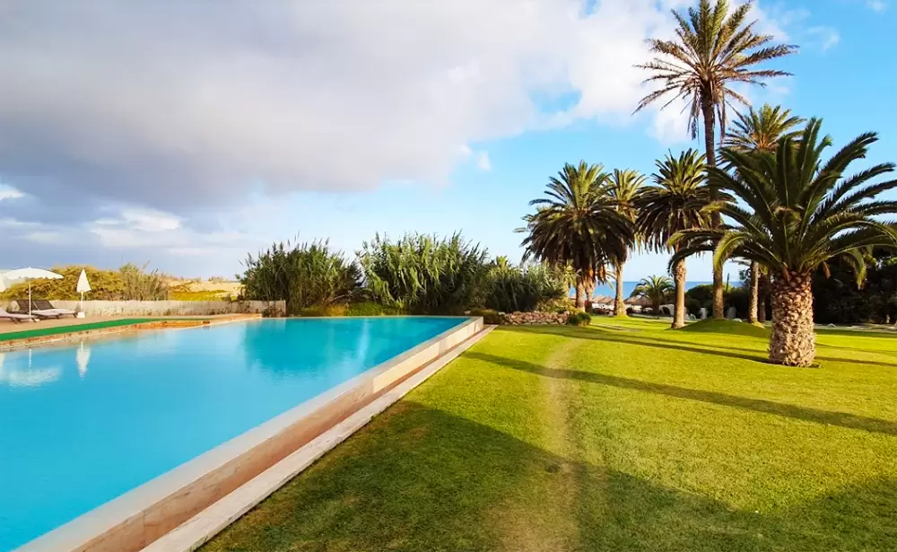
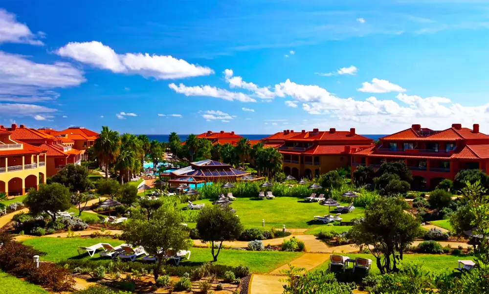
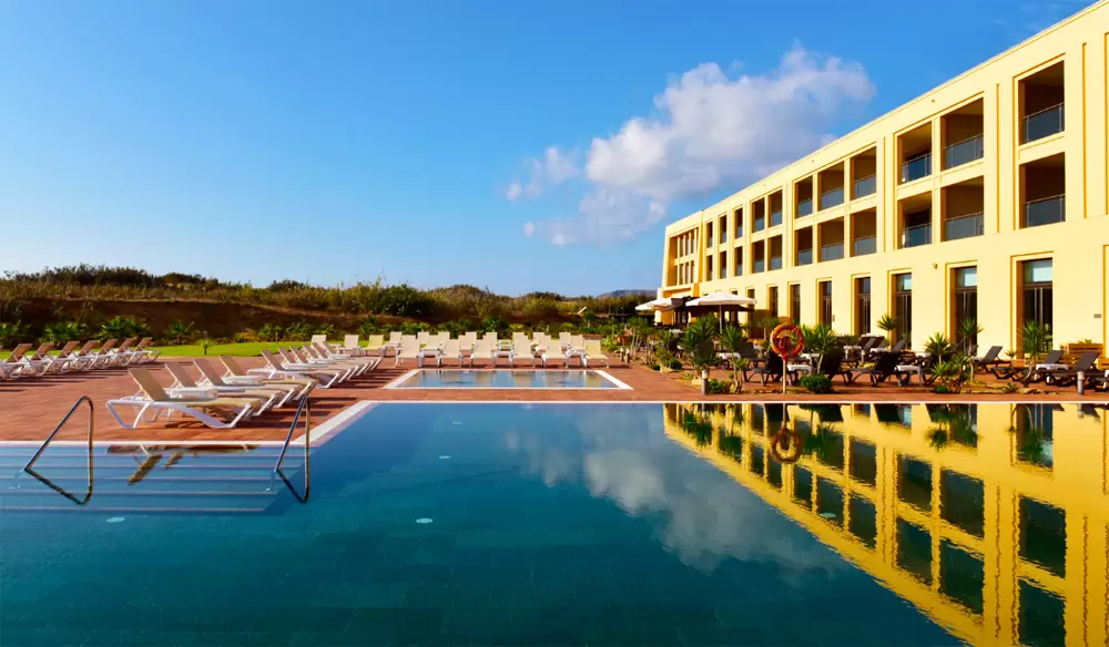
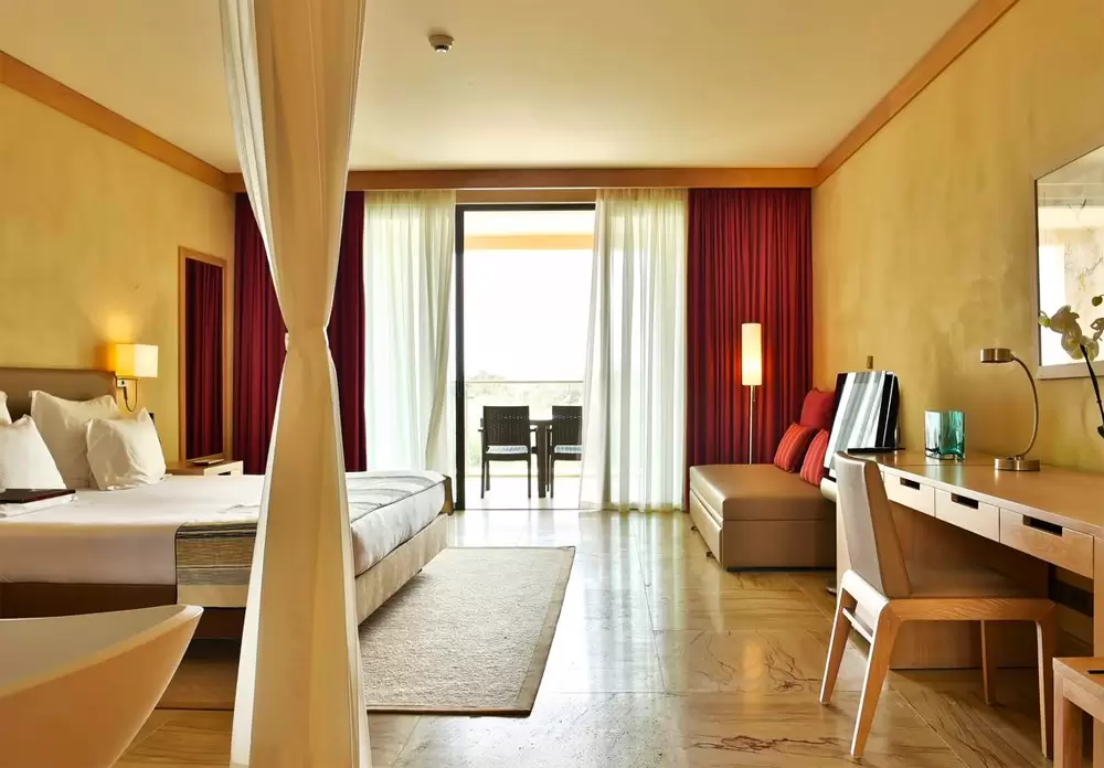
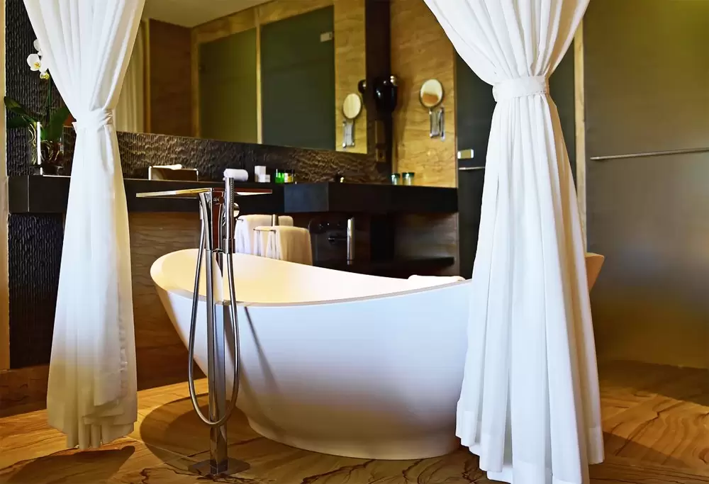
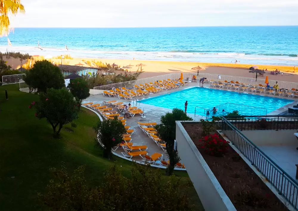
The 2 hotels are from the Pestana Group: the 1st is the 5-star Pestana Porto Santo Beach Resort & Spa, with 2 outdoor pools, 4 restaurants and 30,000 square metres of garden. The rooms are spacious.
- Coordinates: 33.043565, -16.355110
The 2nd is the 5-star Pestana Colombos Premium Club Resort, with rooms and flats (of 2 bedrooms). It shares common areas with the Pestana Porto Santo Beach Resort & Spa (gardens, pools, spa, gym, restaurants…). The rooms are comfortable and the staff helpful.
- Coordinates: 33.043697, -16.354923
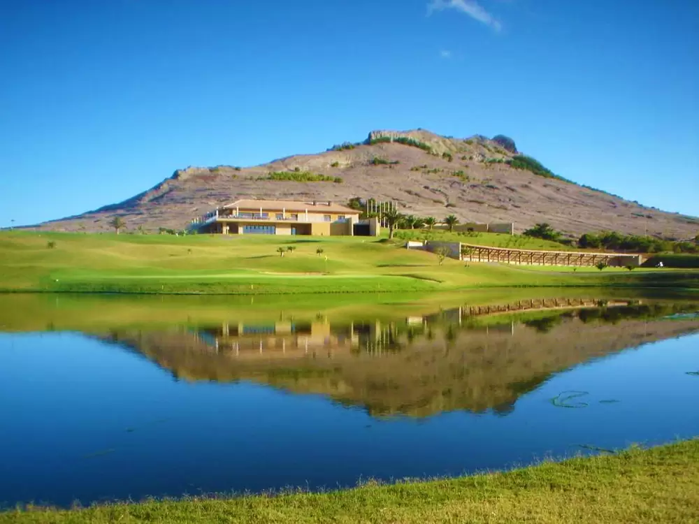
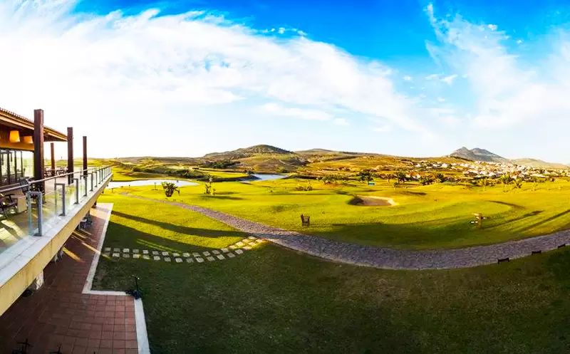
Porto Santo Golf
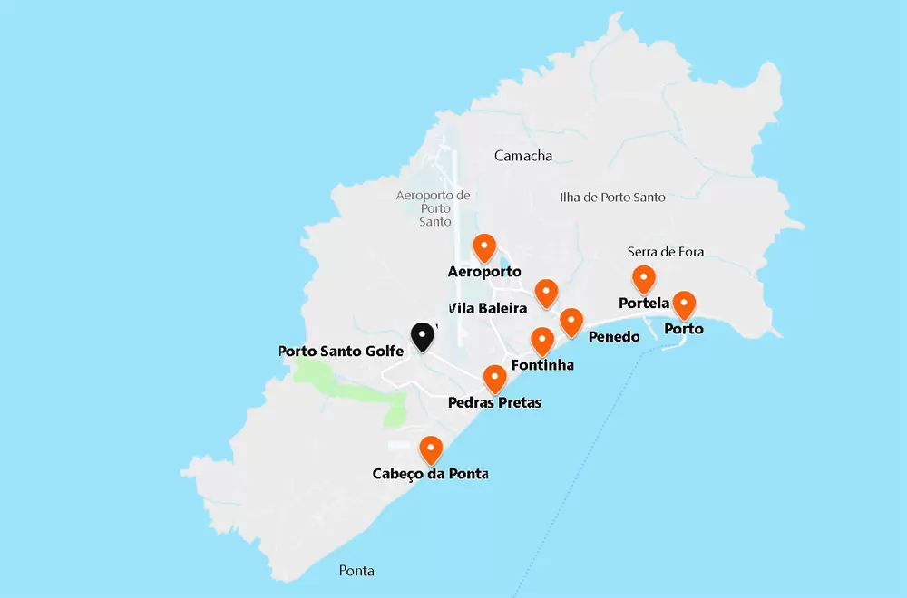
- Coordinates: 33.0577777, -16.3559653
It’s a quick walk to Porto Santo Golf (in Sítio das Marinhas). Developed by the golfer Severiano Ballesteros. Porto Santo Golf Course is more extensive and challenging than the courses in Funchal.
The greens and fairways stand out in clear contrast to the arid surroundings. Beginners cannot use the course but can take 30-minute lessons. The clubhouse is a modern mix of stone, glass and bamboo dotted with cacti.
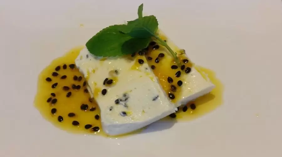
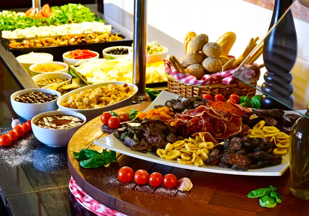
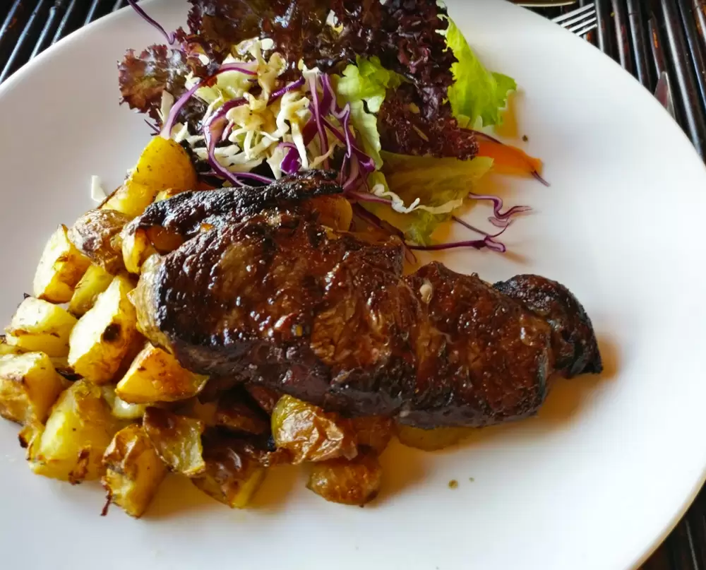
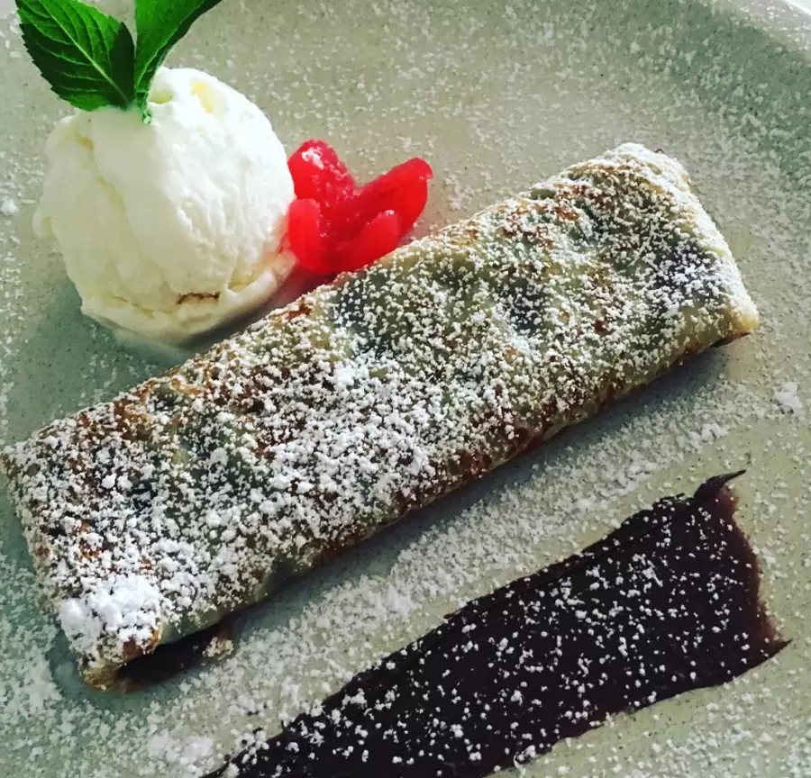
Enjoy a fine meal at the Porto Santo Golf Restaurant: good starters and delicious main courses – try the Chocolate Volcano dessert.
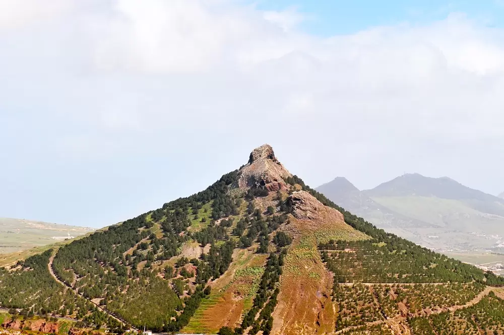
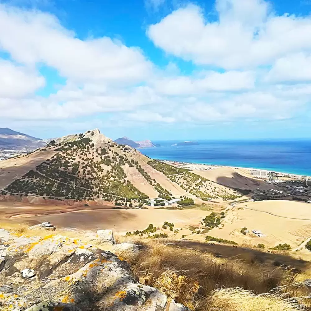
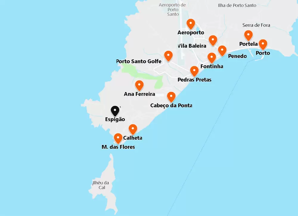
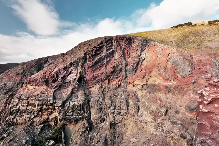
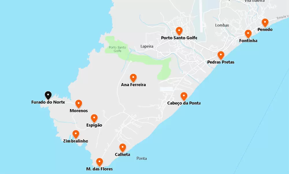
Ana Ferreira Peak
A road to the west takes you to Ana Ferreira Peak (283 metres). The slopes now eroded by the wind stand out.
A magnificent set of prismatic disjunctions resulted from the stresses that occurred during the magma cooling process. Rocha dos Bordões, on the island of Flores, also has a magnificent set of prismatic disjunctions.
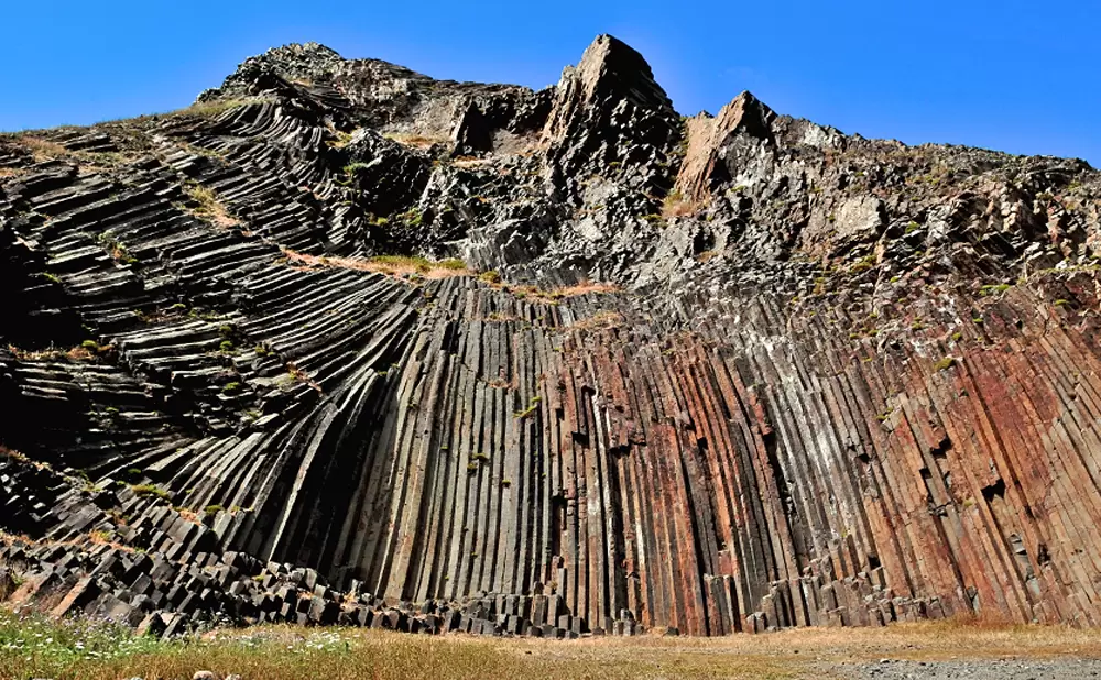
- Coordinates: 33.045943, -16.369837
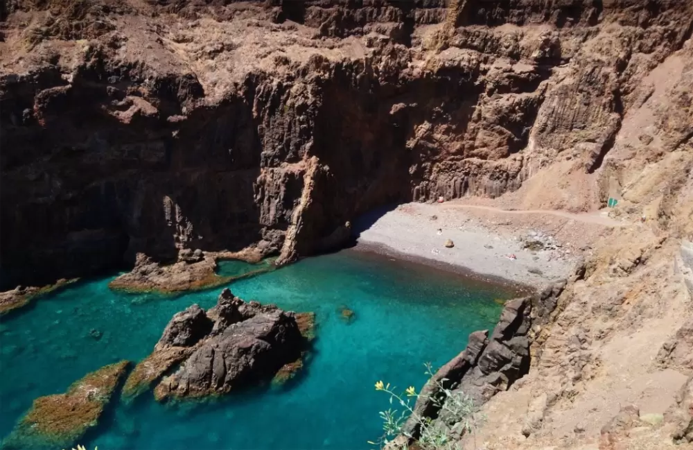
Ponta da Calheta
As you continue westwards, you reach the small Calheta Beach. It is the last beach of the long stretch of sand that makes Porto Santo so popular.
- Coordinates: 33.024553, -16.37970
At Ponta da Calheta, the sand gives way to sculpted volcanic rock. The only building is the Ponta da Calheta Restaurant, which is excellent for watching the sunset.
Between Praia da Calheta and Praia do Cabeço da Ponta, there are two good options for accommodation Hotel Vila Baleira Porto Santo; the first is the 4-star hotel with an indoor pool. The 2-bedroom flats are simple.
- Coordinates: 33.037344, -16.362501
The other option, very close by, is the Vila Baleira Suites (4 stars): flats, spacious with kitchenette and balcony. You will find a good breakfast and good value for money.

- Coordinates: 33.037353, -16.360905
Flores Viewpoint
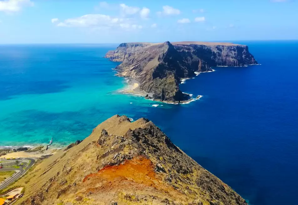
Off the main road, past the Porto Santo Horse-riding Centre, a bend takes you to the Flores viewpoint: a magnificent vantage point overlooking the Ilhéu da Cal from where, in the past, there were lime extraction mines.
- Coordenadas: 33.024649,-16.380029
The viewpoint is marked by a statue of the painter Francisco José Peile da Costa Maya (20th century), whose works on Porto Santo are scattered in several countries. He asked to be buried at sea: between this point and the Ferro islet.
Espigão Peak
- Coordinates: 33.035695,-16.381588
Turning your attention inland, Espigão Peak claims our attention. It reaches an altitude of 270 metres, and you’ll have expansive views of the south coast.
Zimbralinho Beach
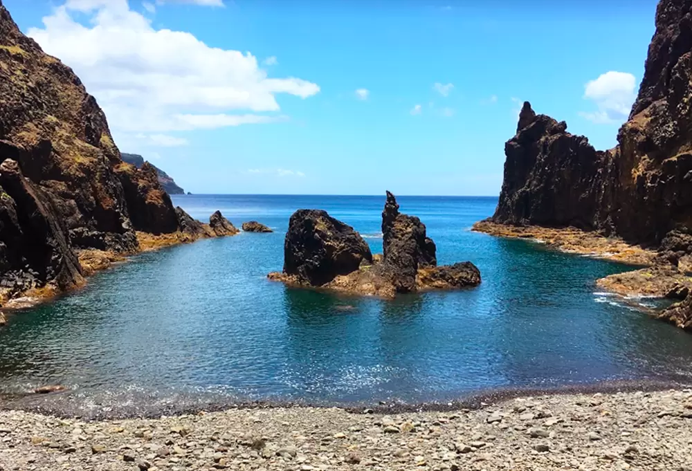
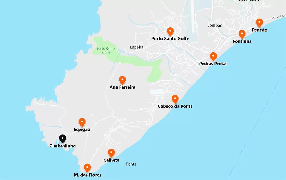
- Coordinates: 33.031695, -16.387180
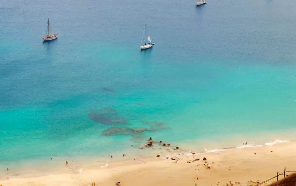
1 km from the Miradouro das Flores you have Praia do Zimbralinho. Small, wild, still unknown to many. Accessed by a dirt road. If you like fantastic beaches, you will love this excellent spot for snorkelling.
Morenos
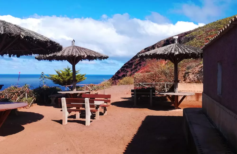
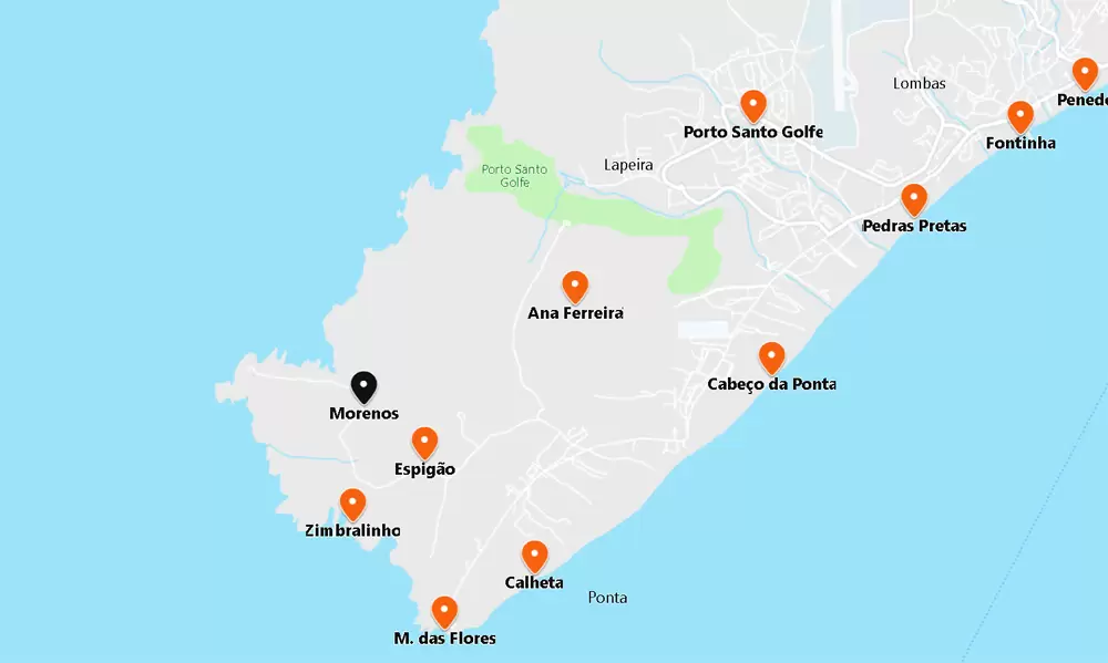
Coordinates: 33.039348, -16.386323
The road north continues to the Morenos Leisure Area, 5 minutes from the beach. Discover wooden tables, barbecues and views of the Ilhéu do Ferro islet.
Don’t miss the opportunity to appreciate the part of the coastal cliff of Morenos with the network of fissures that cut the rock, the product of several volcanic stages that formed the golden island.
- Coordinates: 33.040532, -16.387232
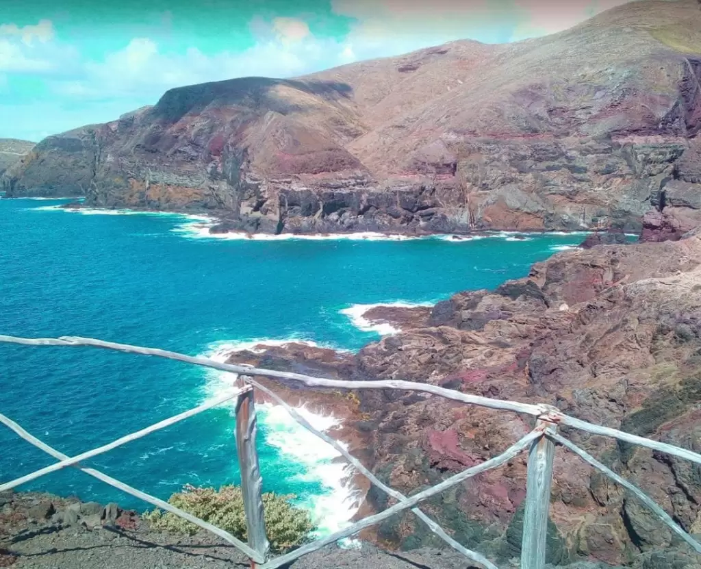
Furado do Norte viewpoint
If you continue along the dirt road, you will reach the Furado do Norte viewpoint – near Ponta da Canaveira and the Ilhéu de Ferro (only 400 metres away). The view is excellent for watching the sunset.
- Coordinates: 33.041506, -16.395510
Quinta das Palmeiras
To the north of Vila Baleira, 10 minutes by car, emerges Quinta das Palmeiras in one of the aridest areas of the island. It is a small oasis, a mini botanical zoo of fruit trees, vines and exotic plants. It has peacocks, toucans, parrots and a lake with ducks and swans. It is delightful.
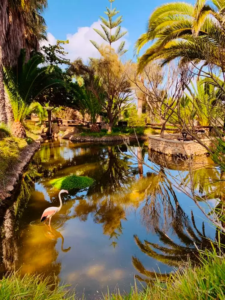
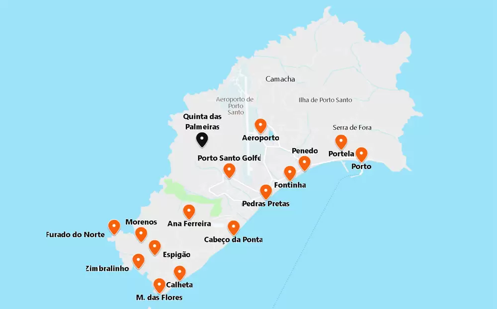
- Coordinates: 33.066716, -16.365301
The principal settlement in the north, Camacha, is a cluster of houses on a hillside overlooking the rocky coast. Very close by, a 5-minute drive is Fonte da Areia – once the leading water resource in the area.
The water is said to have healing powers and was bottled and sold for a time. The process became economically unviable. A series of palm trees have grown around it – a tranquil spot for a picnic.
Fonte da Areia Viewpoint
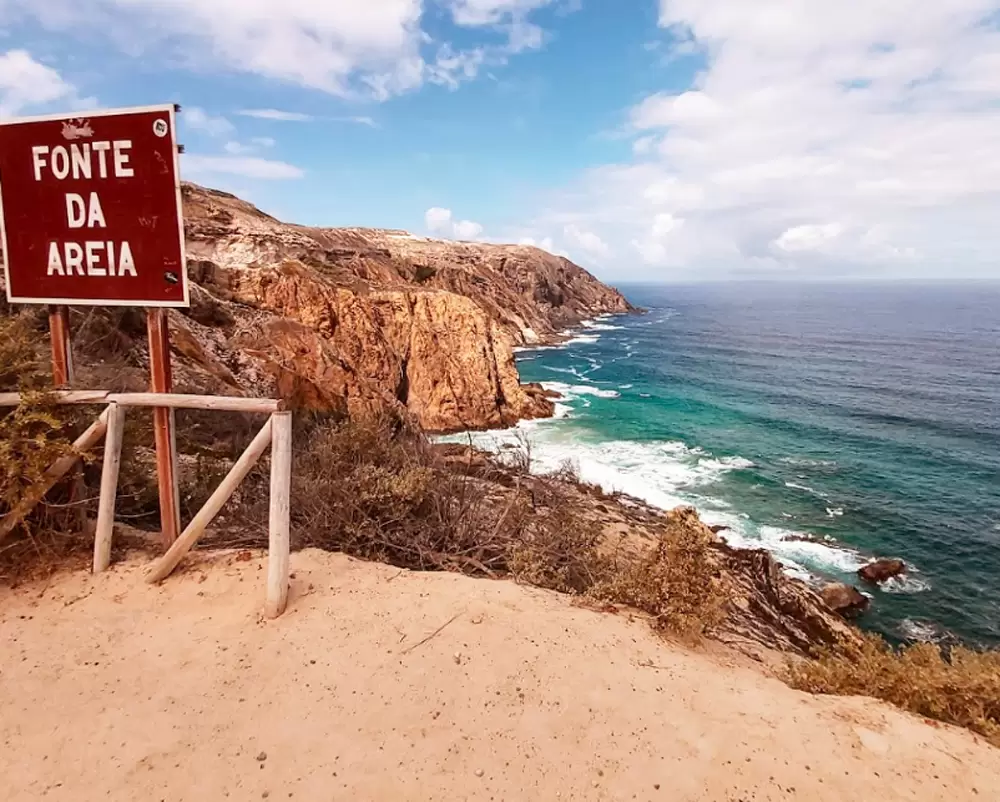
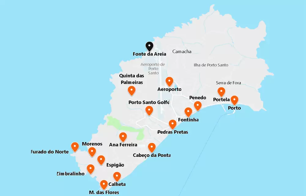
- Coordinates: 33.086381, -16.355800
Fonte da Areia Viewpoint offers views of the dramatic cliffs and Fonte da Areia Islet in the shimmering sea.
Porto das Salemas
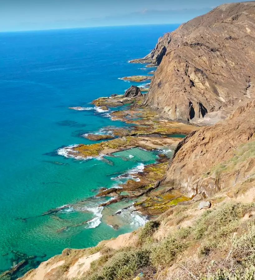
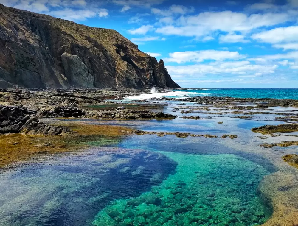
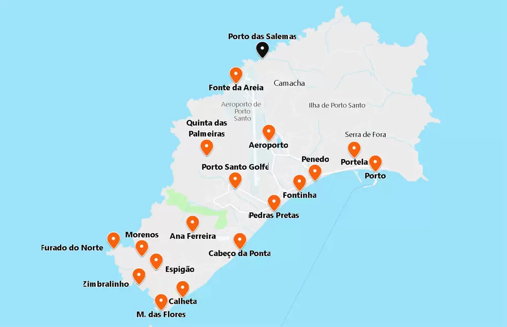
- Coordinates: 33.093209, -16.347178
The charming Porto das Salemas is 500 metres from Camacha. A trail, which is not particularly easy, invites you to descend to the little refuge that is still little known.
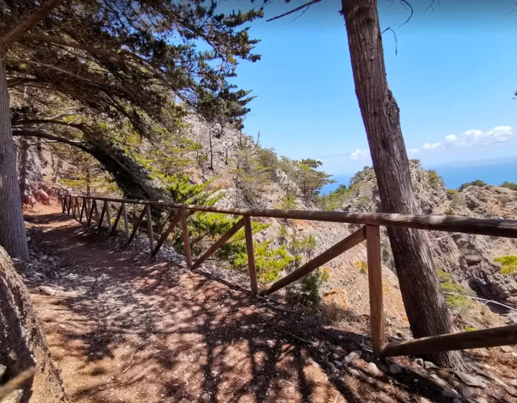
PS PR2 Pico Castelo Footpath
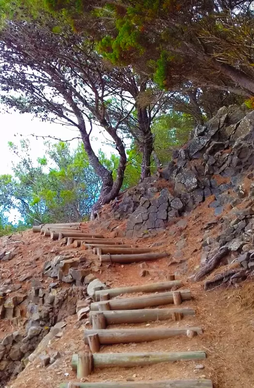
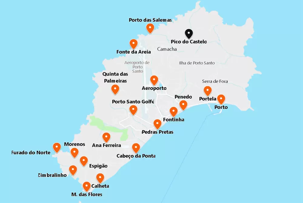
- Coordinates: 33.090800, -16.327207
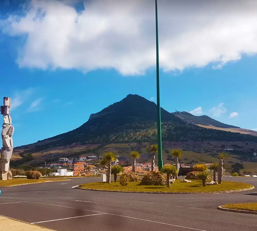
You will have the opportunity to go around the island’s highest peak (516 metres altitude). It starts in Moledo, 2 km from Camacha at the foot of the Regional Road. You have 2 options: the north side of Pico do Facho (3,2 km – 1:30 hours) or the south side (4,5 km – 2:15 hours).
The walk provides magnificent views from where Aleppo Pine trees abound (introduced to the island to lessen the impact of erosive agents).
At the top of the Castle, we see a statue of António Schiappa de Azevedo’s primary person responsible for the reforestation of this area. There is a beautiful silence, with the occasional bird singing.
After the climb, you arrive at the viewpoint at Pico do Castelo with excellent views of the airport and Vila Baleira. A canyon is what remains of the twelve that once stood on the mountain; it was part of the 17th-century fortifications network.
- Coordinates: 33.080705, -16.333927
From the viewpoint, a trail climbs to the summit. It then continues to Pedragal, an abandoned farm. It is a relatively easy descent back to Camacha.
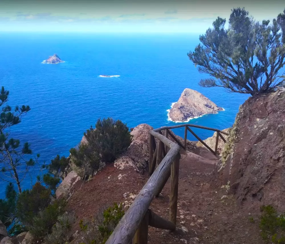
PS PR1 – Pico Branco and Terra Chã Footpath
- Coordinates: 33.096713, -16.314656
A couple of kilometres to the east (5 minutes by car), the start of another walk appears on regional road ER 111: PS PR1 – Vereda do Pico Branco e Terra Chã, which gives you access to the 2nd highest peak in Porto Santo.
The 2.7 km walk takes one and a half minutes: designed initially for pack donkeys. It’s easy to do through a diverse landscape of scrubland, semi-desert and forest. First, it climbs to a fault known as Cabeço do Caranguejo rock.
The scenery changes to a more forested environment: cypress trees, native to southern Europe, predominate. Soon you see a fork in the road. To the right, you climb up to Pico Branco (450 metres high) and pass many endemic species.
If you go left, the path continues to Terra Chã, the north-eastern tip of the island, where the Furna dos Homiziados is located – used as a hiding place when Barbary pirates (at the time of the Ottoman Empire and present-day Algerian territory) attacked the island.
Serra de Dentro
It is 2 km to Casa da Serra (18th century) on the regional road heading south. It is an ethnographic museum that tells the story of traditional life. Take the opportunity to taste the passion fruit liqueur and enjoy the honey and almond biscuits.
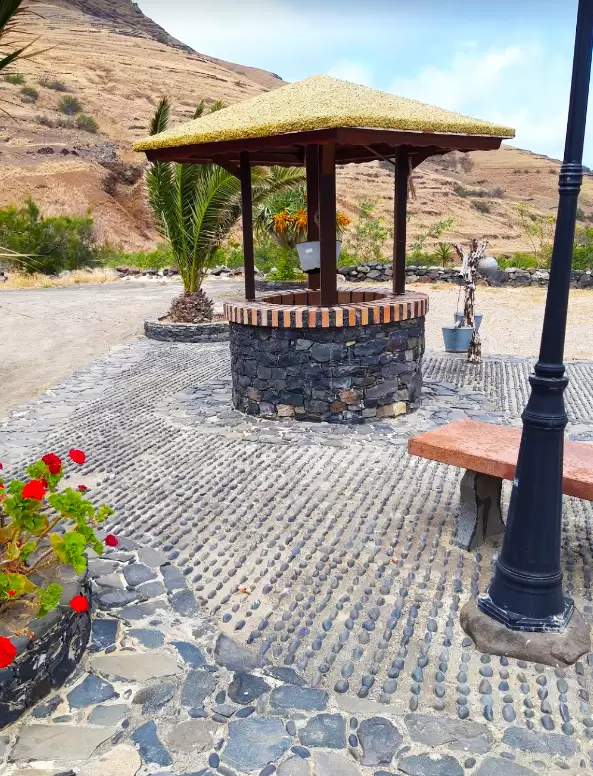
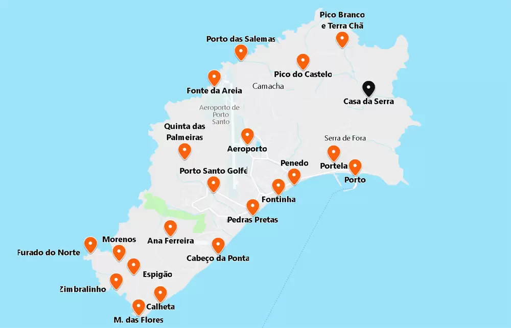
- Coordinates: 33.083466, -16.306193
The Serra de Dentro valley used to consist of agricultural land. Over the years, drought gave way to rows of terraces, leaving it almost a ghost village of rural buildings. The valley is great for bird-watching, including falcons and crested hoopoes.
Porto dos Frades
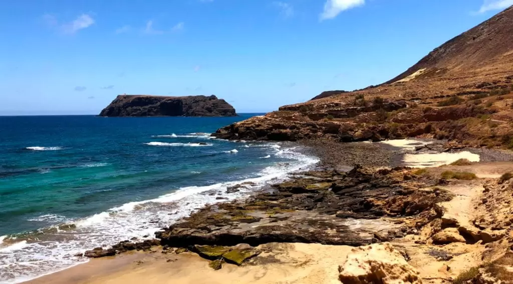
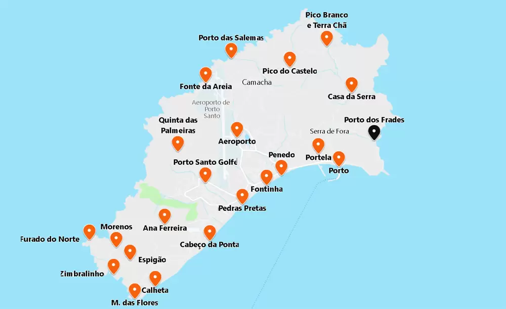
- Coordinates: 33.069826, -16.298569
Continuing south along ER 111, you reach Serra de Fora. Turn right, towards the coast, to go to Porto dos Frades. It is a pebble beach but of immense beauty, with the Cima islet hundreds of metres away.
During Zarco and Tristão’s 2nd voyage, they met 2 Franciscans shipwrecked on their way to the Canary Islands – they wanted to evangelise the Guanches (native people of the Canary Islands). Zarco and Tristão took the friars to Madeira.
They were joined by Portuguese friars and founded the Convent of São Bernardino in the parish of Câmara de Lobos.
- Coordinates: 33.070321, -16.299505
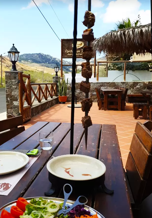
Nearby is the Porto dos Frades Restaurant: it serves regional cuisine, namely the traditional Madeiran espetada (the Octopus à Porto dos Frades isn’t bad either). It’s not expensive, and the portions are generous.
Nossa Senhora da Graça Chapel
- Coordinates: 33.073713, -16.323673
Returning to the regional road mere minutes, you see the Portela viewpoint and the harbour below – already close to the row of windmills. At the top of the hill is the Nossa Senhora da Graça Chapel (15th century) – one of the oldest on the island.
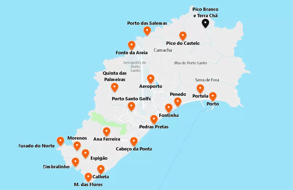
Things to do near Porto Santo:
[td_block_6 custom_title=””” post_ids=”987, 1005, 1011″