

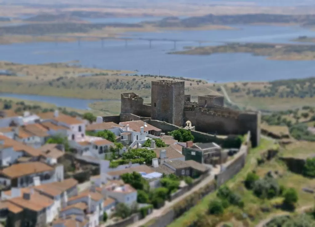
The landscape around Monsaraz has a magical quality, a stunning panorama of sun-kissed and carefully cultivated fields: it is the Alentejo in its most rural version.
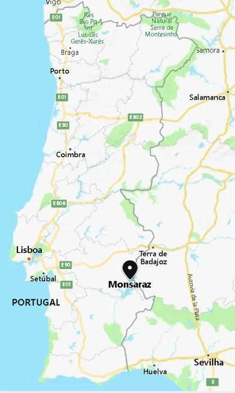
Reguengos is the area that grew around the old village Monsaraz. It is one of those places worth visiting for the views, food, wine, and the local megalithic stone circuit.
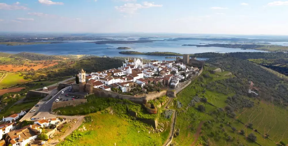
Monsaraz
Known locally as the Eagles Nest – the fortified village rises above the vast plains, entirely contained within walls. To the east, the ancient river Guadiana delineates the border with Spain.
The town is entirely pedestrianised, with only two main and parallel streets: Rua Direita and Rua de Santiago, with the main church in the centre. The population is only a few hundred. Torre das Feiticeiras, at the edge of the village, is part of a chain of frontier forts that continue south and north. The views are magnificent.
When the Moors were expelled (1167), the village was given to the Knights Templar and later to their successors: Christ Order. One of the knights of Monsaraz, João Lourenço, will be the 2nd Master of the Order of Christ.
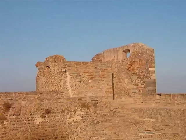
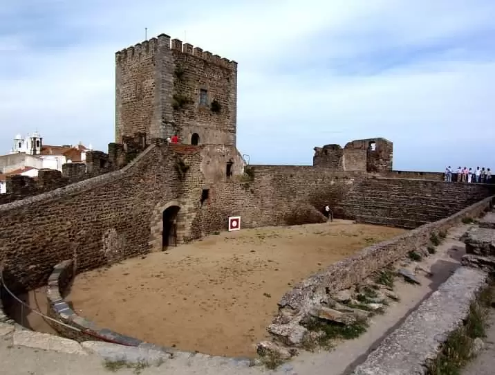
Castle of the Village of Monsaraz
- Coordenadas: 38.44244,-7.381477
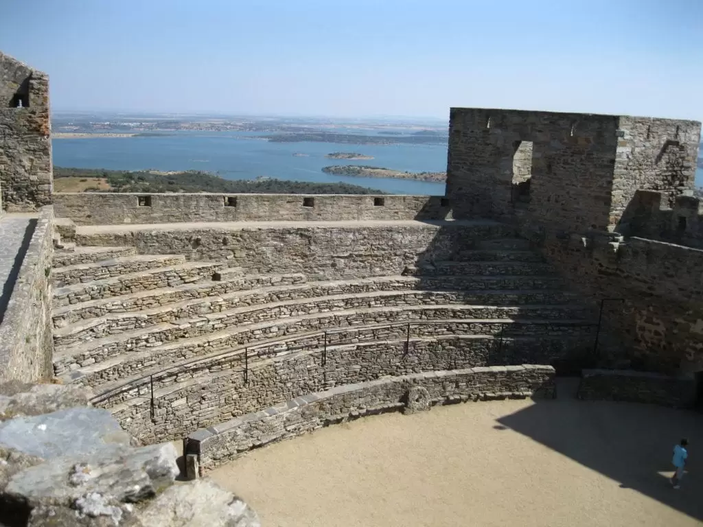
The beautiful Castle of the Village of Monsaraz (14th century) was built by Dom Dinis. Later it was converted into a bullring. The annual festival, 2nd week of September, has bullfights and concerts.
The castle is a tourist gem and one of the best viewpoints of the Alqueva dam reservoir: an immense lake 80 km long, with a water mirror measuring 250 km².
There are half a dozen houses along the street right that advertise rooms for rent. Prices are similar, and good choices include A Casa Dom Nuno, Casa Dona Antónia.
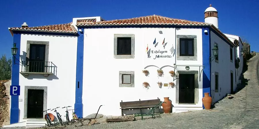
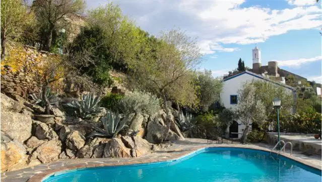
Estalagem de Monsaraz
There is also a small inn, the Inn of Monsaraz, in Largo São Bartolome, outside the castle walls but close to the village with 1 dozen charming rooms, a garden and a pool. In summer, it is best to book in advance.
- Coordenadas: 38.426028,-7.534472
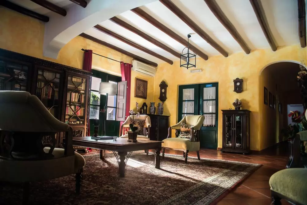
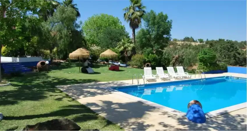
Monte Alerta
Below are reasonable rural tourism accommodations, including Monte Alert, a couple of km from Monsaraz. It has 8 beautiful rooms, a pool, spa and garden. The chaste decoration of the monte alone is worth a visit.
- Coordenadas: 38.447972,-7.365556
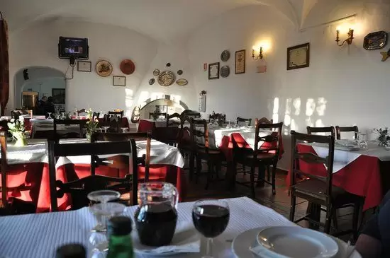
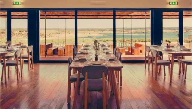
In the heart of Monsaraz, there are a couple of cafes and 4 interesting restaurants – they feed the avid visitors.
The Santiago, with its open-air terrace, offers the best views, but Casa do Forno and O Alcaide also provide good food at moderate prices: Alentejo meat specialities like roast lamb.


- Coordenadas: 38.443408,-7.380682
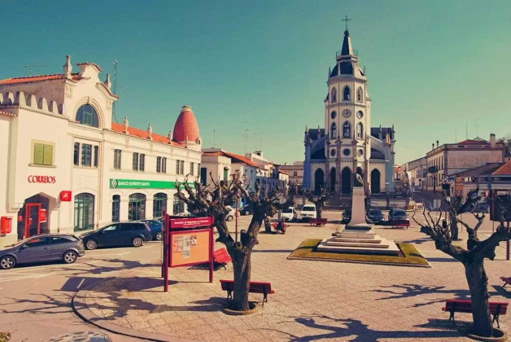
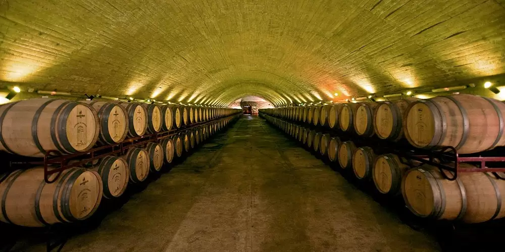
José De Sousa Winery
In the town Reguengos de Monsaraz, a 15-minute drive along the M514, there is a unique winery in the world. The José de Sousa Winery uses giant clay amphoras in an ancient and rare fermentation method inherited from the Romans over 2000 years ago.
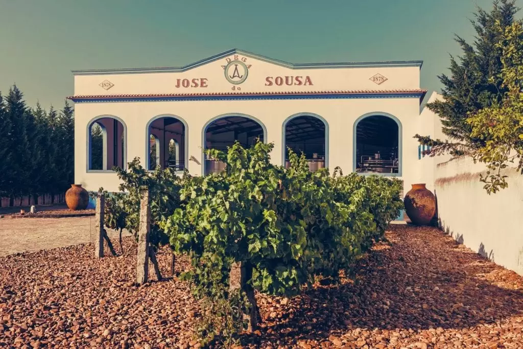
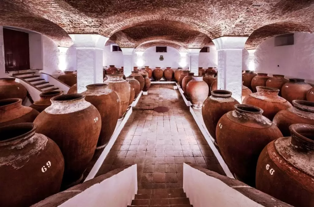

- Coordinates: 38.424789,-7.529891
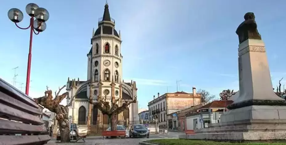
St. Anthony’s Church
- Coordinates: 38.424232, -7.534449
Walk 10 minutes towards the Largo da Fonte Nova and arrives at the precious Church of Santo António (19th century), designed by António José Dias da Silva, also responsible for the Campo Pequeno Bullring in Lisbon.
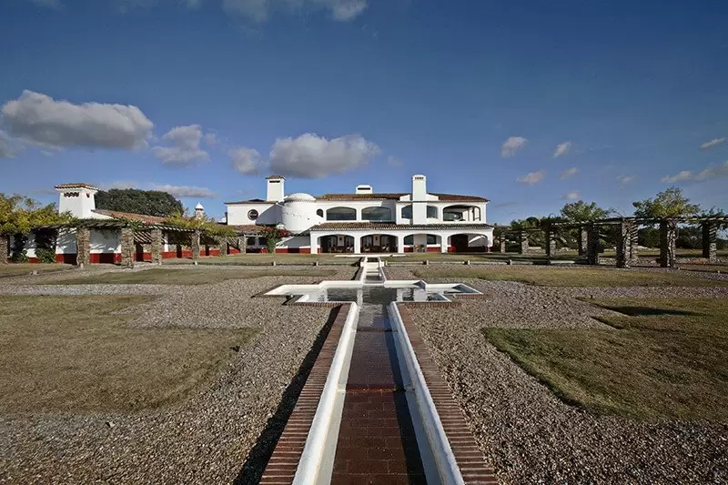
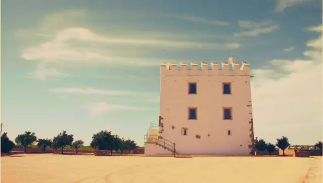
Herdade do Esporão

- Coordenadas:38.379763, -7.560300
Just 10 minutes from the church, and 25 minutes from the village Monsaraz, comes the seductive 700-hectare Herdade do Esporão – one of Portugal‘s most prominent wineries.
Take a walk through the estate’s farm and get to know its delicious wines and wine and olive oil production.
The estate has around 80 hectares of olive trees. The 15th-century Tower of Esporão, built by Álvaro Mendes de Vasconcelos, still stands on the estate. Close by, there is a thousand-year-old olive tree.
- Coordenadas: 38.3911811,-7.5521153
Alqueva Lake Observatory
5 minutes away from the village (by the M514 and CM1127), you reach the observatory of Lake Alqueva. At dusk, learn how to orient yourself by the polar star and know all the constellations and legends.
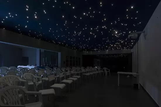
- Coordinates: 38.443106, -7.367102
River Beach of Monsaraz
2 km to the southeast, we discover the blessed blue-flagged Monsaraz Fluvial Beach. It is guarded, with parking, a good infrastructure of bathing support and a small bar. Don’t forget the sun cream.

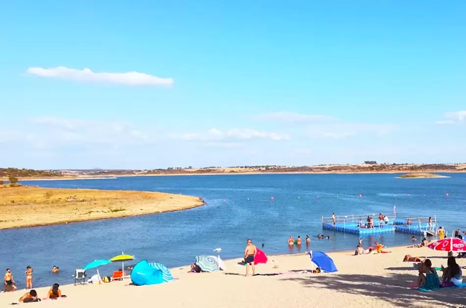
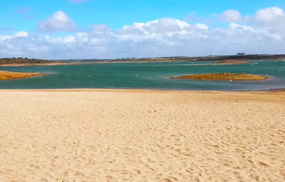
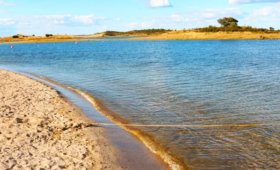
- Coordinates: 38.434609, -7.350260
Megaliths around Monsaraz
4000,000 years ago, the region around Monsaraz was an important megalithic centre: dolmens (temples or covered tombs), menhirs (standing stones), and stone circles still survive. A circuit from the village takes you to 4 examples.
Xerez Cromlech
The nearest to Monsaraz, 1.5 km below the village, is the most impressive: Xerez Cromlech, a square of 49 granite stones and in the centre, one stands 4 metres high – probably the site of fertility rites.
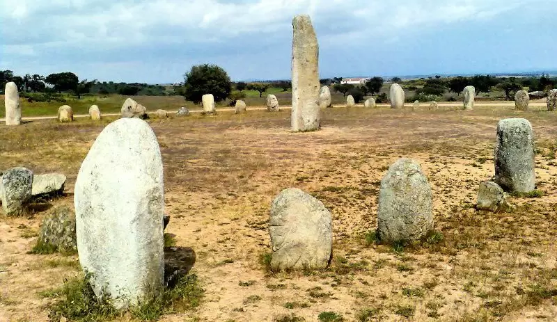
- Coordenadas: 38.453433,-7.371001
Bulhoa Menhir
Back in the car, follow the signs to Telheiro, and then take the road Outeiro. Just before Outeiro there is a blue “Menir” sign that guides you to the Bulhoa: a magnificent 5-meter-high rock visible from the road. 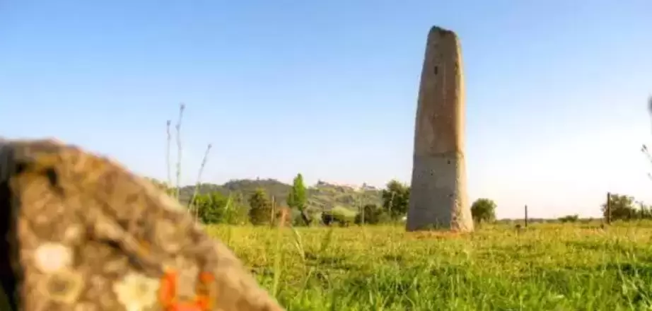
- Coordenadas: 38.462277,-7.382732
Valentine’s Rock
Follow the road through Outeiro, Barrada and Motrinos and turn right towards Reguengos. Just before São Pedro do Corval, you have Rocha dos Namorados: the large mushroom-shaped rock used in fertility rituals. 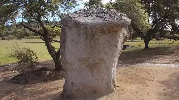
- Coordenadas: 38.445068,-7.475537
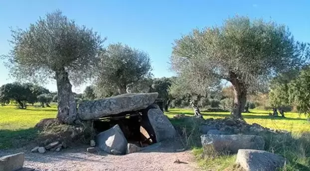
Antas do Olival da Pega
As you turn back along the main road towards Monsaraz, 1,5 km from Telheiro, there’s a sign marking the Antas do Olival da Pega: a 4000 thousand-year-old dolmen hidden in a grove of olive trees.
What to visit Near Monsaraz:
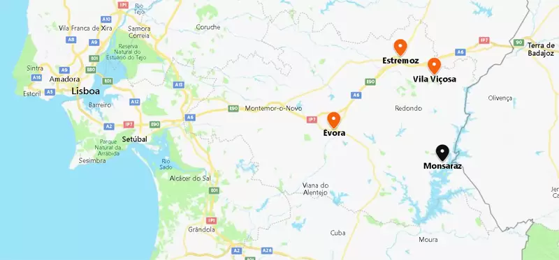
Évora is 35 minutes away (by IP2 and N256), Vila Viçosa is a 55-minute drive (by N255), and Estremoz is 1 hour away (by N255).