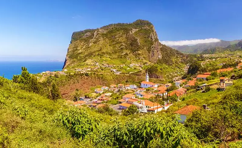
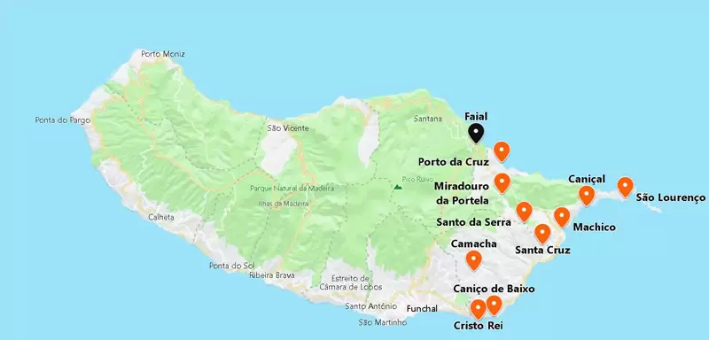
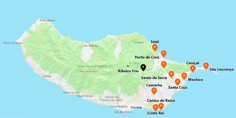
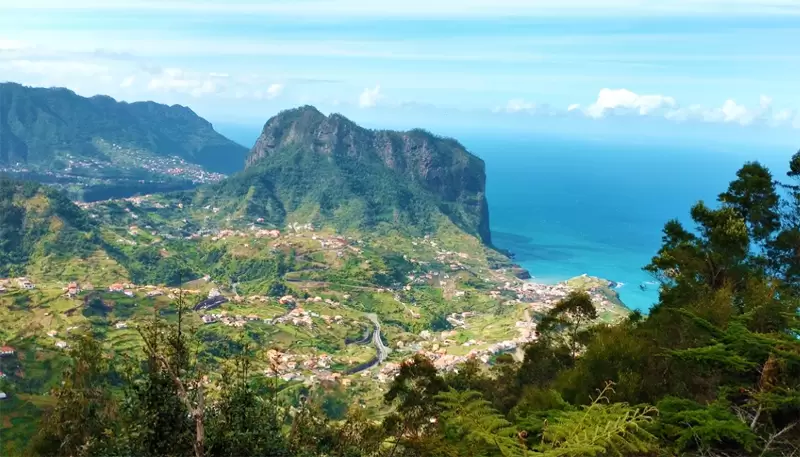
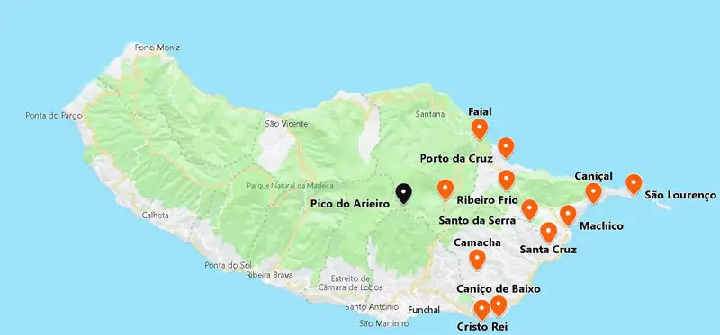
Penha de Águia and Faial
- Coordinates: 32.789219, -16.853188
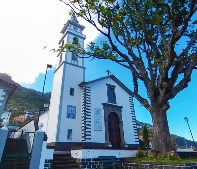
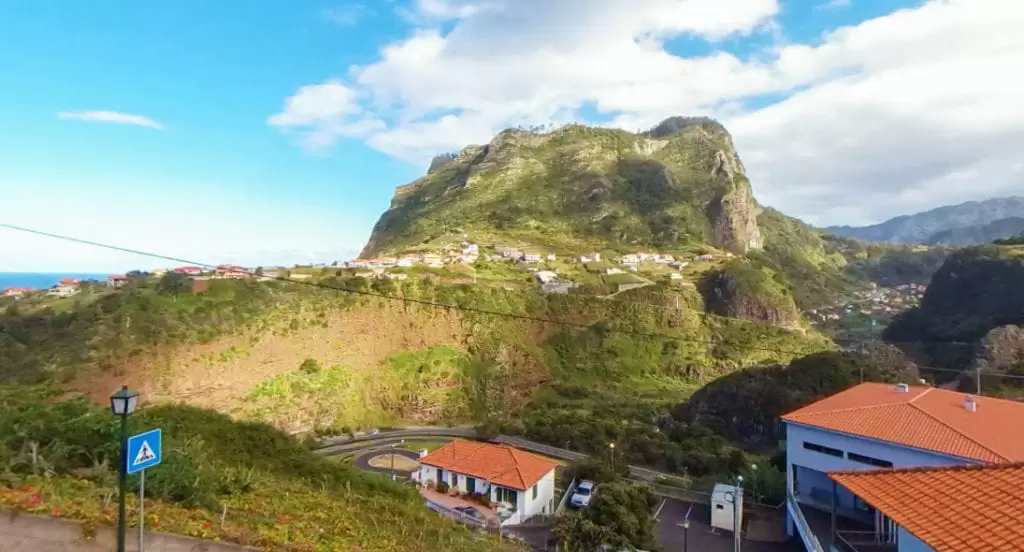
Five miles away comes tranquil Faial and the ubiquitous Penha de Águia Peak. The best is to contemplate its beauty from Faial, namely from its church being the centre of the lively Festa da Nossa Senhora da Natividade (in mid-September).
- Coordinates: 32.789044, -16.853018
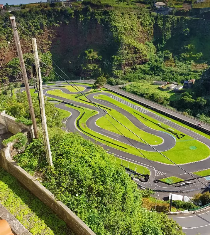
From Faial, a road crosses the deep valley of Ribeira Seca. Near a bridge is the Kartódromo do Faial (track of 1040 meters) of unique atmosphere – costs about 20 euros per person (15 minutes of pure fun).
- Coordinates: 32.787958, -16.852091
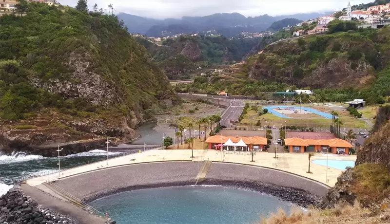
Continuing on the road towards the coast, we reach the Foz da Ribeira do Faial bathing complex: with a saltwater pool, restaurant, and changing rooms, culminating in a rocky beach.

The Miradouro do Guindaste provides a beautiful view of the island’s complex and coast.
- Coordinates: 32.793971, -16.849333
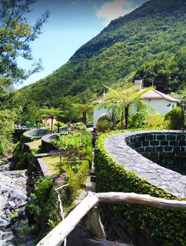
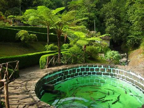
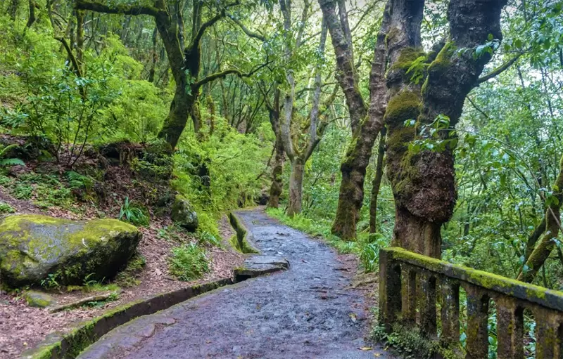
Ribeiro Frio Forest Park
In the island’s interior, halfway between the north and south coasts, is Ribeiro Frio: a wooded, isolated valley that receives little sun. The hydrangeas and orchids colour the gardens surrounding the government-run trout farm.
- Coordinates: 32.738963, -16.887248
The surrounding forest, Laurissilva, is a natural heritage of humankind – with botanical species that once existed in southern Europe and survived on the Macaronesian islands(Madeira, Azores, Canaries, Cape Verde) – in Madeira, the forest occupies 20% of the island.
The forest is the backdrop for exciting walks: the most popular is the Balcões Footpath (1.5 km – 1 hour 30 minutes) to the Balcões viewpoint, which rewards you with breathtaking views over the island’s high peaks.
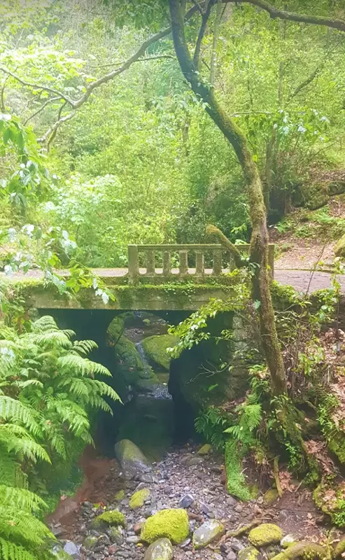
A walk (signposted towards Portela): Levada do Furado – 11 km trail (3 to 4 hours) culminates at the Portela viewpoint in Machico.
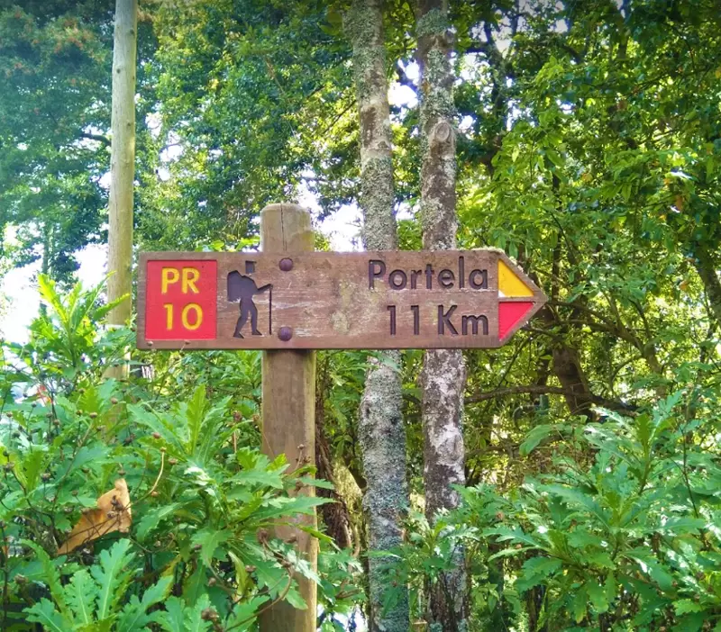
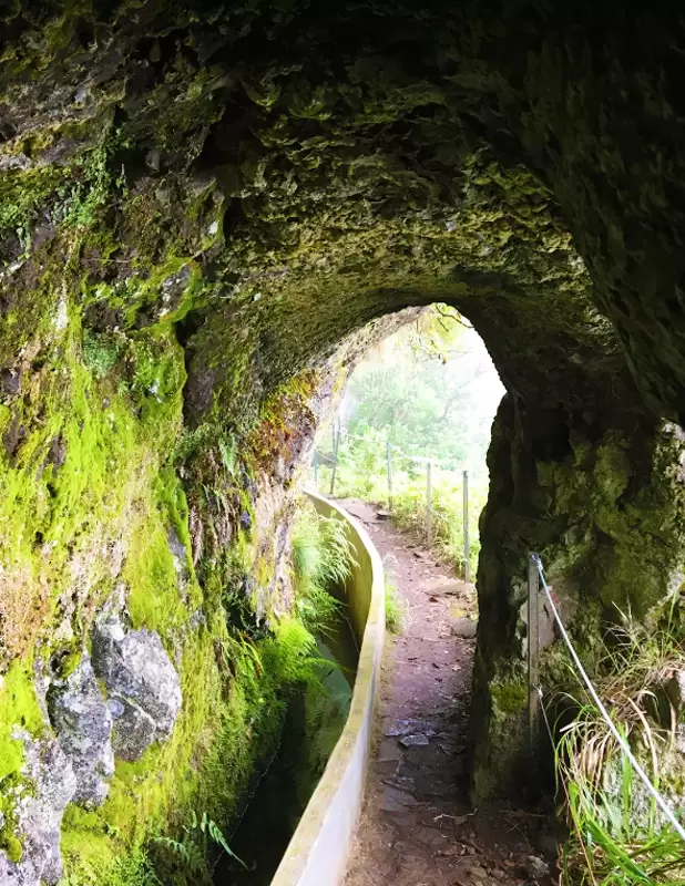
The Levada is a small channel directing water from the interior to the coast – introduced by the Moors in Al-Andalus and is similar to the acéquia carried by the Spanish to Latin America.
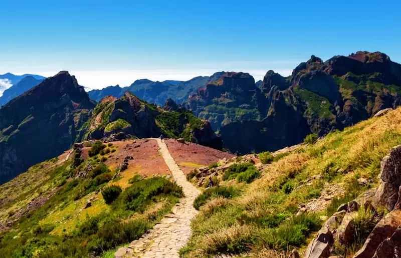
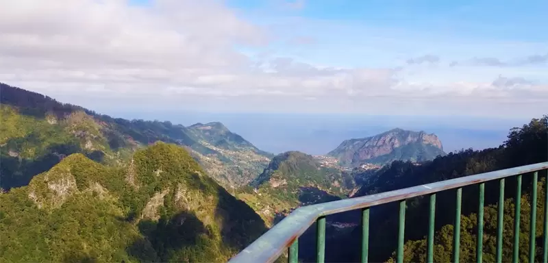
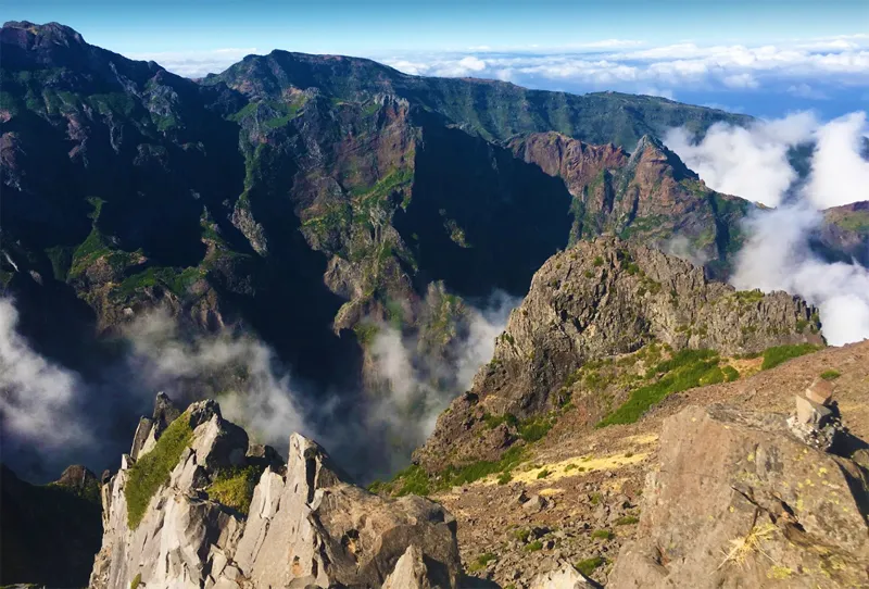
Pico do Arieiro Viewpoint
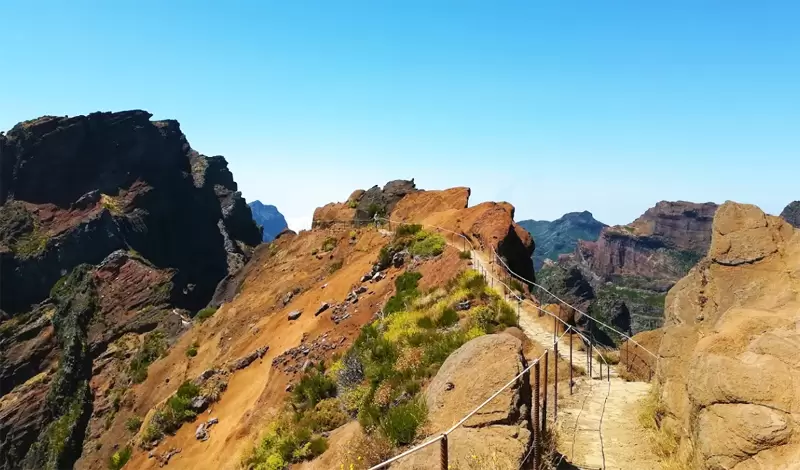
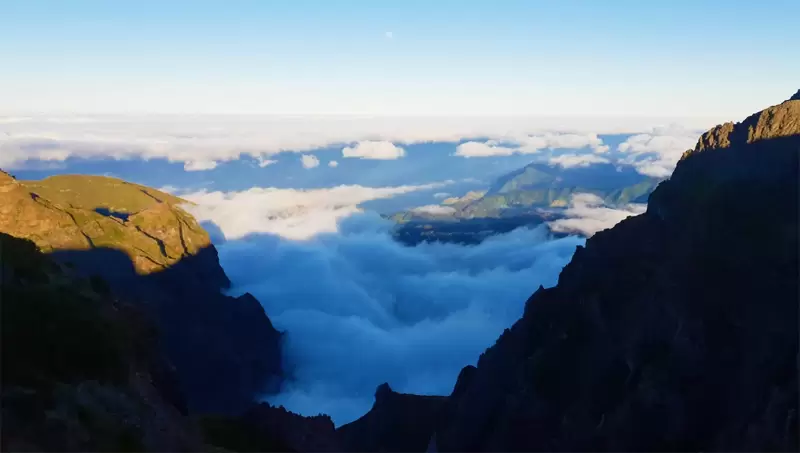
10 km from Ribeiro Frio, discover Madeira‘s 3rd highest point (1810 metres), which is trendy. You should leave early or in the late afternoon to avoid crowds.
- Coordinates: 32.735648, -16.928603
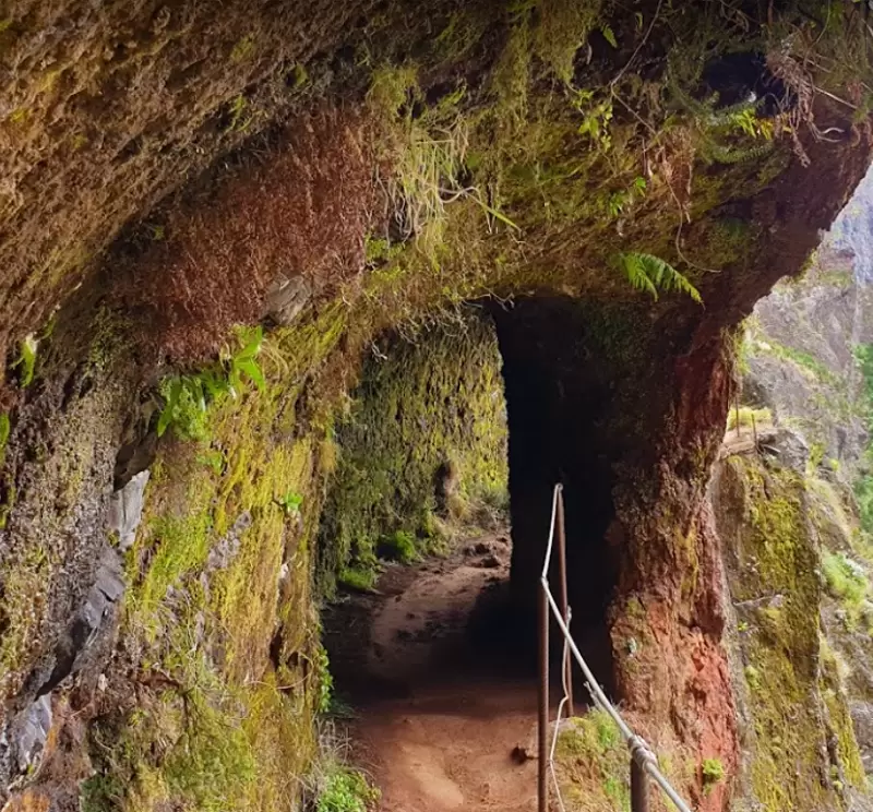
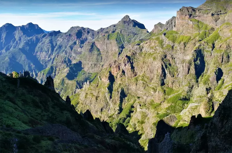
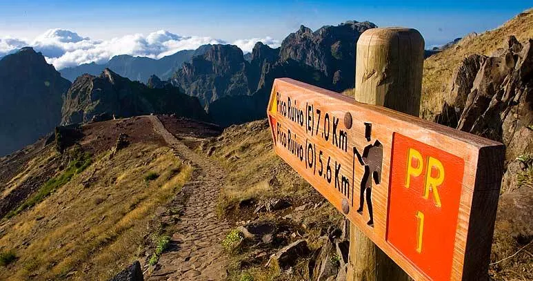
The views from the Pico do Arieiro viewpoint are amazing – sometimes, both coasts are visible. Near the perspective is the start of one of the most exciting walks on the island, the PR1 Arieiro Footpath, which connects 2 of the highest peaks of the island (Pico Ruivo and Pico Arieiro – a 7 km walk.
A good option is to walk only the 1st section of the trail to the Ninho da Manta Viewpoint (It takes 50 minutes, round trip).
- Coordinates: 32.738828, -16.933297
The whole route, through the central mountain massif, is spectacular, but then all you can think about is going back for the hot tub… Unless you’ve arranged for someone to pick you up at Achada do Teixeira, you need 5 hours to make the return trip.