

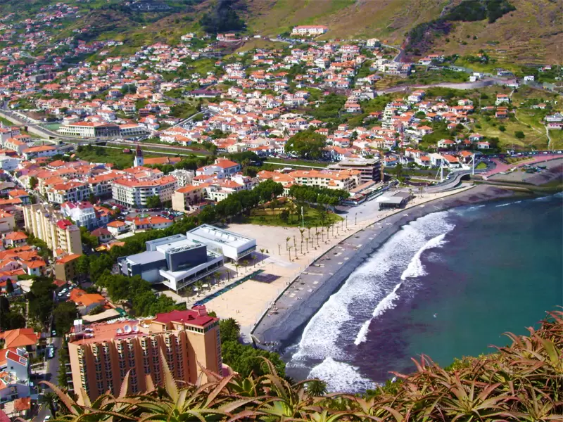
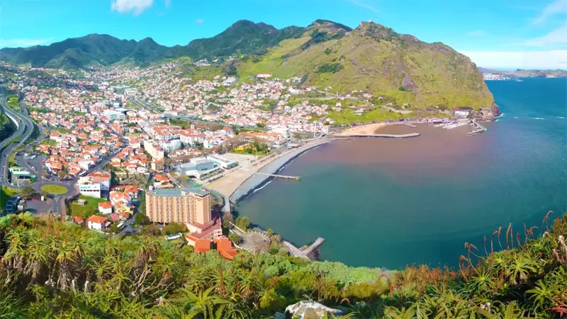
Machico
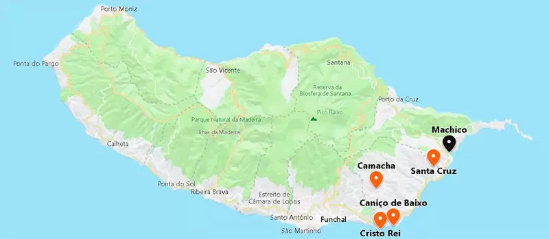
- Coordinates: 32.717507, -16.765864
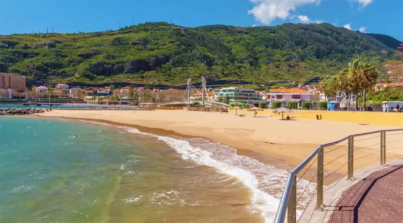
The strait of Machico is 10 minutes from the airport. The first Portuguese landed in the bay, many hardened by the military actions (on the current Moroccan coast) ordered by Prince Henry the Navigator and his brothers.
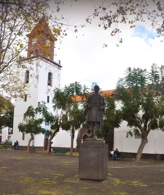
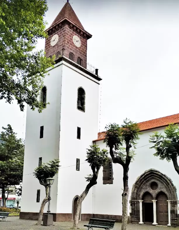
Machico has a relaxed atmosphere and in the centre stands the mother Nossa Senhora da Conceição church (15th century). It was built under the orders of Tristão Vaz Teixeira’s wife. The most striking feature is the gracefully arched Manueline doorway with 3 small marble columns.
- Coordinates: 32.718827, -16.766081
Tristan Vaz, seen as “assaz ardido” (very audacious), adopted his wife’s surname (Teixeira), for she came from a more noble condition. He starts as a squire and, by merit, becomes a knight-armed after the capture of Ceuta (North Africa at the foot of Morocco) by Prince Henry the Navigator.
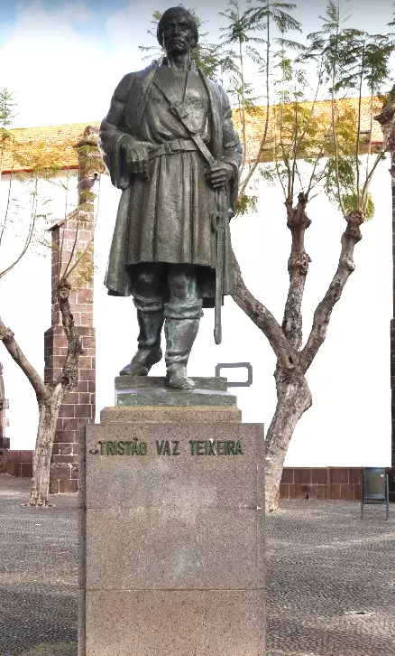
Tristan discovers the archipelago of Madeira (with João Gonçalves Zarco). He chose the bay of Machico for his captaincy – it was a good anchorage with a vast fertile valley.
Tristão was 23 years old. He continued to make expeditions southwards after he had his own captaincy. Several years later, an unhappy nobleman took liberties with one of his daughters.
Tristan had no half measures: he castrated the young man…
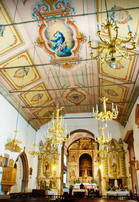
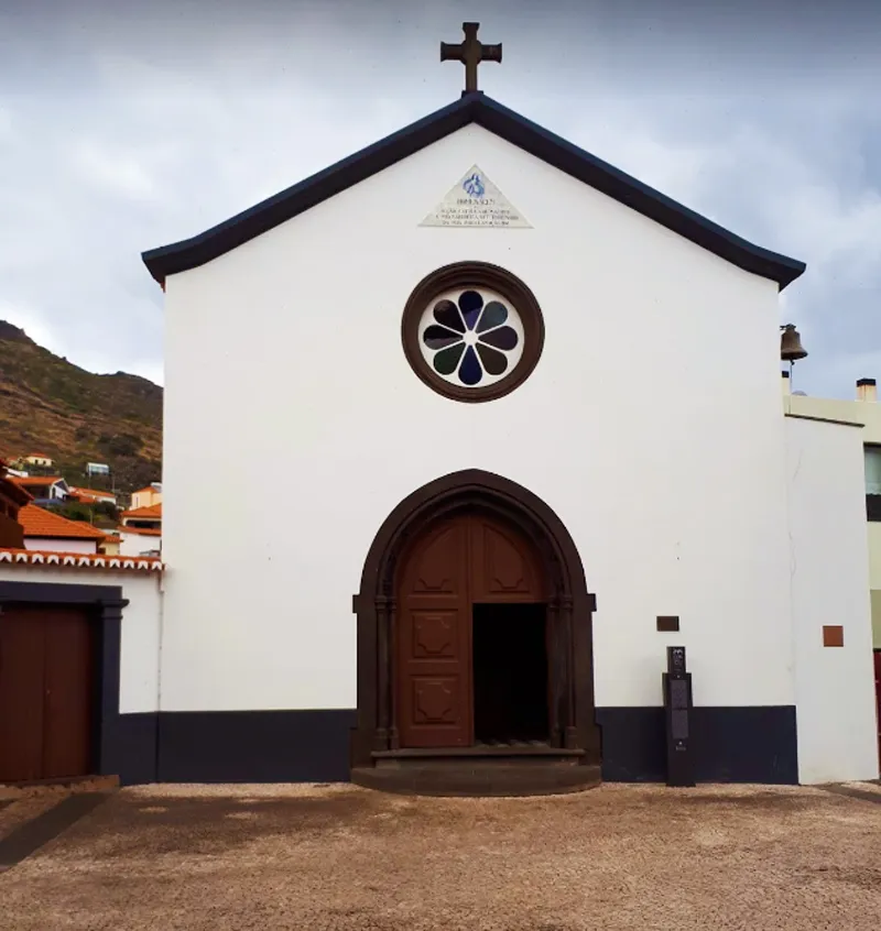
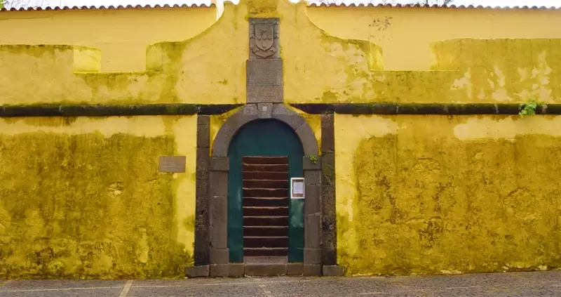
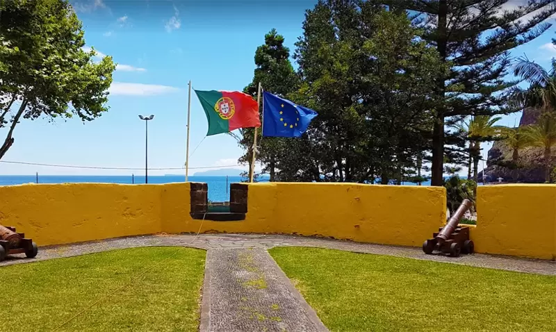
A captain of the Infante had many powers. Still, he could not do this: he lost all his rights – many years passed before he was pardoned by the new king: Dom Afonso V. 700 metres away is the Senhor dos Milagres Chapel which marks the spot where the first Mass was celebrated on the island.
- Coordinates: 32.719100, -16.764172
Now the tiny temple boasts a neo-baroque style, and you will see the crucifix of Bom Jesus in the centre. The temple was almost destroyed in a flood (1803), and the crucifix in the sea ended up.
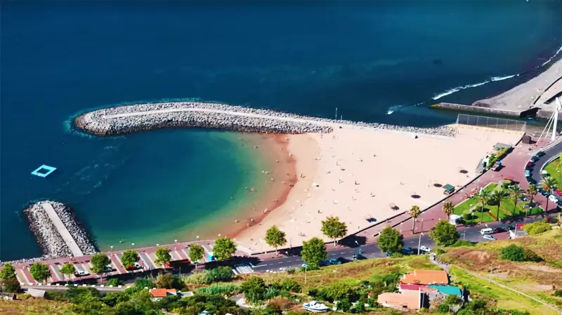
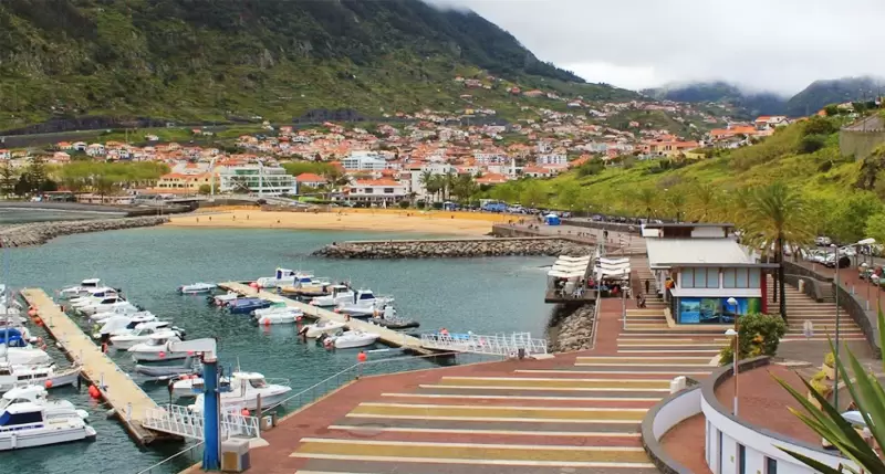
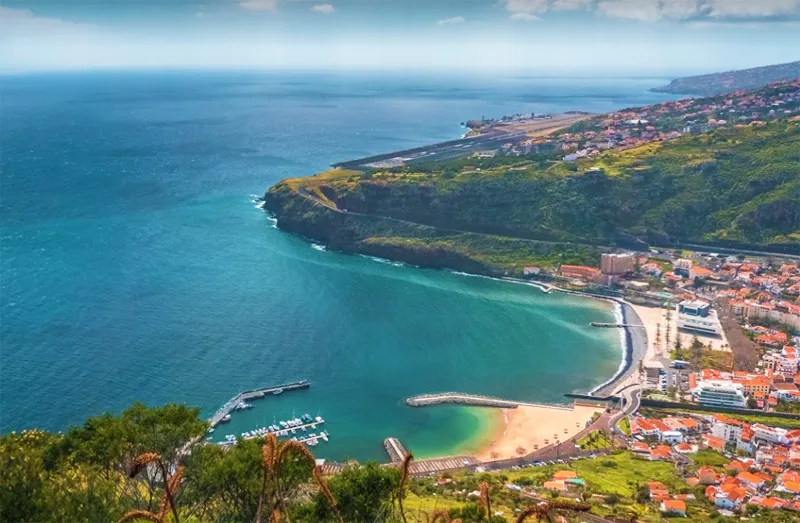
It was discovered by a sailor who delivered it to the Cathedral of Funchal. Eventually, it returned to Machico. By the sea, there are some cafés, and at low tide, the sea reveals a narrow strip of sand: Banda Além Beach by the Porto de Recreio.
- Coordinates: 32.718627, -16.761814
To the east, you will find the Nossa Senhora do Amparo Fort (500 metres), built in 1706 to disperse the pestilent pirates and privateers – today, it houses the tourist office.
- Coordinates: 32.717420, -16.765057
Francisco Alvares Nóbrega Viewpoint
Going up to the west side of the bay, we end at Francisco Alvares Nóbrega viewpoint with a beautiful panoramic bay view.
- Coordinates: 32.712985, -16.764795
The poet Francisco Alvares Nóbrega, known as Little Camões, was born in Machico (18th century). His work was largely destroyed by the inquisition.
Pico do Facho Viewpoint
- Coordinates: 32.723919, -16.758541
On the bay’s east side, we unveil another viewpoint: Pico do Facho Viewpoint – 2 km down the old road towards Caniçal, turning right at the sign “Pico do Facho” – 320-metre peak, used in the past to give warning of the presence of privateers.
This is remembered on the last Sunday of August with a bonfire during the Feast of the Blessed Sacrament.